
Copyright © Panorama Group 1991 - 2026

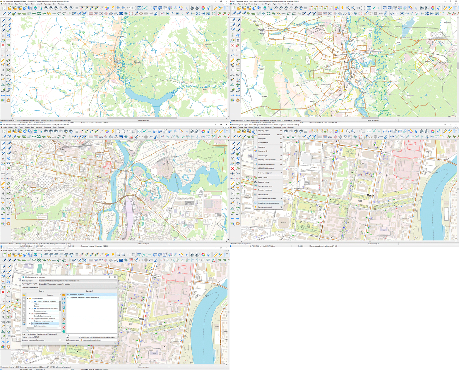
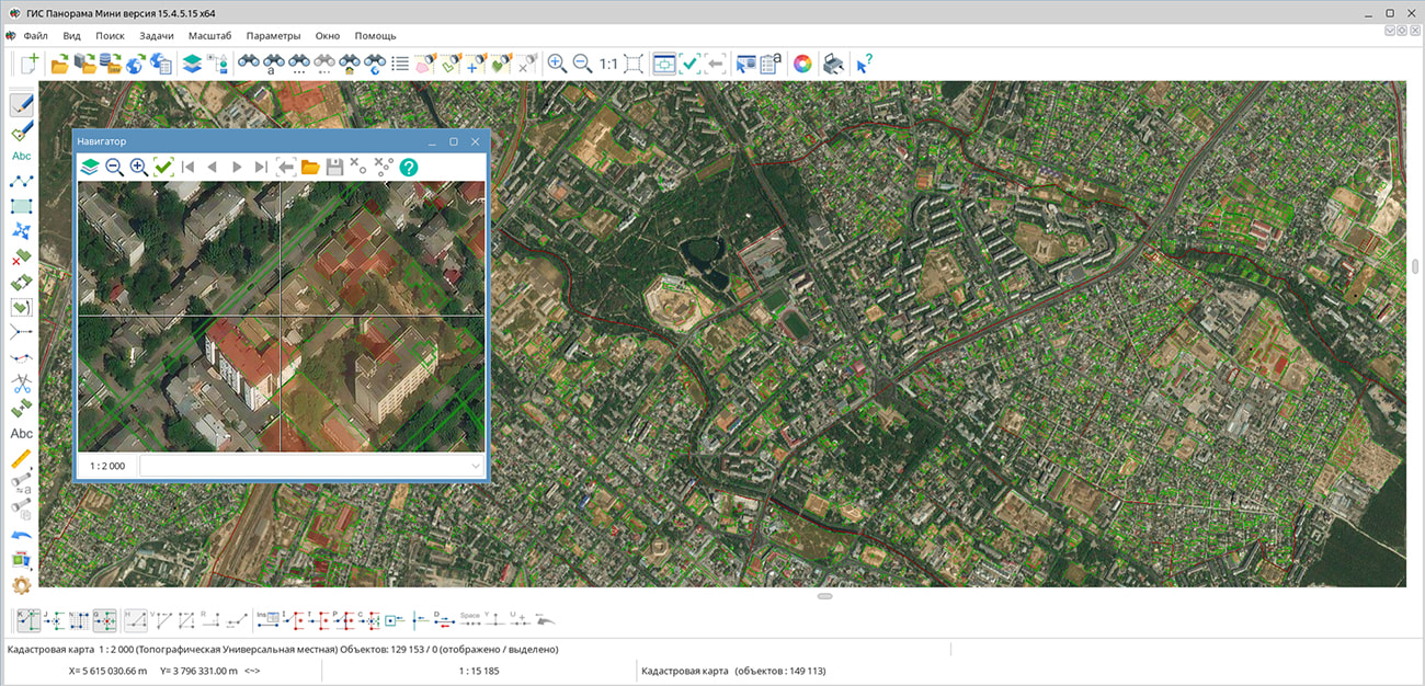
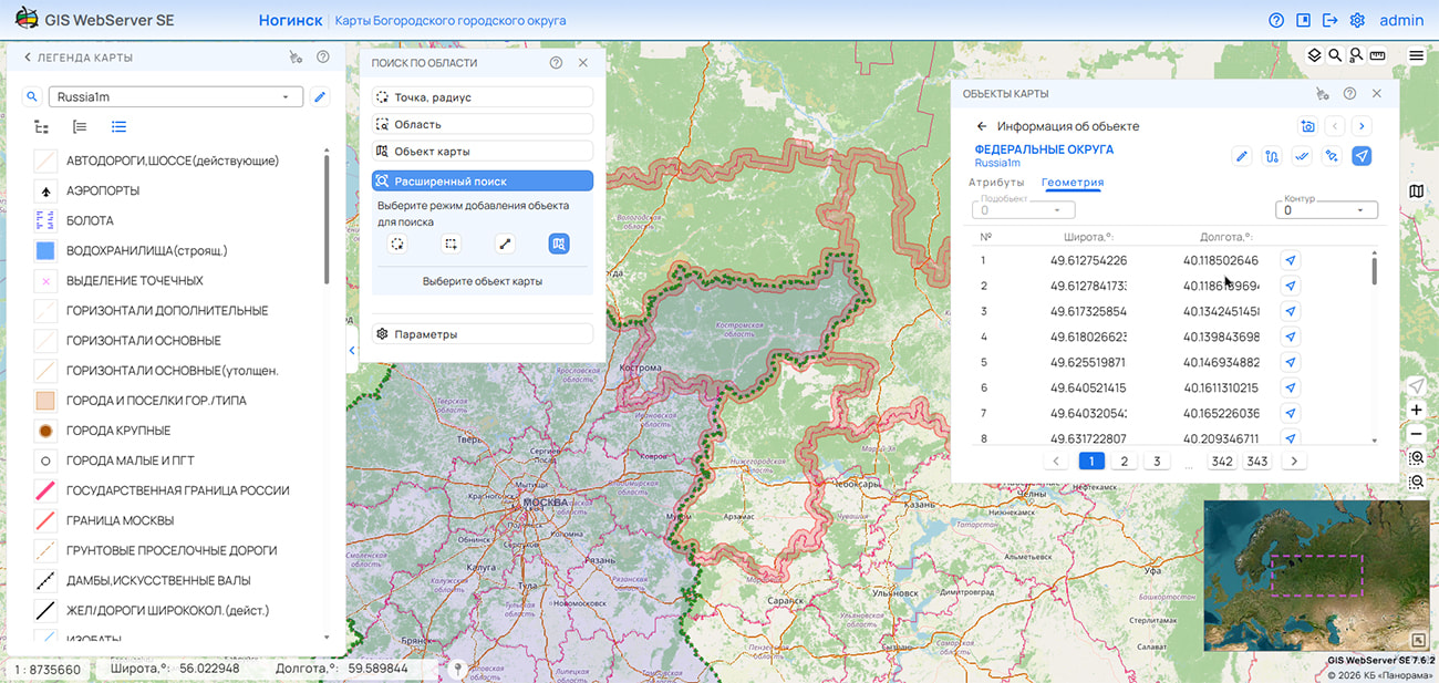
Specialists from KB Panorama have prepared and published a map of Penza Oblast on the geoportal. The map was generated from OpenStreetMap data. The map can be used with or other software products from KB Panorama.
The map has been converted to the modernized large-scale plan classifier at a scale of 1:5,000 (map5000m) and saved as a packaged project (mptz). The MPTZ project comprises a digital map covering the region's territory (country, federal subject, administrative district) and a digital classifier. Updates were placed in the spatial data bank using the program. The publication of the spatial data bank's contents on the geoportal and access to data for download are implemented via .
Free maps based on OpenStreetMap data are available for download on the "Digital Maps" page.
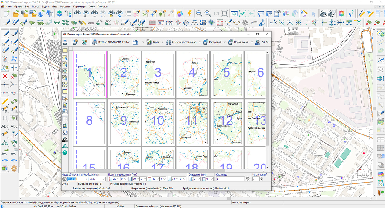
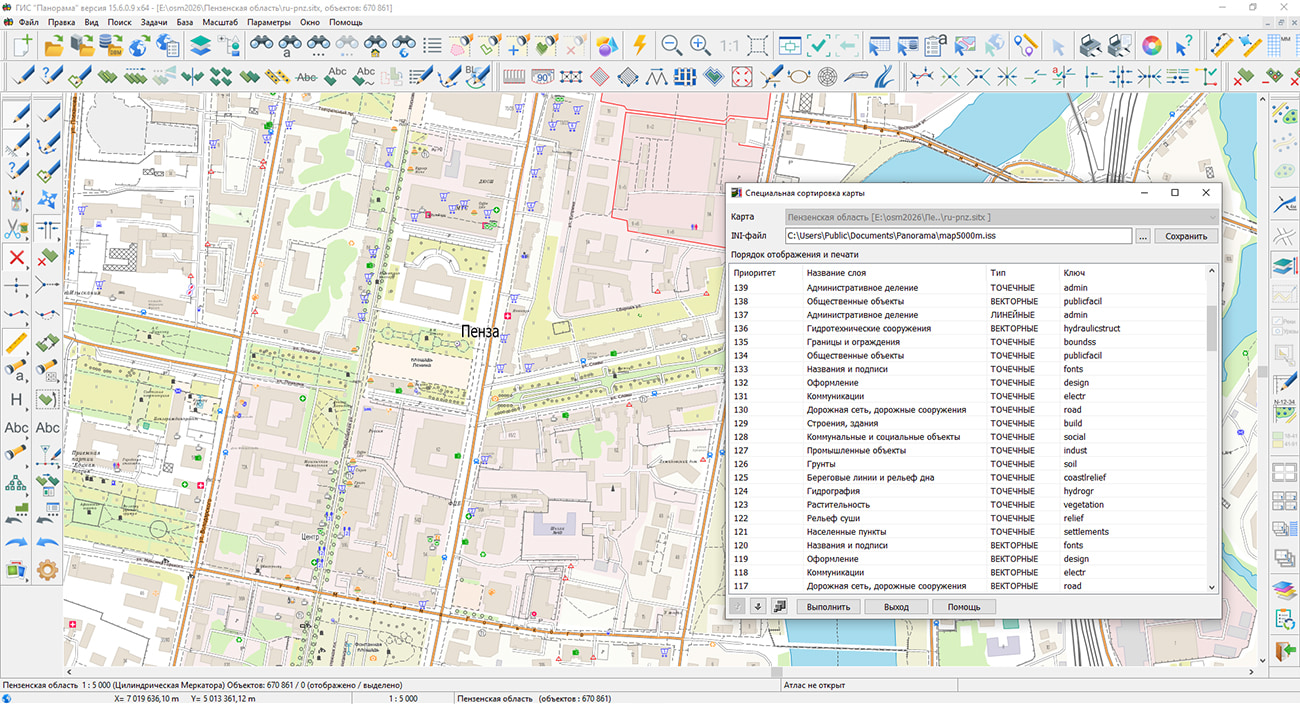

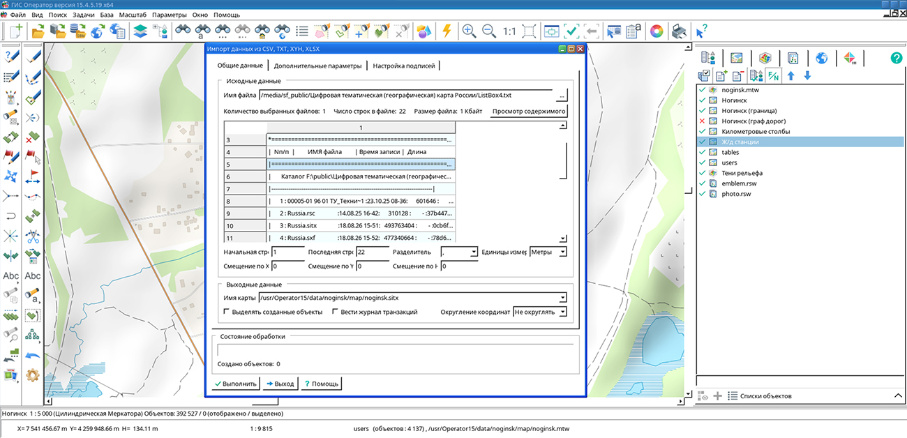
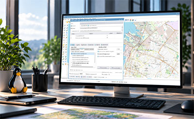
KB "Panorama" has developed version 15.4.5 for Astra Linux Special Edition, Alt Linux, RED OS, Ubuntu, and AlterOS. The new version implements support for group semantics for storing interrelated object characteristics in multi-level structures and for searching objects with account for attribute group membership. Tools for creating and editing map objects have been improved, and spatial data import capabilities from DXF, CSV, TXT, XYH, and XLSX formats have been extended.
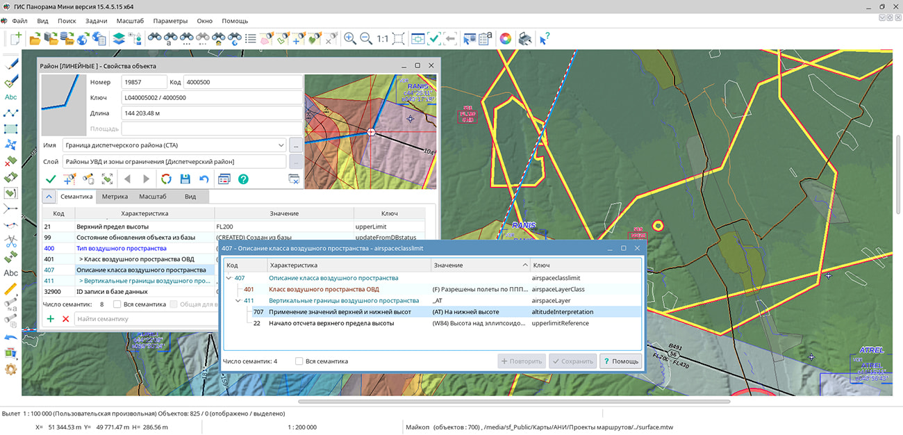
A new attribute type — — has been implemented to describe complex properties of spatial objects. It allows related characteristics to be combined into multi-level structures containing individual semantics, repeating value sets, and other nested groups. Such structures correspond to the representation of complex data in XML and JSON or in related database tables. A simple example of group semantics is a building address. A single object may have multiple "Address" groups, each combining "City," "Street," and "House" values. In cadastral data, this method can be used to store repeating information such as "Right Holders," "Description of Share in Right," and "Title Documents." In aeronautical data, the "Airspace Class Description" group semantics may include a nested repeating group, "Vertical Airspace Boundaries." Populated characteristics are displayed in the as a tree. To search for and select objects, a capability has been added to take into account whether a characteristic belongs to a specific group. For example, the "Organization Name" semantics can be searched separately within the "Managing Organization," "Operating Organization," or "Maintenance Organization" groups. This allows working not only with the attribute value but also with its role in the object description structure.
Tools for creating and editing map objects have been improved. A helper mode, "Vertical/Horizontal Line," has been added to the ; it automatically selects the construction direction based on cursor movement. When changing an object type, the main transformation parameters have been moved to a separate panel, which reduces the number of intermediate prompts during data processing.
Data import tools have been updated. When loading DXF files, processing of MultiLeader primitives has been added, with leader generation and consideration of their formatting parameters. During data import, both clusters — right and left — are processed and generated. Processing takes into account an unlimited number of leaders in each cluster. The task now supports processing of arbitrary-length strings, enabling the loading of objects with complex geometry, an arbitrary number of points, and multi-contours. For data in local coordinate systems, an option to swap the X and Y axes during import is provided.
is a domestic geographic information system used for spatial data collection, database management, and the creation and updating of digital maps and plans, as well as for the development of information systems for various purposes. The program supports import and viewing of vector and raster maps, elevation matrices, TIN models, laser scanning data, as well as work with custom maps and districts. Key features include: map creation with automatic parameter filling (EPSG/XML), export to SXF, DXF, and OGC GM formats, a multi-user mode with access control via GIS Server, map editing in different projections within a single document, integration with geoportals, and data printing with flexible settings. The GIS is included in the Unified Register of Russian Programs for Electronic Computers and Databases (registry entry No. 7226 dated 03.11.2020).
The new version is available for download in the section.
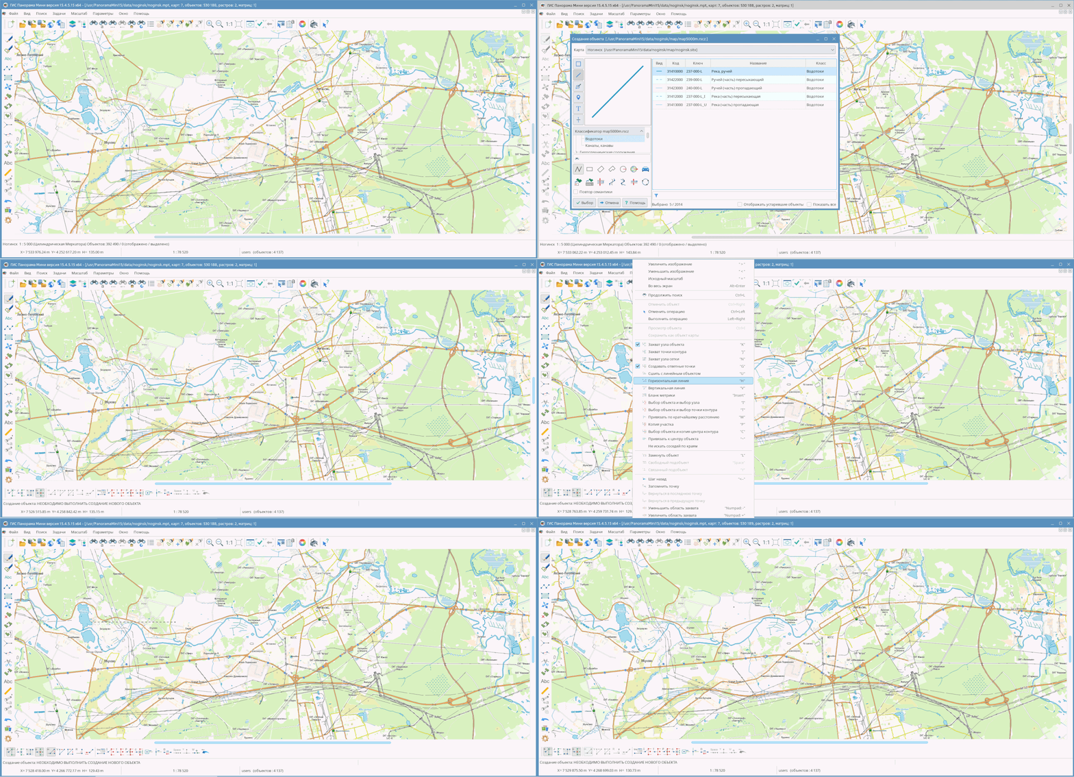

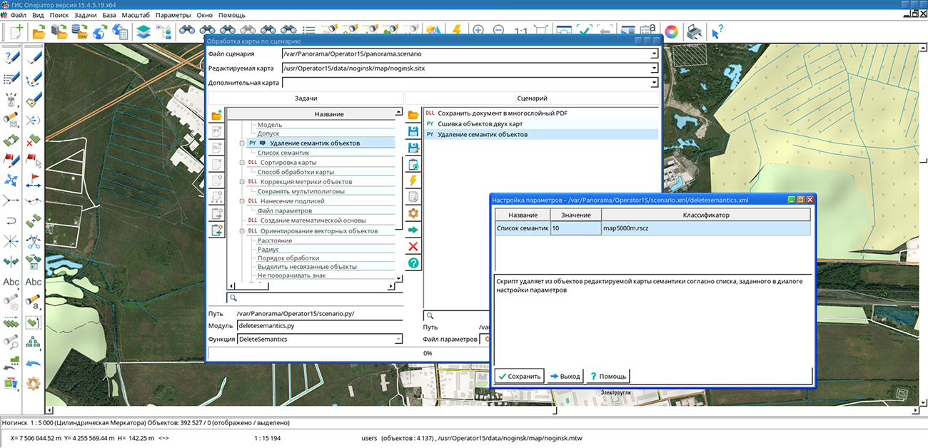
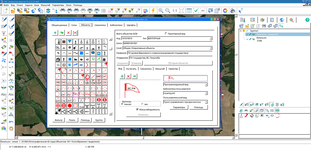
KB "Panorama" has developed version 15.4.5. The program's digital classifier operator.rsc has been updated in accordance with the new edition of the Classifier of Electronic Conventional Signs (KEUS). Automation of vector map processing according to customizable scenarios has been implemented, support for multi-level attribute structures of spatial objects has been added, object creation and editing tools have been improved, and data import capabilities from DXF, CSV, TXT, XYH, and XLSX have been extended.
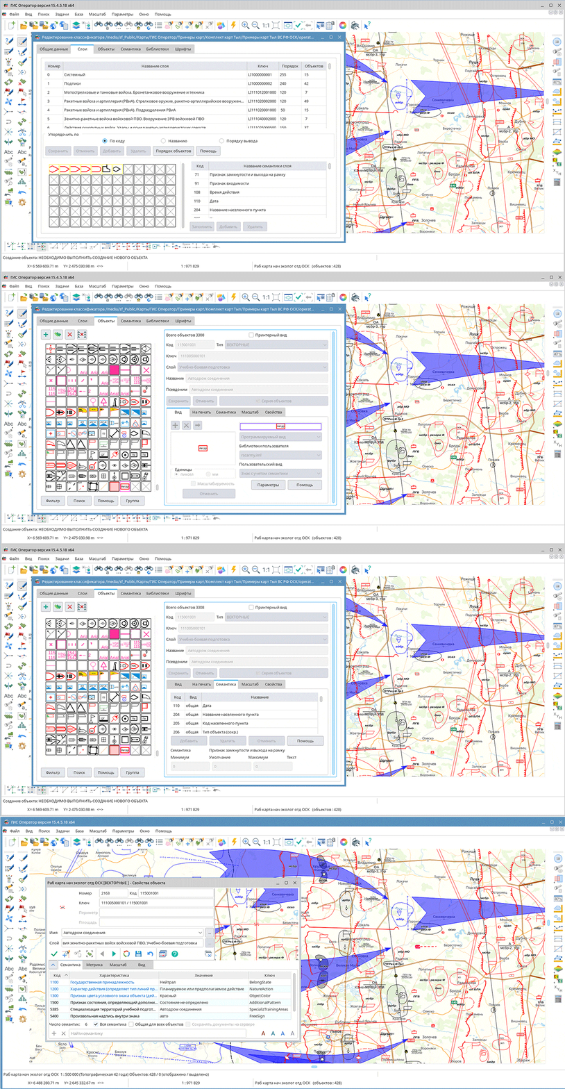
The digital classifier operator.rsc has been updated in accordance with the new edition of KEUS. Names and composition of thematic layers have been updated, and separate layers have been added for displaying actions of air defense units. The composition of attribute characteristics of objects has been refined, and new characteristics have been added to describe the status and purpose of objects, parameters of unmanned aviation, missile systems, special operations units, and other data.
The classifier composition has been supplemented with new conventional signs for command and control points and centers, personnel, weapons and military equipment, artillery and missile systems, air defense assets, areas and lines of action of units. Designations for modern and special equipment have been added, including ATVs, wheeled all-terrain vehicles, tank support combat vehicles, and robotic systems, as well as means of employing precision-guided munitions. For existing objects, names, characteristic sets, thematic layer membership, and display rules have been refined in accordance with the new edition of KEUS.
A mode has been implemented, designed to automate vector map processing. Users can create scenarios from basic and custom tasks, configure parameters, and define the sequence of operations. The list of available tasks is extended by connecting Python scripts and dynamic library functions, which allows custom spatial data processing algorithms to be included in scenarios. Execution of the entire scenario and selective launching of individual tasks are supported. Scenarios and parameters are saved in files for reuse. Available for scenario creation are object creation, semantics filling, metric correction, label placement, map preparation for printing, and other operations. The new mode allows regularly performed operations to be combined into a single process and reduces the number of manual actions when preparing and updating maps.
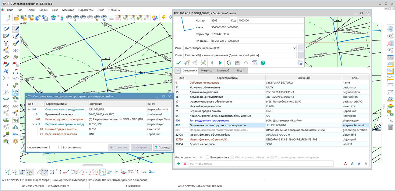
Support for group semantics has been added for creating of spatial objects. A single group may store individual characteristics, repeating value sets, and nested groups. This method allows complex object properties to be described in structures similar to XML, JSON, and related database tables. Populated characteristics are displayed in the object properties as a tree. When searching for and selecting objects, it is possible to take into account whether a characteristic belongs to a specific group, which allows distinguishing identical characteristics that have different purposes in the object description.
Tools for creating and editing map objects have been improved. A helper mode, "Vertical/Horizontal Line," has been added to the ; it automatically selects the construction direction based on cursor movement. In the object type change mode, the main transformation parameters have been moved to a separate panel, which reduces the number of intermediate actions when editing a map.
Data import tools have been updated. When loading DXF files, processing of MultiLeader primitives has been added. During import, right and left clusters are generated with support for an arbitrary number of leaders and consideration of their formatting parameters. The task now supports processing of arbitrary-length strings, enabling the loading of objects with complex geometry, an arbitrary number of points, and multi-contours. For data in local coordinate systems, an option to swap the X and Y axes during import is provided.
The new version is available for download in the section.

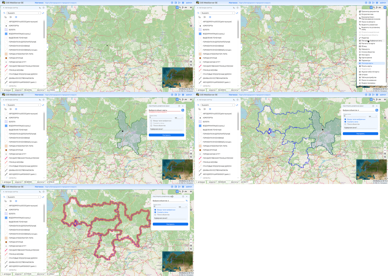
KB "Panorama" has developed version 16.01.0. Support for the MCP protocol has been added to the service, providing connection of applications based on large language models (LLMs) to spatial data processing tools. The new capabilities allow the service's functions to be used in creating intelligent assistants for geographic information systems.
The MCP protocol provides a unified mechanism for obtaining descriptions of available tools, passing parameters, and executing requests. An MCP-enabled application receives information about the purpose of operations and the input data format. Based on the user's request, the language model selects an appropriate tool and generates the parameters for its invocation. GIS WebService SE performs the operation and returns the result for further processing and response preparation. Together with an intelligent assistant, the service allows chains of operations to be performed. For example, find federal highways on the road layer, build a buffer zone with a radius of 500 m around them, and highlight in red on the layer the objects that fall within the buffer zone, and prepare a report as a list of objects.
The use of MCP simplifies the development of applications that use geographic information services. Developers do not need to create a separate integration mechanism for each compatible intelligent assistant. Descriptions of operations and their parameters are provided through a unified interface and can be used by the assistant when writing code, preparing requests, and verifying interaction with the service. This reduces manual effort and accelerates the creation of applied solutions.
The connection of GIS WebService SE via the MCP protocol to GitHub Copilot in the Visual Studio Code environment has been tested, as well as the operation of MCP through ChatGPT in Codex. The integration allows the service's tools to be used directly during application development and in dialogue with an intelligent assistant. The published MCP server is available at the .
MCP support creates the foundation for organizing work with spatial data in natural language. The user formulates a task in dialogue with an intelligent assistant, which accesses the available functions of the service. The set of tasks performed is determined by the tools provided via MCP.
GIS WebService SE is designed for publishing and processing spatial data, providing access to digital maps, and executing requests from client applications. MCP support expands the possibilities of using the service in corporate information systems, geoportals, and automation tools for working with cartographic information.
GIS WebService SE supports all international standards (OGC WFS, WFS-T, WMS, WMTS, WCS, WPS) and interaction with AI agents via the MCP protocol. The program implements the ability to serve tiles in any custom or local coordinate system. The service supports the OpenAPI 3.0 specification and REST API methods. The application is implemented on Windows and Linux platforms and is compatible with Apache, IIS, and nginx web servers.
The new version of the program and documentation are posted on the website in the section.

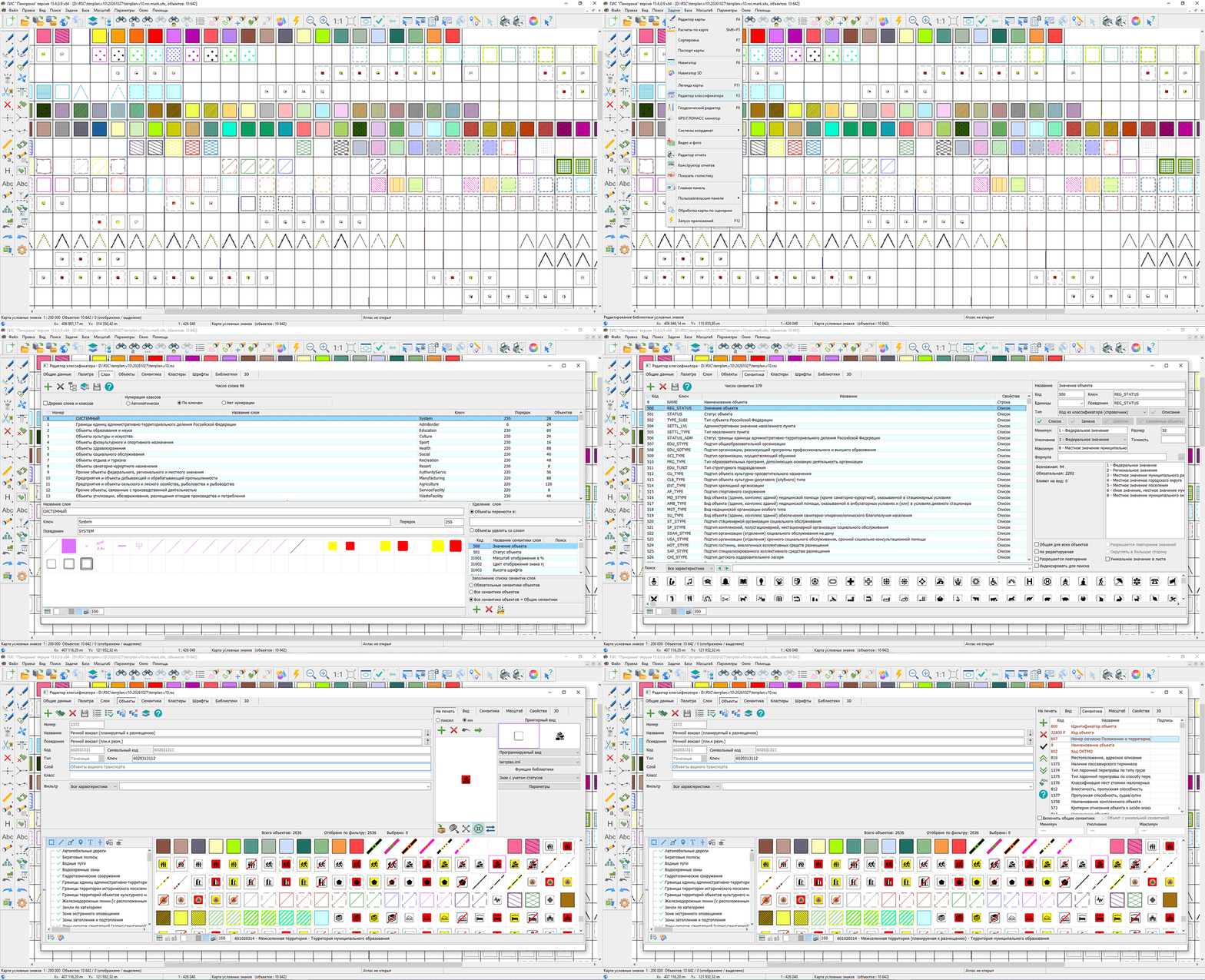
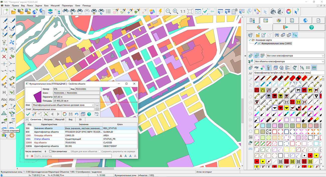
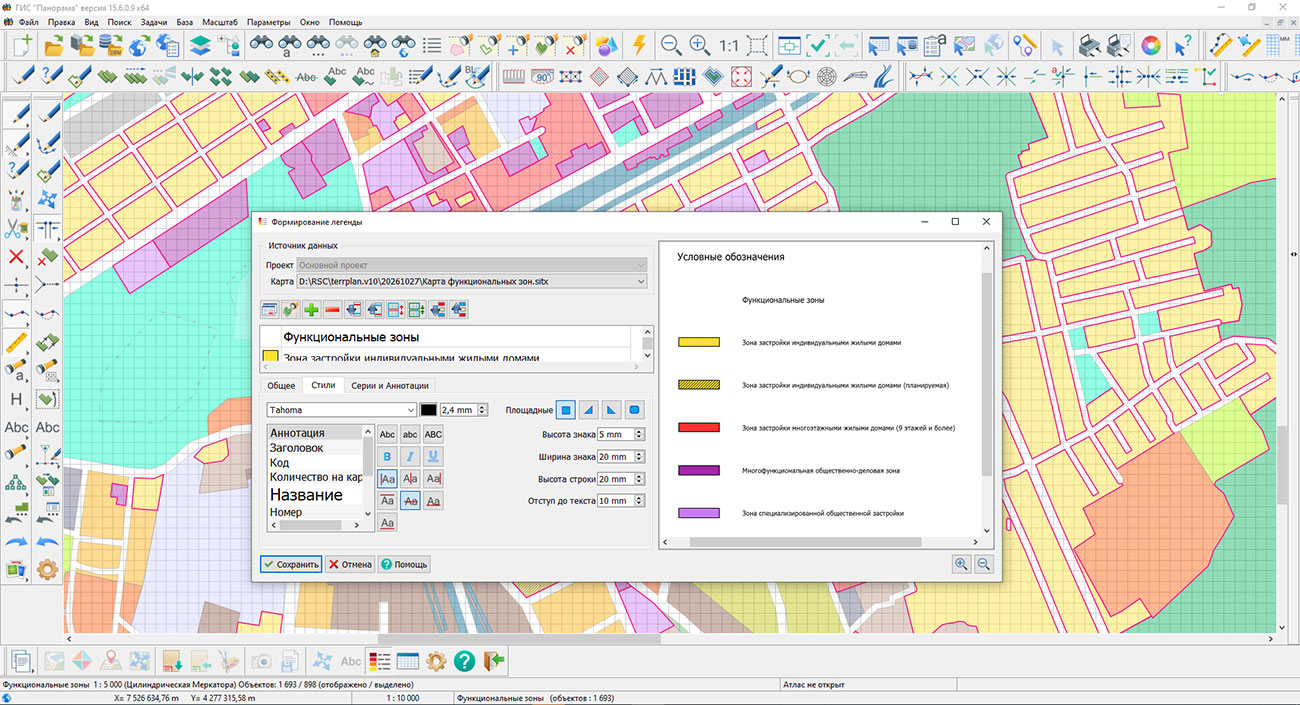
Specialists from KB "Panorama" have prepared a new edition of the digital classifier terrplan.v10.rscz for the preparation of territorial planning documents in accordance with the current XML schema of FGISTP .
The update was carried out taking into account No. 65 of the Ministry of Economic Development of Russia dated 06.02.2025 "On Amendments to the Requirements for the Description and Display in Territorial Planning Documents of Federal Significance Objects, Regional Significance Objects, and Local Significance Objects, approved by Order No. 10 of the Ministry of Economic Development of Russia dated January 9, 2018," as well as changes made to the current XML schema of FGISTP.
In the new edition of the classifier, the composition of territorial planning objects, their attribute description, conventional designations, and requirements for the mandatory completion of characteristics have been refined. Objects planned for reconstruction have been added, including "Forest Park Zone," "Green Zone," "Public and Limited-Use Green Areas," "Special-Purpose Green Areas," "Boundaries of Key Ornithological Territories," and others.
In accordance with the current schema, the composition of attribute characteristics of individual objects has been adjusted. For objects of the "Functional Zones" layer, the "Implementation Period" semantics has been excluded. For objects of the "Road Passenger Transport Objects" layer, the characteristics "Title Document Name" and "Title Document Number" have been excluded. For objects of the "Green Fund Territories of Urban and Rural Settlements" layer, the STATUS semantics ("Object Status") has been added, and the previously used STATUS_PR semantics has been excluded.
Requirements for the mandatory completion of characteristics of objects planned for placement or reconstruction have been updated. For objects of industrial, transport, energy, social, and other purposes, the characteristics of the title document — its name, number, and date — have been designated as mandatory. The changes affect agricultural and forestry enterprises, cultural, educational, and healthcare facilities, power plants and substations, roads and railways, gas and oil infrastructure facilities, social service, recreation, and tourism facilities, as well as other territorial planning objects.
For many objects planned for placement or reconstruction, the "Implementation Period" characteristic has been designated as mandatory. The requirement applies to air, road, rail, and water transport objects, energy, engineering infrastructure, social sphere, integrated territorial development, environmental protection, and other federal, regional, and local significance objects.
The updated classifier allows the composition and mandatory nature of characteristics established by the current FGISTP schema to be taken into account immediately when creating objects. This simplifies the preparation of territorial planning schemes of the Russian Federation, its federal subjects, and municipalities and reduces the number of discrepancies during subsequent verification and transfer of spatial data.
The digital classifier terrplan.v10.rscz and the schema fgistp_2026_0_fixed_21.10.xsd are included in , "Panorama-Editor", "Urban Planner Workstation". The new version of the classifier is available for download in the "Classifiers" section.
29.10.2026 Udmurt Republic Map Updated on the Geoportal
Specialists from KB "Panorama" have prepared and published a map of the Udmurt Republic on the "Spatial Data Bank" geoportal. The map was generated from OpenStreetMap data. The map can be used with GIS "Panorama Mini" or other software products from KB "Panorama".
The map has been converted to the modernized large-scale plan classifier at a scale of 1:5,000 (map5000m) and saved as a packaged project (mptz). The MPTZ project comprises a digital map covering the region's territory (country, federal subject, administrative district) and a digital classifier. Updates were placed in the spatial data bank using the Digital Maps and Remote Sensing Data Bank program. The publication of the spatial data bank's contents on the geoportal and access to data for download are implemented via GIS WebServer SE.
Free maps based on OpenStreetMap data are available for download on the page.
Ph.: +7 (499) 402-2445,
+7 (925) 221-1603
www.gisinfo.ru | panorama@gisinfo.ru
105005, Russia, Moscow, Baumanskaya Street,
house 7, building 1, office 229 (m. Baumanskaya)
Copyright © Panorama Group 1991 - 2026












 Mobile version
 Full version
