
Copyright © Panorama Group 1991 - 2026

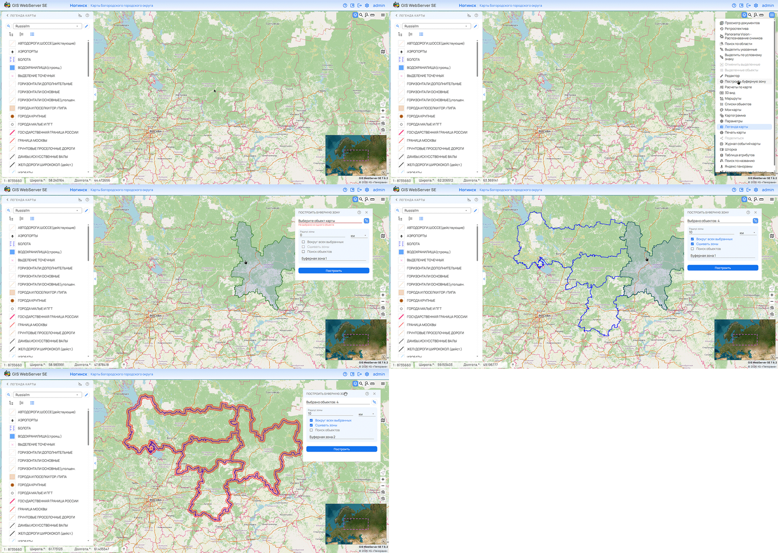
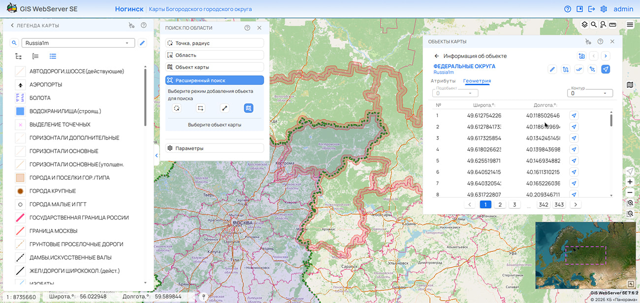
KB "Panorama" has developed version 16.01.0. Support for the MCP protocol has been added to the service, providing connection of applications based on large language models (LLMs) to spatial data processing tools. The new capabilities allow the service's functions to be used in creating intelligent assistants for geographic information systems.
The MCP protocol provides a unified mechanism for obtaining descriptions of available tools, passing parameters, and executing requests. An MCP-enabled application receives information about the purpose of operations and the input data format. Based on the user's request, the language model selects an appropriate tool and generates the parameters for its invocation. GIS WebService SE performs the operation and returns the result for further processing and response preparation. Together with an intelligent assistant, the service allows chains of operations to be performed. For example, find federal highways on the road layer, build a buffer zone with a radius of 500 m around them, and highlight in red on the layer the objects that fall within the buffer zone, and prepare a report as a list of objects.
The use of MCP simplifies the development of applications that use geographic information services. Developers do not need to create a separate integration mechanism for each compatible intelligent assistant. Descriptions of operations and their parameters are provided through a unified interface and can be used by the assistant when writing code, preparing requests, and verifying interaction with the service. This reduces manual effort and accelerates the creation of applied solutions.
The connection of GIS WebService SE via the MCP protocol to GitHub Copilot in the Visual Studio Code environment has been tested, as well as the operation of MCP through ChatGPT in Codex. The integration allows the service's tools to be used directly during application development and in dialogue with an intelligent assistant. The published MCP server is available at the .
MCP support creates the foundation for organizing work with spatial data in natural language. The user formulates a task in dialogue with an intelligent assistant, which accesses the available functions of the service. The set of tasks performed is determined by the tools provided via MCP.
GIS WebService SE is designed for publishing and processing spatial data, providing access to digital maps, and executing requests from client applications. MCP support expands the possibilities of using the service in corporate information systems, geoportals, and automation tools for working with cartographic information.
GIS WebService SE supports all international standards (OGC WFS, WFS-T, WMS, WMTS, WCS, WPS) and interaction with AI agents via the MCP protocol. The program implements the ability to serve tiles in any custom or local coordinate system. The service supports the OpenAPI 3.0 specification and REST API methods. The application is implemented on Windows and Linux platforms and is compatible with Apache, IIS, and nginx web servers.
The new version of the program and documentation are posted on the website in the section.

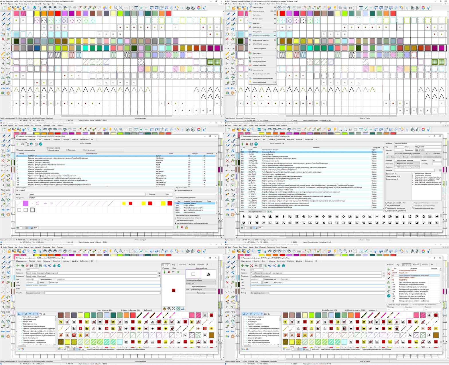
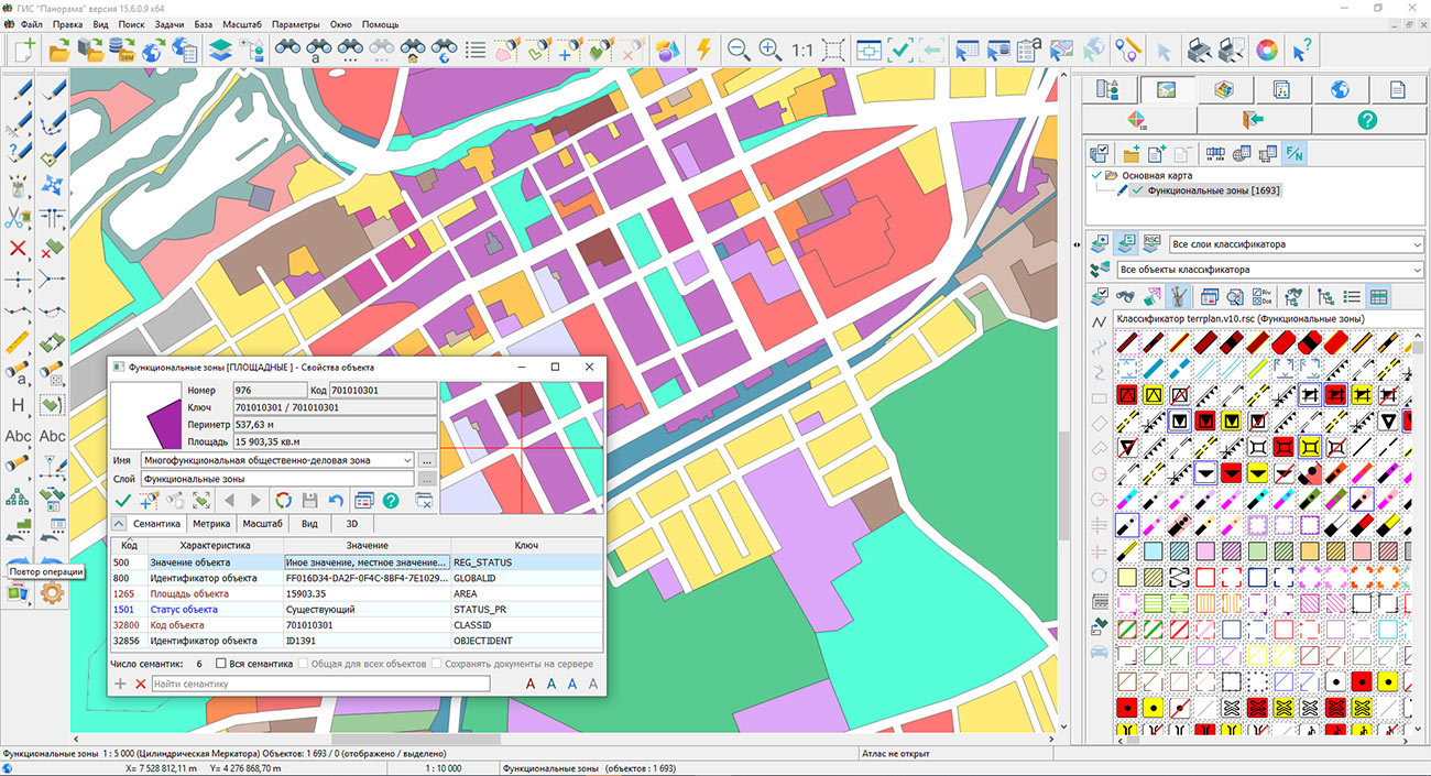
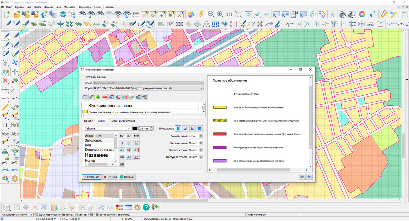
Specialists from KB "Panorama" have prepared a new edition of the digital classifier terrplan.v10.rscz for the preparation of territorial planning documents in accordance with the current XML schema of FGISTP .
The update was carried out taking into account No. 65 of the Ministry of Economic Development of Russia dated 06.02.2025 "On Amendments to the Requirements for the Description and Display in Territorial Planning Documents of Federal Significance Objects, Regional Significance Objects, and Local Significance Objects, approved by Order No. 10 of the Ministry of Economic Development of Russia dated January 9, 2018," as well as changes made to the current XML schema of FGISTP.
In the new edition of the classifier, the composition of territorial planning objects, their attribute description, conventional designations, and requirements for the mandatory completion of characteristics have been refined. Objects planned for reconstruction have been added, including "Forest Park Zone," "Green Zone," "Public and Limited-Use Green Areas," "Special-Purpose Green Areas," "Boundaries of Key Ornithological Territories," and others.
In accordance with the current schema, the composition of attribute characteristics of individual objects has been adjusted. For objects of the "Functional Zones" layer, the "Implementation Period" semantics has been excluded. For objects of the "Road Passenger Transport Objects" layer, the characteristics "Title Document Name" and "Title Document Number" have been excluded. For objects of the "Green Fund Territories of Urban and Rural Settlements" layer, the STATUS semantics ("Object Status") has been added, and the previously used STATUS_PR semantics has been excluded.
Requirements for the mandatory completion of characteristics of objects planned for placement or reconstruction have been updated. For objects of industrial, transport, energy, social, and other purposes, the characteristics of the title document — its name, number, and date — have been designated as mandatory. The changes affect agricultural and forestry enterprises, cultural, educational, and healthcare facilities, power plants and substations, roads and railways, gas and oil infrastructure facilities, social service, recreation, and tourism facilities, as well as other territorial planning objects.
For many objects planned for placement or reconstruction, the "Implementation Period" characteristic has been designated as mandatory. The requirement applies to air, road, rail, and water transport objects, energy, engineering infrastructure, social sphere, integrated territorial development, environmental protection, and other federal, regional, and local significance objects.
The updated classifier allows the composition and mandatory nature of characteristics established by the current FGISTP schema to be taken into account immediately when creating objects. This simplifies the preparation of territorial planning schemes of the Russian Federation, its federal subjects, and municipalities and reduces the number of discrepancies during subsequent verification and transfer of spatial data.
The digital classifier terrplan.v10.rscz and the schema fgistp_2026_0_fixed_21.10.xsd are included in , "Panorama-Editor", "Urban Planner Workstation". The new version of the classifier is available for download in the "Classifiers" section.
29.10.2026 Udmurt Republic Map Updated on the Geoportal
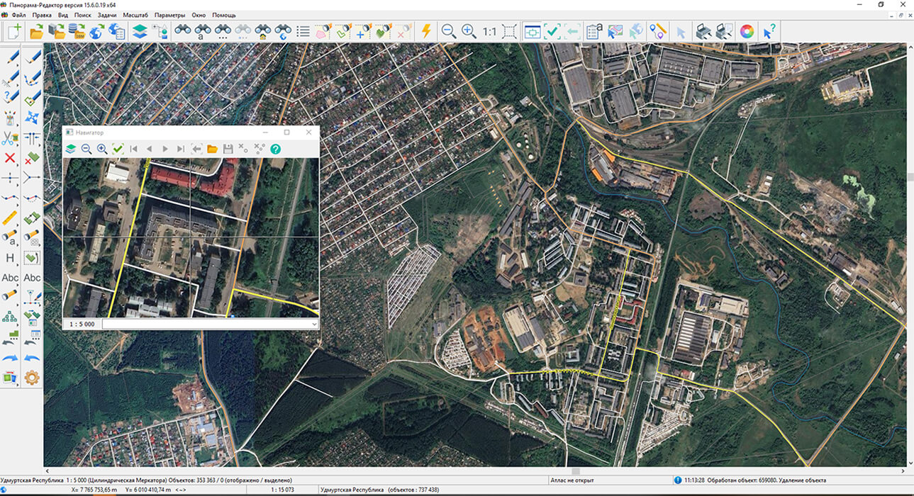
Specialists from KB "Panorama" have prepared and published a map of the Udmurt Republic on the "Spatial Data Bank" geoportal. The map was generated from OpenStreetMap data. The map can be used with GIS "Panorama Mini" or other software products from KB "Panorama".
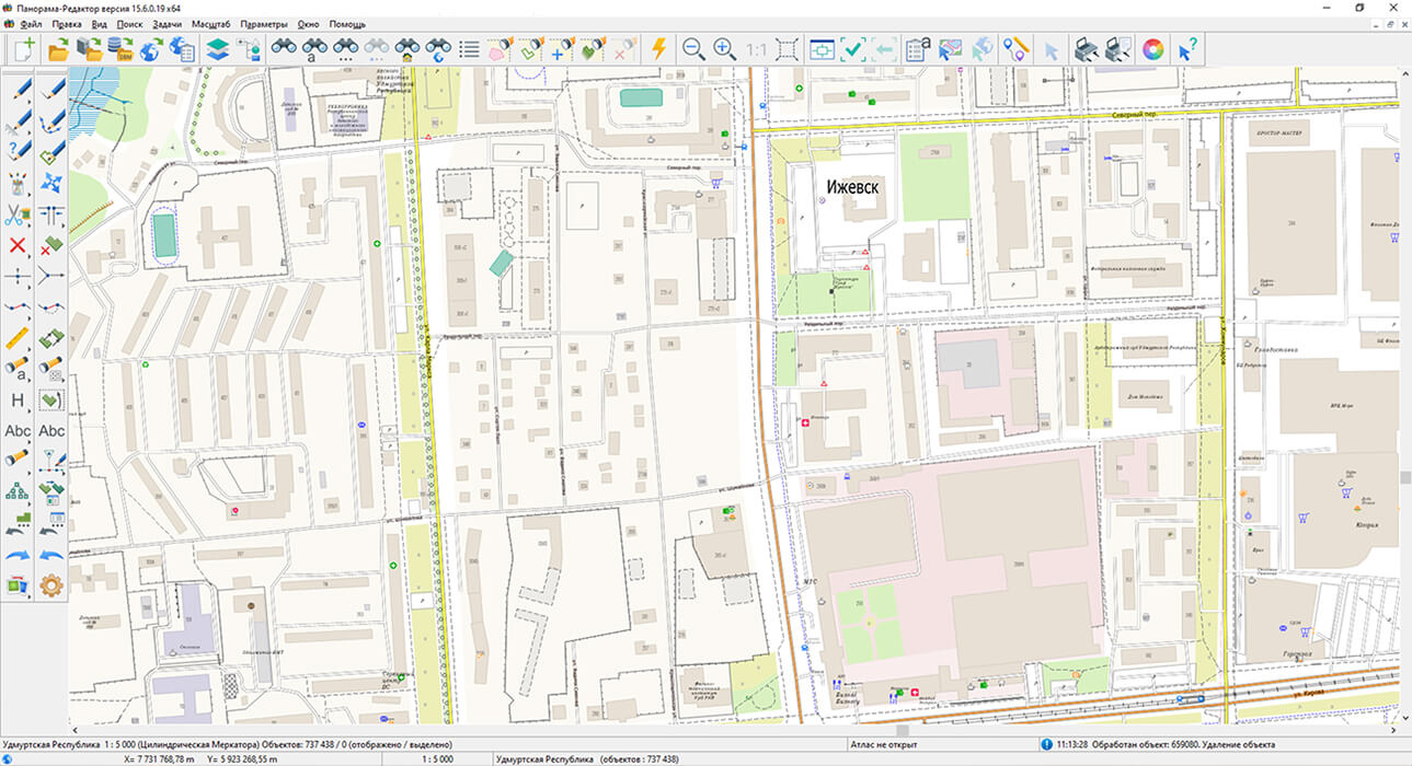
The map has been converted to the modernized large-scale plan classifier at a scale of 1:5,000 (map5000m) and saved as a packaged project (mptz). The MPTZ project comprises a digital map covering the region's territory (country, federal subject, administrative district) and a digital classifier. Updates were placed in the spatial data bank using the Digital Maps and Remote Sensing Data Bank program. The publication of the spatial data bank's contents on the geoportal and access to data for download are implemented via GIS WebServer SE.
Free maps based on OpenStreetMap data are available for download on the page.

Specialists from KB Panorama have prepared and published a map of the Udmurt Republic on the geoportal. The map was generated from OpenStreetMap data. The map can be used with or other software products from KB Panorama.
The map has been converted to the modernized large-scale plan classifier at a scale of 1:5,000 (map5000m) and saved as a packaged project (mptz). The MPTZ project comprises a digital map covering the region's territory (country, federal subject, administrative district) and a digital classifier. Updates were placed in the spatial data bank using the . The publication of the spatial data bank's contents on the geoportal and access to data for download are implemented via .
Free maps based on OpenStreetMap data are available for download on the "Digital Maps" page.

KB "Panorama" has developed the version 9.11.0. Support for the secure PHP 8.5.12 version has been added to the program. It closes the critical vulnerabilities CVE-2026-109618 and CVE-2026-109619, known collectively as PHP2Shell, which allow remote code execution without authentication. The new version includes a number of improvements to metadata control mechanisms, dataset management, and administration of the Data Bank.
Improving the security of the software package contributes to ensuring stable operation of spatial data funds, preserving information resources, and maintaining metadata integrity. This is particularly important for information systems accessible via departmental and interdepartmental networks, as well as when organizing access to spatial data for external users. The new version creates additional conditions for secure operation of the Data Bank as part of federal and regional information infrastructure.
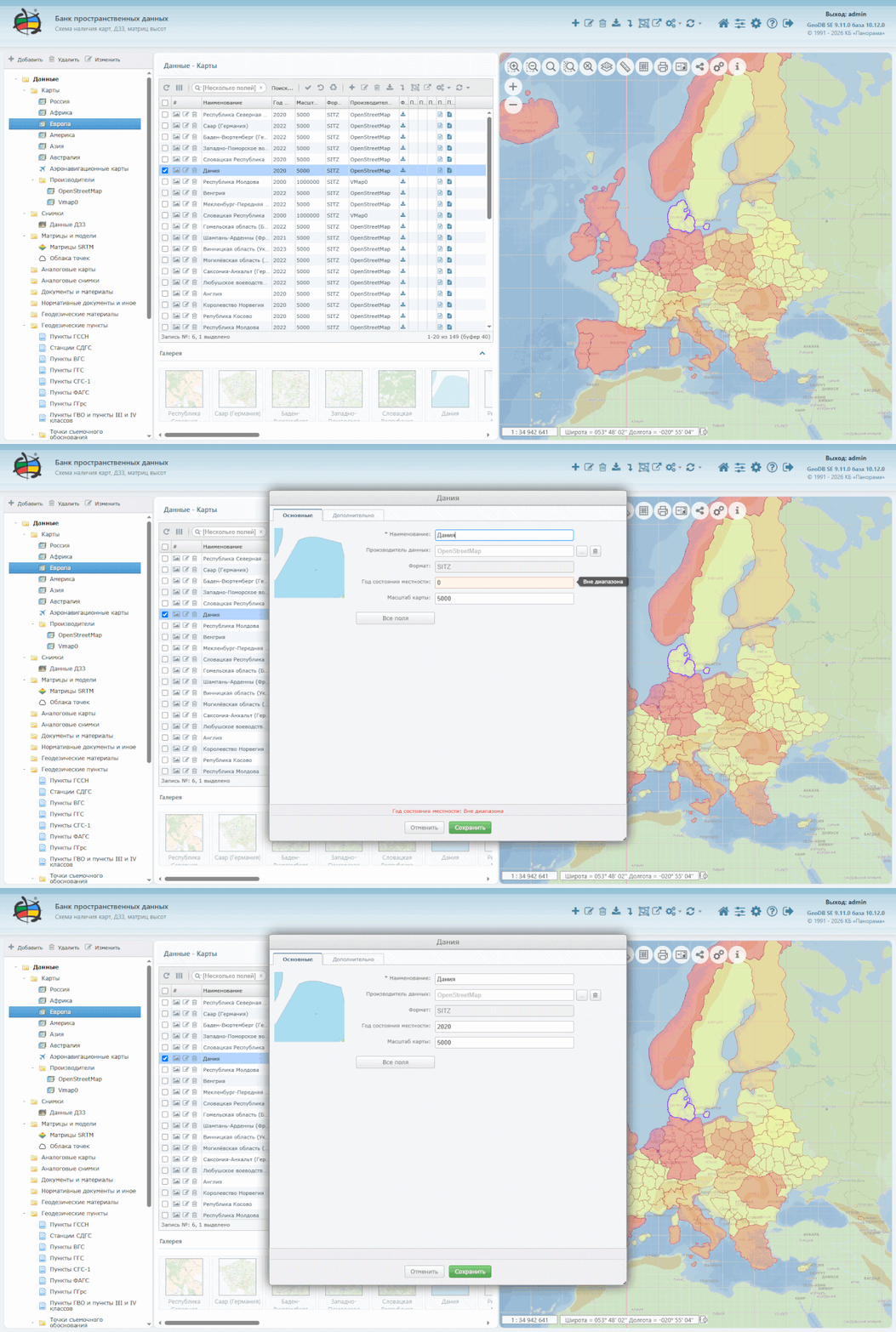
Metadata control has been strengthened. When the edit form is opened, field values are validated. If invalid values are detected, the user receives a corresponding message. Re-validation is performed when changes are saved, which allows errors to be identified promptly and improves metadata quality.
Information on metadata approval has been added. The metadata now includes the fields "Approval Date" and "User Who Approved the Record." When a record is approved, the field values are filled in automatically. For previously approved records, filling in based on the edit date or the metadata record creation date is provided.
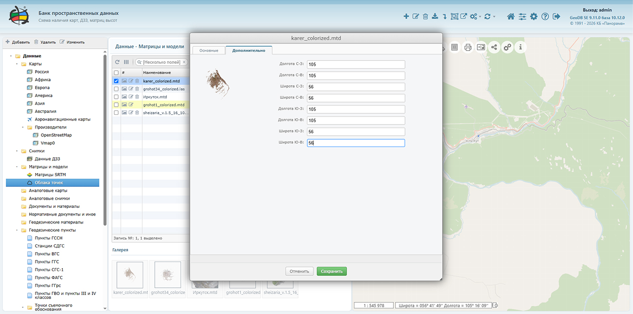
Tools for editing dataset extents have been extended. A capability has been added to correct extent coordinates if they were not filled in automatically or contain zero values. When editing and approving metadata, automatic creation and updating of the meta.xml file is ensured. The update affects only information about dataset extents.
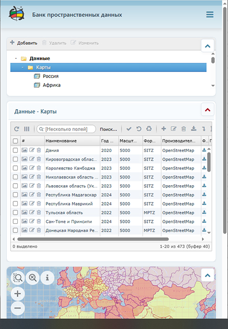
Operation with the mobile interface has been improved. When panels are arranged vertically, a capability has been added to collapse the data tree panel, table, and map panel into a row. This improves usability on devices with limited screen size.
The Digital Maps and Remote Sensing Data Bank is the basis for building spatial data infrastructure at the federal, regional, and municipal levels and in corporate information systems. Within the unified geoinformation space, the Digital Maps and Remote Sensing Data Bank implements collection, storage, quality control, search, and delivery of spatial data in exchange formats. Spatial data selected using the program can be placed for multi-user access on and published according to international OGC WFS, WFS-T, WMS, WMTS, WCS standards on the application server. Users can access data both from a thin client (using GIS WebServer SE) and from desktop applications (, ). The Digital Maps and Remote Sensing Data Bank provides for the construction of cloud storage of spatial data, provision of access to this data, and automated generation and updating of geo-coverage.
The current state of spatial data is displayed using schematic maps maintained for each type of stored data: vector maps, remote sensing data, elevation matrices, and terrain models. Remote placement of spatial data sets in file storage, version management of stored sets, updating of data availability schematic maps, automated collection and generation of metadata, and generation and updating of geo-coverage are provided. Automated collection and generation of metadata is performed according to ISO 19115:2003, Geographic information — Metadata and ISO/TS 19139, Geographic information — Metadata — XML schema implementation standards. Thumbnail copies of data images are generated automatically, and file checksums and dataset completeness are verified. Placement of spatial data in file storage is carried out with integrity verification and control of data structure and content. Work results are logged and entered into the metadata database. Automatic backup of metadata and spatial data storage with integrity control and data recovery is provided. A multilingual interface is supported.
Data security is ensured by access rights differentiation based on security tools included in the operating system. Basic authentication, digest authentication, system authentication (by web server means), and domain authentication (Kerberos or Active Directory) are supported. Additional security is provided by end-to-end authentication when working with the database. The database connection is made with the rights of the user working with the system. The complex is adapted for operation on a wide range of operating systems (Astra Linux SE, Ubuntu, RED OS, MS Windows, and others) and architectures (Intel, Elbrus, Baikal). The program is registered in the domestic software registry under number 1862.
The portal demonstrates capabilities for organizing storage, accounting, and delivery of vector maps, remote sensing data, elevation matrices, and terrain models. The portal contains vector maps in SXF format generated from open-source data (OpenStreetMap, VMap0). The spatial data includes maps of Russian federal subjects, countries, and cities of near and far abroad. In total, more than 470 vector maps and 6,700 matrix data sets with a total volume of more than 100 GB. KB Panorama specialists update and actualize the information composition on the portal weekly. All published data is distributed free of charge under a free license.
The new version of the program is available on the page.
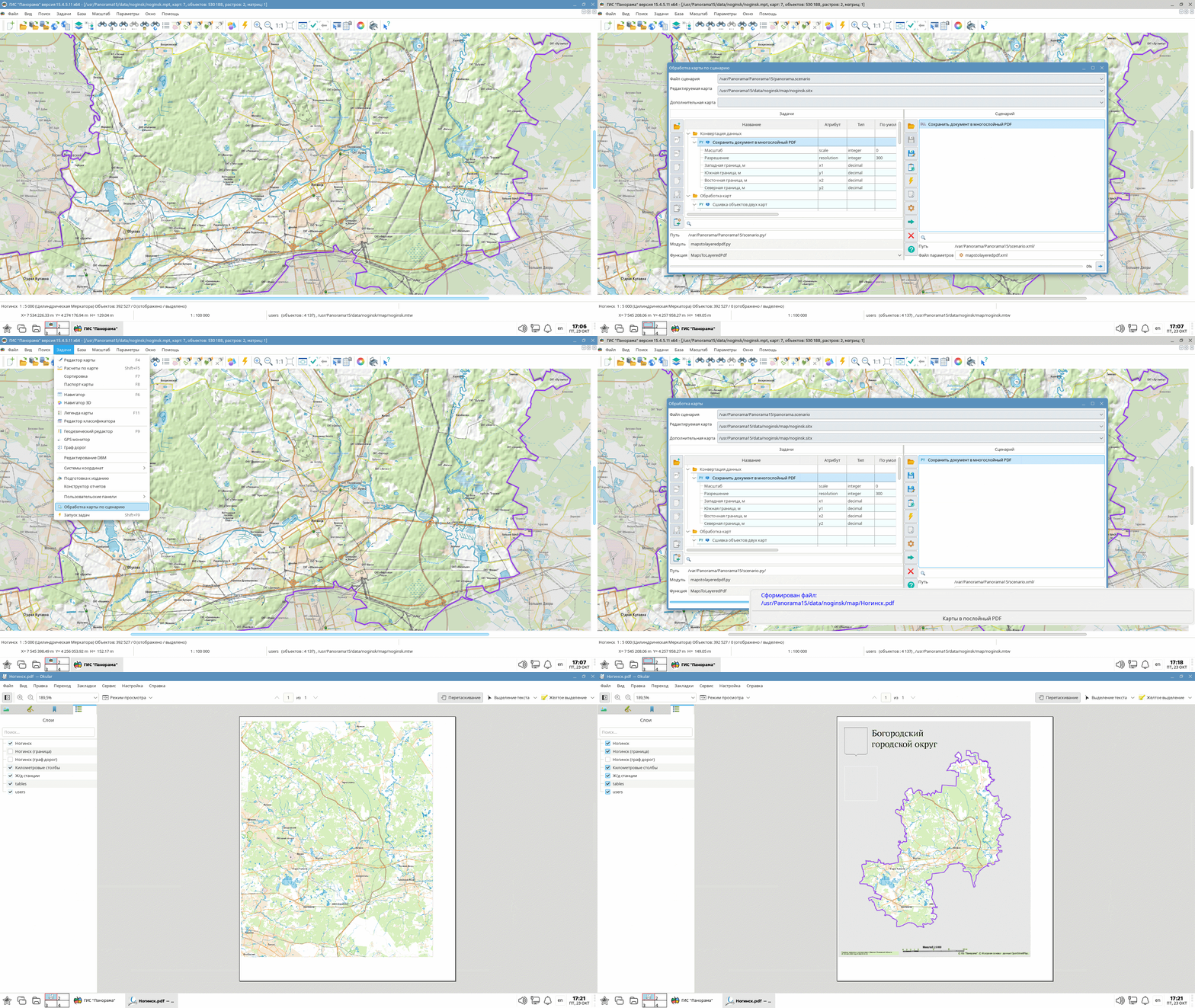
KB "Panorama" has developed version 15.4.5 for Astra Linux Special Edition, Alt Linux, RED OS, Ubuntu, and AlterOS. The new version implements vector map processing by scenarios with connection of Python scripts and dynamic library functions. Tasks for map transformation by control points and calculation of projection parameters for local coordinate systems have been added. Support for group semantics for storing multi-level attribute structures of spatial objects has been implemented. Object creation and editing tools, metric and topology control of multipolygons have been improved, and data import capabilities from DXF and tabular formats have been extended.
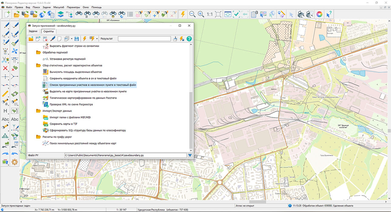
A mode has been implemented, designed to automate vector map processing. Users can create scenarios from basic and custom tasks, configure parameters, and define the sequence of operations. The list of available tasks is extended by connecting Python scripts and dynamic library functions, which allows custom spatial data processing algorithms to be included in scenarios. Execution of the entire scenario and selective launching of individual tasks are supported. If necessary, an additional vector map can be connected for processing. Scenarios and task parameters are saved in files for reuse. An extensive set of tasks is available for scenario creation, including object creation, semantics filling, metric correction, label placement, map preparation for printing, and many other operations. The new mode allows regularly performed operations to be combined into a single process and reduces the number of manual actions when preparing and updating maps.
A "Vector Map Transformation" task has been added, designed for georeferencing maps to a specified coordinate system and correcting displacements and deformations of objects by control points. Four linear and three nonlinear transformation methods are supported, including affine, polynomial, and rubber sheet transformations. Point coordinates are loaded from catalogs or measured on the source and additional maps in single-window and two-window modes. To assess accuracy, residuals and root-mean-square deviations at control and check points are displayed. Construction of nonlinear distortion matrices allows transformation methods to be compared and the appropriate one selected for specific data. Processing of an individual map, selected objects, all open vector maps, or maps from an MPT project is provided. The new task allows cartographic materials from different sources to be harmonized and mutual layer displacements to be eliminated when updating maps.
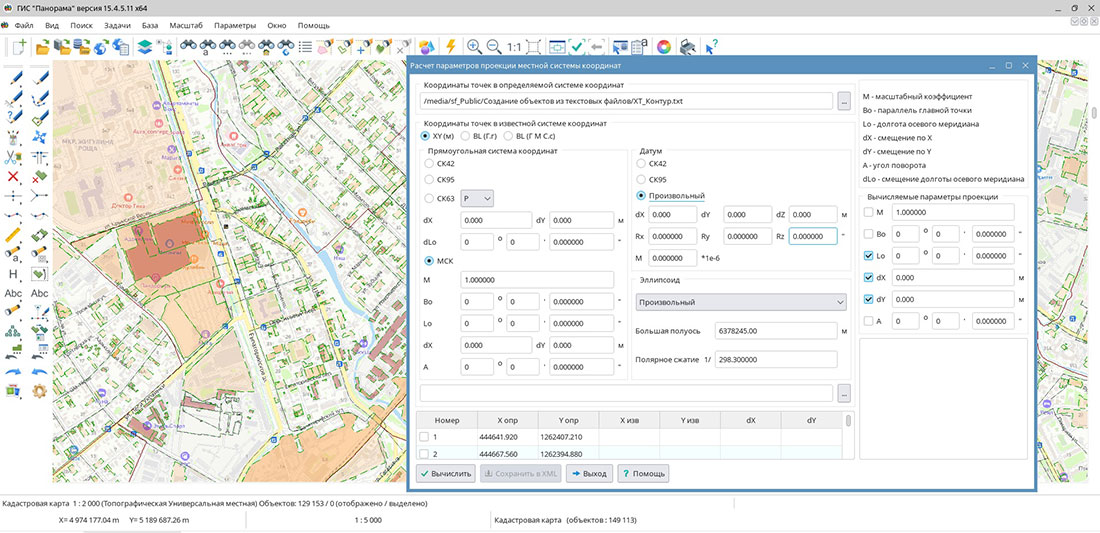
A task has been implemented, allowing projection parameters to be determined from the coordinates of common points in the local and known coordinate systems. Source data is loaded from geodetic or plan coordinate catalogs in SK-42, SK-63, SK-95, and local systems with known parameters. Calculation of Transverse Mercator projection parameters, of which the Gauss-Krüger projection is a special case, as well as the rotation angle of the local coordinate system, is provided. Users can select the parameters to be calculated and fix known values. For accuracy control, residuals and root-mean-square deviations are displayed separately for control and check points, providing an independent assessment of results. The obtained parameters are saved in XML for subsequent use in creating electronic maps. The new task simplifies determination of missing LCS parameters and harmonization of cartographic data from different sources.
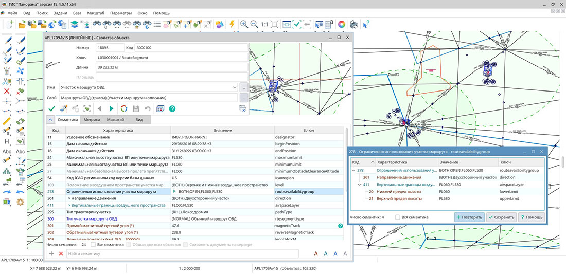
A new attribute type — — has been implemented to describe complex properties of spatial objects. It allows related characteristics to be combined into multi-level structures containing individual semantics, repeating value sets, and other nested groups. Such structures correspond to the representation of complex data in XML and JSON or in related database tables. A simple example of group semantics is a building address. A single object may have multiple "Address" groups, each combining "City," "Street," and "House" values. In cadastral data, this method can be used to store repeating information such as "Right Holders," "Description of Share in Right," and "Title Documents." In aeronautical data, the "Airspace Class Description" group semantics may include a nested repeating group, "Vertical Airspace Boundaries." Populated characteristics are displayed in the as a tree. To search for and select objects, a capability has been added to take into account whether a characteristic belongs to a specific group. For example, the "Organization Name" semantics can be searched separately within the "Managing Organization," "Operating Organization," or "Maintenance Organization" groups. This allows working not only with the attribute value but also with its role in the object description structure.
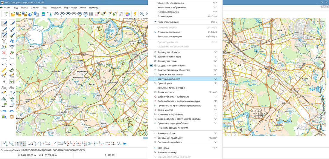
Tools for creating and editing map objects have been improved. A helper mode, "Vertical/Horizontal Line," has appeared in the ; it automatically selects the construction direction based on cursor movement. When changing an object type, the main transformation parameters have been moved to a separate panel, which reduces the number of intermediate prompts during data processing.
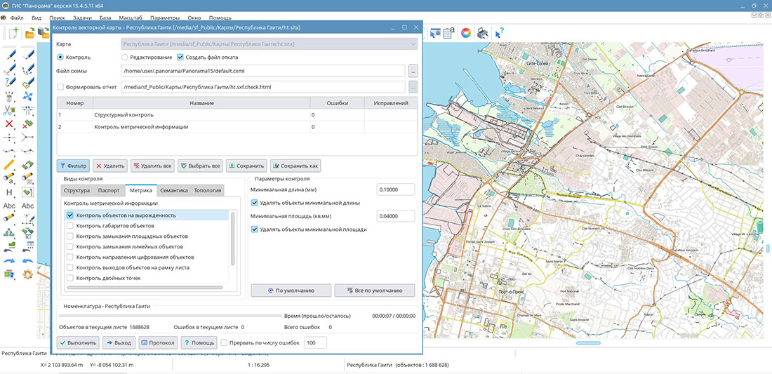
has been refined. When checking the minimum number of metric points, object properties set in the classifier are now taken into account. For objects with the "Metric Not Mandatory" flag, the absence of a metric is not considered an error, and for vector signs with the "One Point in Metric" flag, the presence of one or two points is allowed. Support for multi-point objects containing two or more points in one or several metric contours has been added. Multipolygon topology control has been improved when checking self-intersections and sub-object containment. The system distinguishes between permissible and erroneous cases of boundary contact: adjacency of external contours of a multipolygon at a single point is allowed and is not recorded as an error. If an external and an internal contour touch at a single point, in edit mode automatic geometry correction can be performed by shifting the point of one of them by up to 0.04 mm at the map scale. This allows the geometry of complex objects to be taken into account more precisely and reduces the number of false messages during automated control of digital maps.
Data import tools have been updated. When loading DXF files, processing of MultiLeader primitives has been added, with leader generation and consideration of their formatting parameters. During data import, both clusters — right and left — are processed and generated. Processing takes into account an unlimited number of leaders in each cluster. The task now supports processing of arbitrary-length strings, enabling the loading of objects with complex geometry, an arbitrary number of points, and multi-contours. For data in local coordinate systems, an option to swap the X and Y axes during import is provided.
GIS "Panorama" is a universal domestic geographic information system. The program is designed for accumulation, storage, automated processing, and display of data, calculation results, and forecasts with geospatial referencing. GIS "Panorama" contains tools for displaying and processing vector, raster, and matrix maps. The application provides users with tools for solving specialized tasks such as modeling the movement of special objects against a 3D model background, forecasting the consequences of emergencies at hazardous facilities, monitoring aircraft movement, conducting geodetic and topographic works, processing data from GPS/GLONASS navigation devices, printing displayed spatial data to various output devices, and many others.
The new version of the program is available for download in the section.
Ph.: +7 (499) 402-2445,
+7 (925) 221-1603
www.gisinfo.ru | panorama@gisinfo.ru
105005, Russia, Moscow, Baumanskaya Street,
house 7, building 1, office 229 (m. Baumanskaya)
Copyright © Panorama Group 1991 - 2026










 Mobile version
 Full version
