 KB Panorama
Copyright © Panorama Group 1991 - 2022
GIS toolkit GIS WebToolKit for 1C
GIS WebToolKit for 1C - a toolkit for creation of GIS-modules for a typical configuration 1C:Enterprise 8.3.
Product is implemented in Russian.

The toolkit consists of an extension for a typical 1C:Enterprise configuration and a web application (developed with using the toolkit of developing geoinformation Web-applications the GIS WebToolKit SE).
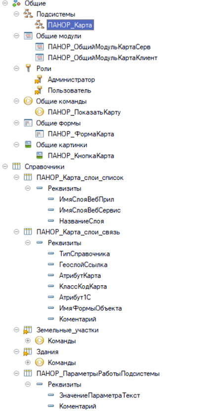
An extension for a typical configuration allows 1C developers to add functions for working with spatial data directly into a managed 1C form.
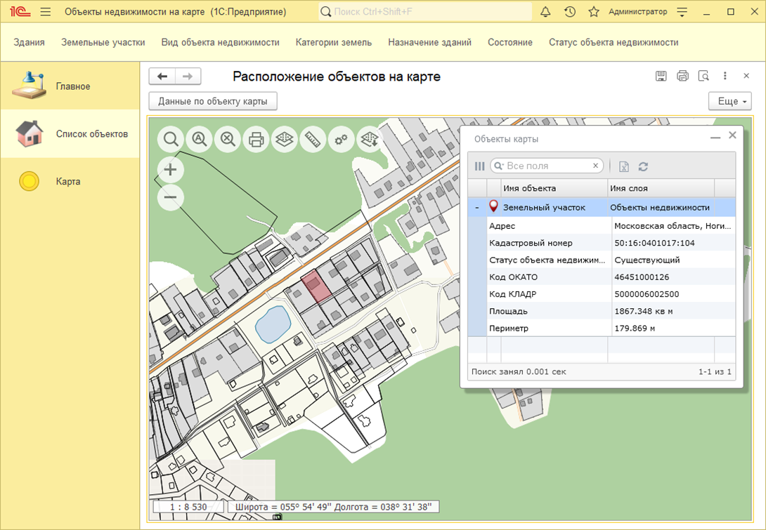
Spatial data can be published on various web services: Panorama, Yandex, OpenStreetMap, Rosreestr and others. When using the GIS WebService SE program in an enterprise, you can deploy your own web service and fill it with spatial data from various sources and formats using the GIS Panorama x64.
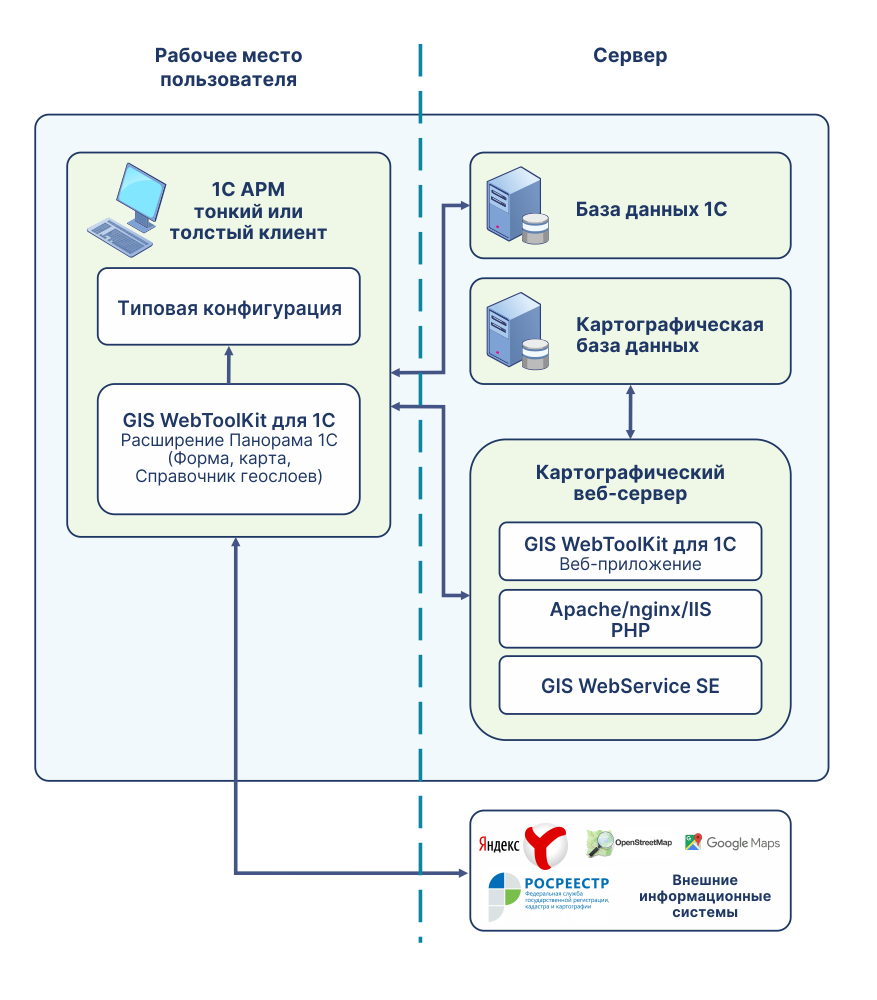
GIS WebToolKit for 1C provides:
GIS WebToolKit for 1C uses a client-server architecture. Accessing the web service and exchanging data with clients is performed through an element of the 1C managed form of the «HTML document field»type via HTTP requests.
To access spatial data from 1C (images of the area, descriptions of individual spatial objects, analytics), they must be previously published on a web server as cartographic web services using GIS WebService SE.
Spatial data is published on a web service in the form of separate spatial layers (hereinafter referred to as geolayers). Geolayers can be overview and thematic (subject). Overview spatial geolayers contain an overview map (a map-substrate containing an image of the earth's surface) that are used to navigate in space. Overview maps can be obtained from various web services: Panorama, Yandex, OpenStreetMap, Rosreestr, etc. Thematic geolayers contain descriptions of spatial objects from a specific subject area (land plots, capital construction projects, power grids, gas pipelines, elements of industrial infrastructure) for a certain territory. All geolayers can be created using professional GIS Panorama x64.
Thematic geolayers are stored in the GIS Panorama format, published on a web service by means of GIS WebService SE and processed on the 1C side by means of a managed form. The connection between map objects and elements of typical 1C directories is carried out by storing an identifier (value) from the attribute of the 1C directory in the map object. One thematic geolayer may contain objects associated with different 1C directories. For unambiguous correspondence of the map object and the directory, additional information is used - the classification code of the map object, which is specified in the service directory.
A typical 1C configuration should have an interface type - Taxi.

Ph.: +7 (499) 402-2445,
+7 (925) 221-1603
www.gisinfo.ru | panorama@gisinfo.ru
105005, Russia, Moscow, Baumanskaya Street,
house 7, building 1, office 229 (m. Baumanskaya)
Copyright © Panorama Group 1991 - 2026
 Mobile version
 Full version
