
Copyright © Panorama Group 1991 - 2026

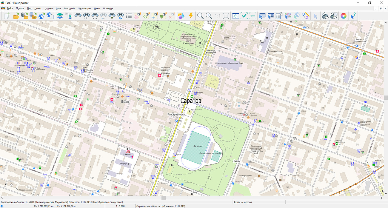
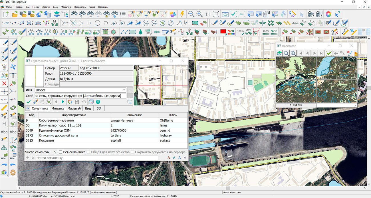
Specialists of KB "Panorama" have prepared and published a map of the Saratov Region on the geoportal. The map was generated from OpenStreetMap data. To work with the map, users can use the software or other software products from KB "Panorama".
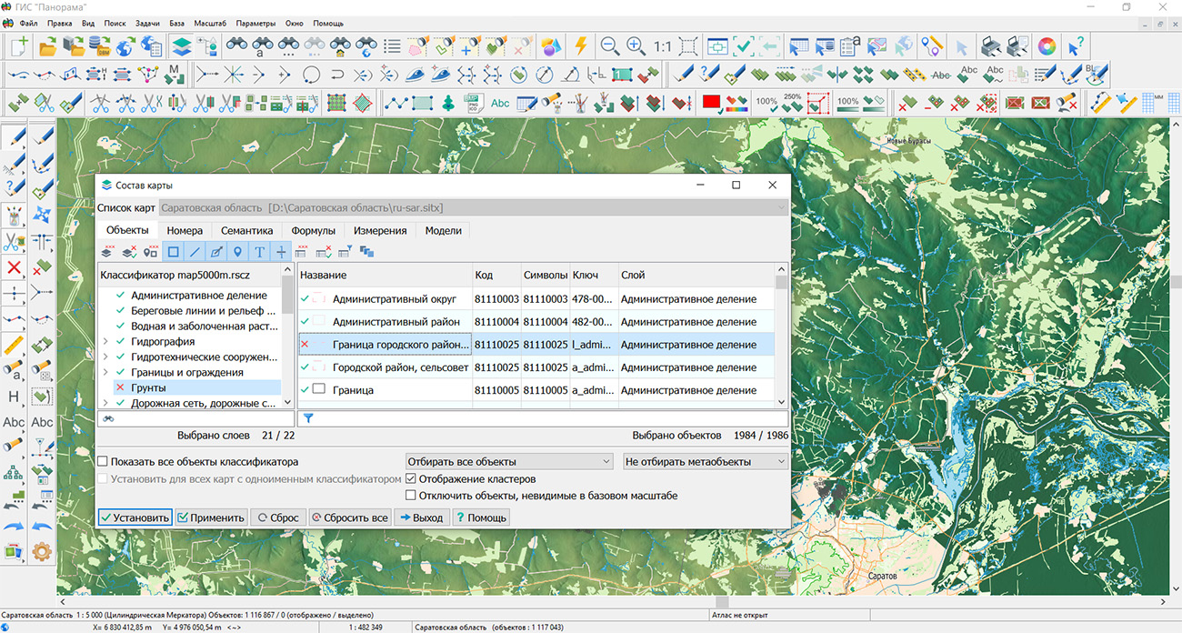
The map has been brought into compliance with the modernized classifier of large-scale plans at a scale of 1:5,000 (map5000m) and saved as a packed project (MPTZ). The MPTZ project includes a digital map covering the region's territory (country, federal subject, administrative district) and a digital classifier. Updates were placed in the bank of spatial data using the software. Publication of the bank of spatial data content on the geoportal and access to data for downloading are implemented via .
Free maps based on OpenStreetMap data are available for download on the "Digital Maps" page.
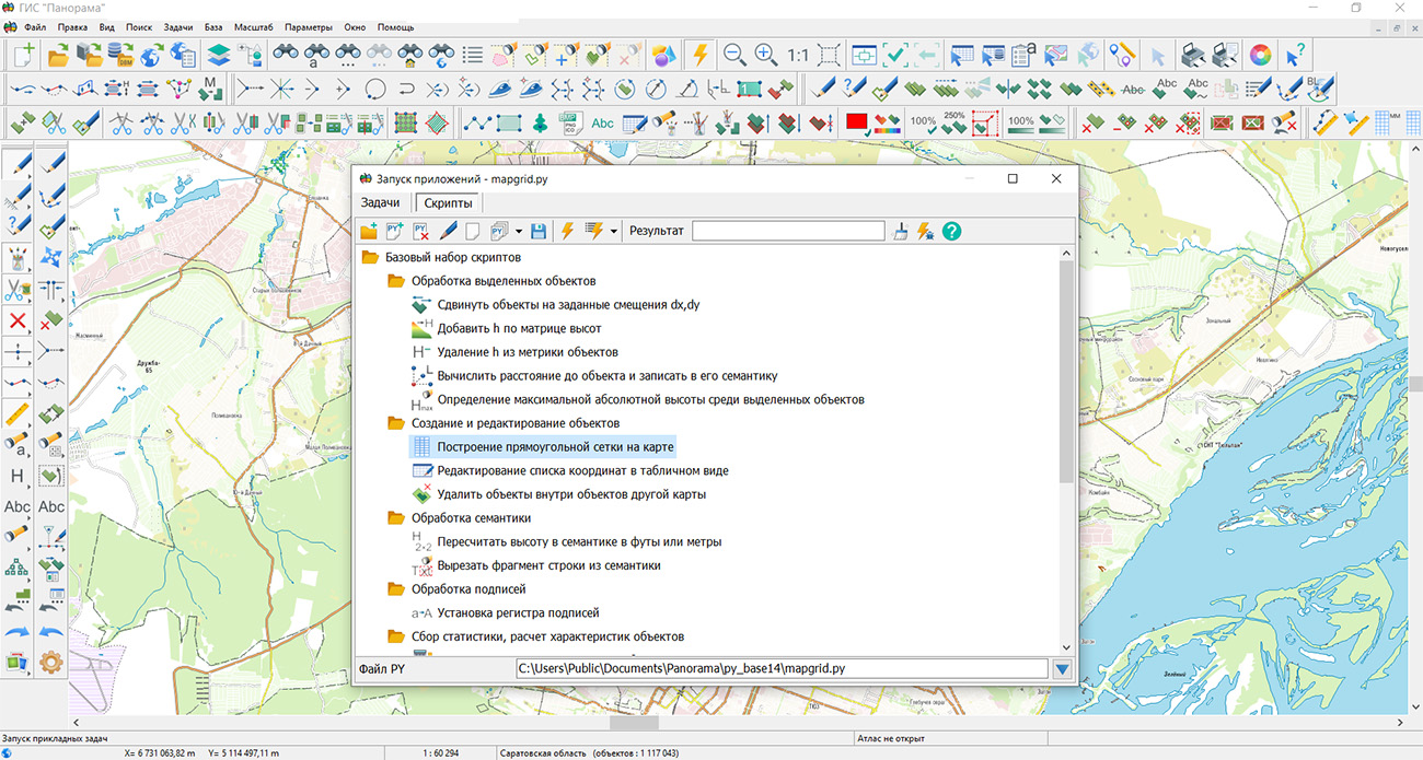

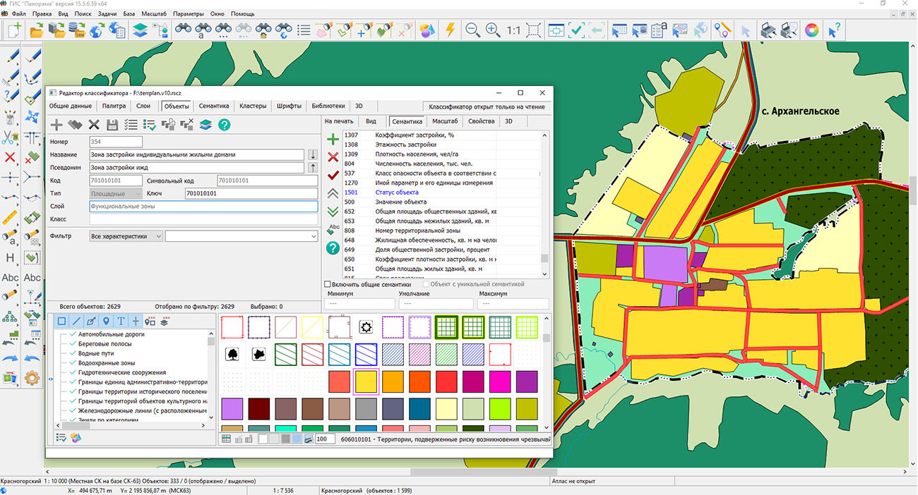
Specialists of KB "Panorama" have prepared a new version of the digital classifier terrplan.v10.rscz, corresponding to the schema . The classifier is intended for creating territorial planning schemes and preparing spatial data for information interaction with the FGIS TP (Federal State Information System for Territorial Planning).
The update was carried out taking into account Order No. 65 of the Ministry of Economic Development of Russia dated 02/06/2025 "On Amendments to the Requirements for the Description and Display in Territorial Planning Documents of Objects of Federal Significance, Objects of Regional Significance, Objects of Local Significance, Approved by Order of the Ministry of Economic Development of Russia No. 10 dated January 9, 2018," as well as changes introduced into the current XML schema of the FGIS TP.
The classifier has refined the composition of territorial planning objects, their attribute descriptions, and conventional symbols. New characteristics have been added, including "Status of the Subject of Protection of a Historical Settlement" (STATUS_OCH) and "Main Specialization, Type of Activity" (MAIN_ACTTV). The names and types of a number of attributes have been updated, and the mandatory nature of their completion for various types of objects has been clarified.
The changes affected the description of cadastral information, timelines for the implementation and functioning of objects, characteristics of transport infrastructure, and other data. In particular, the attributes of the cadastral number of a capital construction object and land plot, the date of the founding document, the date of entering information about ZOUIT (zones with special conditions for the use of territories) into the EGRN (Unified State Register of Real Estate), the implementation timeline, and the parameters of passenger and freight train movement have been updated.
For a number of objects of protection and territorial zones, the use of the STATUS attribute has been brought into compliance with the current FGIS TP schema. The classifier uses the reference description STATUS_PR, which ensures the correct formation of the STATUS value during data export.
The composition of spatial objects has been brought into compliance with the new schema. Conventional symbols have been added for displaying bus and electric bus lines, public access points, self-regulating intersections at the same level, service driveways, and other objects. Descriptions of certain objects that have lost relevance have been excluded, including transport and logistics centers, transport interchange hubs, and territories of advanced socio-economic development.
The updated classifier ensures uniform description and display of objects of federal, regional, and local significance in the preparation of territorial planning documents of the Russian Federation, constituent entities of the Russian Federation, and municipalities.
The digital classifier terrplan.v10.rscz and the schema fgistp_2026_0_fixed_04.09.xsd are included in the . The new version of the classifier is available for download in the "Classifiers" section.

KB "Panorama" has developed version 16. The new version of the service implements centralized storage of WPS process states, expands tools for working with database tables, and adds support for publishing vector tiles. This enables tracking operations in distributed systems and publishing cartographic data for web applications.
The WPS service now stores information about executed processes in a shared database. For each operation, the identifier, start and completion time, completion percentage, current state, and processing result are recorded. Any service connected to this database can retrieve information about the process and transmit it to the client. An operation launched on one node can be tracked through another instance of the service. This approach creates the foundation for forming cluster segments of WPS services and distributing status check and result delivery requests among available nodes.
Cartographic data publishing capabilities have been expanded. Vector tiles in PBF format have been added, along with related styles, sprites, and glyphs necessary for displaying maps in web applications. Tile retrieval via direct links of the form {z}/{x}/{y} has been implemented.
A new data type, "Arbitrary DB Table," and a library for working with such tables have been added. Functions for accessing and displaying tabular data have been implemented. The composition of information about layers returned to the user across all services has been expanded. The response now includes information about the composition of the MPT project and indicators of the availability of point object search and text search. This allows client applications to take into account the capabilities of each layer when forming map interaction tools.
Processing of data from third-party sources has been improved. When republishing point search and text search requests, the service automatically converts responses from third-party servers into a representation corresponding to the OGC WFS standard or GeoJSON format. The conversion ensures a uniform representation of search results for subsequent processing in application systems. A request for converting images from PNG, JPEG, and BMP formats to TIFF has been added.
GIS WebService SE supports all international standards (OGC WFS, WFS-T, WMS, WMTS, WCS, WPS), through which spatial data transmission and display are carried out. The program implements the ability to serve tiles in any user-defined or local coordinate system. The service supports the OpenAPI 3.0 specification and REST API methods. The application is implemented on Windows and Linux platforms and is compatible with Apache, IIS, and nginx web servers.
The new version of the program and documentation are available on the website in the section.


KB "Panorama" has completed organizational and technical measures for assessing the conformity of the quality management system (QMS) by the authorized certification body for QMS, LLC "SOYUZSERT," accredited in accordance with Decree of the Government of the Russian Federation No. 546 dated April 30, 2019, in the sphere of the defense-industrial complex. Based on the results, the validity of Certificate of Conformity for the quality management system No. OA OPK.RU.130019SMK0104 dated 10/10/2025 to the requirements of GOST R ISO 9001-2015, GOST RV 0015-002-2020, as well as other state military standards of the SRPP VT, has been confirmed.

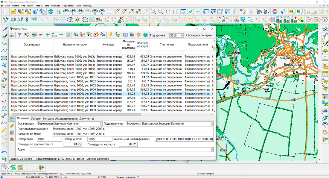
KB "Panorama" has developed "Agronomist Workstation" version 15.5.6. The new version expands the tools for remote monitoring of agricultural lands and the preparation of industry-specific documentation. The improved tools help specialists process satellite and aerial survey materials faster, monitor changes in the farm's territory, and formalize survey results.
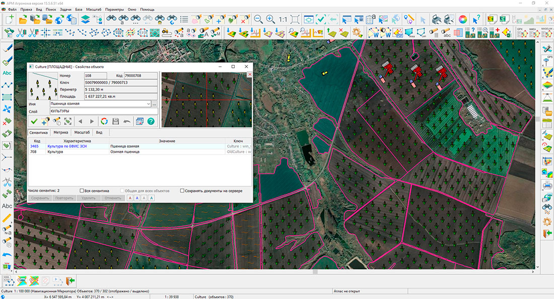
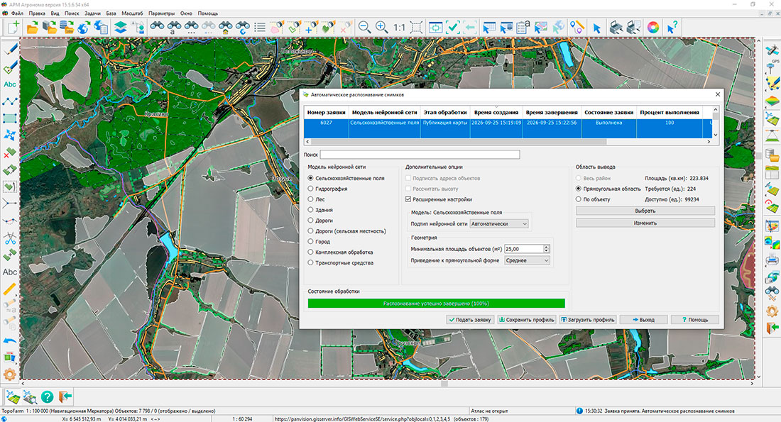
In the tasks of and , it is now possible to process data strictly within the boundaries of a selected contour. Along with the recognition request, the program transmits the contour of the field, land, or other territory, and the resulting objects are automatically clipped to its boundary. This allows agronomists, land surveyors, and specialists of land control services to exclude neighboring plots from the results and focus on the territory of interest. This approach is useful for clarifying the composition of agricultural lands, identifying changes in land use, and verifying the relevance of the farm's digital map.
Recognition parameters can now be saved in JSON profiles and reused. The profile includes the selected neural network model, object classes, and vectorization parameters. Prepared settings can be transferred between workstations and used for similar surveys of different production areas. This reduces the number of manual operations, ensures uniformity of processing, and simplifies collaboration between agronomic and land surveying services.
For preliminary control of source data, reference objects can be selected using a map filter. Suitable contours are highlighted on the map, saved in the profile, and restored on the next launch. Recognition results are transferred directly to the current map with automatic classifier alignment. As a result, the specialist can more quickly compare objects identified from images with existing information and determine areas requiring desk review or field visits.
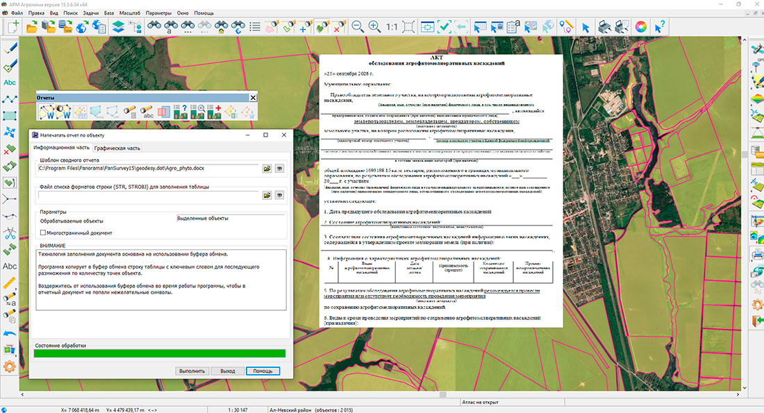
Additionally, the preparation of documents on protective plantings has been improved. In the , the generation of survey reports for agroforestry and agrophytomeliorative plantings has been implemented according to the form approved by Order No. 225 of the Ministry of Agriculture of Russia dated April 26, 2024. The program uses the geometry and characteristics of map objects to fill out the report, which facilitates documenting the condition of forest belts and other elements of agricultural land protection.
The updated tools of "Agronomist Workstation" combine remote observation, cartographic analysis, and the preparation of regulated materials. Their use allows specialists to detect changes in agricultural territories more promptly, plan surveys, and keep information about lands and protective plantings up to date.
The new version of the program is available for download in the Download section.
Ph.: +7 (499) 402-2445,
+7 (925) 221-1603
www.gisinfo.ru | panorama@gisinfo.ru
105005, Russia, Moscow, Baumanskaya Street,
house 7, building 1, office 229 (m. Baumanskaya)
Copyright © Panorama Group 1991 - 2026


 Mobile version
 Full version
