Copyright © Panorama Group 1991 - 2024

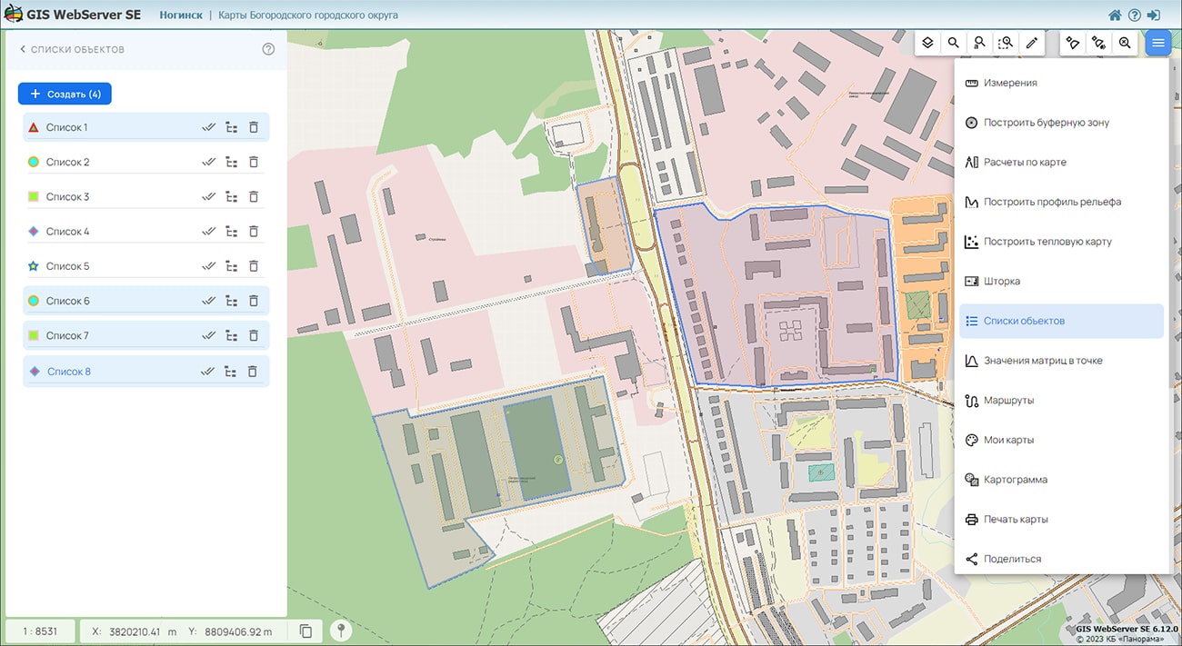
In KB "Panorama" the version 15.3.0 has been developed.The new version adds support for a new standard - OGC 14-065r2 Web Processing Service version 2.0.2 (OGC WPS). In many cases, geospatial or location data, including data from sensors, data from drones, and other data, must be processed before the information can be effectively used. In most cases process of preliminary data processing can take a long time and require significant resources from the server. This standard provides an the interface for execution of simple and difficult computing methods of processing of the information. The OGC WPS standard supports both immediate processing of operations that require little time for execution, as well as asynchronous processing for more complex and time-consuming tasks. OGC WPS standard defines the general model of process and provides a description of the processing functions and their parameters. It is intended for support of cataloging and detection of processes in the distributed environment. Using the model of the OGC WPS standard, the service allows you to receive/issue parameters, both by direct value and through links, for example, the results of previous operations or data from other services.
For OGC WPS, all operations available in the standard are supported: GetCapabilities, DescribeProcess, Execute, GetStatus, GetResult, Dismiss. Based on OGC WPS, all asynchronous information processing methods already available in the service are standardized, such as: checking intersections between objects of different layers; construction of intersections between objects; updating the data cache; building visibility zones; building matrixes of heights; construction of thermal and thematic maps and others. Using the commands of the standard, you can run any other requests supported by the service in synchronous or asynchronous modes. Descriptions of requests and their parameters can be obtained from the OGC WPS specification - GetCapabilities/DescribeProcess requests, and from the OpenApi 3.0 specification - a universal interface for users (clients) to interact with services (servers).
GIS WebService SE supports all international standards (OGC WFS, WFS-T, WMS, WMTS, WCS, WPS), which are used to transfer and display spatial data. The program implements the ability to issue tiles according to any user or local coordinate system. The application is implemented on Windows and Linux platforms and is compatible with Apache, IIS and nginx web servers.
The new version of the program and the documentation are placed on the website in the section.


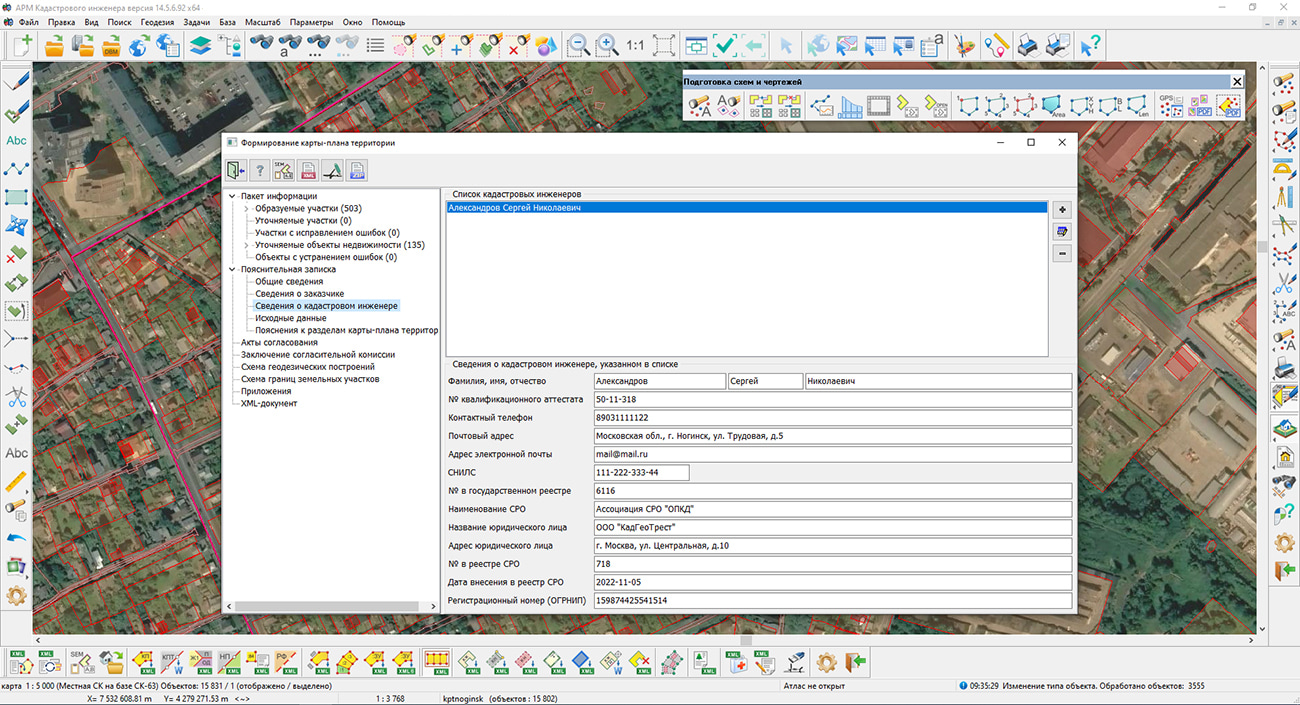
Specialists of KB "Panorama" have prepared a video lesson on using the mode. Dialog is intended for creation of the electronic document "a territory Map-plan" in which reproduces necessary for placing into EGRN an information about land plots located within the boundaries of the territory where complex cadastral works are performed, as well as information about the location of buildings, structures, objects under construction on such land plots.
The initial initialization of the dialog content is performed by information from the digital cadastral map and from the database of cadastral works. The cadastral map for the formation of a map-plan of the territory should be prepared in accordance with the .
The map should be created with use of survey.v5 or survey.v6 classifiers. To draw objects in respect of which cadastral works are performed, it is necessary to use the objects of the "Cadastral plan of the territory" layer. An exception is the point object "Contour of the construction, OHS off-scale round" (key P_REALTYROUND), used for drawing point objects of real estate, which is located in the "Technical plan" layer.
The territory of execution of complex cadastral works should be digitized by the line of borders including all objects of cadastral works. An object within which complex cadastral works are performed can be of two types - "Cadastral block" (key S_BLOK) or "Boundary of complex cadastral works" (key S_CADASTRE). For an object of the first type, the semantics "Cadastral number" (key KADNUM) must be filled in, for an object of the second type - the repeating semantics "Cadastral number of the block" (key KADNUM_K).
You can get acquainted with the training materials in the "Video lessons" section.


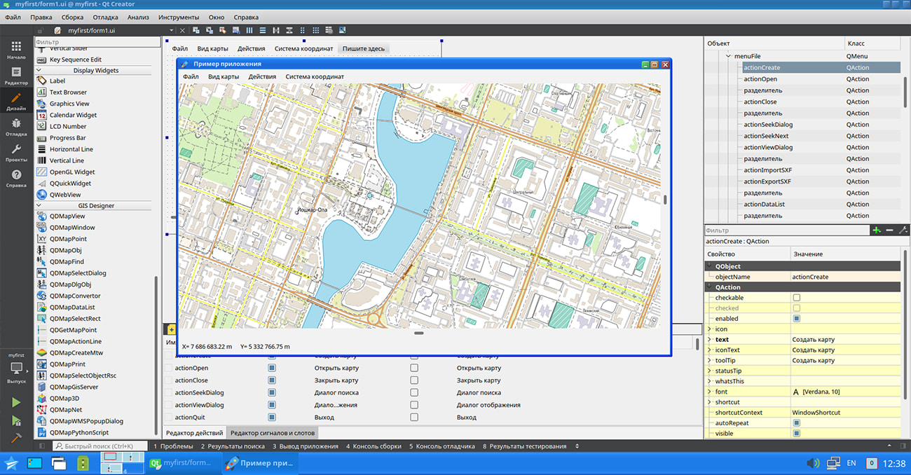
In KB "Panorama" the for Qt Designer SE version 14.3.0 has been developed. In the new version the universal interface of interaction with graphic libraries has been implemented, mechanisms of work of the program in the conditions of the limited system resources have been improved. The list of supported geoportals has been expanded, the display of sea maps has been improved, and new diagnostic capabilities of working the GIS applications have been added.
A programming interface has been developed that allows the developer to use a graphics library for visualization based on his needs. The central element of most GIS applications is the display of spatial data. In this case, the image of a fragment of a digital map is formed using the functions of drawing graphic primitives (lines, polygons, points, and others) by means of a certain graphic library (Qt, GTK, wxWidgets, Xlib, and others). Often the choice of such a library is already determined at the design stage of the application and is a permanent part of the architecture. GIS Constructor provides software tools for implementing data visualization in an application with any selected graphic framework. This is achieved by separating the implementation of displaying graphic primitives into a separate library, which is accessed by the GIS core during the drawing process. As a result, the developer can use either a ready-made set of drawing functions, or implement them independently based on the graphics framework of interest to him. This makes GIS Constructor a universal tool for visualizing spatial data. The installation of the program includes examples of the implementation of drawing graphic primitives based on the Qt and Xlib libraries.
The functioning of the GIS application has been improved with a limited amount of available RAM. The need for the program to work in conditions of a small amount of system resources becomes relevant when using the embedded devices, portable laptops, specialized tablets and other similar devices. If there is a lack of memory, the GIS core automatically activates a buffer with a limited amount of memory and performs all operations with data using only this buffer. As a result, memory consumption by the GIS application is drastically reduced. The new version adds the ability to explicitly set a limit on the amount of memory used by the application for opening the data, when it is reached, this mode will be activated forcibly.
The ability to display only error messages in the diagnostic protocol has been added. This allows you to effectively determine the cause of abnormal behavior of a program that performs a large number of operations with spatial data. In this case, limiting the output by error messages reduces the volume of the resulting protocol and makes it convenient for further analysis.
The task of connecting geoportals has been improved. Into the list of geoportals the geoportal of Krasnodar territory has been added containing the layers: Administrative territorial division, Contours of fields of agricultural land, Fishing grounds, Vine plantations
Display of sea maps according to the S52 standard has been improved. There is clarified the implementation of procedures for forming depth values based on attribute values for underwater obstacles, taking into account the underlying objects, a requesting the code of the displayed symbol and the display flag taking into account the depth of the obstacle and requesting the code of an isolated underwater hazard with a depth less than the safety contour.
GIS Constructor is a set of geoinformation components for use in the visual programming environment of Qt Designer, which allows you to develop your own GIS applications. The visualization of the contents of digital maps is made in conventional symbols adopted for topographic, geographical and various special maps. Geoinformation system has ample opportunities for performing calculations, for providing display of spatial data on various graphic devices in standard and user systems of conventional symbols. The main functions can be executed in multithreaded mode. It supports automatic optimization of used memory for processing large amounts of data (tens of gigabytes) on limited resources (hundreds of megabytes).
The toolkit is adapted for work on a wide range of operating systems (Astra Linux SE, ALT Linux, Elbrus, Ubuntu, CentOS, QNX) and architectures (Intel, Elbrus, PowerPC, SPARC, ARM). The toolkit includes components of visual designing the GIS applications and library of a multiplatform multithreaded GIS core. GIS Constructor provides a cross-platform MAPAPI interface that allows a programmer to implement development in an operating system convenient for it. The developer can release GIS applications for a set of operating systems by simple assembly with minimal changes to the program source code.
The new version of the program is available for download in the section.


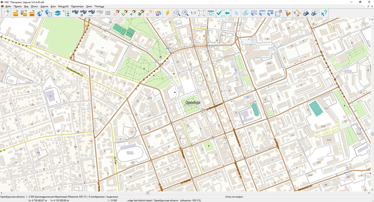
Specialists of KB "Panorama" have prepared and placed the map of the Orenburg region on the geoportal . The map was formed using OpenStreetMap data. To work with the map, you can use the program or other software products of KB "Panorama".
The map was led to the modernised classifier of large-scale plans of scale 1: 5 000 (map5000m) and was saved into a packed project (MPTZ). The MPTZ format project includes a digital map of the region's territory (country, subject of the federation, administrative region), a map of the administrative-territorial division of the region and a digital classifier. Publishing of updates in bank of spatial data is made by using the program of . Publishing contents of bank of spatial data on the geoportal and data access for downloading are implemented by means of .
Free maps on the basis of OpenStreetMap data are available for download on the page "Digital maps".


In KB "Panorama" the version 8.1 under control of has been developed. In the new version, in the dialog, the mode for generating sheets of the air navigation passport of an aerodrome (heliport, landing site) of civil aviation has been improved in accordance with the order of the Ministry of Transport of the Russian Federation dated November, 05th, 2020 №449. Formation of the sheet "Radio navigation aids and landing aids" has been added. The information in the document is presented in the established tabular form. There is implemented an automatic filling of the fields: type of facility, magnetic declination, frequency, channel number, coordinates of installation site of the transmitting antenna, and others.
Creation of the passport of aerodrome (heliport, landing site) is carried out on the basis of MS Word format templates included in the installation package of the program. At filling of templates the data from the database of the Complex of format PostgreSQL version 9.4 and higher is used.
The dialog has been improved. The "Frequency (MHz)" parameter for VHF omnidirectional radio beacons (VOR) is displayed to three decimal places in accordance with the requirement of Annex 10 (to the Convention on International Civil Aviation) - Aeronautical Telecommunications (Volume I).
The complex for preparing documents of aeronautical information is a set of tools for maintaining an aeronautical data base, a modeling and analyzing the aeronautical situation, generating aeronautical maps and exchanging data with other information systems through export and import in the ARINC 424-19 exchange format and export in the AIXM 5.1 format. The task "Flight procedures design" is used to design the routes of departure, approach and landing and to analyze the safety of flights on them. The task "Assessment of compliance for aerodromes with the requirements FAR" is intended for the analysis of the aerodrome and the aerodrome environs for the suitability for operation and aircraft flights in accordance with the Federal Aviation Regulations.
The new version of the program, examples of aeronautical information documents, , video lessons and presentations are available for download on the page.


Ph.: +7 (495) 739-0245, +7 (925) 221-1603
www.gisinfo.ru | panorama@gisinfo.ru
105005, Russia, Moscow, Baumanskaya Street 7, building 1, office 229 (m. Baumanskaya)
Copyright © Panorama Group 1991 - 2024


 Mobile version
 Full version