Copyright © Panorama Group 1991 - 2024

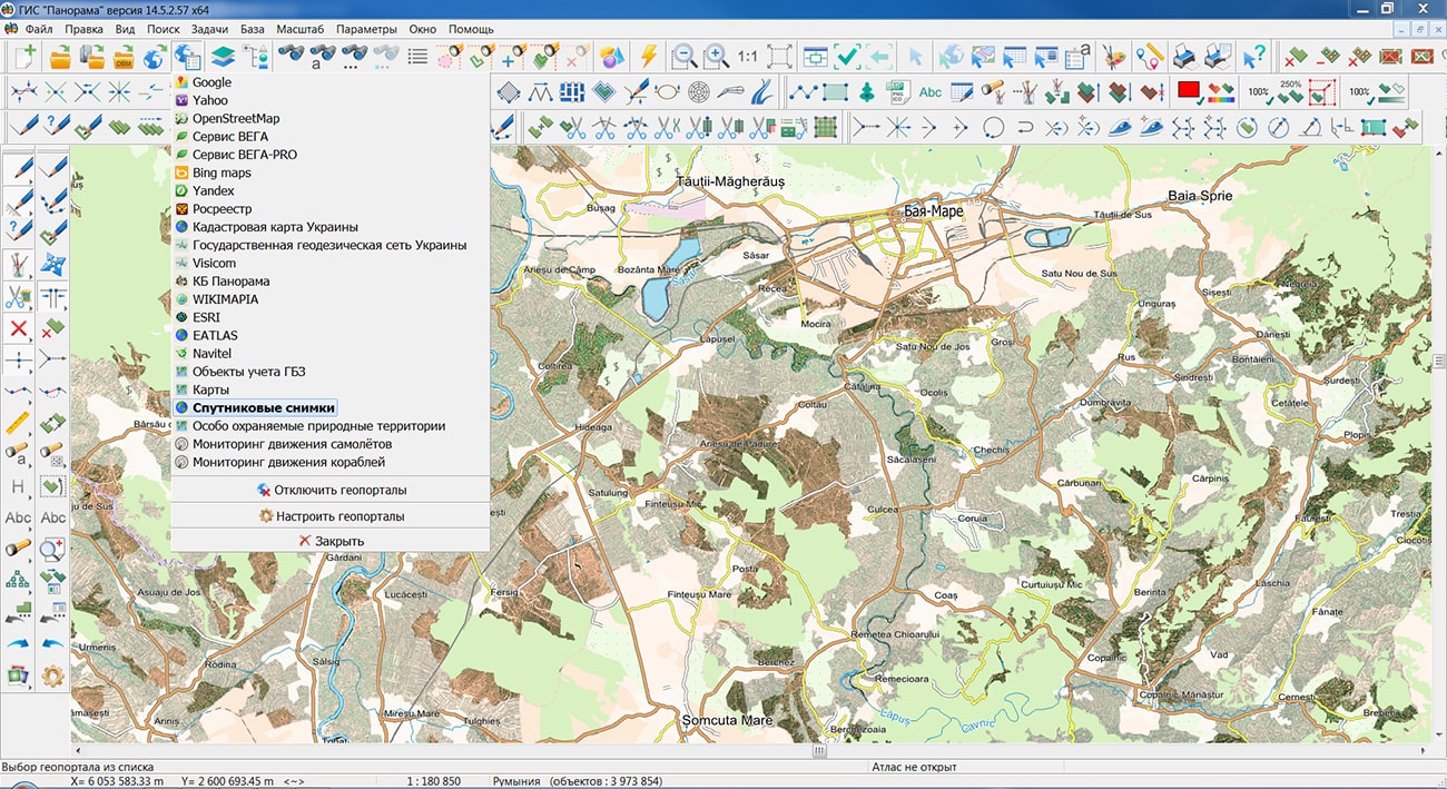
Specialists of KB "Panorama" prepared and placed on the geoportal maps of Moldova and Romania republics, formed according to data OpenStreetMap. To operate maps, it is possible to use the program or other software products of KB "Panorama".
The maps are brought to the modernized classifier of large-scale plans on a scale of 1: 5,000 (map5000m). The placement of updates in the Bank of spatial data was performed using the program - .
Publication of the spatial data bank contents on the geoportal and the access to data for downloading are implemented by means of .
Free maps based on data OpenStreetMap are available for download on the page "Digital maps".


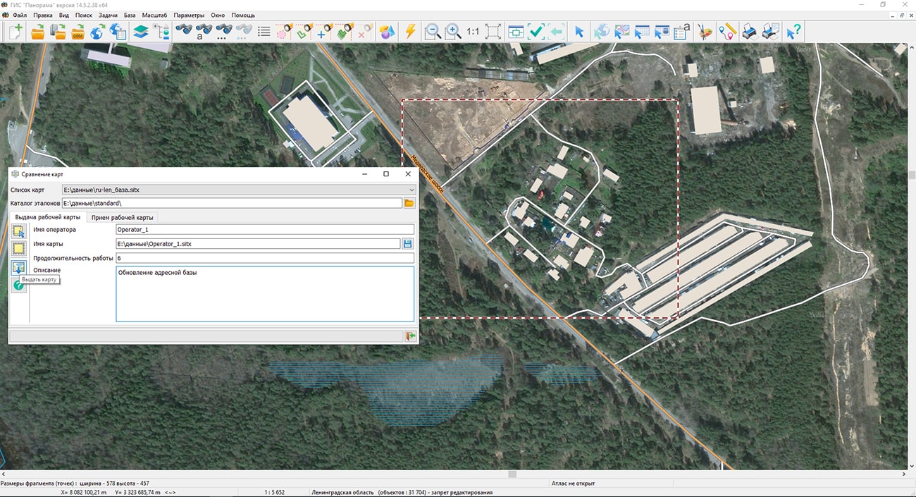
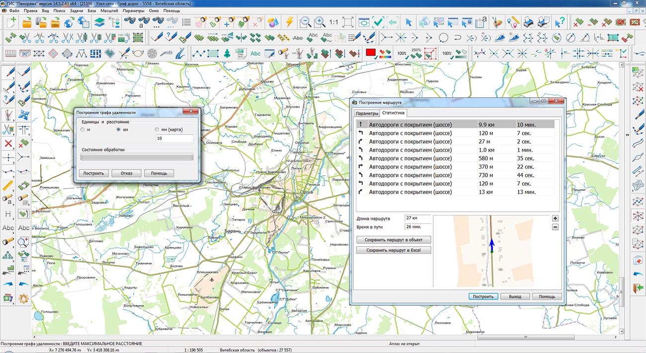
Specialists of KB "Panorama" have prepared a video tutorial on updating the metric and attribute data of a map using the task in . This task is designed to control vector maps, dispatching updates of digital data about the area by employees when performing field work or processing data from remote sensing of the Earth.
The video tutorial clearly demonstrates the issuance and acceptance of the work map (a fragment of the base map) for the update territory. This feature permits to perform parallel tasks to update map data. For example, one operator can update the address base. The second one can update the power grid facilities. The third one can update the gas facilities. When accepting data, there are checked the modified data of the working map and the current state of the base map. After all the necessary checks, the result of the work is placed on the base map. The data are updated on the map.
The task is performed in two stages:
- at the first stage of work, a fragment of the digital map is selected and the standard of the issued fragment is memorized;
- at the second stage, the map is accepted from the operator. The table of changes in the working map is formed in comparison with the standard and the current state of the base map. The table contains records about changing the composition of objects, updating the metrics and semantics of objects.
Before performing the second stage, accepting the processed data for the issued map fragment, it is recommended to check the quality of the plotted information using the task ".
It is possible to be acquainted with the training materials in the section "Video tutorials".


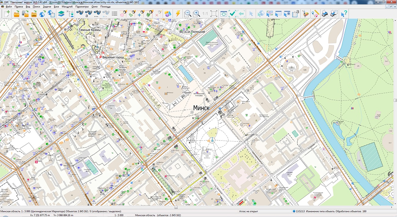
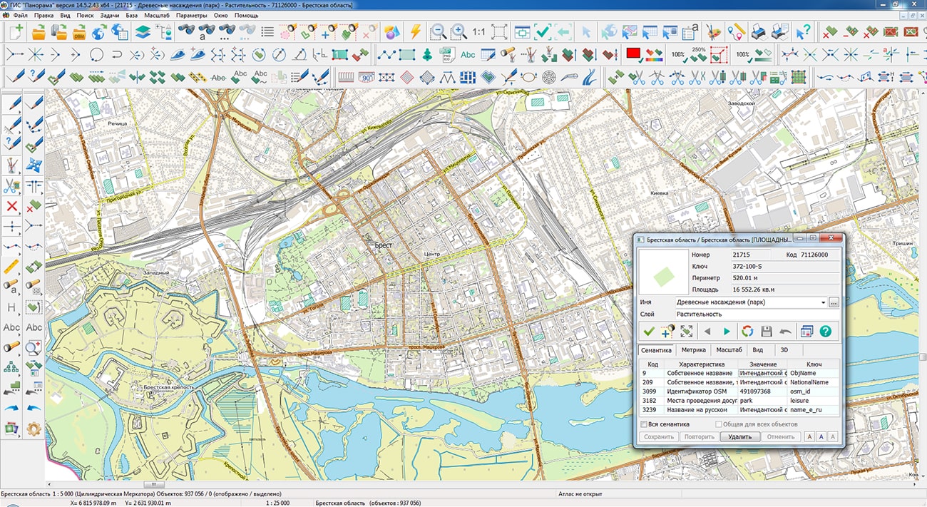
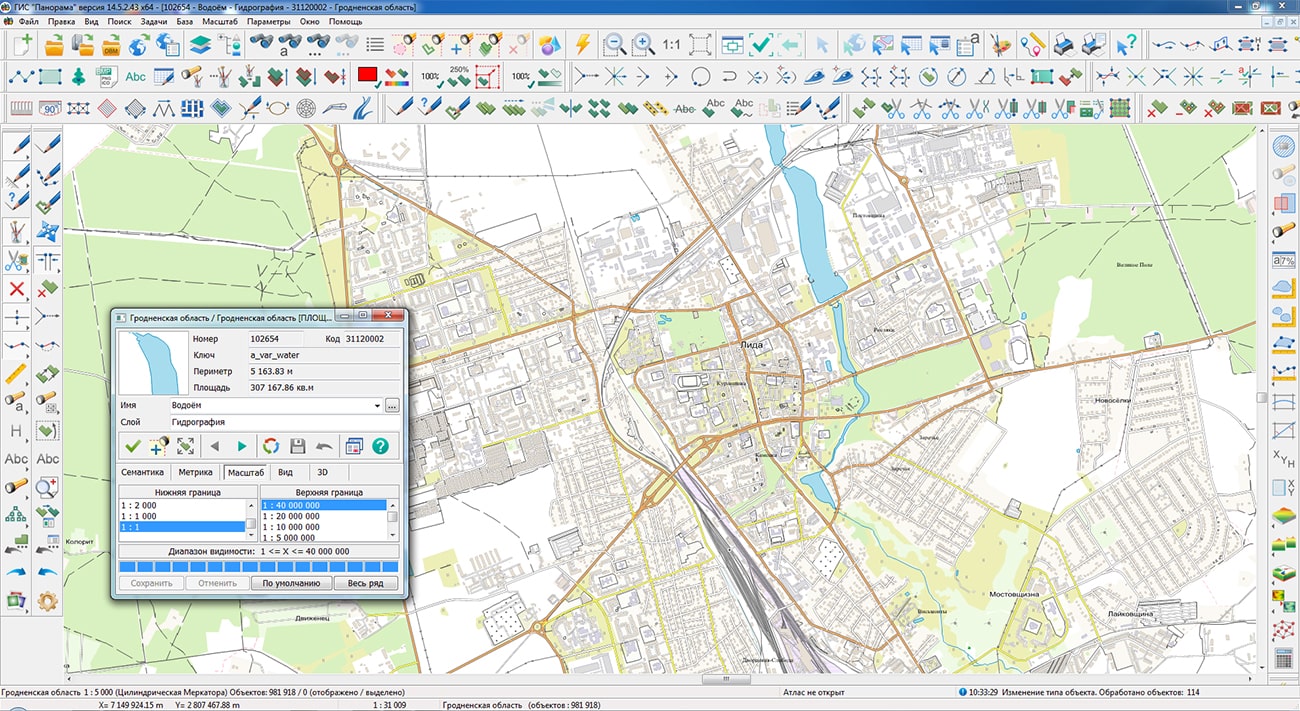
Specialists of KB "Panorama" prepared and posted maps for the Republic of Belarus regions on the geoportal , formed according to data OpenStreetMap. The structure included the regions: Brest, Vitebsk, Gomel, Grodno, Minsk, Mogilev and Minsk city. To operate maps, it is possible to use the program or other software products of KB "Panorama".
The maps are brought to the modernized classifier of large-scale plans on a scale of 1: 5,000 (map5000m). The placement of updates in the Bank of spatial data was performed using the program - .
Publication of the spatial data bank contents on the geoportal and the access to data for downloading are implemented by means of .
Free maps based on data OpenStreetMap are available for download on the page "Digital maps".


KB "Panorama" has developed GIS "MapView" for OS Aurora. The program lets to open the main formats of GIS "Panorama" digital maps and popular geoportals on mobile devices based on OS Aurora, to process information from the built-in GPS/GLONASS receiver. The user can prepare the necessary set of spatial data in advance in one of the desktop products (, , ) and transfer it to the mobile GIS "MapView". The process of working with data is carried out offline, without connecting to the Internet. When the user moves, his/her current position is dynamically displayed according to the coordinates received from the receiver GPS/GLONASS. For ease of use, it is possible to synchronize the position of the map with the current location. To save the coordinates obtained during the movement, a track recording mode is provided, which creates a separate map and plots the trajectory of movement on it. Basic information is provided for all map objects during operation.
Users can jointly display the vector maps (topographic, operational situation, marine navigation, aeronautical), matrix and raster data (Earth remote sensing data). Modern packed formats of vector maps SITZ, MAPZ, MPTZ are supported, which are decompressed on the fly in RAM. The user can dynamically control the visibility of each layer for easy viewing and analysis of spatial data. Popular geoportals of spatial data (OpenStreetMap, Yandex, and others) can be used as cartographic substrates. Connecting of the geoportals permits to receive cartographic information anywhere in the world when determining the current location and recording the route from the built-in receiver GPS/GLONASS. The list of supported geoportals corresponds to the desktop version of GIS "Panorama". This lets to prepare a set of spatial data for display in desktop versions of KB Panorama products (GIS "Panorama", "Panorama-editor", GIS Panorama Mini) and to use it when working in the mobile GIS "MapView". The program has been developed on the basis of the toolkit , which provides components for creating mobile applications for working with digital maps in the software C++ using Qt.
is Russian mobile operating system developed by the company "Open mobile platform". It has been created to build the trusted mobile infrastructure, to protect sensitive information in government organizations, large and medium-sized commercial companies. It contributes to ensuring the technological sovereignty of a state through the secure mobile environment and it meets all the requirements of regulators in the field of national security and information protection. OS Aurora permits to manage centrally the fleet of mobile devices and the used mobile software when using Aurora Center. The current version of mobile OS Aurora has been certified by FSTEC of Russia and fully complies with the requirements to operating systems for type "A" of the 4th protection class and the 4th trust level.
The new version of GIS "MapView" for OS Aurora is available for download in the section Download.


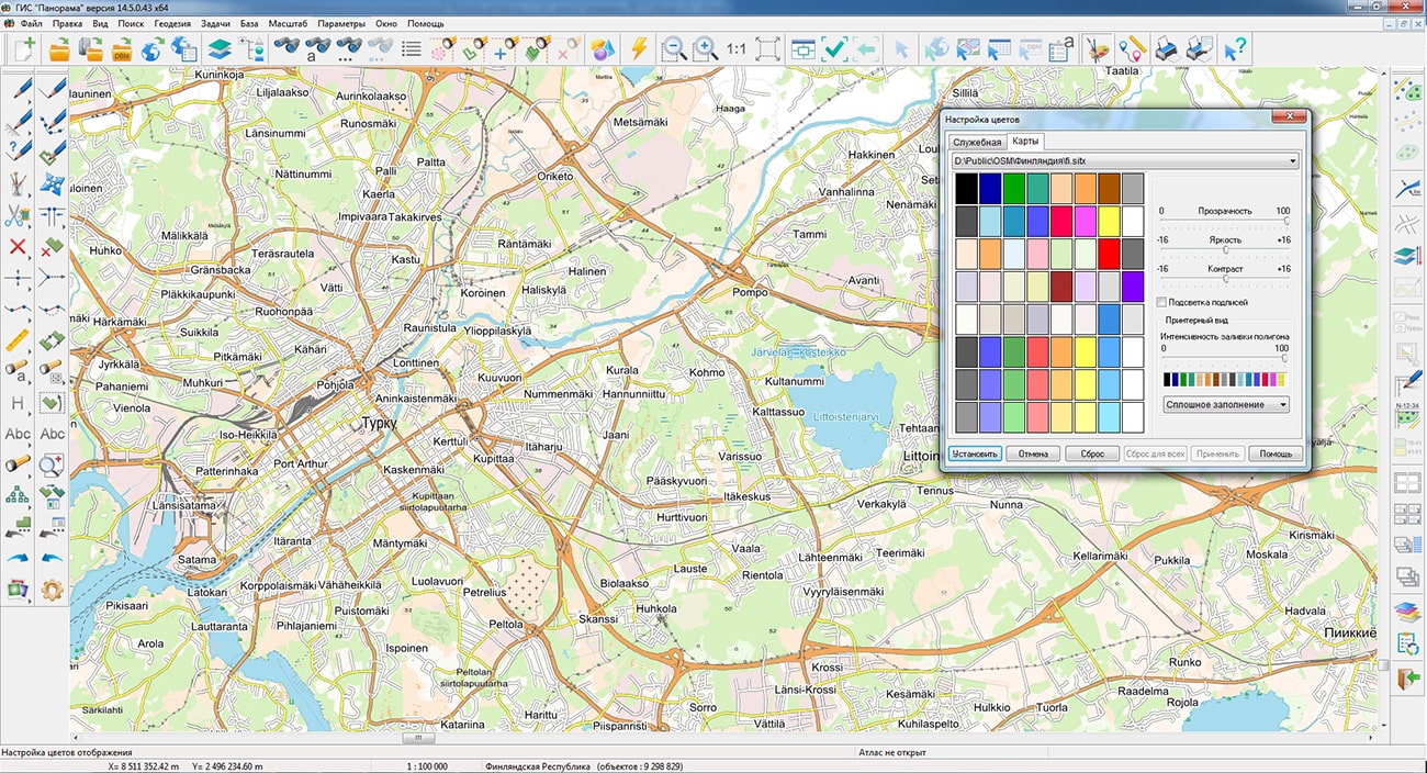
Specialists of KB "Panorama" updated and posted on the geoportal map of the Finnish Republic. The map is based on data OpenStreetMap. To work with the map it is possible to use the program or other software products of KB "Panorama".
The map is brought to the modernized classifier of large-scale plans on a scale of 1: 5000 (map5000m) and saved in the format SITZ. The placement of updates in the Bank of spatial data was performed using the program - . Publication of the spatial data bank contents on the geoportal and the access to data for downloading are implemented by means of .
Free maps based on data OpenStreetMap are available for download on the page "Digital maps".


Ph.: +7 (495) 739-0245, +7 (925) 221-1603
www.gisinfo.ru | panorama@gisinfo.ru
105005, Russia, Moscow, Baumanskaya Street 7, building 1, office 229 (m. Baumanskaya)
Copyright © Panorama Group 1991 - 2024


 Mobile version
 Full version