Copyright © Panorama Group 1991 - 2024

In KB "Panorama" the version 14.5.0 has been developed. In the new version, the tools for using terrain data received from unmanned aerial vehicles have been expanded, tools for report design and editing the vector maps have been updated, data import from formats DXF and S57 sea maps has been improved.
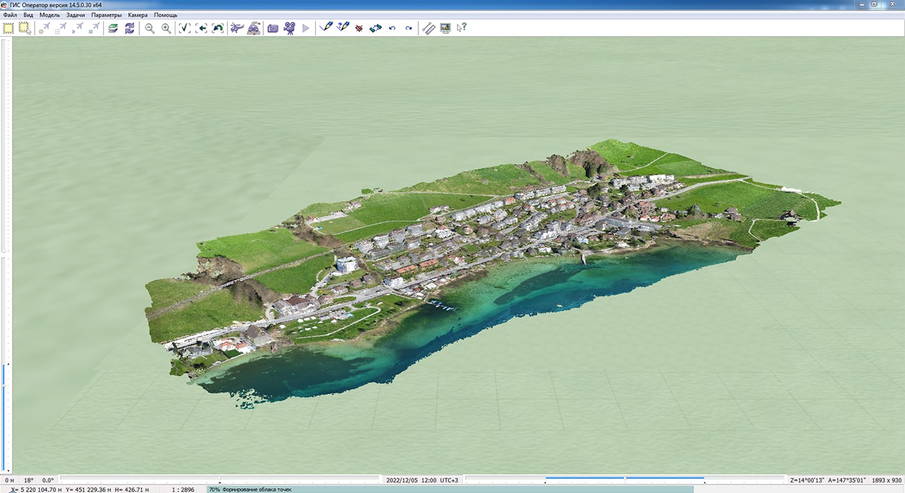
In the task, the loading and displaying clouds of points from MTD models created in the program has been accelerated. The "Panorama Photo" program allows you to create high-precision digital terrain models in the form clouds of points, matrixes of heights and orthophotomaps based on aerial photography from unmanned aerial vehicles. The cloud of points obtained in the "Panorama Photo" program contains point measurements sorted by blocks and by levels. Splitting into levels allows you to store points with spacing. On the first level, there are points with a step specified when creating the MTD model, on the second - with a step of 2 times more, on the third - 4 times more, and so on. In this case, points at different levels are not duplicated. This storage speeds up drawing of the 3D model by drawing blocks distant from the viewer with fewer points loaded from higher levels. The size of the cloud of points depends on the degree of the model's detail (density of points) and the area of the covered area. Displaying large MTD models requires significant hardware resources (RAM, video memory). In this case, the user can set up a filter of cloud of points to speed up drawing. Filter setting is available in the main menu of the "3D Navigator" task: "View" - "Filter of cloud of points". The filter determines the degree of thinning of the cloud of points during display: "Fine" - thinning by 2 times, "Average" - by 4 times, "Coarse" - by 8 times.
To use aerial photography data obtained from UAVs, the GIS also includes a and a set of tasks . "Complex of tasks for support of drones"performs a processing of photo and videos coming from the UAV, mapping of trajectories of their movement and preparation of reports based on the received data. The complex allows you to scroll through the video file recorded during the flight with a synchronous display of the location of the UAV on the map. The "Demonstration of photo and video materials with geolocation" complex is intended for display of photos of the area and video materials containing a coordinate binding to a place of shooting. Geographic images in JPEG format store a coordinate mark in an EXIF tag. The track of a video file (AVI, MP4) can be contained in the subtitles of the video file, or in the GPX, KML or NMEA-0183 format file of the same name. Also the GIS supports work with the remote video cameras connected to the Internet. The functions of viewing the video image, controlling the video camera and obtaining the results of the video analytics built into the camera are available.
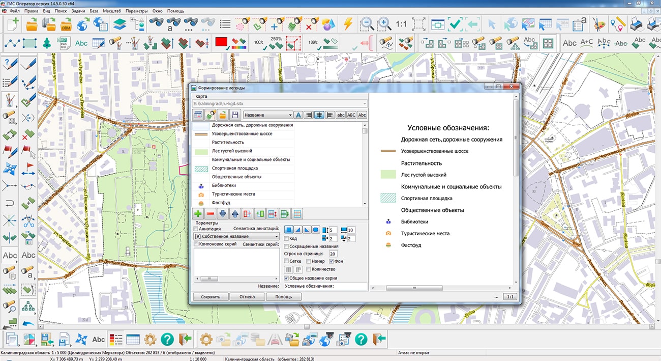
The task has been improved. Ability has been added to build a legend based on the maps contained in the inserts without opening them additionally. To do this, a list of data sources has been added in the Legend Formation dialog, which includes the main open project, as well as a list of maps contained in all the inserts available on the main project. Ability has been added to rotate the map in the insert. Map rotation is implemented in the form of menu items of the same name, as well as using "hot" keys. Each pressing of a "hot" key carries out rotating a map concerning the center of a displayed fragment by one degree to the left or to the right. The angle of rotation is stored in service semantics 31017 ROTATION ANGLE OF POINT ORIENTED SIGN (INSERT) and contains the value of the rotation angle counterclockwise.
The display of objects of the type, implemented in the library of programmable signs shape.iml64, has been improved. The new algorithm allows cutting the map image according to the metric of polygons and multipolygons of arbitrary shape. Objects of type "Map inset" contain a link to the map file in the service semantics "Graphic file or map" (32769). Cutting the map image is performed according to the metric of the "Map Inset" object. Examples of objects of the "Map inset" type are contained in the map included in the GIS Panorama: File - Example data - C:\Users\Public\Documents\Panorama\Panorama14\data\shape\shape.sitx.
Displaying sea maps according to the S52 standard has been improved. The implementation of the procedures has been refined: Depval - formation of depth values based on attribute values for underwater obstacles, taking into account underlying objects, Udwhaz - requesting the code of the displayed symbol and display flag, taking into account the depth of the obstacle, or requesting the code of an isolated underwater hazard with a depth less than the safety contour.
When importing S57 sea maps, support has been added for datasets with updates of sea maps (ER profile), which are located in files with extensions 001, 002, 003, and so on. The update files must be placed with the source data set with extension 000 in the same folder or according to the folder structure according to standards. The names of the source dataset and update files must match.
The task t" has been improved. "Create a set of maps" mode has been added into the dialog, which is designed for automatic processing of a set of selected data and creating a separate user map for each DXF file. As a result of the task execution, the list of generated maps is saved into the MPT project. There is added a recalculation of coordinates and sizes of characters from storage units specified in DXF: inches, feet, miles, millimeters, centimeters, meters, and so on. The formation of graphic primitives from the parameters of symbols specified in DXF has been improved, which allows you to reproduce the view of the original drawing without setting the conventional symbols.
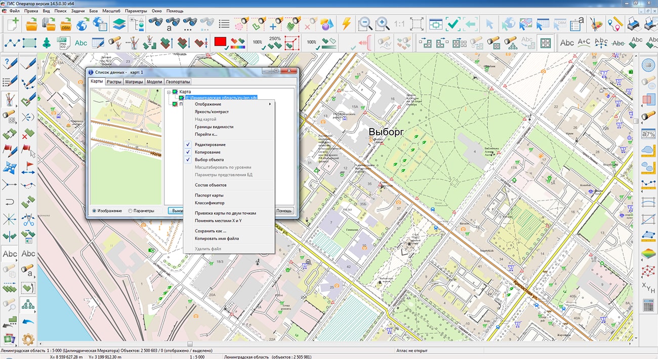
In the and dialogs, on the Maps tab in the pop-up menu, the "Change X and Y" item has been added. When this item is selected on the current map, for all objects, the X and Y coordinates are changed between themselves. The menu item is available only for maps without a sign in the map passport "Limit the map territory by a frame". To cancel the flip of the map, you can perform a «Undo» or re-select the menu item.
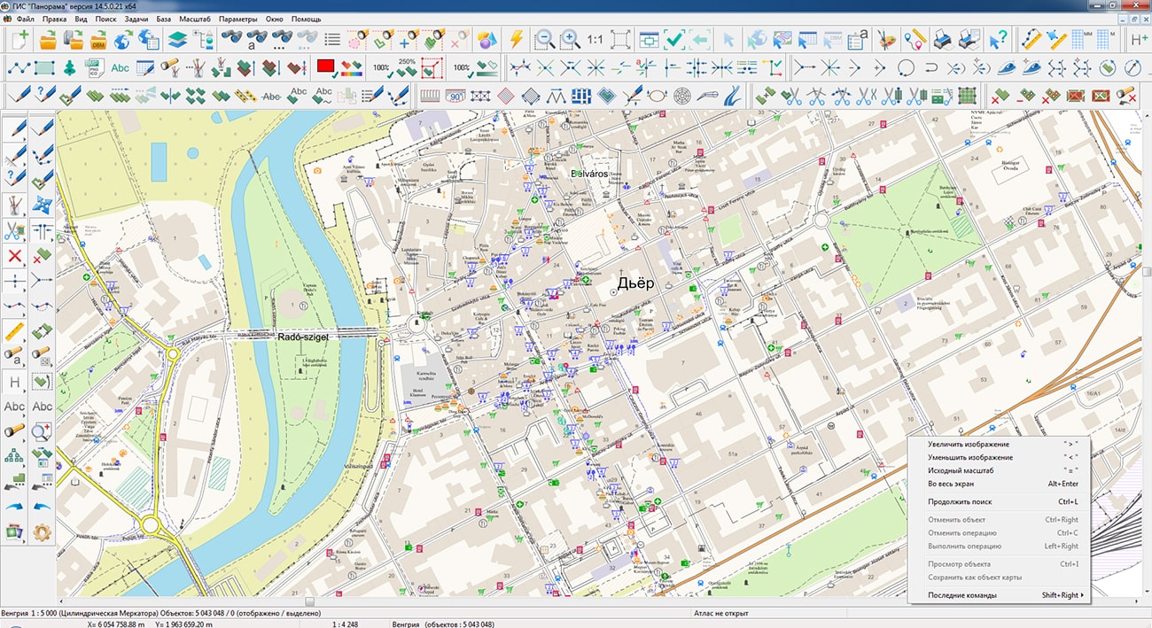
The task has been improved. Changing the conditions for selecting objects selected by area has been simplified. The selection of objects by area is performed using the "Select inside the object" and "Select by any area" modes (polygon, rectangular fragment, lasso). At the end of drawing the area on the map, objects located inside the selected area are highlighted. To change the selection conditions, press the right mouse button and select one of the modes in the context menu: Highlight inside (delete intersection), Highlight with intersection (and inside), Highlight outside (delete intersection).
has been improved. If clusters are displayed on the map (generalized signs of closely spaced objects specified in the classifier), then the corresponding signs of clusters are displayed and marked, taking into account the number of signs and their location on the map.
The new version of the program is available for download in the section.


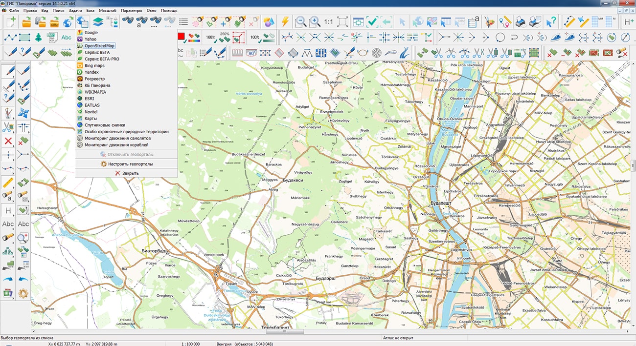
Geoportal has been supplemented with a map of Hungary, formed according to OpenStreetMap data. To work with the map, you can use the i program or other software products of KB "Panorama".
The map was led to the modernised classifier of large-scale plans of scale 1: 5 000 (map5000m). Publishing of updates in bank of spatial data is made by using the program of .
Publishing contents of bank of spatial data on the geoportal and data access for downloading are implemented by means of .
Free maps on the basis of OpenStreetMap data in MPTZ and SITZ format are available for download on the page "Digital maps".


In KB "Panorama" the "Workstation of cadastral engineer" version 14.5 has been developed. In the new version, in the dialogs for the formation of land survey and technical plans, the database of cadastral works of the SQLite format is used to account for the information necessary for filling the sections and . The dialog has been improved in the program, bookmarks have been added onto the main form, corresponding to groups of information about cadastral engineers, customers, contracts for cadastral works and measuring instruments. The binding of addresses and documents to their owners has been changed through the use of a new field the "owner type".
The mode has been improved. In mode dialog a support of formation of the electronic document of the land survey plan under version 6 XML-schemes, 8 and 9 is built in. Number of the formed version is displayed in dialog heading. To create XML documents according to different versions of schemes, different sets of attributes and values of directories are used, which are implemented as classifier semantics. To form an electronic XML-document of the land survey plan version 6, a cadastral map created according to the survey.v5 classifier is used. To form a land survey plan according to the version's XML schema, a map created by the survey.v6 classifier is used. The program automatically controls the version and date of the classifier and determines the version of the XML document.
A new mode "Land Survey plan version 6" has been added for forced formation of the XML document of the land survey plan according to the XML scheme version 6. If the map does not match the survey.v5 classifier, a warning message is issued and the formation is not performed. All the necessary classifiers are included in the delivery set of the "Workstation of cadastral engineer". The procedure for changing the classifier is described in the electronic help for the program in the section .
When forming a text report of the land survey plan, the search for initial contours, land plots that do not intersect with the refined contour has been added. The search radius is 500 meters. The initial contour is used to fill in the column the initial coordinates when specifying the location of the land plot.
The modes of the task have been improved: cutting the map objects inside and outside the selected contour. In order to improve the quality of cutting map objects, the accuracy of processing has been increased. At the end of processing, the coordinates of the cut contours are rounded. In this case, the coordinates of the metric are reduced to the accuracy indicated in the map passport (centimeters, millimeters). In the "Point editing" mode, the "End points in alignment" auxiliary mode has been added, designed to cut or extend the first or last segment of a linear object. In the "Create object" dialog, when using search by name, the ability to configure the filter for localization by pressing CTRL+letter (CTRL+L - linear, CTRL+E - vector, and so on) has been added. The use of filtering is expedient if the list window contains objects with different localizations. Setting the filter provides output into the list of found objects corresponding to the specified type.
In the and dialogs, on the Maps tab in the pop-up menu, the "Change X and Y" item has been added. When this item is selected on the current map, for all objects, the X and Y coordinates are changed between themselves. The menu item is available only for maps without a sign in the map passport "Limit the map territory by a frame". To cancel the flip of the map, you can perform the Undo or re-select the menu item.
has been improved. There is added a recalculation of coordinates and sizes of characters from storage units specified in DXF: inches, feet, miles, millimeters, centimeters, meters, and so on. Formation of graphic primitives from the parameters of conventional symbols specified in DXF has been improved, which allows you to reproduce the view of the original drawing without setting the conventional symbols.
The new version of the program is available on the website in the Download section.


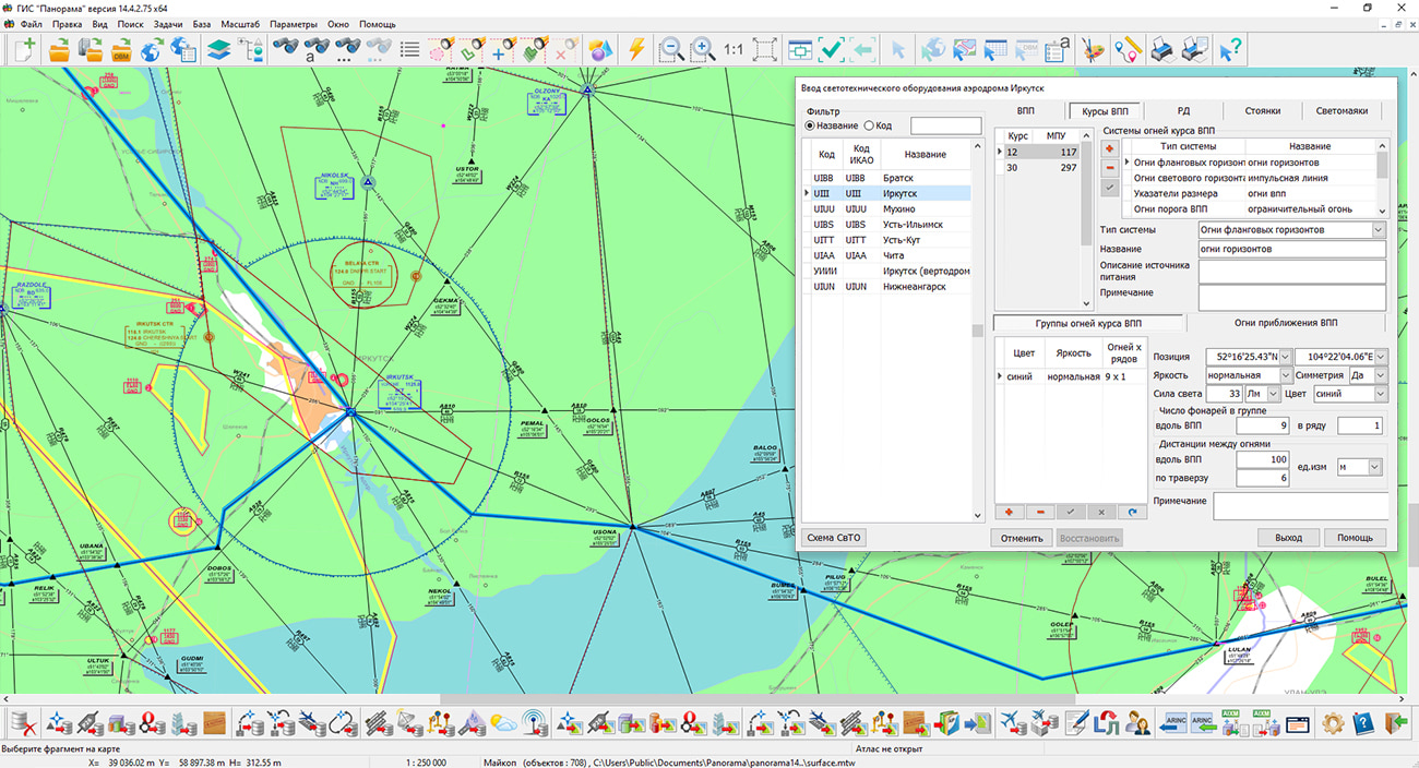
In KB "Panorama" the version 8 under the control of 14 has been developed. The new version has been refined in accordance with the order of the Ministry of Transport of the Russian Federation dated November, 05th, 2020 №449. The list of parameters for maintaining the database of aerodromes (heliports, landing sites) includes new parameters: transition level, annual changes in magnetic declination, coverage, value of the longest runway (the length is calculated automatically based on the aerodrome runway data in the database) and others.
Dialogs , have been improved. The list of runway lighting system types has been expanded, new parameters have been added: luminous intensity of lights, airstrip size, clearway size, emergency braking system, available take-off distance, available landing distance.
In the dialog, the ability to form a list of routes for drawing onto a map has been added, taking into account the values of the heights of the lower minimum level and the upper maximum level of route sections, route codes and valid dates.
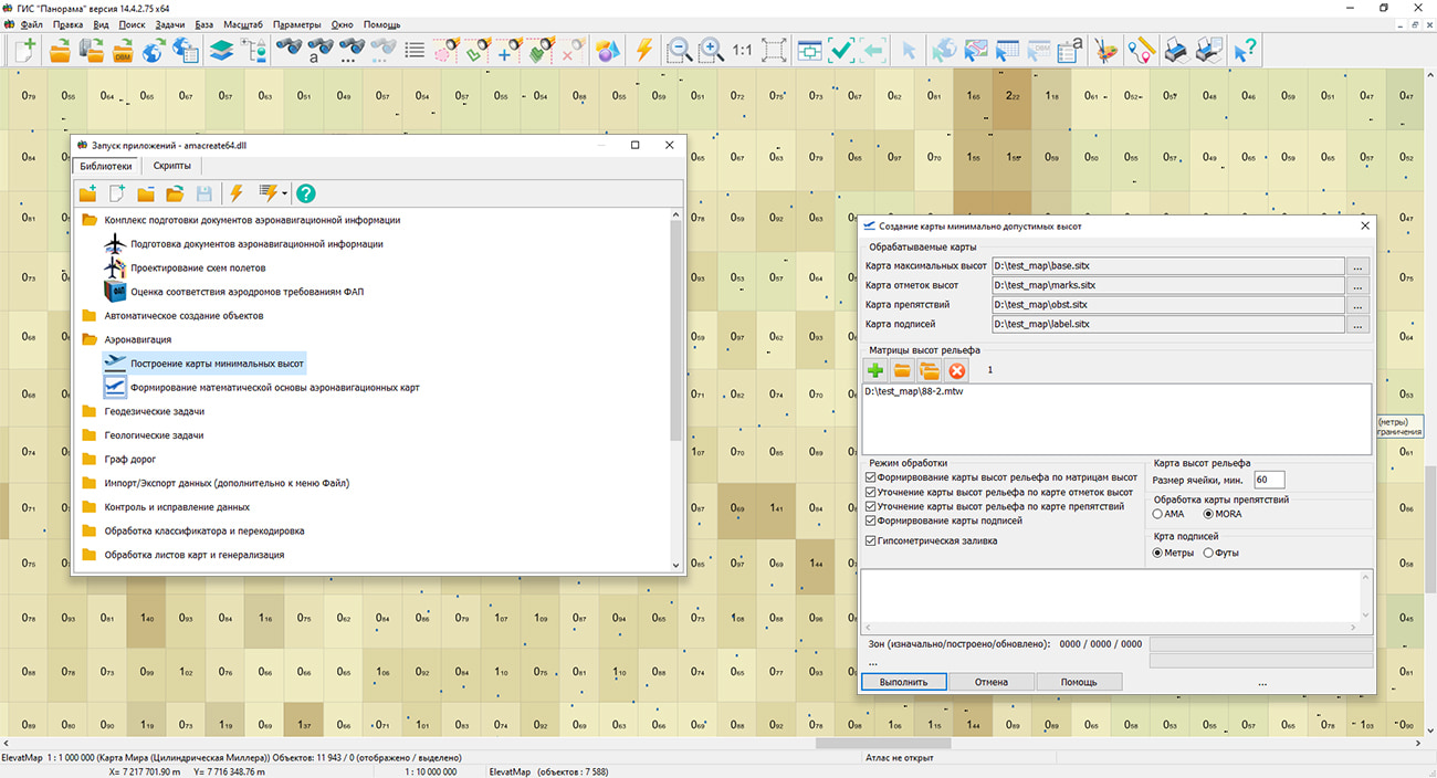
In the dialog, the mode of saving obstacles into the database from the "Map of signatures" (maps of minimum heights) has been added. The "Map of signatures" is preliminarily created using the task "Construction of a map of minimum heights" from the group of applications "Air navigation" (according to the classifier).
The task "Creating a map of minimum heights" is intended for automatic forming a map of the minimum heights that are allowed for aviation flights based on elevation matrixes, maps of marks of heights and maps of artificial obstacles. Calculations are performed in accordance with Doc 8168 ICAO Rules - Aircraft Operations - Volume II. The map of minimum heights is a matrix of signatures for the values of minimally allowable heights of flight in established conventional signs with a given size of the analyzed cells on the ground. Heights labels are drawn up in accordance with the requirements of Doc 8697 ICAO Manual for Aeronautical Charts.
The complex for preparing documents of aeronautical information is a set of tools for maintaining an aeronautical data base, a modeling and analyzing the aeronautical situation, generating aeronautical maps and exchanging data with other information systems through export and import in the ARINC 424-19 exchange format and export in the AIXM 5.1 format. The task "Flight procedures design" is used to design the routes of departure, approach and landing and to analyze the safety of flights on them. The task "Assessment of compliance for aerodromes with the requirements FAR" is intended for the analysis of the aerodrome and the aerodrome environs for the suitability for operation and aircraft flights in accordance with the Federal Aviation Regulations.
The new version of the program, examples of , operational documentation, video lessons and presentations are available for download on the page.


Specialists of KB "Panorama" have prepared a video lesson on how to manage polling and viewing events in real time from remote cameras using the task in the GIS "Panorama". The video lesson clearly demonstrates the pairing of the possibilities of using remote cameras with the functions of video analytics and event handler scripts in the Python language.
The Python programming language has a large set of plug-ins and provides the user with an easy-to-use and extensive toolkit (including mathematical calculations, text and graphic data processing, networking, databases, and more).
for processing events from a video camera are located in the C:\Users\Public\Documents\panorama\py_base14\ folder. In the training material, using the example of working with video data, the distribution of event notifications from a video camera to e-mail was configured using a Python script. A complete description of the possibilities of organizing video surveillance on the basis of the GIS "Panorama" is given in the presentation .
You can get acquainted with educational materials in the section "Video lessons" and "Presentations".


Ph.: +7 (495) 739-0245, +7 (925) 221-1603
www.gisinfo.ru | panorama@gisinfo.ru
105005, Russia, Moscow, Baumanskaya Street 7, building 1, office 229 (m. Baumanskaya)
Copyright © Panorama Group 1991 - 2024


 Mobile version
 Full version