Copyright © Panorama Group 1991 - 2024

In KB "Panorama" the version 14.3.4 has been developed. In the new version, the tools of accessing the registries of urban planning documentation are optimized, the possibilities of the mode of autofilling the land plot development regulations are expanded, and the check for the presence of the PostgreSQL driver in the ODBC system has been implemented.
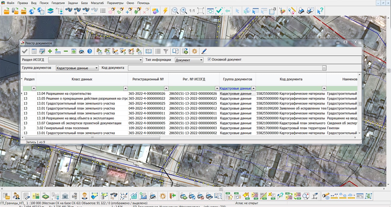
"Workstation of urban planner" allows you to accumulate in the database the information about land plots, capital construction objects, engineering communications, as well as store urban planning documentation in specialized sections of . In the new version, to improve work efficiency and increase the speed of information processing, the processes of accessing data stored in the system metadata have been optimized. At execution of long processes, the information window has been added and the exit from uncompleted process without loss of data is provided.
Between registers of the "Workstation of urban planner" an information interaction and spatially-logic communications with digital map's objects are established. The formation and maintenance of a database of urban planning regulations established by the rules of land use and development is supported. Using the map of territorial zoning, it is possible to automatically establish the rules for building a land plot.
"Workstation of urban planner" supports work with PostgreSQL DBMS. In the new version a check of presence of the PostgreSQL driver in the ODBC system on the user's computer is added. Without the installed driver, the functionality of the program is limited, only modes for working with a digital map are available.
The new version of the program and the updated documentation are placed the website in the Download section.


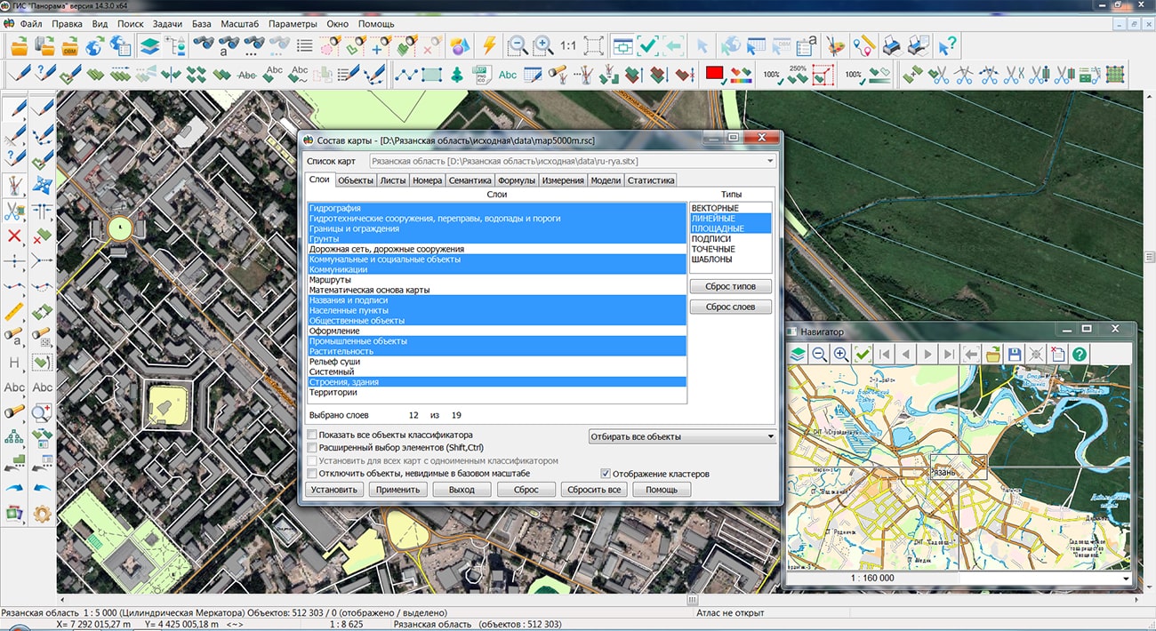
Specialists of KB "Panorama" have prepared and placed the maps of the Ryazan and Tambov regions on the geoportal . The maps were formed using OpenStreetMap data, source data were obtained from website. To work with the maps, you can use the program or other software products of KB "Panorama".
The maps were led to the modernised classifier of large-scale plans of scale 1: 5 000 (map5000m) and were saved into a packed project (mptz). Publishing of updates in bank of spatial data is made by using the program of . Publishing contents of bank of spatial data on the geoportal and data access for downloading are implemented by means of .
Free maps on the basis of OpenStreetMap data are available for download on the page "Digital maps".


In KB "Panorama" the version 14.5.9 has been developed. In the new version a support of files in MPTZ format has been implemented, the list of supported requests has been expanded, work with maps in local coordinate systems has been improved, tools of check of connection to remote servers have been refined, support of user semantics has been added.
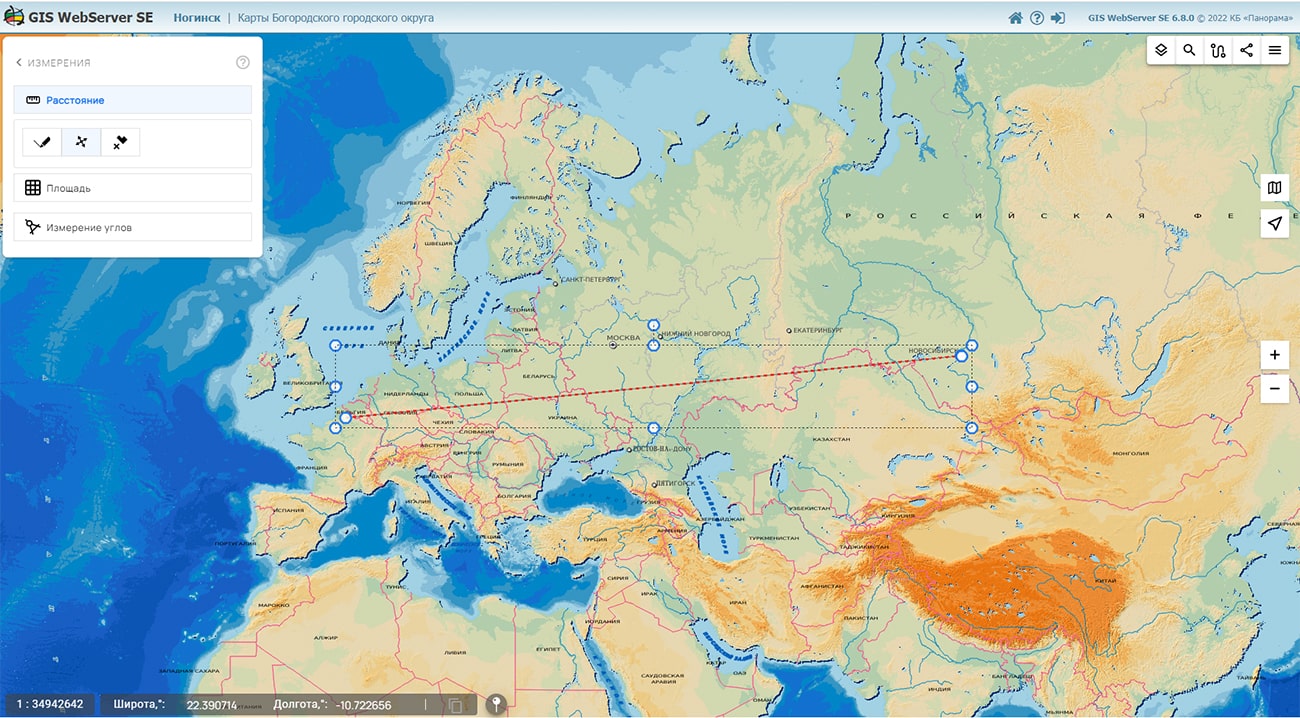
GIS WebService SE works with maps in local coordinate systems and maps with undefined projections (large-scale plan). The use of such maps will increase the degree of data protection, the accuracy of calculations and information processing. For specialists of municipal and regional geoportals constructed on the basis of GIS WebService SE, it will be easier and more convenient to use data they already have. GIS WebService SE together with , provide indispensable tools and capabilities for using and publishing data. In order to improve support for local coordinate systems, in addition to existing requests, calculations for calculating azimuth, direction angle and distance have been added.
In GIS WebService SE, a request for the intersection of objects of several maps has been implemented. Result of request is the user layer containing objects of intersections and their semantics. For the received layer all operations available to a usual layer are supported. The request supports the user filters by semantics, metrics, spatial characteristics.
Support of files in format MPTZ is added. Support of user semantics for writing arbitrary object properties which has been not described in the semantics list of RSC classifier has been added. User semantics are created when importing vector data (SHP, KML, MIF, WFS and others) when names of fields (keys) of objects attributes are not found in the selected RSC classifier. Output of styles for point objects in JSON format has been added. For request of obtaining the description of object semantics a support of layers consisting from MPT projects has been added. Obtaining the presence of semantics for objects on the map is significantly accelerated.
Periodic check of connection to the remote server has been added when republishing data, if when opening the layer the remote server did not respond. It will allow to restore connection and to relay necessary requests. Speed of displaying data is increased when republishing geoportals. Support of groups in symbols in a national language has been added.
GIS WebService SE supports all international standards (OGC WFS, WFS-T, WMS, WMTS, WCS), which are used to transfer and display spatial data. The program implements the ability to issue tiles according to any user or local coordinate system. The application is implemented on Windows and Linux platforms and is compatible with Apache, IIS and nginx web servers.
The new version of the program is placed on the website in the section.


Specialists of KB "Panorama" have prepared a video lesson of execution of automatic creation of titles with use of value of the attributive data at objects on a vector map by means of the task . This task is available to users in the , "Panorama-editor" and GIS "Operator".
In the training material, using the free map OpenStreetMap as an example, automatic creation of labels for objects of a point character of localization was performed. Before performing automatic creation of labels, you should first select objects on the map, which must be available for editing. When performing the task, the types of values of semantic characteristics, the location of the label relative to the binding point of the object, the choice of the type of generated label (conventional classifier or graphic sign), as well as the formation of mutual links between the object and the label for automatic data updating are taken into account.
You can get acquainted with the training materials in the "Video lessons" section.


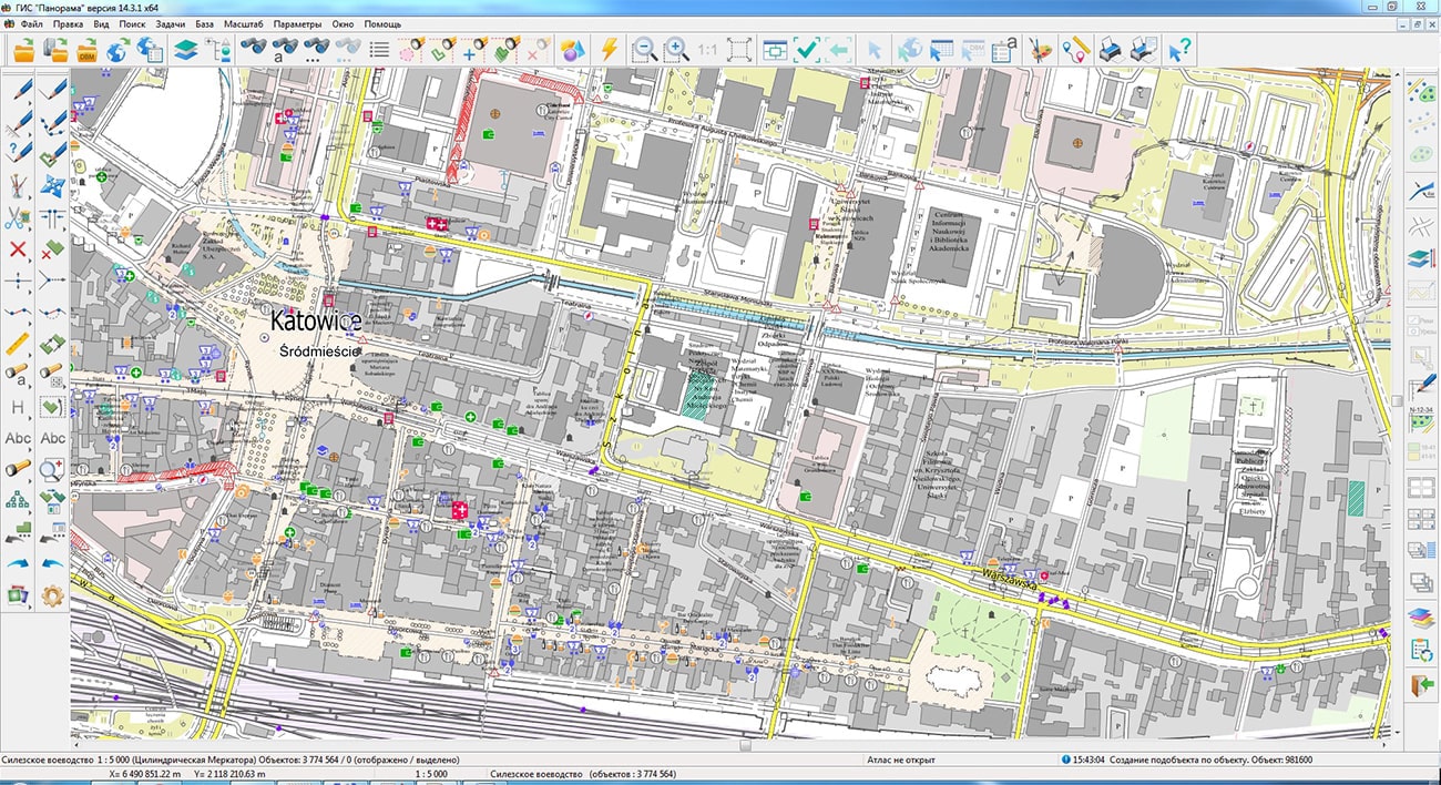
The geoportal is supplemented with maps of the Lodz, Pomeranian, ?wi?tokrzyskie and Silesian Voivodeships (Poland), formed according to OpenStreetMap data. The source data was obtained from the website. To work with maps, you can use the program or other software products of KB "Panorama".
The maps were led to the modernised classifier of large-scale plans of scale 1: 5 000 (map5000m). Publishing of updates in bank of spatial data is made by using the program of . Publishing contents of bank of spatial data on the geoportal and data access for downloading are implemented by means of .
Free maps on the basis of OpenStreetMap data are available for download on the page "Digital maps".


Ph.: +7 (495) 739-0245, +7 (925) 221-1603
www.gisinfo.ru | panorama@gisinfo.ru
105005, Russia, Moscow, Baumanskaya Street 7, building 1, office 229 (m. Baumanskaya)
Copyright © Panorama Group 1991 - 2024


 Mobile version
 Full version