Copyright © Panorama Group 1991 - 2024

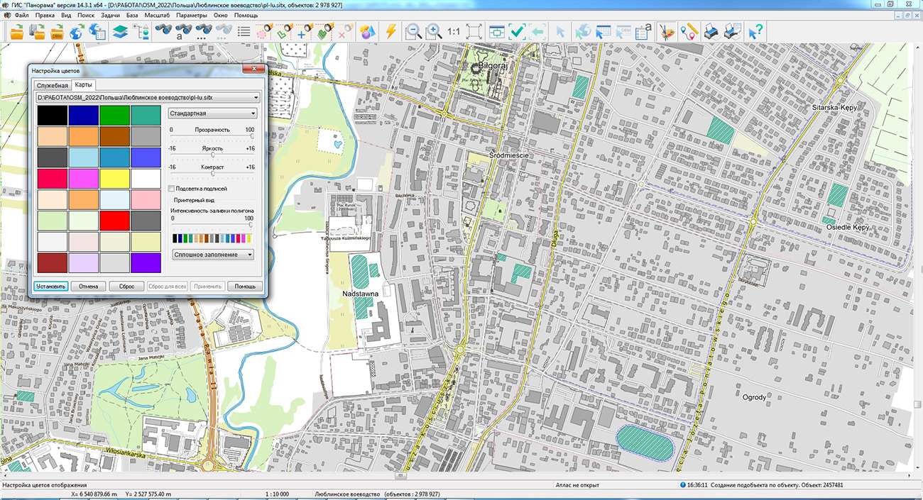
The geoportal is supplemented with maps of the Warmian-Masurian and Lubelskie voivodeships (Poland), formed according to OpenStreetMap data. The source data was obtained from the website. To work with maps, you can use the program or other software products of KB "Panorama".
The maps were led to the modernised classifier of large-scale plans of scale 1: 5 000 (map5000m). Publishing of updates in bank of spatial data is made by using the program of . Publishing contents of bank of spatial data on the geoportal and data access for downloading are implemented by means of .
Free maps on the basis of OpenStreetMap data are available for download on the page "Digital maps".


In KB "Panorama" the version 14.3.3 has been developed.
In the new version, the GIS possibilities for processing vector data downloaded from open sources have been expanded, the use of arbitrary user attributes of vector map objects has been refined, the tools for displaying S57/S52 sea maps have been improved, python scripts have been added for multi-threaded calculations using a road graph, diagnostic tools have been supplemented when executing scripts in python, the request of the information about sites from the Rosreestr geoportal was provided.
The program for correcting the metrics of objects has been improved. Processing of emissions (peaks) and junctions of contours has been improved. Processing of complex peaks (such as "antenna") was added. If it is impossible to correct the metric, for uncorrected objects, the output of a list of errors into the protocol has been added. At the end of the program, information on the number of corrected and uncorrected errors is entered into the protocol. This task is recommended when processing vector data loaded from sources that do not have advanced control tools (for example, OpenStreetMap). The task is called through the main menu: Tasks - Map processing by the scenario - Correction of objects metrics.
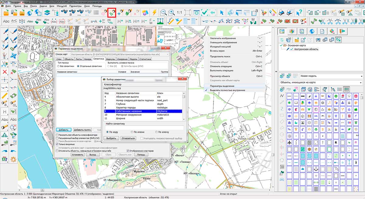
Possibilities of applying user semantics have been expanded for recording arbitrary object properties which are not described in the list of semantics of RSC classifier. User semantics are created when importing vector data (SHP, KML, MIF, DXF, WFS, GML, JSON, and others), when the field names (keys) of object attributes are not found in the selected RSC classifier. To support such semantics in various tasks (, , and others), temporary semantics are created in the RSC classifier in the range of codes 660000 and higher for the duration of a GIS session. Semantics name is filled by name of fields in the source vector data. This provides work with user-defined semantics and semantics from RSC in a common list in various tasks. When simultaneous opening several maps with one classifier, the list of temporary semantics will be supplemented with user semantics from all maps. When opening different combinations of maps, temporary codes in different sessions may have different values. When exporting vector maps to SXF and TXF files, user semantics is written with code 32862 and data record of the form "field_name:value". When imported, such semantics are transfered back into temporary semantics with the addition of new code to RSC. On the map, semantics are written with codes in the range from 60000 and above. The correspondence between the semantics code on the map and the field name is stored in the map metadata. When opening a map by the list of field names of user semantics, temporal semantics are automatically added into RSC.
The S57navy.rsc digital classifier of sea maps and the procedure for importing digital maps of the S57 standard have been improved to increase the degree of compliance of the displayed maps with the S52 standard.
Tools have been enhanced for diagnosing and debugging python scripts executed from the dialog on the bookmark. In debug mode, you can execute a script one line at a time, view the values of local and global variables, enter or bypass functions, set breakpoints, make changes to the script code, and re-execute it. Into the list of basic scripts, section the "Calculations by road graph" has been added with the script "Search for minimum distances between map objects". The new script demonstrates the ability to calculate the shortest distances between two sets of objects recorded on different maps and generate a report in a CSV file. The selected semantics - object identifiers (cadastral number, address or other property) and the shortest distance for each pair of objects are written into the file. The script demonstrates writing of multi-threaded tasks, which can speed up the execution of scripts by an order of magnitude by loading all the processor cores on the computer.
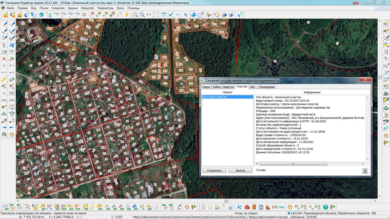
The task of has been improved. When connecting the Cadastral quarters layer, Rosreestr's geoportal requests data from a more accurate level, taking into account the presence of tiles. On the layer of Cadastral plots a possibility has been added for viewing information about plots by means of the button on the main panel the "Viewing the information on object". When connecting geoportals with a slow speed of issuing tiles, the periodic drawing of data on the screen in a background mode is carried out to improve image perception. For accurate alignment of the contours of terrain objects on images of pictures, vector maps and geoportals with an accuracy up to mm, a dialog for setting the geoportal offset has been added. The dialog is called by the right mouse button in the list of geoportals. To ensure the readability of tiles from geoportals on smartphones and tablets with high resolution, the image is automatically scaled to the standard resolution of the original tiles (96 dpi) with the adjustment of the image scale and the determined coordinates of points.
The new version of the program is available for download in the section.


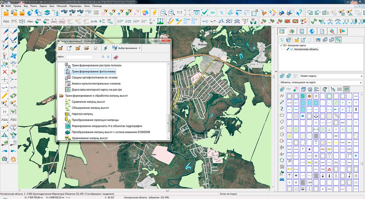
Specialists of KB "Panorama" prepared and placed the maps of the Kaluga and Kostroma regions on the geoportal . The maps were formed using OpenStreetMap data, source data were obtained from website. To work with the maps, you can use the program or other software products of KB "Panorama".
The maps were led to the modernised classifier of large-scale plans of scale 1: 5 000 (map5000m) and were saved into a packed project (mptz). Publishing of updates in bank of spatial data is made by using the program of . Publishing contents of bank of spatial data on the geoportal and data access for downloading are implemented by means of .
Free maps on the basis of OpenStreetMap data are available for download on the page "Digital maps".


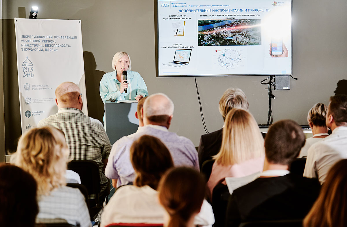
On Wednesday, on July, 27th, 2022, an interregional conference was held in Ryazan. The event was held for an exchange of experience of the Ryazan region with representatives of IT-sphere from other regions of Russia on key issues of digitalization. The conference was organized by ANO "Digital Region" and the Corporation for the Development of the Ryazan Region with the support of PJSC "Rostelecom".
Within the framework of the conference, a number of panel discussions were held on various issues of digital governance in the region. In a welcoming speech to the participants of the panel discussion "Geoinformation technologies in regional management", the Minister of Digital Development, Information Technologies and Communications of the Ryazan Region Andrey Yuryevich Ulyanov noted the key role of the regional geoinformation system in the formation of a digital environment for monitoring activities and managing the region.
is built on the serial software of KB "Panorama" . The complex of programs includes server products - , , and desktop application. To solve special industry tasks, RGIS RO includes specialized products - , "Workstation of agronomist". With the help of RGIS geoinformation technologies, interactive layers of an electronic map are developed, which allow in a real-time mode to monitor the development of territories and on the basis of this data to make management decisions. In addition, a was developed for the RGIS of the Ryazan region, which provides access to public geoinformation layers.
In that the main direction of RGIS RO development is not only the expansion of the composition of geoinformation layers, but the consistent introduction of services of processing and analysing the spatial data. A service for accounting the agricultural land has already been introduced. Work is underway on a service of informing the beekeepers about the use of plant protection products to prevent the death of bees.
Works on the use of space monitoring services are planned.
Besides representatives of the operator of RGIS РО and , offers on development of services regional a GIS have sounded in reports of participants of discussion: In addition to representatives of the RGIS operator RO and KB "Panorama", proposals for the development of regional GIS services were made in the reports of the participants in the discussion: the , , and others.
Photo materials provided by the organizers of the event.


In KB "Panorama" the has been developed. In the new version the possibilities of the GIS have been improved for remote management of video cameras and processing of events from video cameras, scripts on python for multi-threaded calculations by a road graph were added, diagnostic tools have been supplemented at execution of scripts on python, the request of the information about sites from the Rosreestr geoportal was provided, application of arbitrary user attributes of objects of vector maps have been improved, tools of processing of matrixes of heights and display of sea maps S57/S52 were expanded.
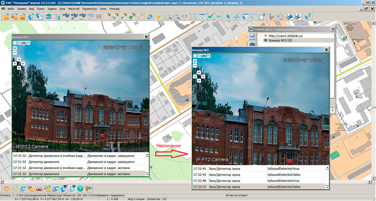
In the task, the ability to control video cameras that support remote change of viewing direction and image scale (Pan-Tilt-Zoom cameras) has been added. The PTZ camera is a PTZ camera with a magnifying lens. Video camera control is available in the window. Positioning is carried out by the modes: turn to the left or right, tilt up or down, zoom in or out of the video image. At a choice of one of modes there is a movement of a video camera lens in the chosen direction with the preset speed. You can stop the movement by pressing the button of the selected mode again, otherwise the movement will stop itself when the specified angle of turn/tilt is reached. The PTZ camera must support the ONVIF standard for interacting with it over the Internet.
The has been added. Now notifications from video cameras are automatically saved in the SQLite format log, which provides quick information search. Viewing archived messages from the video camera is available in the dialog mode, which is called in the "Viewing a photo- and video data" window. Immediately after opening the dialog, a list of all notifications received in the last week is displayed. The most important messages, for example, about crossing the perimeter, the disappearance of objects from the frame, are highlighted in orange and red. The user can choose for display the events of interest to him by setting the time interval and type of events. It is possible to sort events by the time of their occurrence.
You can set up receiving the notifications from video cameras located on the map of the area in the "List of photo and video data" of the "Share your photos with the coordinates of the shooting" task. To subscribe to events, the video camera must support the ONVIF standard for interaction with it over the Internet.
Tools have been enhanced for diagnosing and debugging python scripts executed from the dialog on the bookmark. In debug mode, you can execute a script one line at a time, view the values of local and global variables, enter or bypass functions, set breakpoints, make changes to the script code, and re-execute it. Into the list of basic scripts, section the "Calculations by road graph" has been added with the script "Search for minimum distances between map objects". The new script demonstrates the ability to calculate the shortest distances between two sets of objects recorded on different maps and generate a report in a CSV file. The selected semantics - object identifiers (cadastral number, address or other property) and the shortest distance for each pair of objects are written into the file. The script demonstrates writing of multi-threaded tasks, which can speed up the execution of scripts by an order of magnitude by loading all the processor cores on the computer.
The task of has been improved. When connecting the Cadastral quarters layer, Rosreestr's geoportal requests data from a more accurate level, taking into account the presence of tiles. On the layer of Cadastral plots a possibility has been added for viewing information about plots by means of the button on the main panel the "Viewing the information on object". When connecting geoportals with a slow speed of issuing tiles, the periodic drawing of data on the screen in a background mode is carried out to improve image perception. For accurate alignment of the contours of terrain objects on images of pictures, vector maps and geoportals with an accuracy up to mm, a dialog for setting the geoportal offset has been added. The dialog is called by the right mouse button in the list of geoportals. To ensure the readability of tiles from geoportals on smartphones and tablets with high resolution, the image is automatically scaled to the standard resolution of the original tiles (96 dpi) with the adjustment of the image scale and the determined coordinates of points.
Possibilities of applying user semantics have been expanded for recording arbitrary object properties which are not described in the list of semantics of RSC classifier. User semantics are created when importing vector data (SHP, KML, MIF, DXF, WFS, GML, JSON, and others), when the field names (keys) of object attributes are not found in the selected RSC classifier. To support such semantics in various tasks (, , and others), temporary semantics are created in the RSC classifier in the range of codes 660000 and higher for the duration of a GIS session. Semantics name is filled by name of fields in the source vector data. This provides work with user-defined semantics and semantics from RSC in a common list in various tasks. When simultaneous opening several maps with one classifier, the list of temporary semantics will be supplemented with user semantics from all maps. When opening different combinations of maps, temporary codes in different sessions may have different values. When exporting vector maps to SXF and TXF files, user semantics is written with code 32862 and data record of the form "field_name:value". When imported, such semantics are transfered back into temporary semantics with the addition of new code to RSC. On the map, semantics are written with codes in the range from 60000 and above. The correspondence between the semantics code on the map and the field name is stored in the map metadata. When opening a map by the list of field names of user semantics, temporal semantics are automatically added into RSC.
Ability has been added to save several open matrixes of heights into one matrix (MTW file) with the specified parameters. The program allows you to save matrixes of different accuracy, that are opened locally or through the . Mandatory execution condition: matrixes of heights must be of the same type (absolute heights, relative heights or total heights). For the stored matrix, the scale, precision, and height units can be specified that are different from the characteristics of the initial data. Reducing the size of the element allows you to increase the accuracy of the matrix in plan coordinates, but increases the size of the resulting matrix. The choice of height measurement units (mm, cm, dm, m) affects the accuracy of height storage: if "mm" is selected, the accuracy of height storage is maximum, if "m" is selected, it is minimal. The choice of the unit "m" (meters), for example, makes sense when processing matrixes of heights with an accuracy of 30 meters per element or more. When choosing the unit "m", the size of the resulting matrix can be reduced by two or more times (compared to "mm"). The task is called via the menu: File - Export to... - Matrix (TXT, TIFF, KMZ, MTW) - in the file selection dialog, select the "MTW file" file type.
The program for correcting the metrics of objects has been improved. Processing of emissions (peaks) and junctions of contours has been improved. Processing of complex peaks (such as "antenna") was added. If it is impossible to correct the metric, for uncorrected objects, the output of a list of errors into the protocol has been added. At the end of the program, information on the number of corrected and uncorrected errors is entered into the protocol. This task is recommended when processing vector data loaded from sources that do not have advanced control tools (for example, OpenStreetMap). The task is called through the main menu: Tasks - Map processing by the scenario - Correction of objects metrics.
The digital classifier of sea maps S57navy.rsc and the procedure for importing digital maps of the S57 standard have been improved to increase the degree of compliance of the displayed maps with the S52 standard.
The new version of the program is available for download in the section.


Ph.: +7 (495) 739-0245, +7 (925) 221-1603
www.gisinfo.ru | panorama@gisinfo.ru
105005, Russia, Moscow, Baumanskaya Street 7, building 1, office 229 (m. Baumanskaya)
Copyright © Panorama Group 1991 - 2024


 Mobile version
 Full version