Copyright © Panorama Group 1991 - 2024

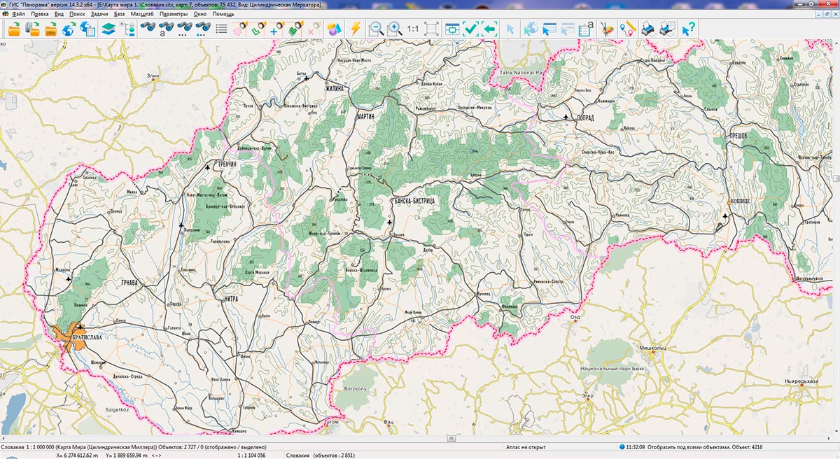
In KB "Panorama" the digital geographic maps of scale 1: 1 000 000 in SITZ format onto territory of the Slovak Republic and the Republic of Moldova have been prepared. As a source for preparation of the map the obtained from the information from the site has served. The maps contain information on the number of inhabitants for cities and the name of settlements in Russian. As additional materials the World map of scale 1: 5 000 000 and data were used.
The maps were led to the classifier of geographic maps of scale 1: 1 000 000 (1mogk13g.rsc). It can be used for a general assessment of the area and the study of natural conditions, to ensure the educational process, as a basis for the creation of geographic maps of a smaller scale, thematic and special maps, and solving other tasks. The map is distributed free of charge under a free .
Digital geographic maps of scale 1: 1 000 000 in SITZ format are available for download on the page "Digital maps".


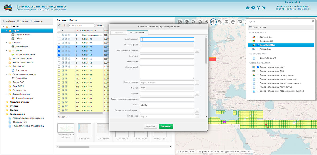
In KB "Panorama" the version 7.3.0 has been developed. The new version provides more convenient processing of large volumes of vector and raster data, analog maps and images, geodetic data, documents and accompanying materials. Version control is supported when storing and issuing data. When issuing data for different dates of the area's state, each data set is placed in a separate folder indicating the date of the state. When viewing the presence of spatial data on a map-scheme, the data can be combined into groups (clusters) so as not to clutter the scheme with many small objects. Distribution of client data processing services is provided for separate servers that are connected to the parent server that stores spatial data standards. Editing tools of metadata have been improved. Multiple editing is supported, including fields with different values. When displaying data on a map-scheme, the year of the area's state, the initial scale, and the type of product are taken into account. All these parameters are filled in automatically when the data is loaded.
Control at filling and editing of directories has been improved. When a directory is approved, its use is analyzed. Attempts to delete the used directory are blocked. There is added a warning when trying to close the application's page, during the execution of long-term operations - data loading, uploading, import, export, control procedures. The percentage completed, the elapsed time, and the estimated end time of the operation are displayed.
Formation of an extract for geodetic points has been improved. Report design when exporting metadata into DOC format was updated. Processing of metadata when loading data by folders and work in the absence of activity in the application have been optimised. Reading of the Databank parameters at the start of the application and opening the sections via a direct link were optimised. The list of logged error messages when reading parameters, loading data, control procedures, exporting and importing metadata has been expanded. There is added a recording into the events log of the information about the client's browser and authentication type, the list of recorded system information has been extended.
Data security is ensured by the differentiation of access rights based on security tools included in the operating system. Basic authentication, digest authentication, system authentication (via web server), and domain authentication (Kerberos or ActiveDirectory) are supported. Additional security is provided by the use of pass-through authentication when working with the database. Connection to the database occurs with the rights of the user working with the system. The complex is adapted to work on a wide range of operating systems (Astra Linux SE, ALT Linux, Elbrus, Ubuntu, CentOS, MS Windows and others) and architectures (Intel, Elbrus, Baikal). The program is registered in the register of domestic software under the number 1862.
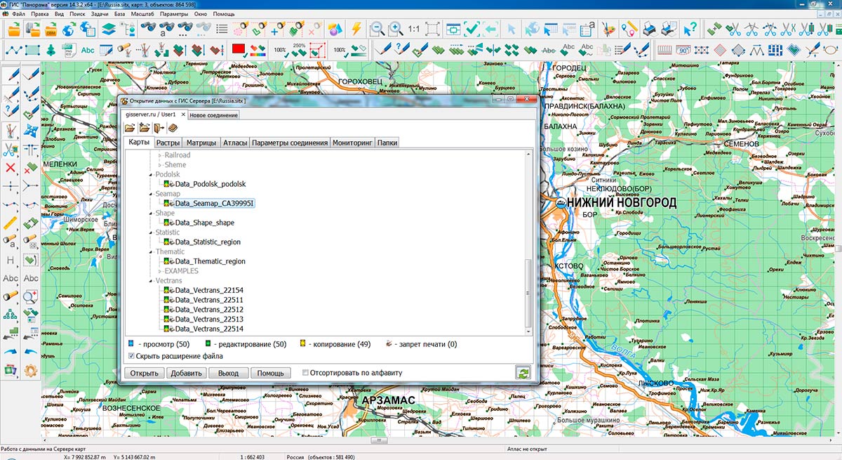
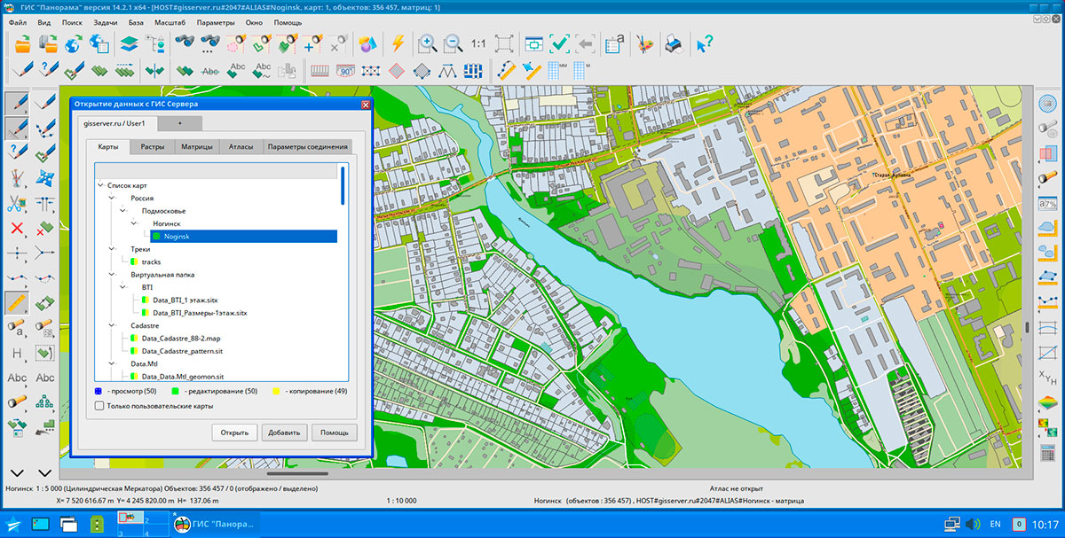
The databank of digital maps and remote sensing data is the basis for building infrastructure of spatial data of federal, regional and municipal levels, in corporate information systems. Within the framework of a single geoinformation space, the Data Bank of digital maps and remote sensing data realises gathering, storage, quality control, search and delivery of the spatial data in exchange formats. The spatial data selected by means of the program can be placed for the multiuser access on the and be published according to the international standards OGC WFS, WFS-T, WMS, WMTS, WCS on application server the . Users can access data from both a thin client (by means of ) and from desktop applications (, GIS "Operator"). The databank of digital maps and remote sensing data provides construction of cloud warehouse of spatial data, provision of access to these data, the automated formation and updating of geocovers.
The current state of spatial data is displayed by means of maps-schemes that are maintained for each type of stored data: vector maps, remote sensing data, elevation matrixes and terrain models. It provides remote placing the sets of spatial data into file warehouse, keeping versions of stored sets, updating maps-schemes of data availability, the automated collection and formation of metadata, and the formation and updating of geocovers. Automated collection and formation of metadata is performed according to the standards of ISO 19115: 2003, Geographic information - Metadata and ISO/TS 19139, Geographic information - Metadata - XML schema implementation. The reduced copies of data images are automatically formed, checksum of files and completeness of data sets are checked. Placement of spatial data into file storage is performed with integrity check, control of structure and content of data. The results of the work are recorded and are entered into the metadata base. Automatic backup of metadata and spatial data storage with integrity control and data recovery has been provided. Multilingual interface is supported.
The portal demonstrates the possibilities of organizing storage, accounting and and issuance of vector maps, remote sensing data, matrixes of heights and the terrain models. The portal contains vector maps in SXF format, generated on the basis of data from open sources (OpenStreetMap, VMap0). The spatial data includes maps of: subjects of the Russian Federation, countries and cities of the near and far abroad. In total, over 250 vector maps and 6700 matrix data with a total volume of 60 GB. Specialists of KB "Panorama" weekly update and refresh the content of the information on the portal. All published data is distributed free of charge under a free license.
The new version of the program is available for download on the page.


In KB "Panorama" the version 10.3 has been developed for operating systems Astra Linux SE, Ubuntu 18.04, CentOS 8, CentOS 7 and MS Windows. The new version of the program has improved support for client services that generate an automatic flow of commands at multilevel connection of servers to each other for distributed storage and processing of spatial data with automatic replication, backup and data protection.
When building information systems that process terabytes of spatial data in an automated mode, client services of data processing can be distributed among separate servers that are connected to the parent server that stores spatial data standards. Such an architecture reduces the load on the data transmission network by dozens of times, speeds up data access and increases the reliability of operation.
Control of the state of data availability schemes in the and their automatic updating have been accelerated. The analysis of metadata uploaded to the Databank for vector maps, remote sensing data, geopoints and analog materials has been improved.
The new version of the program is available for download on the page.


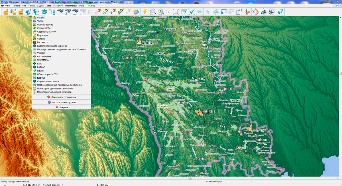
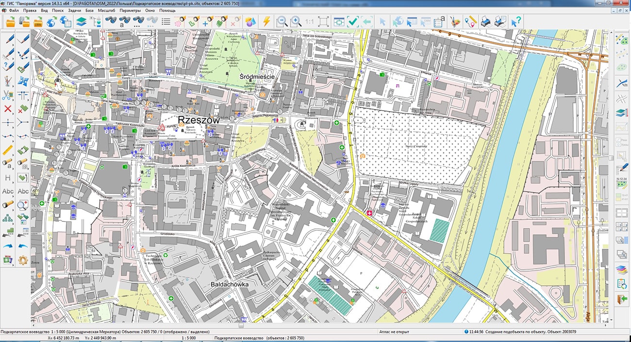
Specialists of KB "Panorama" prepared and placed the maps of Podkarpackie and Podlaskie Voivodships (Poland) on the geoportal . The maps were formed using OpenStreetMap data, source data were obtained from website. To work with the maps, you can use the program or other software products of KB "Panorama".
The maps were led to the modernised classifier of large-scale plans of scale 1: 5 000 (map5000m) and were saved into a packed project (mptz). Publishing of updates in bank of spatial data is made by using the program of . Publishing contents of bank of spatial data on the geoportal and data access for downloading are implemented by means of .
Free maps on the basis of OpenStreetMap data are available for download on the page "Digital maps".


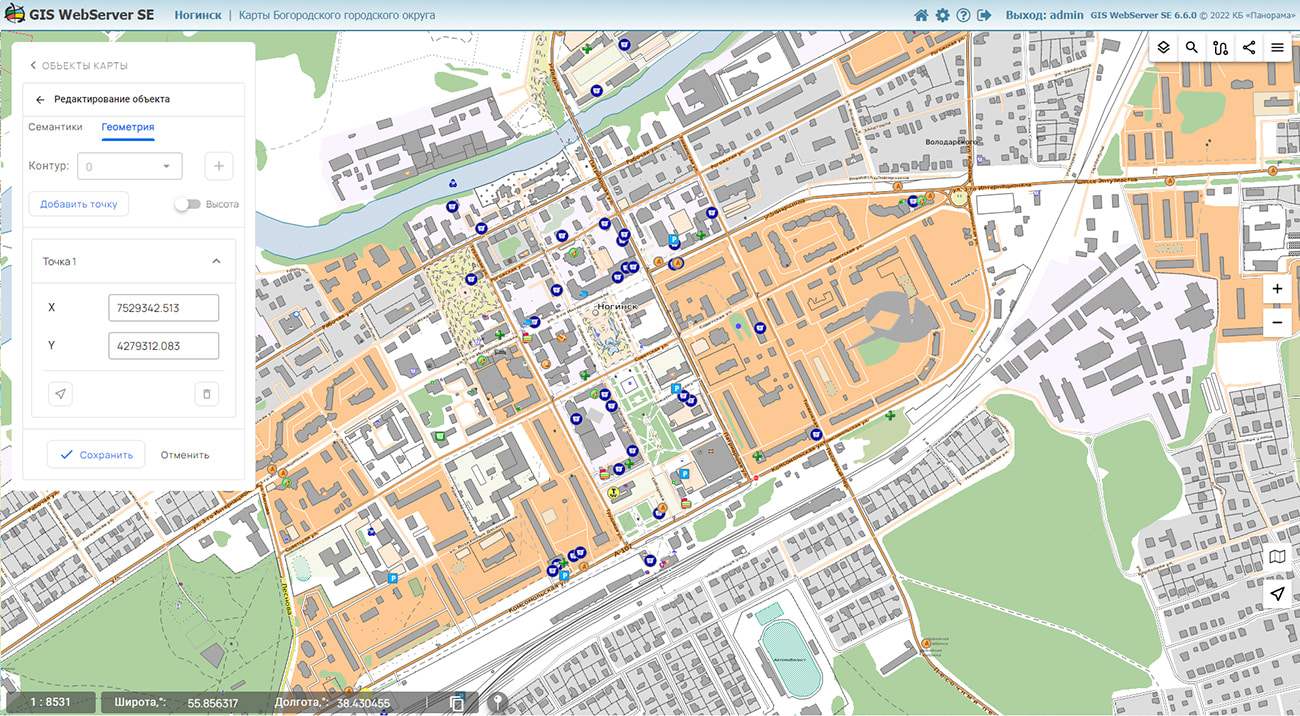
In KB "Panorama" the version 6.7. has been developed for operating systems Astra Linux, CentOS, Ubuntu, MS Windows. In the new version a support of local and arbitrary user coordinate systems has been added when publishing large-scale maps, plans of cities, floor plans and other detailed data. In the projections of local coordinate systems (LCS) all functions of of the application are available: output of map images, search and editing of objects, computations and calculations. The units of measurement are meters in the projection of the selected coordinate system. This improves the accuracy of calculations when working with geospatial data.
Support for local coordinate systems allows the Map Editor to perform operations in meters. This eliminates the conversion from geodetic coordinates to meters and allows you to create and update cadastral plans and engineering schemes that require increased accuracy in storing coordinates. Work in LCS is supported for map layers published on . The setting of work parameters in local coordinate systems has been added into the administration module.
In the new version the toolkit for developing Web applications the has been improved, which expands the possibilities of GIS WebServer SE and can be integrated into other information systems. Access to data (images, vector maps and information about the terrain) is provided by Web services according to the generally accepted OGC protocols and ISO standards. Various types of elevation data are used as a digital elevation model: matrixes (in SRTM, GeoTIFF, IMG, MTW formats), TIN models, point clouds, and others.
can be as a source of spatial data. It provides collection, storage, search and issuance of spatial data in exchange formats, a displaying the state of the data bank in the form of maps-schemes, automated generation and updating of geo-covers.
GIS WebServer SE is used in the construction of closed corporate systems to ensure the protection of data having a security classification or a trade secret. GIS WebServer SE certified by the 2nd level of control over the absence of undeclared capabilities. The new version of the program expands the possibilities of the application when solving problems of analysis, management and long-term planning of the development of territories. GIS WebServer SE is implemented using the GIS WebToolKit SE, which can be used in development tools that use the JavaScript and TypeScript.
The new version of the program is available on the website in the section.


Ph.: +7 (495) 739-0245, +7 (925) 221-1603
www.gisinfo.ru | panorama@gisinfo.ru
105005, Russia, Moscow, Baumanskaya Street 7, building 1, office 229 (m. Baumanskaya)
Copyright © Panorama Group 1991 - 2024


 Mobile version
 Full version