Copyright © Panorama Group 1991 - 2024

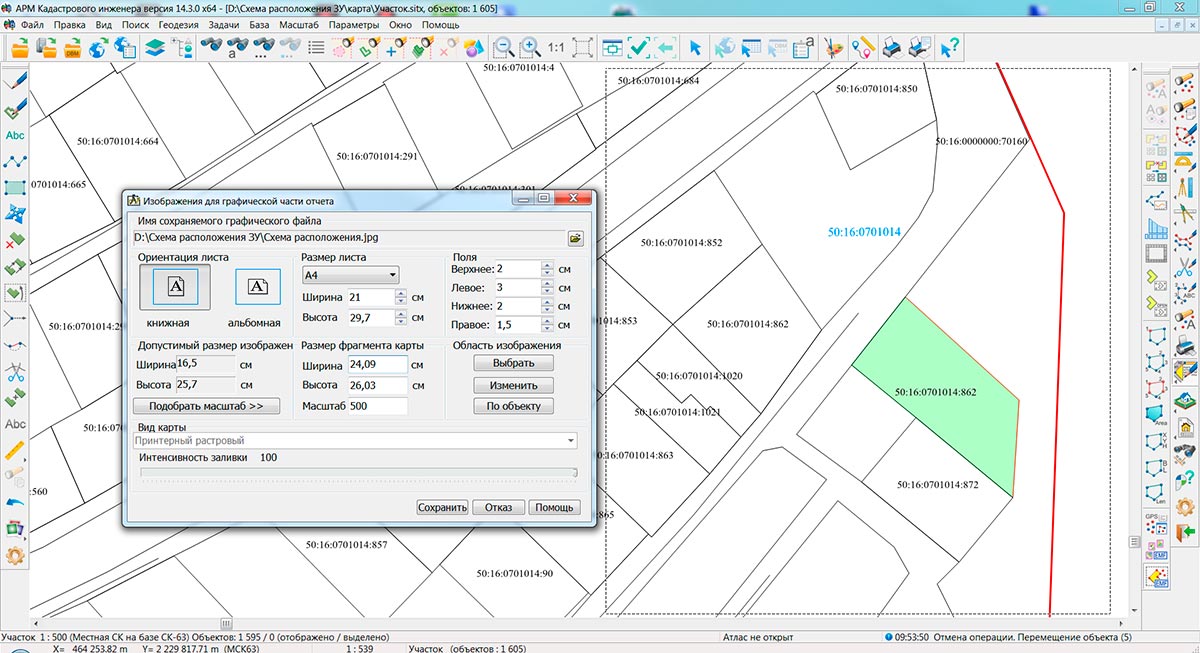
Specialists of KB "Panorama" have prepared a video lesson of of the scheme of land plots layout for a graphic part of the land survey plan. Users of "Workstation of cadastral engineer", or can make schemes of land plots layout with the subsequent formation of graphic files of schemes using the tools of the complex of geodesy calculations.
The training material demonstrates the procedure for forming the scheme of a land plots layout for the graphic part of the land survey plan, drawn up in accordance with the Order of the Ministry of Economic Development of the Russian Federation dated December, 8th, 2015 № 921. On the basis of this order in software products of KB "Panorama" the classifiers of symbols survey.v5.rscz and survey.v6.rscz have been developed. In classifiers there are implemented the general list of layers, semantic characteristics and objects for displaying cadastral information on cadastral maps and other cadastral documents.
The scheme of land plots layout is intended for displaying a location of land plots relative to adjacent land plots, borders of cadastral division, natural objects and (or) objects of an artificial origin, lands of the general using, land plots of the general using, territories of the general using.
Preparing a scheme of land plots layout is an obligatory stage in the production of cadastral works on formation of land survey plan of the land plot.
You can get acquainted with training materials in the section "Video lessons".


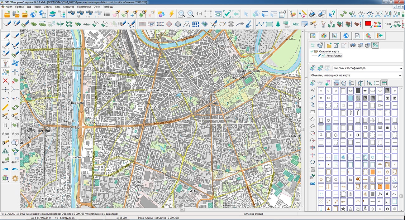
Specialists of KB "Panorama" prepared and placed the maps of the Astrakhan and Volgograd regions on the geoportal . The maps were formed using OpenStreetMap data, source data was obtained from website. To work with the maps, you can use the program or other software products of KB "Panorama".
The maps were led to the modernised classifier of large-scale plans of scale 1: 5 000 (map5000m) and were saved into a packed project (mptz). Publishing of updates in bank of spatial data is made by using the program of . Publishing contents of bank of spatial data on the geoportal and data access for downloading are implemented by means of .
Free maps on the basis of OpenStreetMap data are available for download on the page "Digital maps".


In KB "Panorama" the has been developed. In the new version the tools for selecting and analyzing events from remote video cameras, connecting geoportals, editing and control of vector terrain maps and designing aeronautical maps have been improved.
Options for working with r have been expanded. Now the user can select the types of events for which he wants to receive notifications from the video camera. Events include: movement of people, cars and other objects in the video camera's visibility field, crossing the perimeter of a closed zone, appearance or disappearance of objects in the frame, detection of facts of vandalism and sabotage. To receive event notifications, the video camera must support appropriate video analytics and the ONVIF standard for Internet communication.
New features provide filtering of event notifications from the video camera. The user can select the types of events that interest him in the dialog , which is called in the "List of photo and video data" mode of the task. The dialog displays a list of event types supported by a particular video camera. Events are grouped by topics. At the top level of the hierarchy, the groups correspond to the main video camera services. These include: a video analytics service, a media service, a service of camera status monitoring, etc. At the lower levels, events are grouped according to clarifying features. For example, events from the video analytics service are divided into events related to motion detection in the frame, field detection (perimeter intrusion, the appearance or disappearance of objects), object detection (person, car), etc. If authorization is required when connecting to a camera, and it has not been saved earlier, then its parameters will be requested from the user before opening the "Setting up an event filter" dialog. After the user has marked all the events of interest to him, the subscription to receive events is activated. Viewing event notifications will be available in the camera video view window.
The task of has been improved. Ability to access archived data from geoportals has been added. The archives may contain data on the state of the area for a certain period of time or other geospatial information. Examples of such data can be remote sensing data, electronic field maps, thematic maps, weather maps, geological, geographic, geophysical, engineering and other data. For example, using this task, you can connect fire maps provided by the Information System for Remote Monitoring of the Federal Forestry Agency (Rosleskhoz). This system provides data from aviation and ground observations, from satellite monitoring of forest fires, from a lightning direction finding system. Access to information is carried out taking into account the specified time interval of observations.
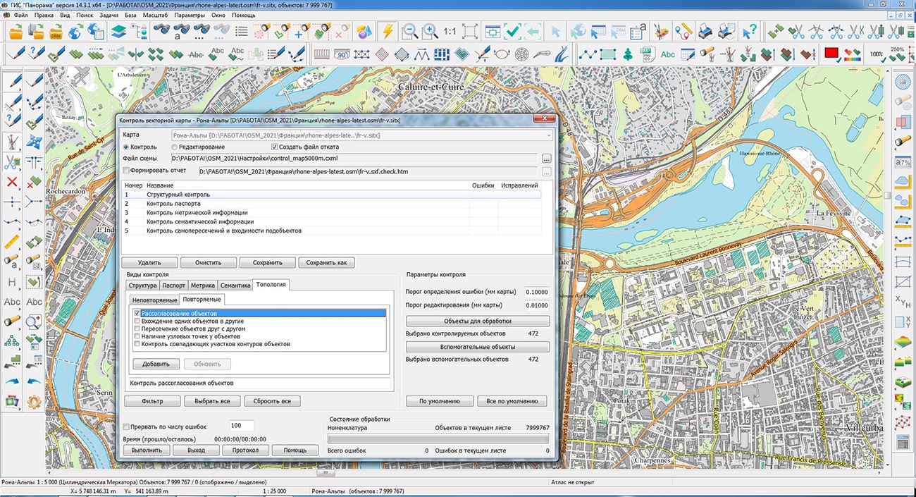
has been improved. When performing of "Mismatch of objects" with editing, the matching of the metrics of point objects, vector objects (buildings) with areal objects (blocks) has been added. The new algorithm takes into account the presence of several objects adjacent at one point. Errors corrected during the checking process are not displayed into the log. Duplicate error messages have been reduced.
There is significantly accelerated the opening of the containing a tree of types of objects with conventional signs. The Map Legend is opened by pressing the F11 key or via the Tools\Map Legend menu.
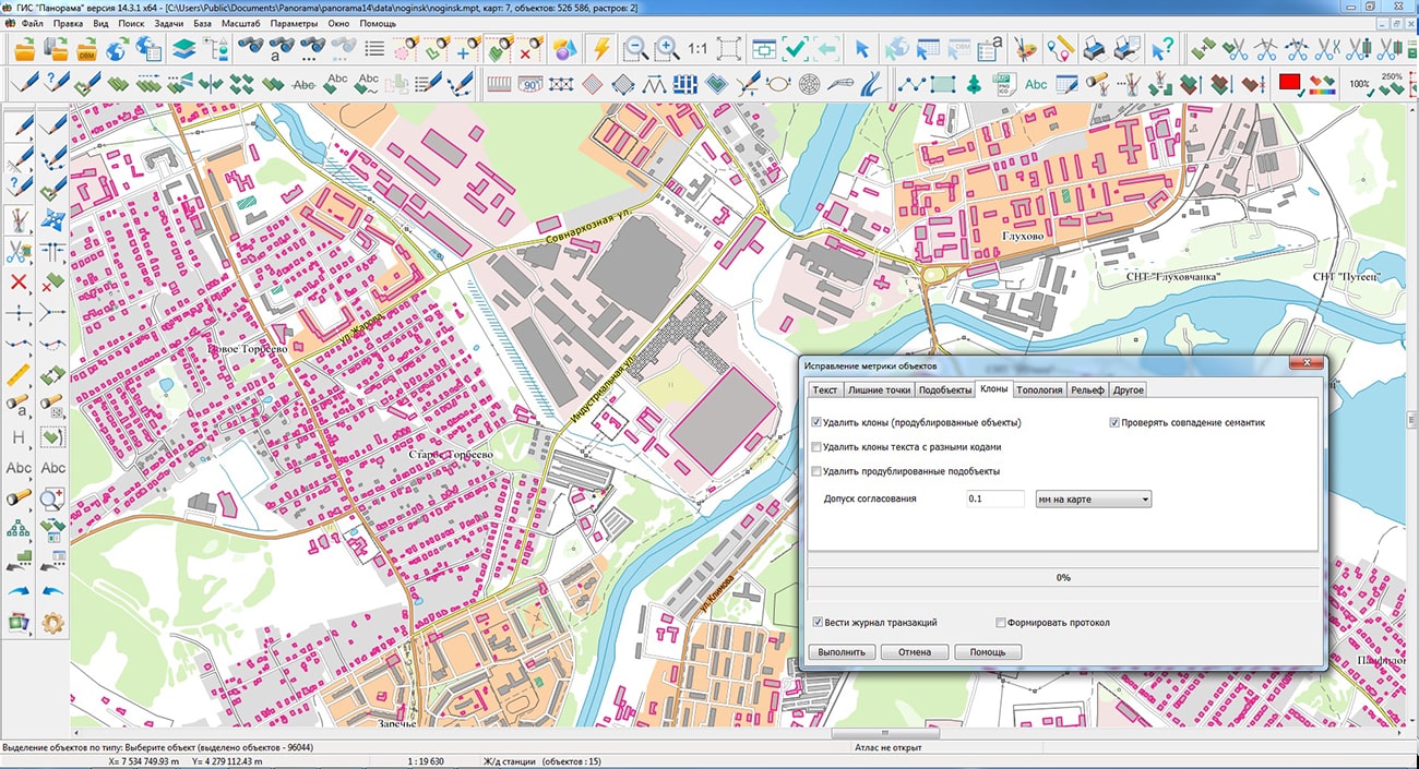
In the "Clones killer" mode of the application, the "Check semantic values" option has been added. This allows you to exclude from processing the objects that match in spatial coordinate description, but have differences in the description of attributes.
A containing service information about the program's operation has been developed. The diagnostic log file can be large. To speed up work with the log, reading and displaying the file is performed block-to-block from the end of the file. Initially, the last block of the diagnostic log is displayed. Within the current block, it is possible to search for the message text in the forward and backward directions.
Conventional symbols have been added into the classifier of aeronautical maps to display the signatures of the minimum absolute flight altitude in the area with the value displayed in meters or feet. The symbols are designed in accordance with the requirements of Doc 8697 ICAO Guidelines for Aeronautical Charts.
The new version of the program is available for download in the section.


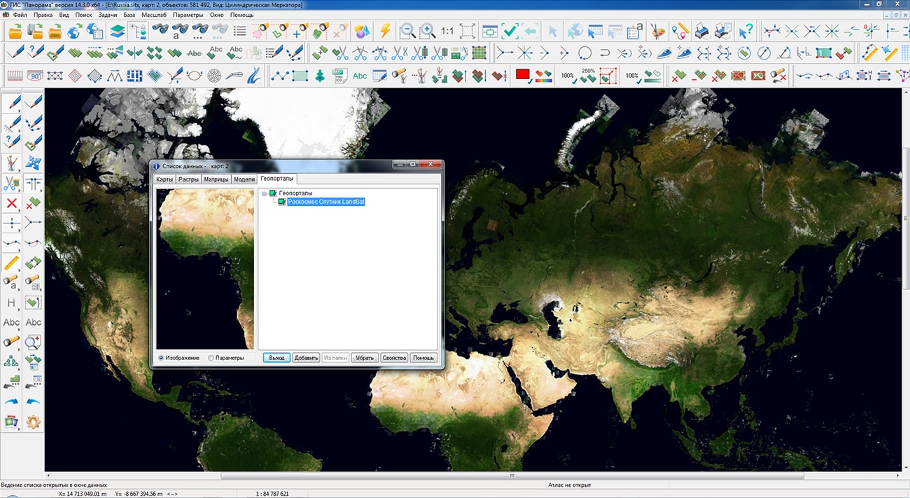
In the a support has been implemented for seamless coverages from composition of geoinformation service "Basic Products Bank" (BBP) of . The service, which provides services for the search, formation and dissemination of information products of remote sensing data, was developed by specialists of joint-stock company . To connect to the service, you need to register on the BBP
The BBP contains data from various spacecraft, such as BKA, KANOPUS-V, KANOPUS-V-IK, METEOR-M, RESURS-P and others. Seamless coverages are provided in the form of a tile substrate according to the TMS standard for various territories of the Russian Federation in separate regions. To support seamless BBP coverages in the GIS "Panorama", a direct connection of geoportals according to the TMS standard has been added. The storage of tiles of the TMS service is presented as a set of files ordered by directories, the so-called tile pyramid. To quickly find the required tiles, the coordinates of the tile pyramid (Z/X/Y) corresponding to the level of the pyramid, the column number and the row number of the tile are used. The GIS "Panorama" supports two search algorithms Z/X/Y and Z/Y/X, which allow you to generate a request for providing data, get tiles from the storage and draw the extracted data.
The composition of seamless coverages is constantly updated, to dynamically add layers to the composition of the displayed map, you must use the "Open map in WMS/WMTS service" dialog. To connect to BBP, it is enough to enter the connection string and api-key received in your personal account on the BBP website. In the task of connecting geoportals, a support has been added for arbitrary user matrixes of tiled pyramids in local coordinate systems with user-defined reference points and arbitrary direction of axes. This allows you to include BIR and GeoPackage format data.
BBP integration with GIS "Panorama" provides information independence from foreign remote sensing data providers and creates a geoinformation ecosystem based entirely on domestic software technologies and information resources. For users of state and municipal authorities of various levels, the BBP is a tool for accessing information products generated according to the remote sensing data of Russian Space Systems. Embedding BBP products into the GIS "Panorama" ensures their application for solving various applied problems of global and regional monitoring.


Specialists of KB "Panorama" will take part in the All-Russian meeting . The event will be held in a format of a video conferencing from April, 19 till April, 22nd, 2022. The event is organized by the and .
The meeting's purpose is discussion of a current state and development of the State geological mapping for the period up to 2025 with a perspective up to 2035. The company's specialists will make a report , which is scheduled to be presented at 13:05 on April 20, 2022. The report will consider the possibilities of the for creating a geoinformation platform for state geological mapping and the experience of solving similar problems in the interests of state structures of the Russian Federation. The report also includes issues of using such software products as: , GIS WebService SE, , the , and others.
The meeting is broadcast live on and .


Ph.: +7 (495) 739-0245, +7 (925) 221-1603
www.gisinfo.ru | panorama@gisinfo.ru
105005, Russia, Moscow, Baumanskaya Street 7, building 1, office 229 (m. Baumanskaya)
Copyright © Panorama Group 1991 - 2024


 Mobile version
 Full version