Copyright © Panorama Group 1991 - 2024

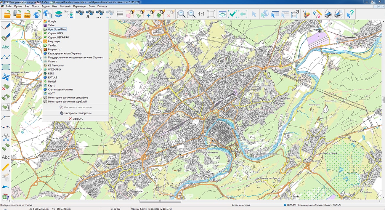
Geoportal has been supplemented with a map of the Franche-Comte region (France), formed according to OpenStreetMap data. Source data was obtained from website. To work with the map, you can use the program or other software products of KB "Panorama".
The map was led to the modernised classifier of large-scale plans of scale 1: 5 000 (map5000m). Publishing of updates in bank of spatial data is made by using the program of . Publishing contents of bank of spatial data on the geoportal and data access for downloading are implemented by means of .
Free maps on the basis of OpenStreetMap data are available for download on the page "Digital maps".


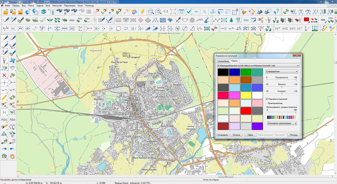

In KB "Panorama" the version 14.2.1 has been developed for the operating system "Astra Linux Special Edition" release "Smolensk" versions 1.7. In the new version the tools have been updated for editing digital terrain maps and plans of cities, calculations on a map, preparations of three-dimensional terrain models, creating matrixes of heights and others.
To display various tabular information on the map, a new graphic sign "Table" has been developed. To display the table in the desired position, a point object is created that has a link to the CSV file in semantics and a conventional symbol of the "Table" type. A CSV file is a set of lines containing the values of one or more table fields (columns) separated by symbols - comma, semicolon, tab. The graphical parameters of the table are customized in the semantics of the object.
With the help of objects of the "Table" image the various statistical data on financial, environmental, economic, medical, tax, meteorological, demographic topics can be presented, which can be obtained on the websites of the Federal State Statistics Service. Statistical data can be displayed both for Russia as a whole, and for various indicators for municipalities in the Database of indicators of municipalities.Different layers of the map can contain tables for different themes and years. Tables, like other objects, can have visibility scale ranges. At updating the table the data will change accordingly on a map.
The ability to work with text and hypertext documents has been enhanced by adding support for PDF documents. The user can add to a map a set of PDF-documents, for example, for their use as an auxiliary material during work. When you change the size of the added document's window, its scale will change depending on the current map scale. You can customize the display on the user document of the desired page of the PDF document. For convenience of customizing there is a preview window for added documents.
Geographic information system GIS "Panorama" is the universal geographic information system that has tools for creating and editing digital maps and city plans, processing remote sensing data, performing various measurements and calculations, overlay operations, building 3D models, processing raster data, tools of preparing graphic documents in digital and printed form, as well as tools for working with databases. Geographic information system GIS "Panorama" is registered in the Unified Register of Russian Computer Programs and Databases (№4227).
Certified operating system "Astra Linux Special Edition" release "Smolensk" version 1.7 has built-in verified information security tools. This is a fault-tolerant platform for secure IT infrastructures of any scale and work with data of any degree of confidentiality. This operating system is highly appreciated not only by government agencies and corporations, whose exactingness in the quality of IT solutions is a clear marker of their high level of reliability, but also by ordinary users, because of the convenience and compatibility with most products of domestic and foreign software and hardware manufacturers.
On the basis of the "Smolensk" release, you can create a full-fledged workstation for solving almost all everyday tasks: working on the Internet, with office or multimedia tools, as well as with applications that require maximum use of the capabilities of graphic video cards, including geographic information systems.
The new version of the program is available for download in the section.
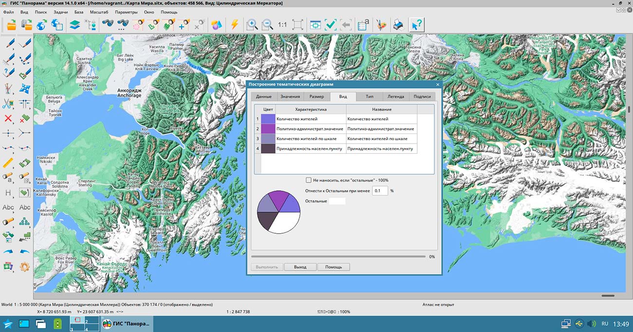


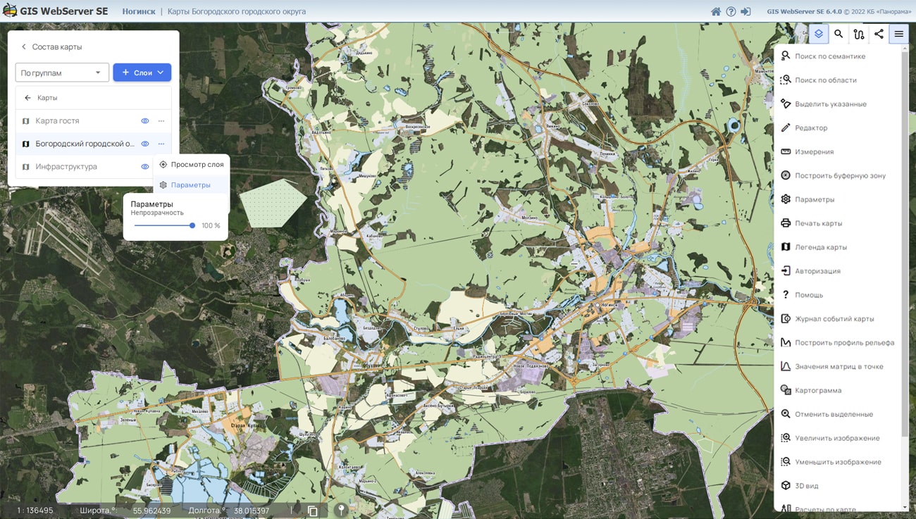
In KB "Panorama" the version 14.4.1 has been developed. In the new version the tools for creating thematic cartograms for arbitrary user objects have been added. Maps can be created to analyze geological, geographic, geophysical, engineering, and other data models. Types of objects are specified by primitives described in JSON (SLD) or xml (SLD) format. In this case, the type of objects may depend on the parameters passed in the request or be specified by a formula. Data for analysis can be transferred in an arbitrary text file, a CSV file, or located in object semantics. Tools for creating and using cartograms are implemented in .
The service's capabilities for working with layers have been expanded. A request to get the state of the map has been added. It will allow to reduce the traffic for dynamically updated layers (for example monitoring of movement of motor transport) and not to receive a picture if the state of data has not changed. Possibility to limit scale of data output for a layer has been added. Possibility to set the type of data displayed for the layer is added: screen/printer. Support of transactions with graphic primitives in JSON and SLD formats has been added.
GIS WebService SE supports all international standards (OGC WFS, WFS-T, WMS, WMTS, WCS), which are used to transfer and display spatial data. The program implements the ability to issue tiles according to any user or local coordinate system. The application is implemented on Windows and Linux platforms and is compatible with Apache, IIS and nginx web servers.
The new version of the program and documentation are posted on the website in the section.


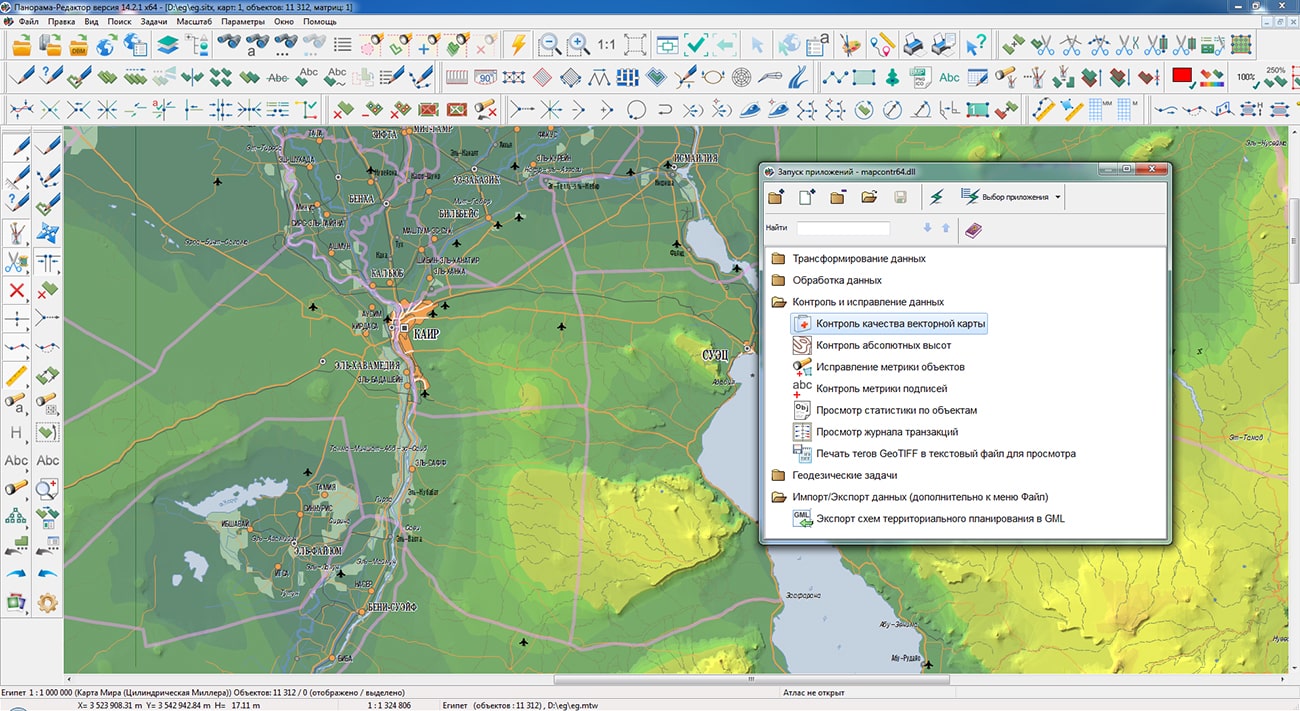
In KB "Panorama" the professional vectorizer version 14.2.1 has been developed. In the new version the tools have been improved for checking the quality of topographical and special maps and processing of matrixes of heights, editing of spatial databases in information systems, automation of constructing and updating the diagrams for the territory analysis.
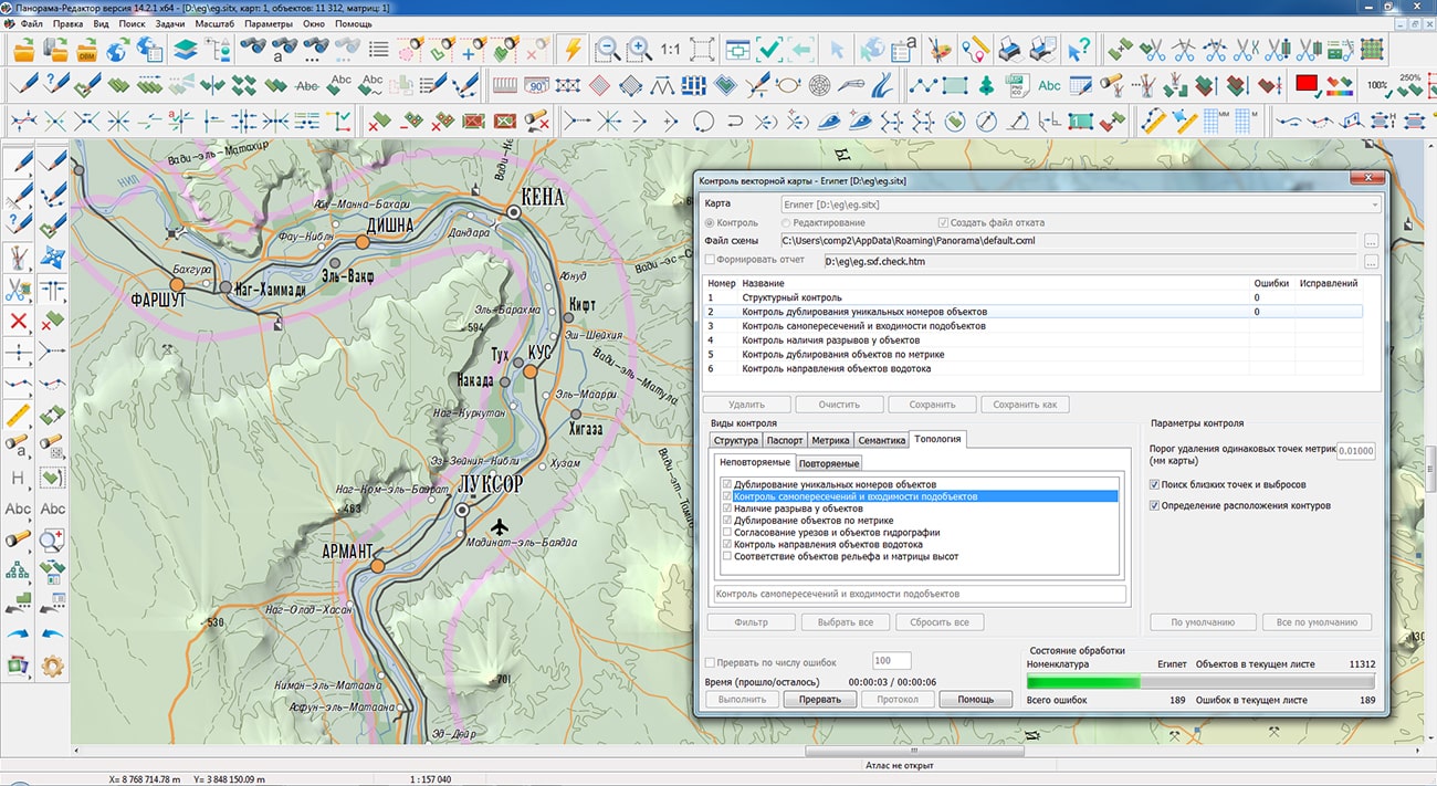
Requirements for the accuracy, content and format of the electronic presentation of state topographic maps and the state topographic plans are established by order of the Ministry of Economic Development of Russia dated 06/06/2017 № 271 "On approval of requirements for state topographic maps and state topographic plans, including requirements for the composition of information displayed on them , to the conventional symbols of the specified information, requirements for the accuracy of state topographic maps and state topographic plans, for the format of their presentation in electronic form, requirements for the content of topographic maps, including relief maps" (registered in the Ministry of Justice of Russia on July 03, 2017 № 47276).
In accordance with the requirements of Order № 271, the task has been improved, which is designed to check the structural integrity of digital data, the completeness and quality of the metric and semantic description of objects, and to automatically correct detected errors. In the mode of control of self-crossings and location of subobjects, additional processing has been added: search and removal of matching fragments of the contours of linear objects, control and correction of flags for the occurrence of contours of multipolygons. The task is started via the main menu: Tools - Run Applications - Check of vector map quality.
The task has been improved. Into the profiling mode "By triangulation" there are added a processing mode "By sheets" and the ability to select individual sheets of the region using the "Filter" button. The "By sheets" mode does not detect erroneous elevations differences between objects of different sheets, but it is performed 5-6 times faster than processing in the region, since triangulation is built for each sheet separately with a smaller number of edges (profiles). For the processing mode in the region, the issuance of unnecessary messages caused by the passage of profiles through the areas of sheets absence in the case of a non-rectangular form of region has been eliminated. Processing time indicator "Time (used/remain)" has been added. For a flat terrain with a large number of elevations and a small number of isolines, the "By triangulation" profiling mode eliminates misses that are possible when searching for heights in horizontal and vertical directions, which reduces the number of uninformative messages and facilitates the analysis of control results.
The procedure for has been improved: search and removal of shuttle and spiral self-crossings has been added, statistics output on corrected and uncorrected errors has been added into the message log (Map Editor - View map control log). The procedure for correcting the metric is started through the main menu: Tools - Processing map by scenario - Correction of objects metrics.
There are added the new types of programmable signs for . The description of diagrams includes a list of codes of semantics corresponding to sectors of the diagram. Each semantics has its own sector display parameters (color of filling, contour color, filling with shading and others). For a pie diagram, the parameters of the contour line and the size of the diagram radius in mm are set. The conventional symbol the Pie diagram is shown in the data example on the map \Data\shape.
The dialog for has been improved: the choice of a translucent line type (Line - color glass) and the setting for shift of hatching have been added. Use of imposing of two or more hatched views with different shifts of hatching allows to receive hatching of double, multicolor or other more complex views. Object type setting is performed in the map Classifier Editor or in the object selection dialog (on the "View" tab). The conventional symbol the Hatching with offset is shown in the data example on the map \Data\shape.
Possibility has been added when updating multilayer cartographical representations of data. Objects of a digital map that displays the state of a spatial database are stored in various tables with their own sets of attributes. Objects from different tables can be displayed by conventional symbols from one classifier containing the corresponding layers and types of symbols. Database tables do not contain metadata that restricts recording the new objects from "alien" layer. The operator should choose a layer on which the object will be put from a large list, which slows down the work and introduces errors. To automatically determine the table to be updated, the ability to set filters by layers, objects, and a set of characteristics has been added into the settings of connected databases.
The new version of the program is available for download in the Download section.


Specialists of KB "Panorama" prepared and placed the map of the Novgorod region on the geoportal . The map was formed using OpenStreetMap data, source data was obtained from website. To work with the map, you can use the program or other software products of KB "Panorama".
The map was led to the modernised classifier of large-scale plans of scale 1: 5 000 (map5000m) and was saved into a packed project (mptz). The MPTZ format project includes a digital map of the region's territory (country, subject of the federation, administrative region), a map of the administrative-territorial division of the region and a digital classifier. Publishing of updates in bank of spatial data is made by using the program of . Publishing contents of bank of spatial data on the geoportal and data access for downloading are implemented by means of .
Free maps on the basis of OpenStreetMap data are available for download on the page "Digital maps".


Ph.: +7 (495) 739-0245, +7 (925) 221-1603
www.gisinfo.ru | panorama@gisinfo.ru
105005, Russia, Moscow, Baumanskaya Street 7, building 1, office 229 (m. Baumanskaya)
Copyright © Panorama Group 1991 - 2024


 Mobile version
 Full version