Copyright © Panorama Group 1991 - 2024

Specialists of KB "Panorama" prepared and placed the map of the Ryazan region on the geoportal . The map was formed using OpenStreetMap data, source data was obtained from website. To work with the map, you can use the program or other software products of KB "Panorama".
The map was led to the modernised classifier of large-scale plans of scale 1: 5 000 (map5000m) and was saved into a packed project (MPTZ). The MPTZ format project includes a digital map of the region's territory (country, subject of the federation, administrative region), a map of the administrative-territorial division of the region and a digital classifier. Publishing of updates in bank of spatial data is made by using the program of . Publishing contents of bank of spatial data on the geoportal and data access for downloading are implemented by means of .
Free maps on the basis of OpenStreetMap data are available for download on the page "Digital maps".


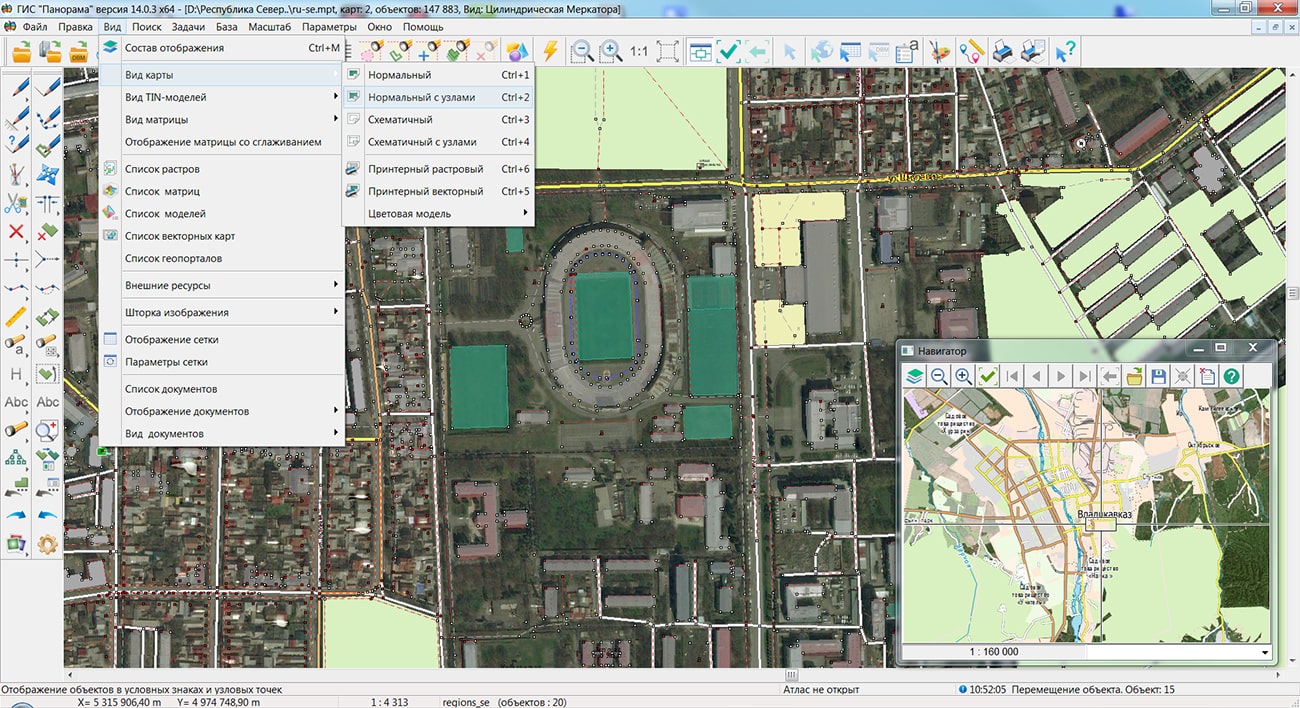
Specialists of KB "Panorama" prepared and placed the map of the Republic of North Ossetia - Alania on the geoportal . The map was formed using OpenStreetMap data, source data was obtained from website. To work with the map, you can use the program or other software products of KB "Panorama".
The map was led to the modernised classifier of large-scale plans of scale 1: 5 000 (map5000m) and was saved into a packed project (MPTZ). The MPTZ format project includes a digital map of the region's territory (country, subject of the federation, administrative region), a map of the administrative-territorial division of the region and a digital classifier. Publishing of updates in bank of spatial data is made by using the program of . Publishing contents of bank of spatial data on the geoportal and data access for downloading are implemented by means of .
Free maps on the basis of OpenStreetMap data are available for download on the page "Digital maps".


Specialists of KB "Panorama" have prepared the regular lecture and from the course "Geoportals" - "Software for geoportals. Part 2". The training is conducted according to the bachelor's program of the Department of of the Faculty of of MIIGAiK, which contains lectures and practical exercises.
One of the areas of training at the faculty - information systems and technologies - for a long time continues to be a significant growth factor for most sectors of the economy, therefore, graduates in the relevant specialties are in wide demand. At the faculty in this direction, specialists are trained in the field of designing and development of information systems, including, taking into account the specifics of MIIGAiK, geographic information systems.
Geographic information systems are an important class of information systems. GIS is a tool for processing the spatial data that integrates various aspects related to location and content.
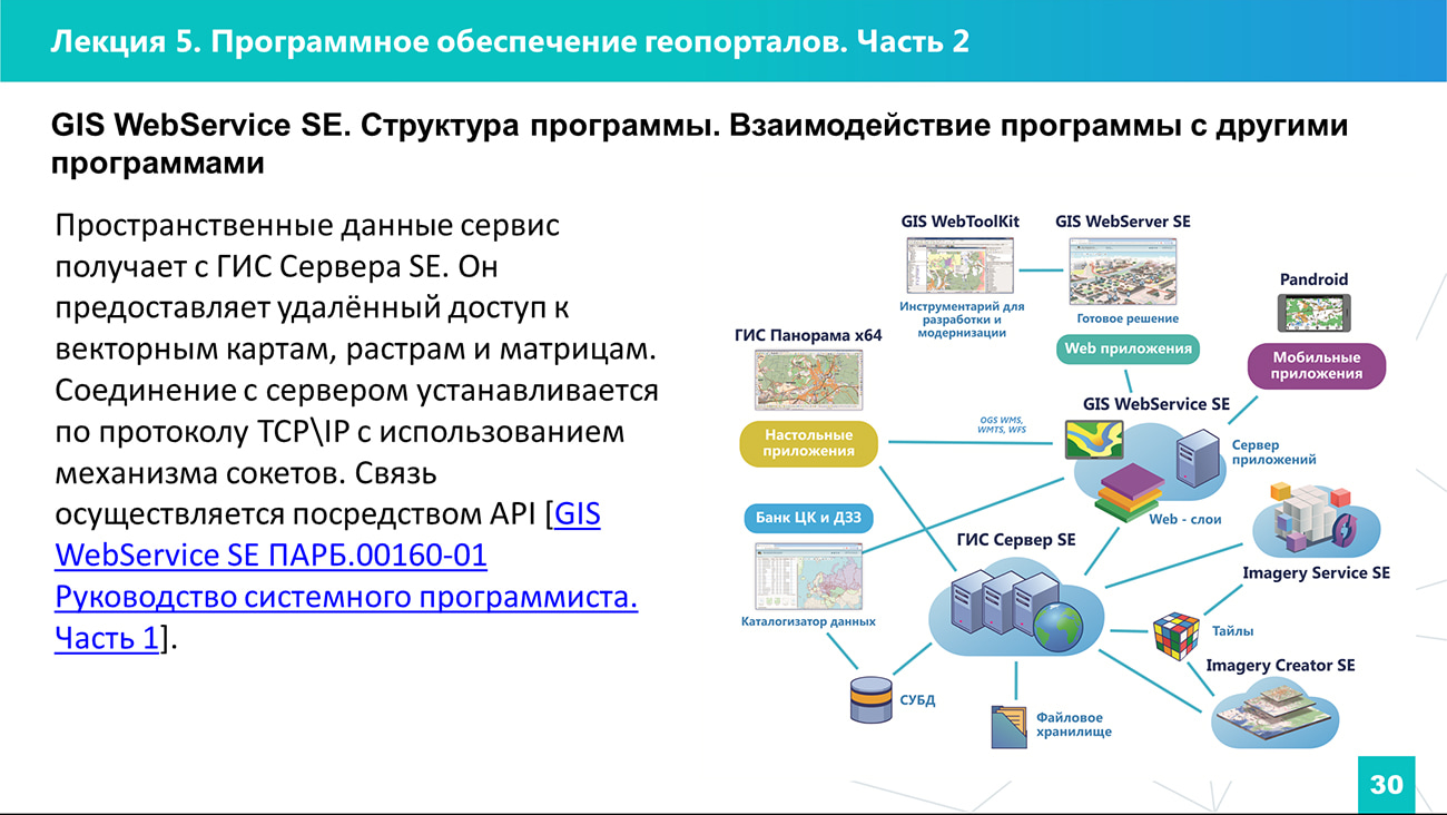
The lecture "Software of geoportals. Part 2" is devoted to the software product of KB "Panorama" - . The lecture reflects the purpose and basic capabilities, information about the hardware and software for the operation of the service, the structure and interaction with other programs. The procedure for installation and configuration is described. As a homework assignment, students were offered to independently deploy a software package that includes the , and the GIS WebService SE. Currently, materials on the following topics are available for viewing and downloading:
- "General characteristics of geoportals" (lecture and );
- "Organization of data in distributed geographic information systems" (lecture and );
- "Architecture of distributed GIS" (lecture and );
- "Software of geoportals. Part 1" (lecture and );
- "Software of geoportals. Part 2" (lecture and );
Lecture materials on the topic "Geoportals" are available for viewing in the sections "Video lessons" and "Presentations".


Specialists of KB "Panorama" prepared and placed the map of the Republic of Ingushetia on the geoportal . The map was formed using OpenStreetMap data, source data was obtained from website. To work with the map, you can use the program or other software products of KB "Panorama".
The map was led to the modernised classifier of large-scale plans of scale 1: 5 000 (map5000m) and was saved into a packed project (MPTZ). The MPTZ format project includes a digital map of the region's territory (country, subject of the federation, administrative region), a map of the administrative-territorial division of the region and a digital classifier. Publishing of updates in bank of spatial data is made by using the program of . Publishing contents of bank of spatial data on the geoportal and data access for downloading are implemented by means of .
Free maps on the basis of OpenStreetMap data are available for download on the page "Digital maps".


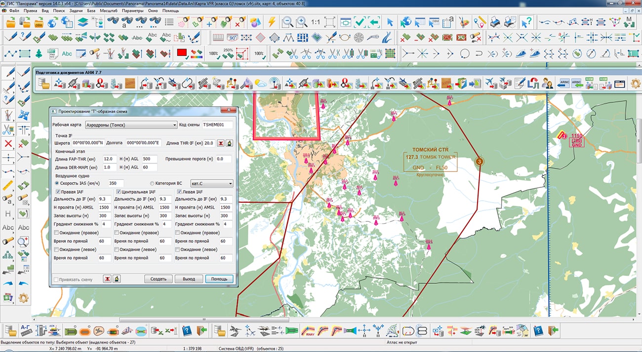
KB "Panorama" has developed a version 7.7.7 under the control of the 14. In the new version in the task the tools of maintaining the database of airdrome infrastructure have been improved, the operations of reading and writing data from the DBMS PostgreSQL have been optimized. In the task , a preparation of schemes the "turn" and ""NAVAIDS guidance" has been improved. In the task , the schemes of the ICAO regions were refined. The converter from the ARINC format has been improved for the correct transfer and rounding of the heights of objects when writing into semantics. Support for English localization of dialogs of maintaining a database of the aeronautical information has been added.
The task of preparing documents of aeronautical information is a set of tools for maintaining an aeronautical data base, a modeling and analyzing the aeronautical situation, generating aeronautical maps and exchanging data with other information systems through export and import in the ARINC 424-19 exchange format and export in the AIXM 5.1 format. The task "Flight procedures design" is used to design the routes of departure, approach and landing and to analyze the safety of flights on them. The task "Assessment of compliance for aerodromes with the requirements FAR" is intended for the analysis of the aerodrome and the aerodrome environs for the suitability for operation and aircraft flights in accordance with the Federal Aviation Regulations.
The new version of the program, examples of aeronautical information documents, operational documentation, video lessons and presentations are available for download on the page.


Ph.: +7 (495) 739-0245, +7 (925) 221-1603
www.gisinfo.ru | panorama@gisinfo.ru
105005, Russia, Moscow, Baumanskaya Street 7, building 1, office 229 (m. Baumanskaya)
Copyright © Panorama Group 1991 - 2024


 Mobile version
 Full version