Copyright © Panorama Group 1991 - 2024

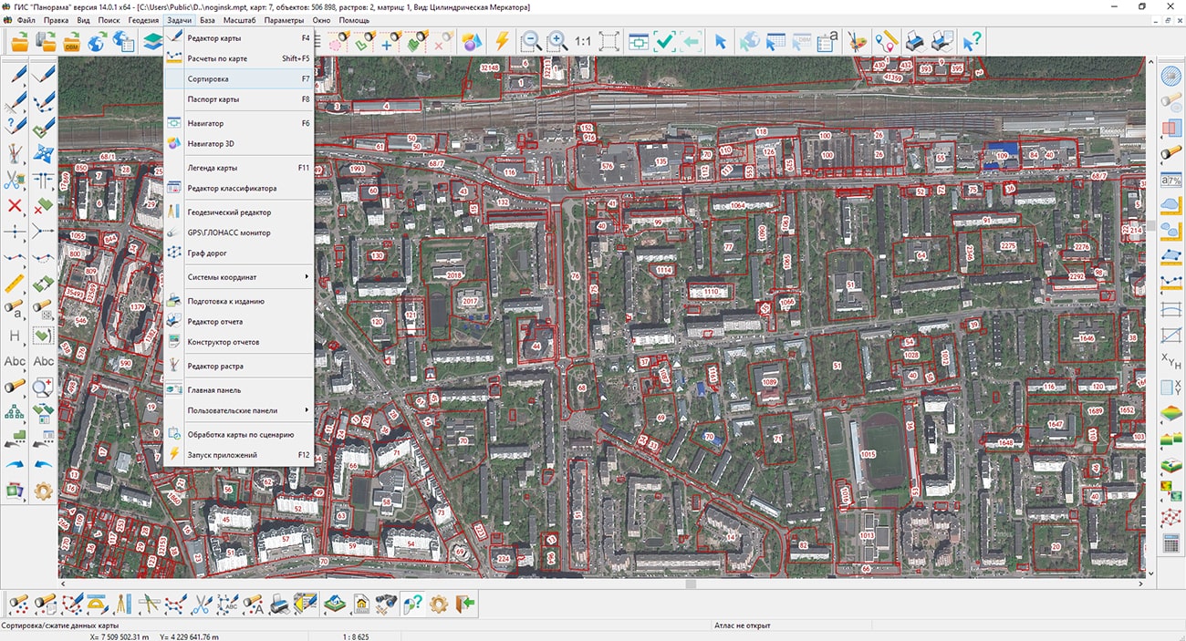
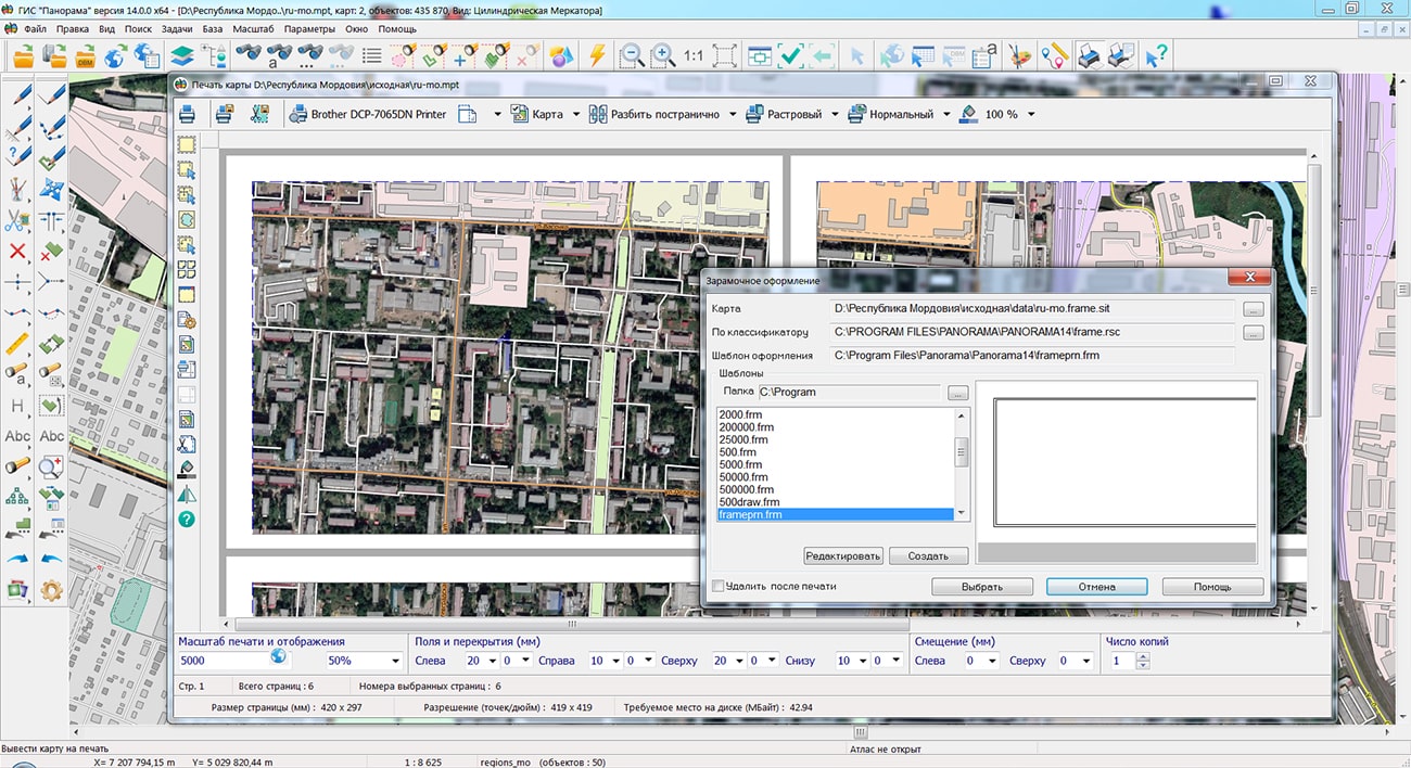
Specialists of KB "Panorama" have prepared a video lesson on sorting map objects. Users of the can independently perform the procedure of sorting data. The tutorial demonstrates the task. This tool organizes the placement of object descriptions in metrics and semantics files, which speeds up their further processing and ensures the correct sequence of displaying objects. In addition, when sorting, you can exclude from files the metrics and semantics of deleted objects and copies of edited objects. Thus, data compression is performed. Sorting map objects can change the accuracy of data storage (the number of decimal places) and the system of stored coordinates of objects - flat rectangular in meters or geodetic in radians. Storing coordinates in radians speeds up the display of maps when it is required to perform recalculation into different display projections "on the fly", and allows you to create maps of any length in longitude. Storing coordinates in meters significantly speeds up the display of the map in its projection.
For the correct formation of land management documentation, calculation of lengths, areas, a list of coordinates, it is additionally recommended to set the storage accuracy in millimeters or centimeters. This will provide uniformity of calculation results in tasks (, , and others) without additional parameter settings. Sorting allows to change a format of a vector map. At sorting with change of a data format, the files of the initial format of a map are automatically deleted. Formats SITX, SITZ, MAPZ can be converted back to initial formats SIT or MAP by sorting. Packaged maps, when reverse conversion, retain the metric accuracy in centimeters. The coordinates of objects in centimeters are stored in integers, which reduces the size of the metric files by half.
You can get acquainted with the training materials in the "Video lessons" section.


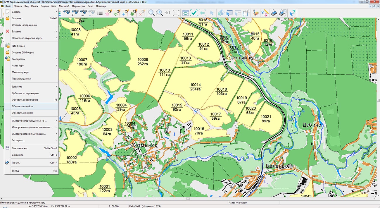
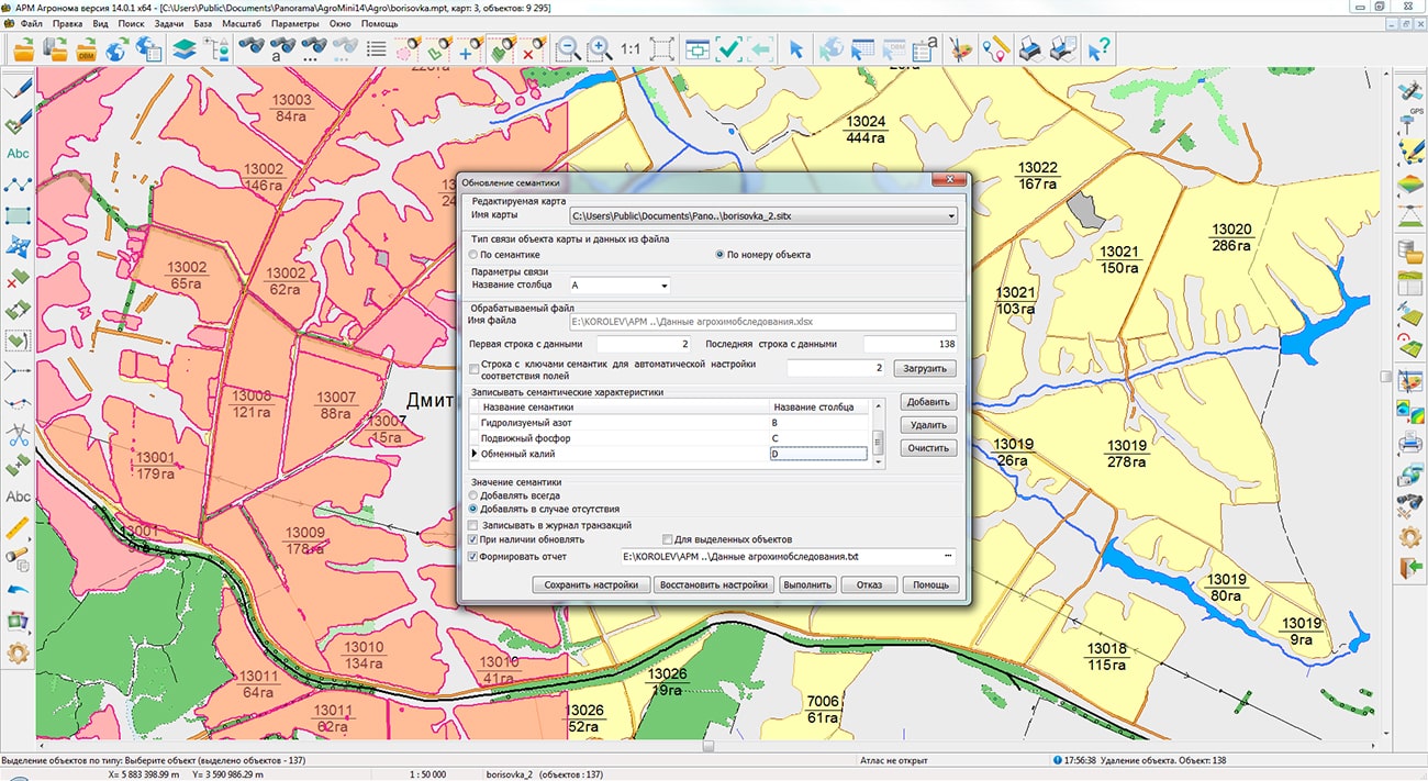
In KB "Panorama" the agrarian geoinformation system "Workstation of agronomist" version 14.0.1.6 has been developed. The new version adds a mechanism for updating cartographic data from files of various types.
Due to the lack of control over agricultural operations, many agricultural producers lose their crops and profits. Mistakes are made at all stages of growing crops: from improper soil preparation, fertilization, sowing and vegetation and finishing by untimely or poor-quality harvesting. "Workstation of agronomist" implements the automated agroscouting technologies, allows you to import spatial and attributive information from Excel, DBF, TXT, CSV files and update existing maps of farmland on its basis. Thanks to the ability to save the settings, the operation of entering or synchronizing data can be easily carried out on a regular basis.
The set of programs "Workstation of agronomist" is an automated workstation of an agronomist based on the and an additional module "Complex of agronomical tasks". The software tools included in the complex include the necessary set of tools for creating and editing electronic maps, and also conducting a sectoral database of agricultural land. In addition, the program allows you to process data from satellite monitoring of fields, connect external data sources from the Internet, form thematic cartograms of fields and reporting documents using customizable templates.
Conducting passports of fields is carried out in structure of information base the , which allows the joint use of these products. Multi-user access, separation of rights, data encryption and load scaling are provided by means of the . The web application provides remote access to the agricultural enterprise management system using a web browser.
GIS of an agricultural enterprise, built on the basis of geoinformation systems of KB "Panorama", allows companies to keep a long history of their fields with photographs, descriptions and reporting. Digital data provide identification and solution of the problem, give forecasts of plant development and yield, taking into account the characteristics of the fields. Correction of agricultural technologies is possible both at the planning stage and during field work. Agroscouting, in addition, allows you to organize effective and fast communication between managers and agronomists.
The new version of the program is available on the website in the Download section.


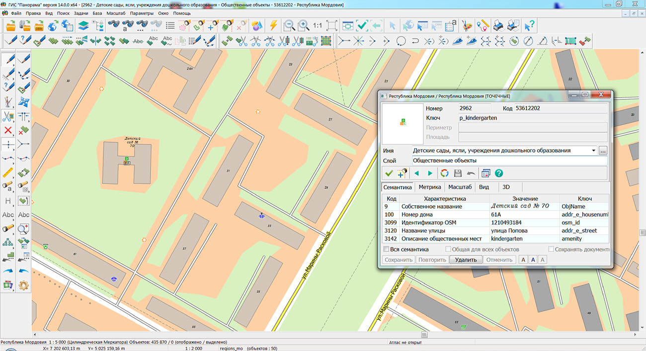
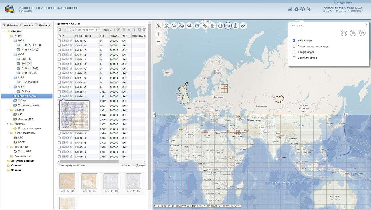
Specialists of KB "Panorama" prepared and placed the map of the Republic of Mordovia on the geoportal . The map was formed using OpenStreetMap data, source data was obtained from website. To work with the map, you can use the program or other software products of KB "Panorama".
The map was led to the modernised classifier of large-scale plans of scale 1: 5 000 () and was saved into a packed project (MPTZ). The MPTZ format project includes a digital map of the region's territory (country, subject of the federation, administrative region), a map of the administrative-territorial division of the region and a digital classifier. Publishing of updates in bank of spatial data is made by using the program of . Publishing contents of bank of spatial data on the geoportal and data access for downloading are implemented by means of .
Free maps on the basis of OpenStreetMap data are available for download on the page "Digital maps".


In KB "Panorama" the version 6.1.0 has been developed. In the new version the tools of customizing access to the separate groups of spatial data - to data layers have been added. The ability to save data selections has been implemented, filling the tree of sections of the complex with them. The operator can form data layers on the fly for their further use when generating reports, exporting and issuing spatial data, creating geo-covers, editing metadata, and generating requests.
The selection can contain a filter by the state of the terrain, scale, data format, coordinate system, comment and others. This makes it possible to provide access to data in accordance with the requirements of the enterprises of Roskartography and other organizations. Selecting a specific data layer automatically filters the metadata. The number of such layers is not limited and is configured by the administrator. Each layer has its own icon and can include child layers.
When drawing the contours of objects onto the data availability scheme, the generalization of the metric contour is performed to speed up the search for data over the area and display the scheme. Data security is ensured by the differentiation of access rights based on security tools that are part of the operating system. Basic authentication, digest authentication, system authentication (via web server), and domain (Kerberos or Active Directory) are supported. The complex is adapted to work on a wide range of operating systems (Astra Linux SE, ALT Linux, Elbrus, Ubuntu, CentOS, MS Windows and others) and architectures (Intel, Elbrus).
The complex of conducting a databank of digital maps and remote sensing data of the earth is registered in the register of domestic software under number 1862.
The databank of digital maps and remote sensing data is the basis for building infrastructure of spatial data at the federal, regional and municipal levels, in corporate information systems. Within the framework of a single geoinformation space, the Data Bank of digital maps and remote sensing data realises gathering, storage, search and delivery of the spatial data in exchange formats. The spatial data selected by means of the program can be placed for the multiuser access on the GIS Server and be published according to the international standards OGC WFS, WFS-T, WMS, WMTS, WCS on application server the GIS WebService SE. Users can access data from both a thin client (by means of ) and from desktop applications (, GIS "Operator"). The databank of digital maps and remote sensing data provides construction of cloud warehouse of spatial data, provision of access to these data, the automated formation and updating of geo-covers. The current state of spatial data is displayed by means of maps-schemes that are maintained for each type of stored data: vector maps, remote sensing data, elevation matrixes and terrain models. It provides remote placing the sets of spatial data into file warehouse, keeping versions of stored sets, updating maps-schemes of data availability, the automated collection and formation of metadata, and the formation and updating of geo-covers. Automated collection and formation of metadata is performed according to the standards of ISO 19115: 2003, Geographic information - Metadata and ISO/TS 19139, Geographic information - Metadata - XML schema implementation. The reduced copies of data images are automatically formed, checksum of files and completeness of data sets are checked. Placement of spatial data into file storage is performed with integrity check, control of data structure and content. The results of the work are recorded and entered into the metadata base. Automatic backup of metadata and spatial data storage with integrity control and data recovery has been provided. Multilingual interface is supported.
The portal presents the possibilities of organizing storage, accounting and and issuance of vector maps, remote sensing data, DEMs and terrain models. The portal contains vector maps in SXF format, generated on the basis of data from open sources (OpenStreetMap, VMap0). The spatial data includes maps of: subjects of the Russian Federation, countries and cities of the near and far abroad. In total, over 240 vector maps and 6700 matrix data with a total volume of 56 GB. Specialists of KB "Panorama" weekly update and refresh the content of the information on the portal. All published data is distributed free of charge under a free license.
The new version of the program is available for download on the page.


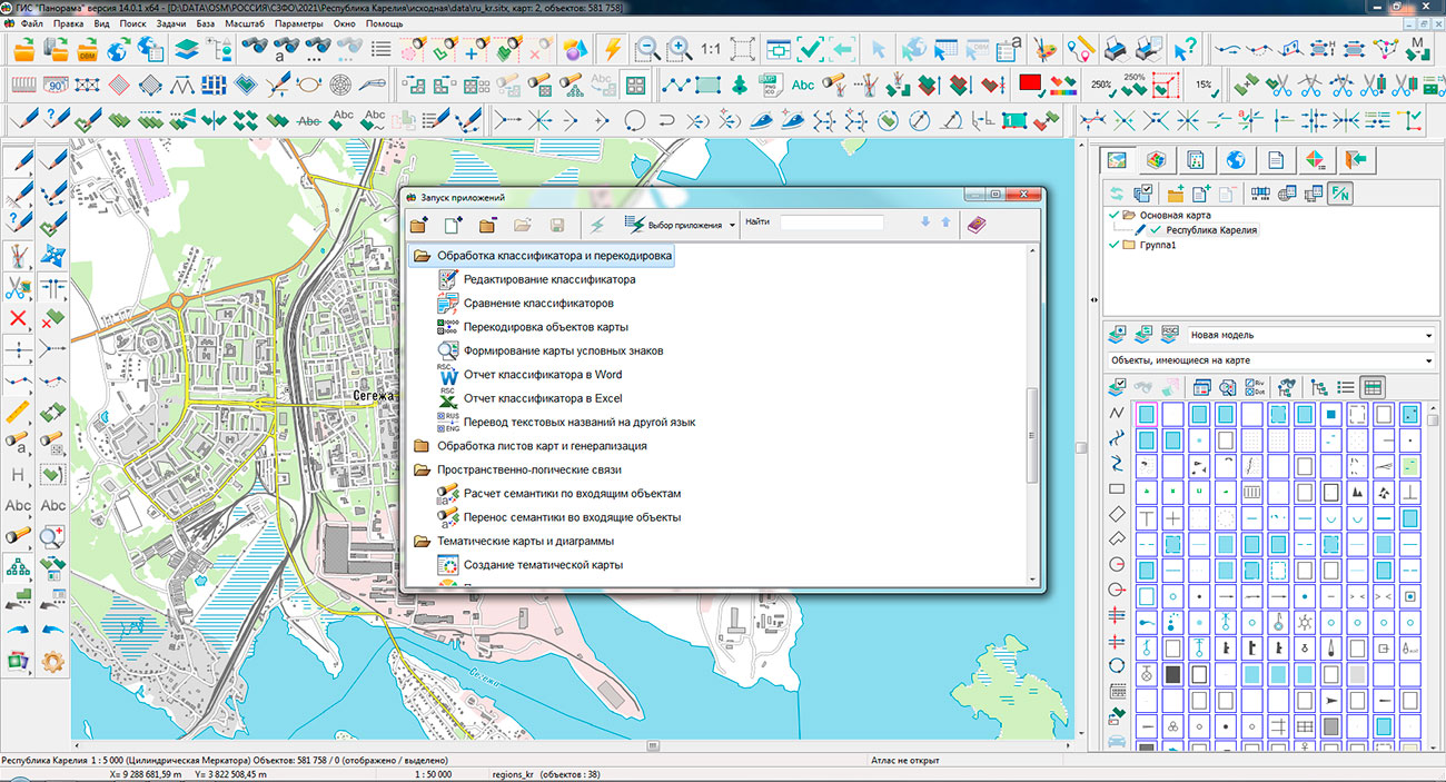
Specialists of KB "Panorama" prepared and placed the map of the Republic of Karelia on the geoportal . The map was formed using OpenStreetMap data, source data was obtained from website. To work with the map, you can use the program or other software products of KB "Panorama".
The map was led to the modernised classifier of large-scale plans of scale 1: 5 000 () and was saved into a packed project (MPTZ). The MPTZ format project includes a digital map of the region's territory (country, subject of the federation, administrative region), a map of the administrative-territorial division of the region and a digital classifier. Publishing of updates in bank of spatial data is made by using the program of . Publishing contents of bank of spatial data on the geoportal and data access for downloading are implemented by means of .
Free maps on the basis of OpenStreetMap data are available for download on the page "Digital maps".


Ph.: +7 (495) 739-0245, +7 (925) 221-1603
www.gisinfo.ru | panorama@gisinfo.ru
105005, Russia, Moscow, Baumanskaya Street 7, building 1, office 229 (m. Baumanskaya)
Copyright © Panorama Group 1991 - 2024


 Mobile version
 Full version