Copyright © Panorama Group 1991 - 2024

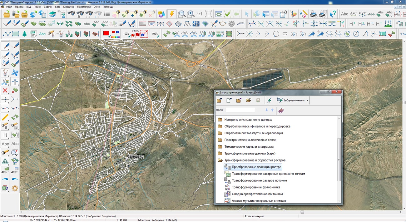
Specialists of KB "Panorama" prepared and placed the map of Mongolia on the geoportal . Source data was obtained from website. To work with the map, you can use the program or other software products of KB "Panorama".
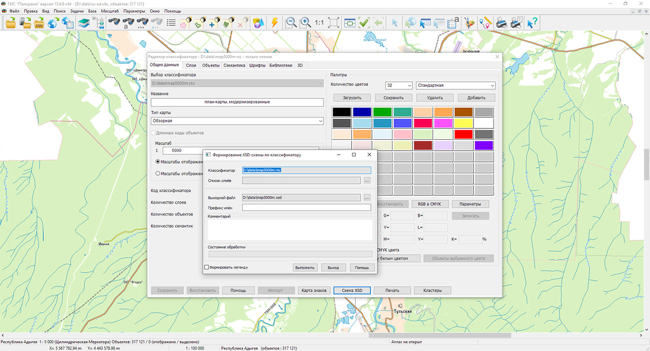
The map was led to the modernised classifier of large-scale plans of scale 1: 5 000 (map5000m). Publishing of updates in bank of spatial data is made by using the program of . Publishing contents of bank of spatial data on the geoportal and data access for downloading are implemented by means of .
Free maps on the basis of OpenStreetMap data are available for download on the page "Digital maps".


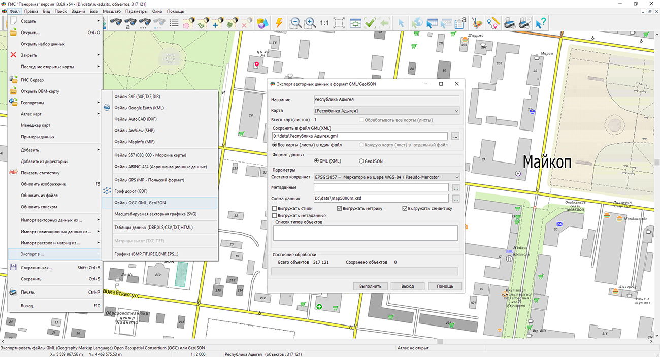
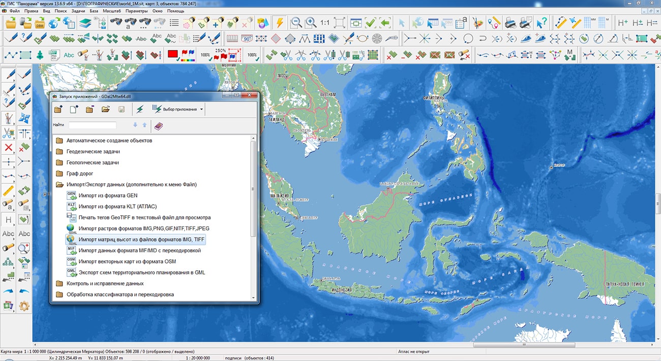
Specialists of KB "Panorama" have prepared a video lesson demonstrating the possibilities of the mode. Users of the can independently convert vector maps using the presented tool into files of format GML and GeoJSON.
Video lesson demonstrates the settings of the export's tool: creation of styles, semantics and metrics in the created GML (GeoJSON) file, creation and use of the data schema, modes for creating maps and sheets, compiling a list of object types. The tool "Export of vector data to GML or JSON format" is intended for export of vector maps from the GIS "Panorama" into files of format GML and GeoJSON. Users can change the export's parameters: specify the data format, set the coordinate system, set the mode for creating styles, metrics, semantics and metadata, select the parameters for saving several maps or sheets, and also specify or independently create application data schemes using the classifier editor in the GIS "Panorama ". The result of the converter work is recorded into the protocol.
You can get acquainted with the training materials in the "Video lessons" section.

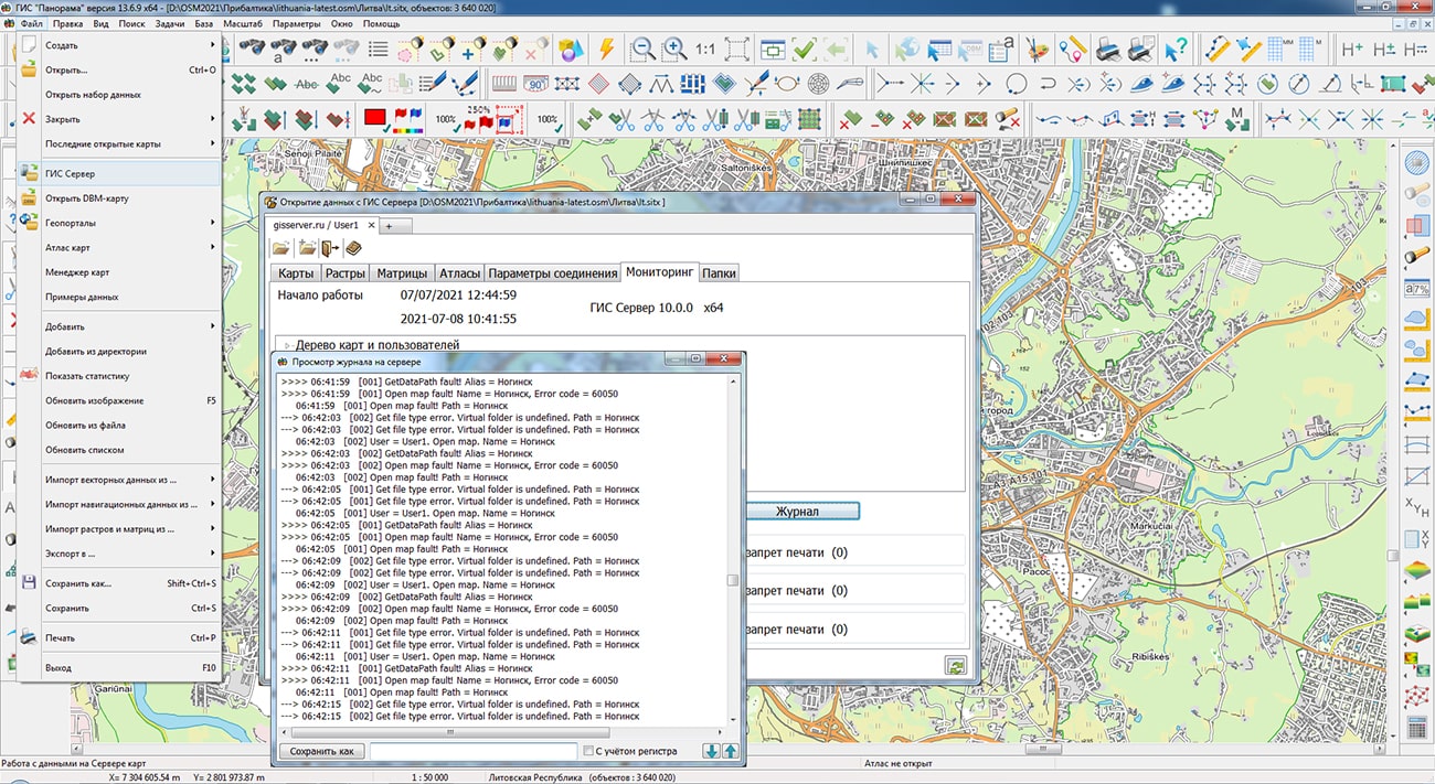
In KB "Panorama" the version 10.0 has been developed. GIS Server provides remote access to spatial databases, digital maps of the area, remote sensing data, matrixes and documents. In the new version the list of supported DBMS for work with spatial databases has been expanded: PostgreSQL with PostGIS extension (St_Geometry data type), Oracle with Oracle Spatial extension (SDO_GEOMETRY data type), Oracle with ArcSDE extension (St_Geometry data type).
The program implements a new algorithm for monitoring virtual folders and controlling access rights to accelerate access to data with a large number of clients and a high intensity of operations for creating and deleting data sets in virtual folders. GIS Server supports automated data access control at the level of virtual data folders. The administrator can specify the rights of individual user groups to access different folders, without detailing the contents of the folders and their structure. In the process of work, the GIS Server automatically scans the contents of the folders and grants the users belonging to the corresponding group the rights to the data that will be placed in the virtual folder. The user can remotely change the structure of virtual folders and the composition of the data in them. When the contents of the folder are changed, the tree of available data is automatically rebuilt, which is displayed on the client when data is selected. This allows you to dynamically change the composition of data in a folder, add and delete data without interrupting the work of the GIS Server and without using administration tools for each instance of data.
There is added a support of publishing the packaged MPTZ projects, inside which other packaged projects are stored (reports with inserts and similar datasets). When a user enters several Active Directory groups, the rights to edit data are granted if there is access to this data for editing at least in one group.
Updating the GIS Server program from version 9 to version 10 for those who purchased the program after June 1, 2020 or has the paid technical support, free of charge.
The new version of the program is available for download on the page.


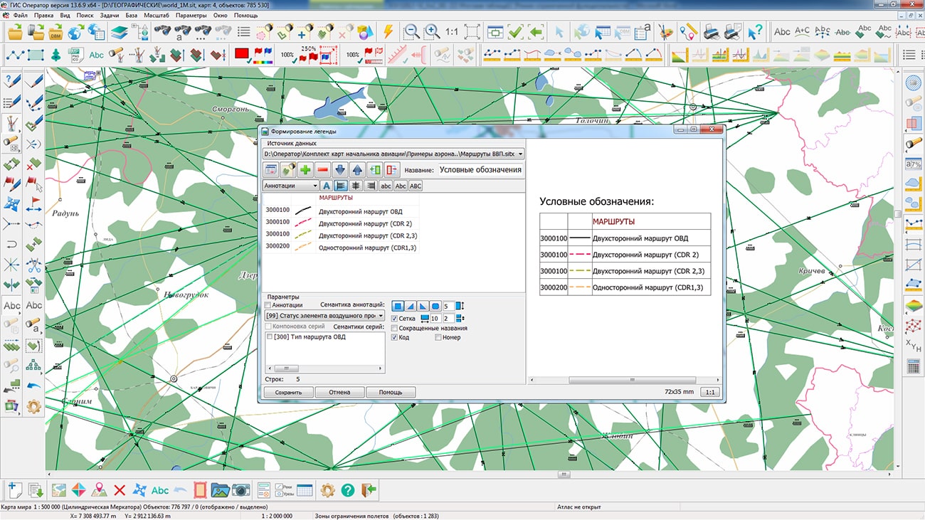
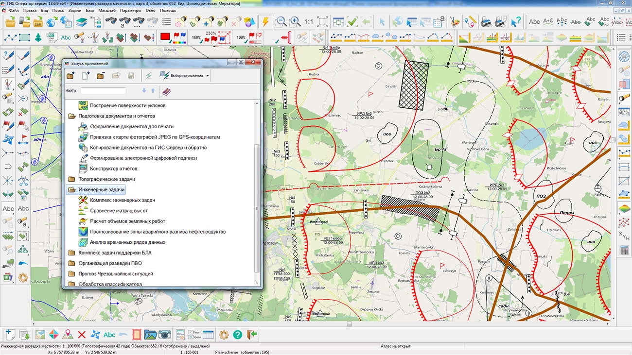
In KB "Panorama" the version 13.6.9 has been developed. In the new version, a display of conventional symbols of aircraft in the operator.rsc classifier has been improved. A point of a binding of aircraft (planes, helicopters) is the point of intersection of the basic lines defining a typeface of a symbol. Aircraft, when drawing, are displayed vertically upward or at an angle of 90 degrees to the left of the direction of the metric from the first point to the second one. For simplifying a turn of symbols in applications, to the aircraft the semantics 951 Course (directional angle) has been added, which turns a vertical axis of a conventional sign onto the specified course. The display of polygons with a title in the center with the text from the service characteristic 5400 has been improved - for positional areas, areas of fire positions, areas of formations, units, areas of events, areas of reconnaissance and destruction, area of use of means and others.
In the new version, the mode in the form of a table in the "Report Designer" task has been improved. Options for the automated formation of annotation columns (explanatory texts) were added. The mode allows to form columns of general annotations based on the values of the selected semantics of objects and annotations of conventional symbols over the corresponding images of these symbols. There are added the ability to use full or abbreviated names of objects for the initial filling of columns, the ability to enter text for sample of fonts, line wrapping, style settings. Arrangement of a series of objects (types of conventional symbols of one object code) by table rows has been implemented. Options for adding and deleting the columns in the map legend were added. Using the Create map legend mode in conjunction with other modes of the "Report Designer", such as "Table Create", "Adding text", "Save Legend", can significantly speed up the preparation of graphic documents.
Support has been added for reading and displaying graphic files and maps from packed projects of MPTZ, MAPZ, SITZ maps placed on the . The algorithm for updating the spatial indices of objects used for displaying and searching vector data has been improved.
The new version of the program is available for download in the section.


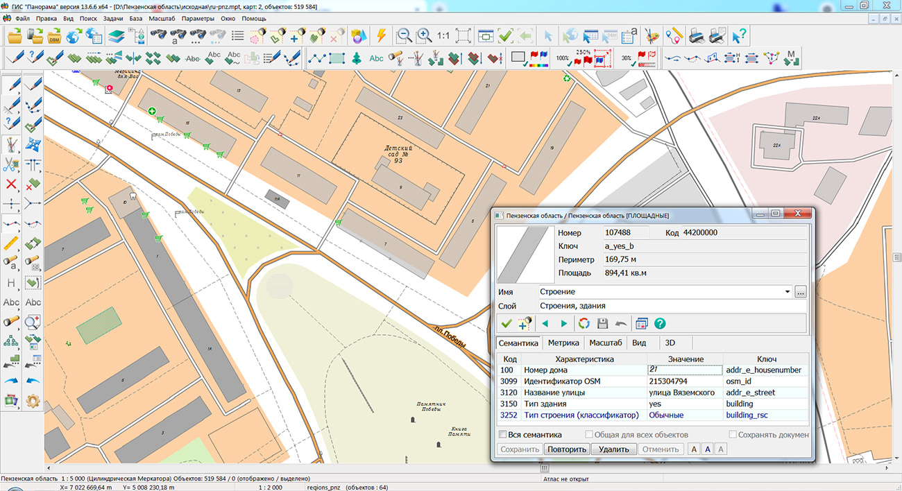
Specialists of KB "Panorama" prepared and placed the map of the Penza region on the geoportal . The map was formed using OpenStreetMap data, source data was obtained from Geofabrik website. To work with the maps, you can use the program or other software products of KB "Panorama".
The map was led to the modernised classifier of large-scale plans of scale 1: 5 000 (map5000m.rsc) and was saved into a packed project (mptz). The MPTZ format project includes a digital map of the region's territory (country, subject of the federation, administrative region), a map of the administrative-territorial division of the region and a digital classifier. Publishing of updates in bank of spatial data is made by using the program of . Publishing contents of bank of spatial data on the geoportal and data access for downloading are implemented by means of .
Free maps on the basis of OpenStreetMap data are available for download on the page "Digital maps".


Ph.: +7 (495) 739-0245, +7 (925) 221-1603
www.gisinfo.ru | panorama@gisinfo.ru
105005, Russia, Moscow, Baumanskaya Street 7, building 1, office 229 (m. Baumanskaya)
Copyright © Panorama Group 1991 - 2024


 Mobile version
 Full version