Copyright © Panorama Group 1991 - 2024

Specialists of KB "Panorama" have prepared a video lesson on the formation of an XML document and a paper report of the technical plan of version 06 for registering a building onto cadastral registration. Users of "Workstation of cadastral engineer", or can form XML documents and paper reports of the technical plan of version 06 by means of a complex of geodesy calculations.
The training material demonstrates the features of data preparation, filling in the mandatory characteristics and the formation of an XML file and a paper report of the technical plan of version 06 in accordance with the Order of the Ministry of Economic Development of the Russian Federation from December, 18th, 2015 № 953.
On the basis of this order in software products of KB "Panorama" the classifier of conventional symbols survey.v5.rscz has been developed. In the classifier there is implemented a general list of layers, semantic characteristics and objects for display of cadastral data on cadastral maps and other cadastral documents.
Technical plan can be formed for one or several objects of real estate depending on a variant of a selecting the objects on a cadastral map. Procedures "Formation of XML document and "Formation of a text report" are performed in the "Technical plan" dialog. The initial initialization of the dialog content and the setting of the type of real estate object is performed based on information from the digital cadastral map, taking into account the chosen mode of formation.
Elements for entering and editing data in the dialog are sorted into groups, in accordance with the sections and details of the technical plan, and arranged by screen pages (bookmarks): , , , , , , .
You can get acquainted with the training materials in the "Video lessons" section.


In KB "Panorama" the version 13.4.3 has been developed for creating GIS applications in the environment of C ++ Builder, Delphi Embarcadero. In the new version the TMapDataConversion component has been added. It provides export/import of spatial data presented in the formats SXF, TXF, DIR, TXT, MAP, SIT, SITX, S57, KML / KMZ, MIF / MID. The component is based on the use of high-performance GIS core functions.
When importing a set of maps sheets of and format, specified by the list in the DIR file, the ability has been added for transfer of sheets by longitude on +/-360 degrees. It allows to duplicate the columns of sheets in the western and\or eastern hemisphere for expansion of dimensions of work region up to -360/+360 degrees. To duplicate sheets, copy the required file with a different name (for example, rename 01-12.sxf to 01-12_west.sxf) and change its nomenclature so that all sheets in the region have a unique designation (for example, rename 01-12 to 01-12_west ). Then, in a text editor, add a line with a new name sxf or txf into the DIR file and press the tab after the file name and enter the direction of transfer (for example, -360 or +360). The recalculation of coordinates and sheet passport will be performed automatically when importing the work region by the DIR file.
When , a customizing the styles of polygons, lines and icons is automated according to the current graphical parameters of objects on the map. Icons for point objects are generated in png format in the \kml_name.icons folder. Ability has been added of saving the kml file and folder with icons into the kmz archive. When importing and exporting SHP the four-dimensional records containing fields X, Y, Z (height) and M (measurement) are processed. When processing data, the new component allows you to receive messages about the current state of the process to notify the operator: percentage of execution, presence of errors, the need to interrupt processing, information about the map.
The GIS ToolKit consists of a set of visual components (supplied in source code) and API functions of the GIS core for direct access to spatial data. The toolkit is intended for the development of client-server and desktop 32-bit and 64-bit applications that require processing and visualization of spatial data. Spatial data can be located both at the workplace (direct access to data) and in a local network or the Internet (components of access to the or data exchange by international protocols are used).
The new version of the program is available for download on the page.


In KB "Panorama" the version 13.6.7 has been developed. In the new version of the program the import of data about a relief from files of has been added. ArcInfo Binary Grid files can contain a digital elevation model, a slope model, and a relief shading. Data in binary Files ArcInfo Binary Grid is organised in the form of a regular grid. The digital elevation model contains elevation data as a cell value of regular grid. According to digital model of a relief the matrixes of heights MTW are formed. To store a relief shading, the value of the regular grid cell corresponds to the degree of illumination. The files containing a relief shading or model of slopes, are converted into matrixes of qualities MTQ. The task of importing matrixes of elevations also supports loading of the data from the SRTM, GeoTIFF, IMG, DEM formats. The import of the pyramid of matrixes of elevations of relief from the KMZ format into a set of MTW files, combined into a single MPT project, has been provided.
To assess the tactical properties of the terrain, the GIS "Operator" is equipped with the panel. The complex is intended for creating models of surfaces and solving the problems of the spatial analysis with use of the constructed models. The surface model can display such terrain properties as elevation, pollution concentration, precipitation, radiation levels, and others. Surfaces can be represented by regular GRID models (matrix of relief heights, matrix of qualities of a given characteristic). Models of surfaces can be created according to a vector map data. Surface models are used to form a three-dimensional terrain map, and also when solving the analysis tasks (calculating distances, areas and volumes, profiling, determining the directions of slopes). Matrix models allow performing transformation operations on them with obtaining derived surfaces. Surface models can be used to construct isolines, form the coordinates H (height) of map objects, when calculating the volume of earthworks, when constructing flood zones and modeling emergency situations.
In the , onto the panel, a mode has been added for quickly drawing "icons" on the map - graphic files of BMP, PNG, JPEG, ICO, TIF and others formats. The selected graphic files are copied into the map subdirectory with the name \map name.images. The relative path to the file is recorded into the semantics of the graphic object. When copying a map to another folder, you must also copy the subdirectory with graphic files. When scaling a map the raster symbol can decrease and increase. When packing a map in SITZ\MAPZ\MPTZ formats, graphic files are packed automatically.
To create and update special maps, the GIS contains a digital classifier of conventional symbols of the operational situation operator.rsc and a library of programmable symbols rscarmy.iml64. The program supports the modes of drawing the following groups of conventional symbols: "Command posts", "Marching columns", "Borders", "Weapons", taking into account the requirements of the document "Classifier of electronic conventional symbols of the operational situation". The provided functions allow to reduce the number of conventional symbols in the classifier by several times. The conventional symbol of the object on the map is automatically formed from the basic symbol of the type of object, taking into account a specific combination of values of semantic characteristics. Such approach reduces time of a choice of the necessary symbol from the library and reduces the number of operator errors. Instead of choosing an icons, the operator enters into the semantics of the object the information he knows about state belonging, condition, mobility, security, properties of equipment, weapons, and so on. Programmable signs themselves determine the type of a suitable sign.A similar approach is used in the standard of the International Hydrographic Organization for displaying nautical maps S57/S52.
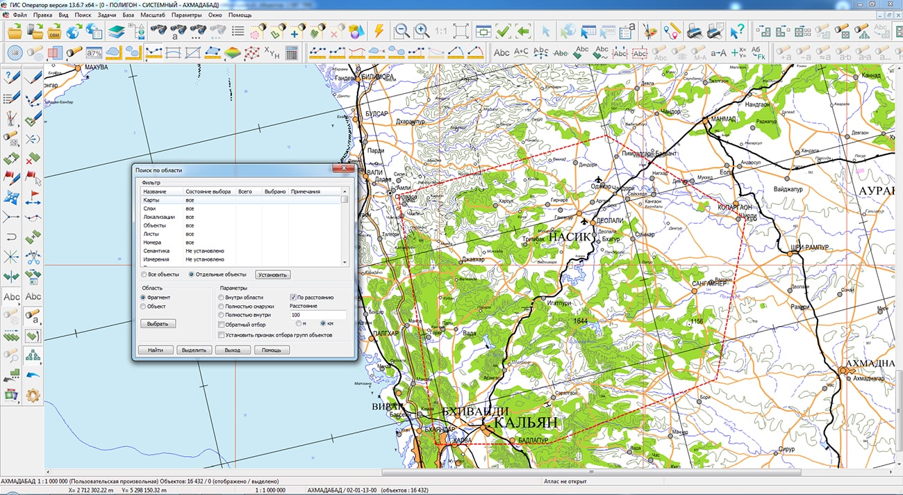
In the program the display, editing and search by area of objects for vector maps of great volume (from hundreds thousand to tens millions objects in one set - a layer), located locally or on a is accelerated. It is realised at the expense of optimisation of construction and updating of spatial indexes of the objects applied at display and search of the vector data.
The task has been improved. There are added the modes: Automatic setting of field matching by semantics key, Save/Restoring settings, Delete a list of semantics. In the dialog of semantics selection a search by key, code or name has been added. Execution of function of updating the list of semantics by all objects or objects selected according to certain conditions is accelerated.
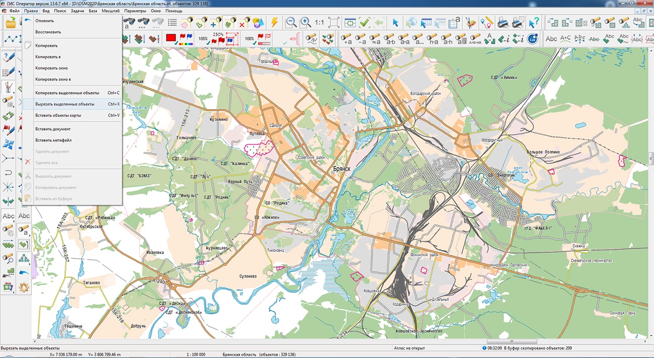
The item has been added into the menu. This mode allows you to simultaneously copy to the clipboard and delete selected objects on the map. Cutting of selected objects is carried out by the Ctrl+X hotkey combination. "Quick deletion" of selected objects without copying to the clipboard - Ctrl+Delete.
The new version of the program is available for download in the section.


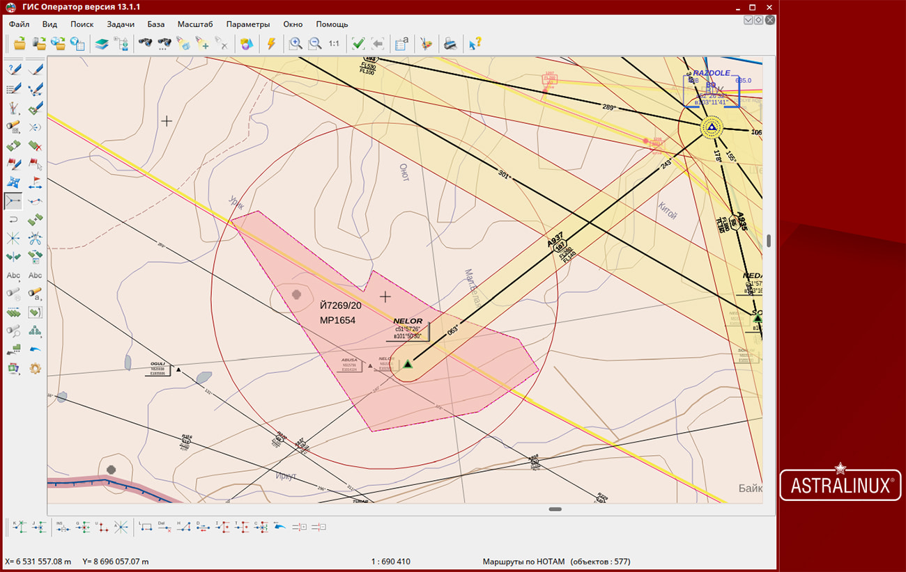
In KB "Panorama" the Complex of solving aeronautical tasks of version 7.6 for the version 13, OS Astra Linux SE (Release "Smolensk") and OS Astra Linux CE (Release "Oryol ") has been developed. The new version implements the ability to enter and output helicopter and landing sites (TLOF) onto the map as part of the airport/heliport infrastructure.
Dialogs for entering aeronautical data are supplemented with functions of closing the air navigation objects by date with the ability to copy with valid dates following the date of closing. The mode allows you to quickly make editing, reducing working hours for filling the attributes of new objects with minor changes.
In the new version the possibility has been added for filling a legend of aeronautical maps with tables of restrictions on route sections, air traffic service areas and restricted areas. The mode automates the process of preparing an aeronautical map for printing. The function of partial updating of the main attributes of aeronautical objects of the map has been added, which allows making minor changes to the current situation.
The form for entering the minimum safe heights for the airfield has been improved. This makes it possible to enter into the database all types of circles of minimum safe heights with absolute or relative heights. All boundaries of ICAO areas in the aeronautical database have been updated and the Nakhichevan region as the UB1 region was added.
The complex for solving aeronautical tasks is intended for creating and maintaining a database of aeronautical information, generating aeronautical maps, designing flight routes for aircraft, exchanging data with other information systems. The program allows calculating flight routes, analyzing objects of the airfield and the surrounding area for their impact on air traffic safety. The main source of aeronautical information is the aeronautical data base created on the basis of the AICM (Aeronautical Information Conceptual Model) model, with additions for storing planned information and route design results. The model is recommended by the "Eurocontrol" - international organization of planning and coordination of air traffic.
The new version of the program is available for download in the Download section.


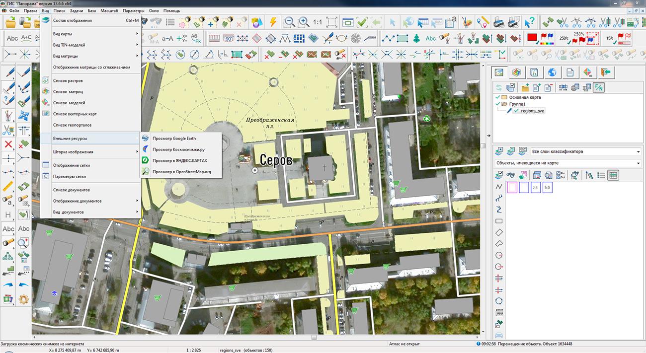
Specialists of KB "Panorama" prepared and placed on the geoportal the map of the Sverdlovsk region . The map was formed using OpenStreetMap data, source data was obtained from Geofabrik website. To work with the map, you can use the program or other software products of KB "Panorama".
The map was led to the modernised classifier of large-scale plans of scale 1: 5 000 (map5000m.rsc) and was saved into a packed project (mptz). The MPTZ format project includes a digital map of the region's territory (country, subject of the federation, administrative region), a map of the administrative-territorial division of the region and a digital classifier. Publishing of updates in bank of spatial data is made by using the program of . Publishing contents of bank of spatial data on the geoportal and data access for downloading are implemented by means of .
Free maps on the basis of OpenStreetMap data are available for download on the page "Digital maps".


Ph.: +7 (495) 739-0245, +7 (925) 221-1603
www.gisinfo.ru | panorama@gisinfo.ru
105005, Russia, Moscow, Baumanskaya Street 7, building 1, office 229 (m. Baumanskaya)
Copyright © Panorama Group 1991 - 2024


 Mobile version
 Full version