Copyright © Panorama Group 1991 - 2024

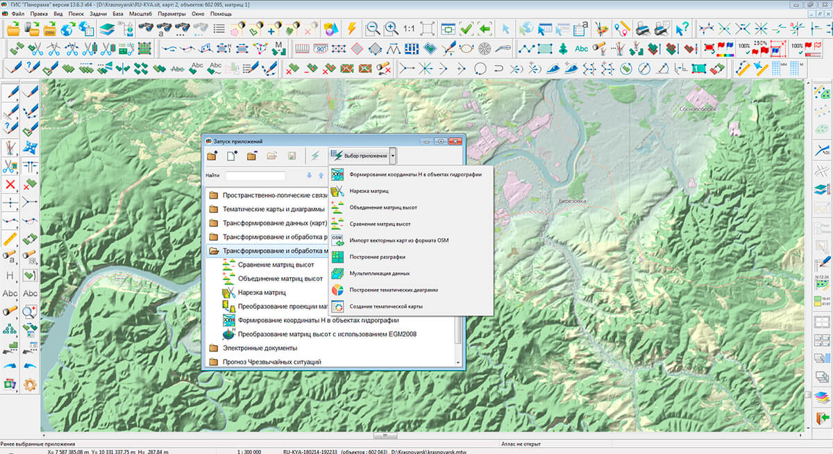
In KB "Panorama" the version 13.4.1 has been developed for creating GIS applications in the environment of C++ Builder, Delphi Embarcadero. The GIS ToolKit includes the TMapEditMetric component, which is intended for editing the metric's points of map object in an interactive mode. The developer just needs to select the desired map object and activate the editing process. In the new version the a mode for working with a group of map objects has been added. After starting editing, the following editing modes are available for the developer: creating a new object; creating a subobject in an existing object; adding a point into the metric of an existing object; deleting a point from the metric of an existing object; obtaining the coordinates of a virtual point on the contour of an object; obtaining the coordinates of the real point of the object metric; changing the coordinates of the metric of an existing object; moving the entire object; moving a group of objects.
The TMapScreen component is used to display the map and edited objects. It allows to accelerate and improve visual qualities (an exception of map blinking) of displaying edited, movable (mobile) and stationary user objects against the background of the map. Improving the display of user objects is carried out at the expense of optimizing the redrawing of the background map. In general, the image of a background map is drawn into the window from the internal buffer of map image, rather than by drawing the map from the data store. The more user objects are displayed at the same time, the higher the optimization factor in terms of speed and quality of display.
The GIS ToolKit includes an example of a map editor based on the TMapEditMetric component (located in the \Example\delphi\mapedit\ or \Example\builder\mapedit\directory). In the new version, the possibilities for determining the relative position of map objects have been expanded. The OverlapTest function has been added into the TMapOverlay component to analyze the intersections of two areal objects with subobjects and multipolygons.
The GIS ToolKit consists of a set of visual components (supplied in source code) and API functions of the GIS core for direct access to spatial data. The toolkit is intended for the development of client-server and desktop 32-bit and 64-bit applications that require processing and visualization of spatial data. Spatial data can be located both at the workplace (direct access to data) and in a local network or the Internet (components of access to the or data exchange using international protocols are used).
The new version of the program is available for download on the page.


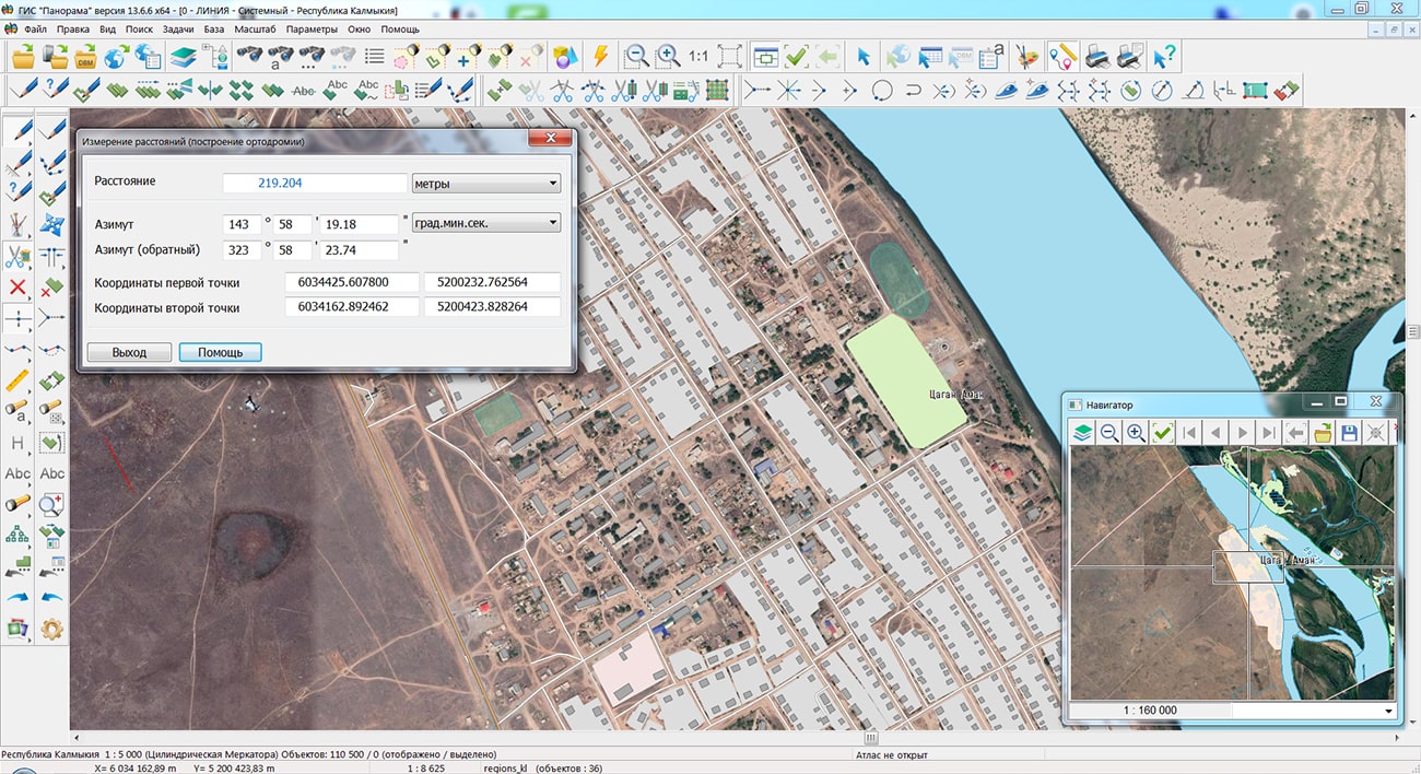
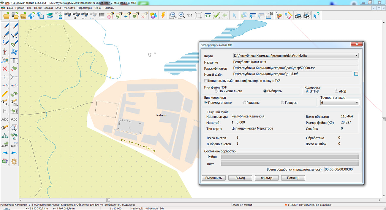
Specialists of KB "Panorama" prepared and placed on the geoportal the map of the Republic of Kalmykia. The map was formed using OpenStreetMap data, source data was obtained from website. To work with the map, you can use the program or other software products of KB "Panorama".
The map was led to the modernised classifier of large-scale plans of scale 1: 5 000 (map5000m.rsc) and were saved into a packed project (MPTZ). The MPTZ format project includes a digital map of the region's territory (country, subject of the federation, administrative region), a map of the administrative-territorial division of the region and a digital classifier. Publishing of updates in bank of spatial data is made by using the program of . Publishing contents of bank of spatial data on the geoportal and data access for downloading are implemented by means of .
Free maps on the basis of OpenStreetMap data are available for download on the page "Digital maps".


In KB "Panorama" the version 6.2.0 has been developed for operating systems Astra Linux, CentOS, Ubuntu, Windows. In the new version of the program, the "Cartogram" mode has been added, which automates the preparation of infographics from public statistical information on regions and municipal districts of the Russian Federation. Creation of thematic maps is performed using tabular data from a file of CSV format. The cartogram is formed by combining information about the spatial objects of the map layer and the data values of the thematic indicator in the table. As a cartographical basis the published map of the regions of Russia is used. The table can consist of two or more columns one of which should contain names of subjects of the Russian Federation or municipal districts of the subject of the Russian Federation. The constructed thematic layer is automatically published on the service and opens in the map. It contains colored images of objects with the caption of the data indicator value. The ranges scale of the indicator values is displayed in the layer legend in the tree of the map composition. You can see an example of creating a cartogram on the . It is necessary preliminarily to download an example of a CSV-file of data. The file contains statistical information on the increase in the incidence of COVID-19 by territories, the data is demonstrative. Application's operation when using PAM authorization has been updated.
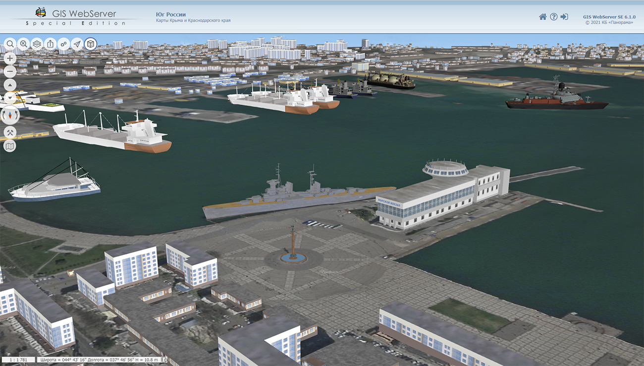
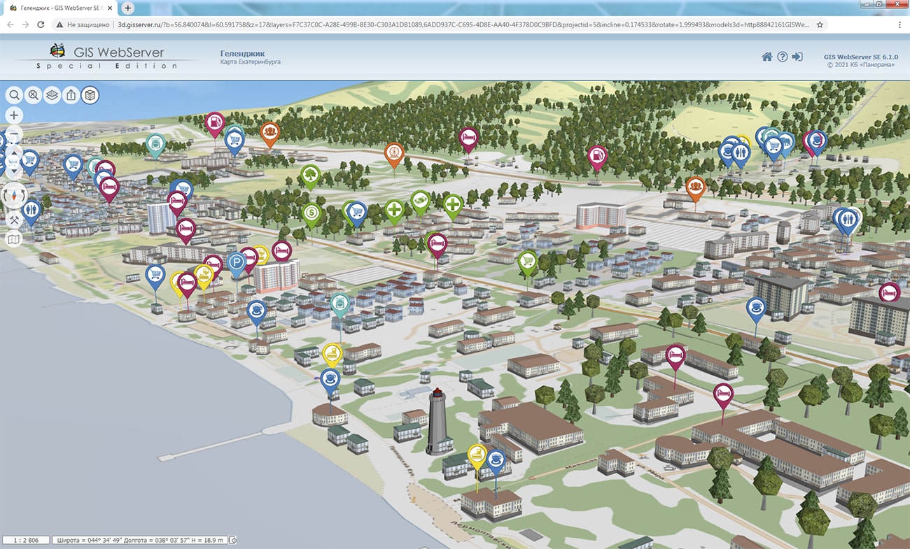
In the new version the toolkit for developing Web applications the has been improved, which expands the capabilities of GIS WebServer SE and can be integrated into other information systems. Access to data (images, vector maps and information about the terrain) is provided by Web services according to the generally accepted OGC protocols and ISO standards. Various types of elevation data are used as a digital elevation model: matrixes (in SRTM, GeoTIFF, IMG, MTW formats), TIN models, point clouds, and others.
can be as a source of spatial data. It provides collection, storage, search and issuance of spatial data in exchange formats, a displaying the state of the data bank in the form of maps-schemes, automated generation and updating of geo-covers.
GIS WebServer SE is used in the construction of closed corporate systems to ensure the protection of data that are classified or trade secrets. GIS WebServer SE is certified for level 2 of the absence of undeclared possibilities. The new version of the program expands the possibilities of the application when solving problems of analysis, management and long-term planning of the development of territories. GIS WebServer SE is implemented using the GIS WebToolKit SE, which can be used in development tools that use the JavaScript.
The new version of the program is available on the website in the section.


The results of research work on the use of open data for geoinformation mapping and data analysis for solving applied business problems and managing territories using the GIS "Panorama" software will be discussed at the II Scientific and Discussion Student Club of the CIS countries. The discussion will take place within the framework of the student week from May 24 to May 26 at the conference , organized by the Moscow State University of Geodesy and Cartography ().
The conference "Spatial Data: Science and Technology 2021" is an annual international scientific platform organized by MIIGAiK with the participation, as partners, of leading industrial companies, federal regulators of requirements and standards in the field of spatial data. The goal of the conference is to form an international platform for scientists and researchers from various fields of knowledge, using spatial data as unique characteristics of objects and phenomena of the world around us.
Within the framework of the scientific-discussion club, students and young specialists, with the technical support of KB "Panorama", work out scientific and practical issues on the use of geodata for business, state and municipal administration of territories. To conduct research, participants use software the , , , and the developer's toolkit . The topics of the reports can be found on the "Schedule" page in the section "Open Data - Competition for Applied Scientific Research of Students, Postgraduates, Young Scientists".
This year the conference is being held in a remote format. To listen to the reports, you must connect to the broadcast at the specified date and time by selecting the desired section of the conference.

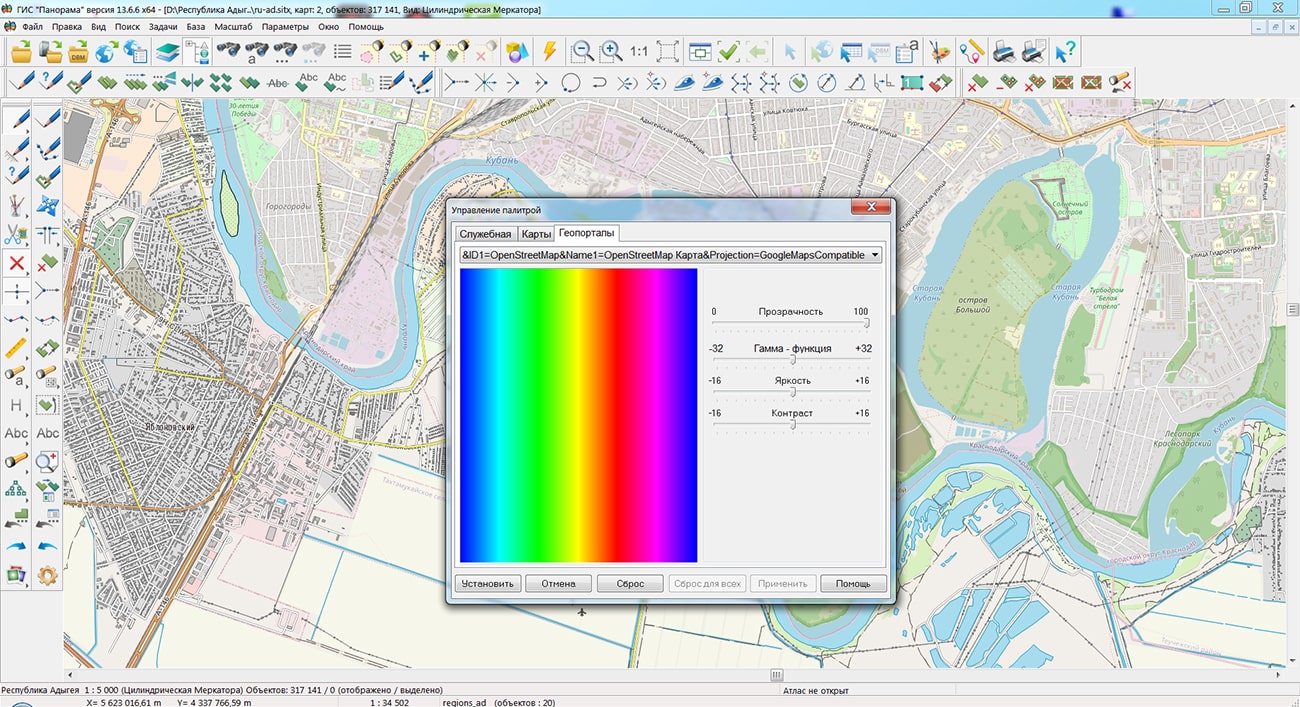
Specialists of KB "Panorama" prepared and placed on the geoportal the map of the Republic of Adygea. The map was formed using OpenStreetMap data, source data was obtained from website. To work with the map, you can use the program or other software products of KB "Panorama".
The map was led to the modernised classifier of large-scale plans of scale 1: 5 000 (map5000m.rsc) and was saved into a packed project (MPTZ). The MPTZ format project includes a digital map of the region's territory (country, subject of the federation, administrative region), a map of the administrative-territorial division of the region and a digital classifier. Publishing of updates in bank of spatial data is made by using the program of . Publishing contents of bank of spatial data on the geoportal and data access for downloading are implemented by means of .
Free maps on the basis of OpenStreetMap data are available for download on the page "Digital maps".


Ph.: +7 (495) 739-0245, +7 (925) 221-1603
www.gisinfo.ru | panorama@gisinfo.ru
105005, Russia, Moscow, Baumanskaya Street 7, building 1, office 229 (m. Baumanskaya)
Copyright © Panorama Group 1991 - 2024


 Mobile version
 Full version