Copyright © Panorama Group 1991 - 2024

Specialists of KB "Panorama" prepared and placed on the geoportal the maps of the Belgorod and Bryansk regions. The maps were formed using OpenStreetMap data, source data was obtained from Geofabrik website. To work with the maps, you can use the program or other software products of KB "Panorama".
The maps were led to the modernised classifier of large-scale plans of scale 1: 5 000 (map5000m.rsc) and were saved into a packed project (MPTZ). The MPTZ format project includes a digital map of the region's territory (country, subject of the federation, administrative region), a map of the administrative-territorial division of the region and a digital classifier. Publishing of updates in bank of spatial data is made by using the program of . Publishing contents of bank of spatial data on the geoportal and data access for downloading are implemented by means of .
Free maps on the basis of OpenStreetMap data are available for download on the page "Digital maps".


Specialists of KB "Panorama" have prepared a video lesson of calculating the parameters of the projection of the local coordinate system by a set of points. Users of the Workstation of "Cadastral engineer" or the can independently calculate the parameters of the transition from the local coordinate system to the state one by a set of point coordinates.
The parameters of the transition between the local coordinate system and state coordinate systems, catalogs of coordinates of geodetic points in the local coordinate system are permanently stored in the federal fund of spatial data and are provided to interested parties in the order prescribed by part 7 of article 10 of the Federal Law of December, 30th, 2015 N 431-FZ "About geodesy, cartography and spatial data". If it is not possible to obtain the transition keys, you can calculate the approximate parameters using the task "Calculation of projection parameters of local coordinate system".
The training material demonstrates the features of the task "Calculation of projection parameters of local coordinate system". The initial data for calculations are the coordinates of points in the local (X, Y) and geodetic coordinate system (latitude, longitude). Geodetic coordinates can be loaded from the catalog of coordinates or calculated from coordinates in the state (CS42, CS63, CS95) or local coordinate system with known parameters. The task calculates the longitude of the axial meridian, the latitude of the main point, the scale on the axial meridian, the offsets of the coordinates along the X and Y axes, the angle of rotation of the axes. The results of calculations can be saved to an XML file for later use when creating electronic maps.
You can view the training materials in the "Video lessons" section.


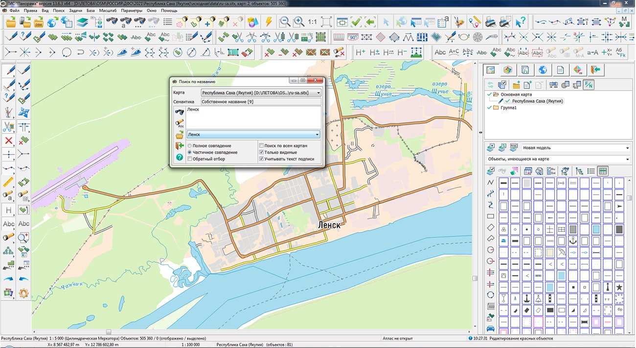
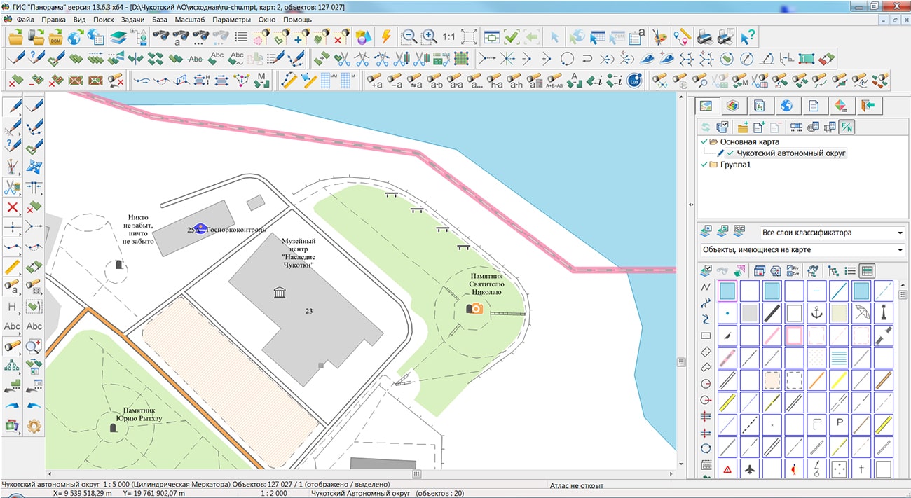
Specialists of KB "Panorama" prepared and placed on the geoportal the maps of the the Republic of Sakha (Yakutia) and the Chukotka Autonomous Okrug. The maps were formed using OpenStreetMap data, source data was obtained from Geofabrik website. To work with the maps, you can use the program or other software products of KB "Panorama".
The maps were led to the modernised classifier of large-scale plans of scale 1: 5 000 (map5000m.rsc) and were saved into a packed project (MPTZ). The MPTZ format project includes a digital map of the region's territory (country, subject of the federation, administrative region), a map of the administrative-territorial division of the region and a digital classifier. Publishing of updates in bank of spatial data is made by using the program of . Publishing contents of bank of spatial data on the geoportal and data access for downloading are implemented by means of .
Free maps on the basis of OpenStreetMap data are available for download on the page "Digital maps".


In KB "Panorama" the version 13.4.0 has been developed for OS Astra Linux SE (releases "Smolensk" and "Leningrad") and OS Zarya. In the new version of the program, the search speed of objects with given semantic characteristics is increased by an average of 1000 times due to the indexing of semantics values using polynomial hashing methods, constructing values reference books and other improvements of search algorithms. On a test case of 4 000 000 objects, a search was performed using three indexed semantics: "Name", "Number of inhabitants", "Unique object identifier", which were filled in for more than 3 350 000 objects. The speed of performing sample of objects has decreased from 4 seconds to 4-5 milliseconds. The additional amount of RAM for placing the hash tables was 95 MB, the size of the source map was 802 MB. To reduce the time for building hash tables, they are saved into a file with the ".seh" extension and read when the map opening. When saving a map into the packed SITZ\MAPZ\MPTZ format, hash tables are packed in a common archive with the map. The new algorithm makes it possible to execute more requests on search from application tasks in multithreaded mode and improve the performance of server applications.
In the new version, the transformation of vector maps into a preset coordinate system has been accelerated by 4-6 times. When adding a map with transformation, a copy of the source map is created in the map subdirectory with a name containing the name of the passport file and the current date. Additionally, the opening and first display of maps has been accelerated due to the formation of a "*.sol" file with a tree of territorial distribution of objects onto each map sheet. When the map is opened, the objects tree is read and the first display is accelerated by 5-15 times (for a map with 2 million objects, the opening and first display is accelerated from 9-12 seconds to 1 second). When sorting a map in SITZ\MAPZ format or saving an MPTZ project, the tree of objects is saved in a packed data file with further acceleration of the first opening of a map. In the absence of the "*.sol" file the automatic constructing a tree and file saving are carried out.
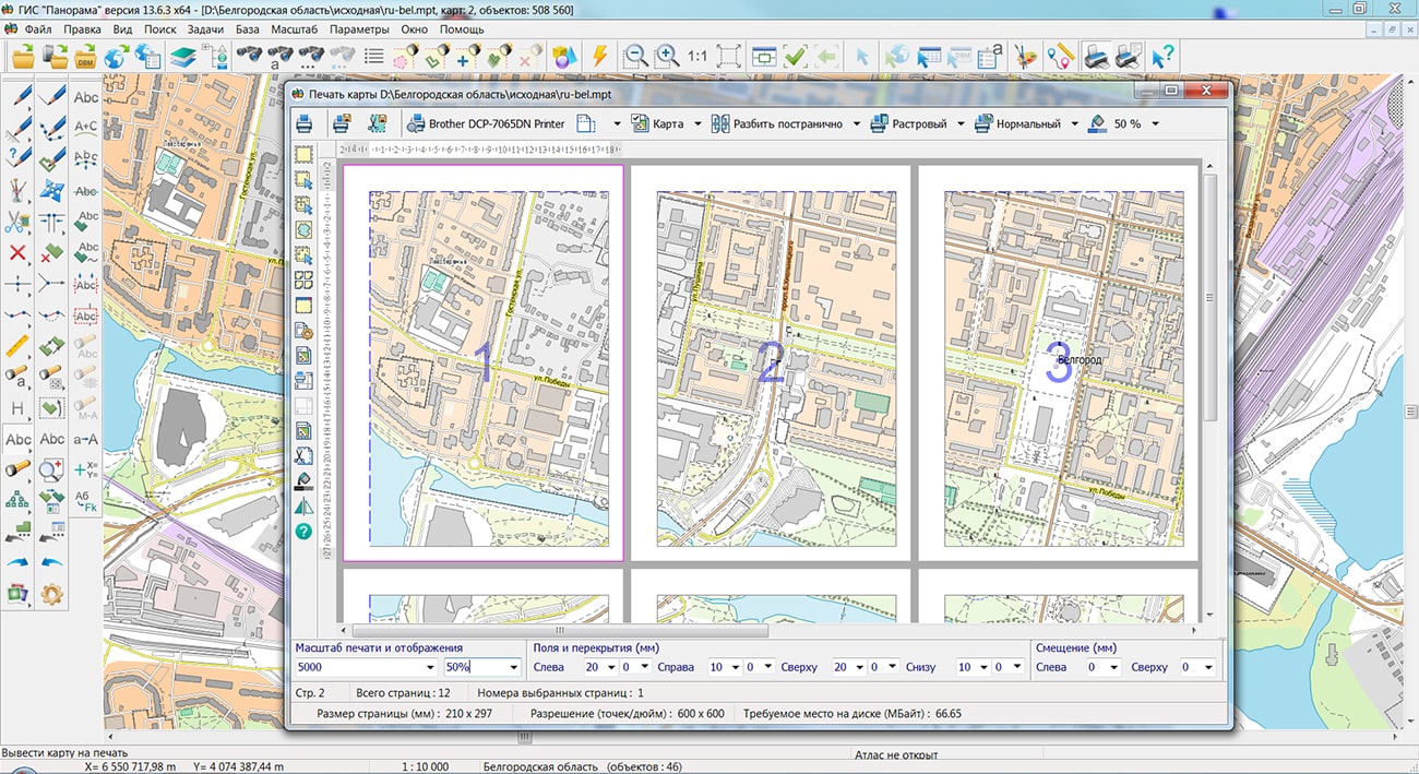
Possibility has been added for displaying a packed project of spatial data MPTZ from the of version 9.4 and higher. A packaged project may include a complex representation of the territory in the form of vector maps of different levels of detail, images of the terrain in RSW format, matrixes of heights and matrixes of quality characteristics of the terrain, insets from the same data, the reference to data from the GIS Server and from geoportals by various protocols. All data sets are packed into one file of MPTZ format. The total amount of packed data is reduced by 3-10 times. The speed of data exchange, packed into an MPTZ project, increases 5-20 times, taking into account the decrease in the number of transferred files. The size of the MPTZ file and the number of sets in the project are not limited. Maps are packed together with classifiers, a tree of distribution of objects over the map area, multiscale objects (generalized contours for different display scales) and hash tables indexed for search of objects semantics, pyramids of tiles, rasters and matrixes, which provides high speed of display and data search. The virtual folder on the GIS Server can be supplemented/updated by MPTZ projects in a background mode, changing the area and detail of the background cartographic coverage and the composition of remote sensing data without additional data administration. Packaged MPTZ projects can be formed by region (as, for example, on Digital maps page) or according to nomenclature sheets (for example, at a scale of 1: 500 000), which allows you to quickly form a complex coverage of a given territory.
The classifier of objects of the operational situation operator.rsc has been updated. There is specified the type of conventional signs such as command posts, communication facilities, engineering equipment, units of permanent readiness and many others contained in the layers: "Actions of ground forces. Strikes, fires of missile-artillery means", "Engineering troops", "FSB bodies", "MIA of the RF","GIBDD of MIA of the RF", "Ministry of Transport of the RF", "Electronic Warfare troops", "Signal troops", "Road Bodies of the RF", "Space troops", "Mobilization deployment", "Moral and psychological support of troops", "EMERCOM and Civil defense", "Operational objects of general use", "Border agencies. Management", "Enemy - position, actions", "Strategic missile forces", "Formations and military units of technical troops", "Topogeodetic support of troops" and others.
Classifiers of digital topographic maps of scales : 25 000, 1: 50 000, 1: 100 000, 1: 200 000, 1: 500 000, 1: 1 000 000 have been updated. There were specified the parameters of scaling of conventional symbols of linear and areal objects with filling signs and contours of various thicknesses for layers of hydrography, land relief, road network and road structures, vegetation, soils and lava covers, industrial and social objects, borders, fences, certain natural phenomena and territories. The updated classifiers provide support for multiscale topographic maps, along with automatic generalization of contours for different scales, setting the ranges of objects visibility.
The emercom.v2.rscz classifier has been updated, designed to create electronic maps of emergency situations. For accounting objects under the jurisdiction of the Ministry of Emergencies, and highlighting these objects with special conventional symbols, the following objects have been added: Label of an object under the jurisdiction of the Ministry of Emergencies, Label of an object under the jurisdiction of the Ministry of Emergencies (simplified), Building under the jurisdiction of the Ministry of Emergencies.
The classifier of aeronautical maps dfc.rscz has been updated. There are clarified the conventional symbols of objects, the width of which depends on the length of the signature in the symbol: 5100300 Signature of landing course, 4000600 Signature of control area (CTA) without transition altitude, 4000800 Signature of Flight Information Sector (FIS), 4000200 Signature of Flight Information Region (FIR), 4000200 Signature of the control area (CTA), 4000200 Signature of the Aerodrome Flight Information Zone (AFIZ), 4000200 Signature of the restricted zone of P-zone, 4000200 Signature of the danger zone of the D-zone, 4000200 Signature of the R-zone flight restriction zone, 4000200 Signature of TSA Temporary Reserved Airspace, 2001200 Signature of terminal turning point, 2001200 Signature of waypoint RNAV, 2000510 Signature of ILS. When you change the text of the signature selected in the sign, the width of the sign will be automatically changed so that the text remains within the frame.
The user interface and functionality of the task of constructing a mathematical base have been expanded. In the new version, when processing a multisheet map, the user can select from the list and process only the required set of sheets. The projection parameters of sheets located in different zones are automatically converted to the projection parameters of the first sheet during the process of construction. The task implements a separate detailed setting the parameters of rectangular and cartographic grids. To speed up working the task on maps with a large number of sheets, it is possible to disable transaction logging.
When saving and opening the projects of maps in MPT\MPTZ format, the currently specified contents of display for each project map is taken into account. Into a project file the records of XML format in the form of sections with the name [#xml#vclxNNN] have been added. It allows to form from one set of maps the projects of different composition of layers, scale, color design for use in the form of inserts in various reports and other tasks.
When importing a set of maps sheets of SXF and TXF format, specified by the list in the DIR file, the ability has been added for transfer of sheets by longitude on +/-360 degrees. It allows to duplicate the columns of sheets in the western and\or eastern hemisphere for expansion of dimensions of work region up to -360/+360 degrees. To duplicate sheets, copy the required file with a different name (for example, rename 01-12.sxf to 01-12_west.sxf) and change its nomenclature so that all sheets in the region have a unique designation (for example, rename 01-12 to 01-12_west ). Then, in a text editor, add a line with a new name sxf or txf into the DIR file and press the tab after the file name and enter the direction of transfer (for example, -360 or +360). The recalculation of coordinates and sheet passport will be performed automatically when importing the work region by the DIR file.
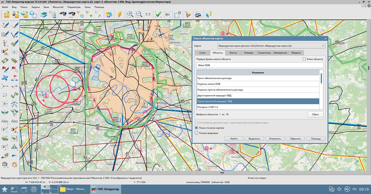
GIS "Operator" SE is a universal domestic geographic information system for power structures. The program is intended for accumulation, the storage, the automated processing and displaying the data, results of calculations and the forecasts having a geospatial binding. GIS "Operator" contains tools for displaying and processing vector, raster and matrix maps. The application provides users with tools for solving specialized tasks of modeling the movement of special objects against the background of 3D model, a forecasting the consequences of emergencies on hazardous objects, a monitoring the movement of aircraft, a performing the geodetic and topographic work, processing data from GPS/GLONASS navigation devices, a printing the displayed spatial data to various output devices and many others.
The new version of the program is available for download in the Download section.


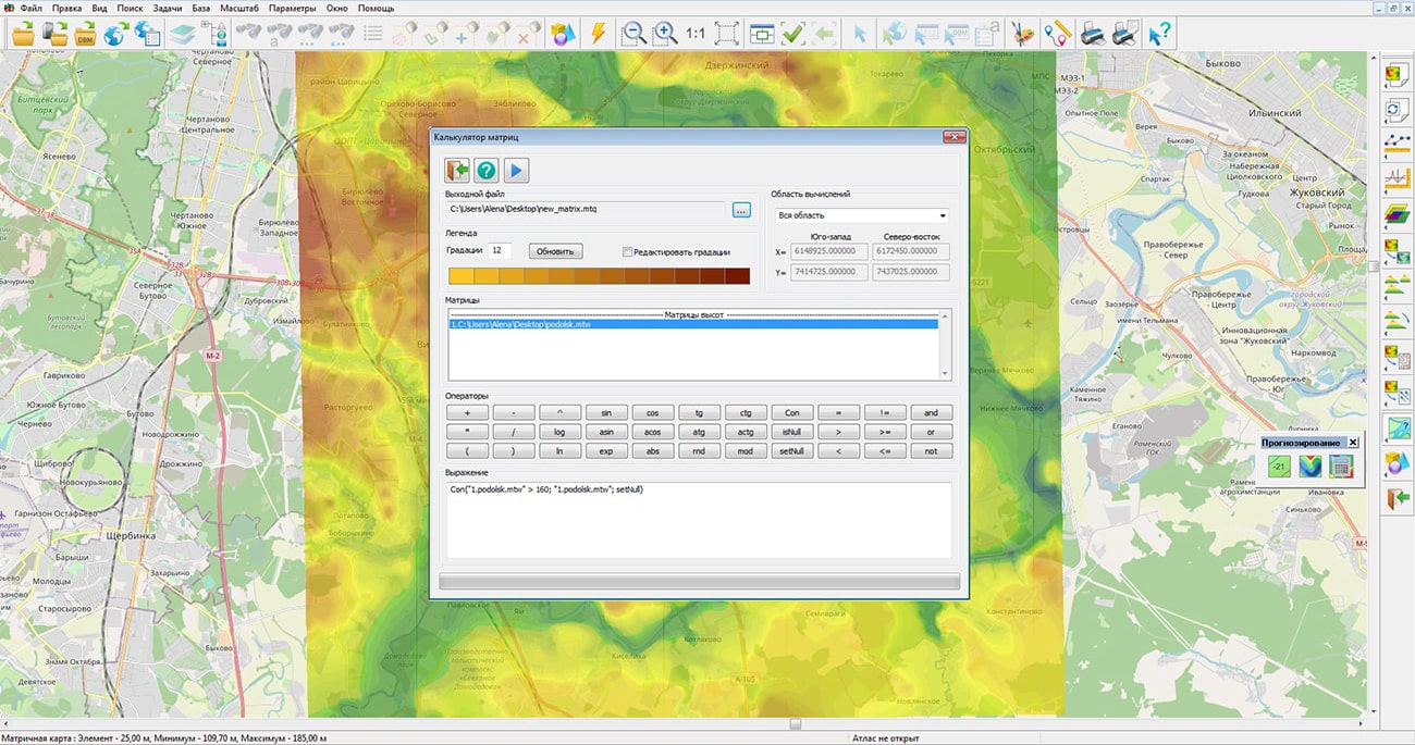
In KB "Panorama" the "Workstation of Geologist" version 13.6.3 has been developed. In the new version of the program the "Matrix calculator" has been updated, that provides execution of engineering calculations with using the methods of matrix algebra. Calculations can use simultaneously matrixes of qualities and matrixes of heights. Results of calculations will be presented in the form of a new matrix of qualities.
The matrix calculator supports not only computational operations (addition, subtraction, multiplication), but also logical operations for comparing elements of matrixes of heights of a relief and quality characteristics of the terrain. Many problems solved using matrix algebra are reduced to finding areas in which the values from the matrix must meet a given condition. The matrix calculator allows you to build expressions to form a request of engineering calculation with a combination of calculation and comparison methods. For example, on the basis of a matrix of heights and a matrix of quality containing values of level of water rising, it is possible to build a matrix of depths.
The matrix calculator allows you to perform geological, hydrological and mine surveying calculations to obtain estimated matrixes containing binary values - whether it meets or does not meet the expression conditions. The matrixes of the estimated coefficients are further used for contouring the areas corresponding to the given calculation conditions. For example, the expression: Con("1.podolsk.mtw" > 160; "1.podolsk.mtw"; setNull), allows you to solve the problem of finding areas in which the value of the matrix of heights podolsk.mtw is greater than 160.
In the new version of the program, due to the use of multithreaded processing on a multicore processor, the import of rasters and matrixes from the GeoTIFF, PNG, JPEG, SRTM, IMG formats into the internal formats of the "Panorama" geoinformation platform has been significantly accelerated. For users who have the right to view the state of the operation, in the "Monitoring" bookmark, there is added the ability to save the log (protocol) of the server operation into a text file for further analysis or sending to the technical support service.
The new version of the program is available for download in the Download section.

Ph.: +7 (495) 739-0245, +7 (925) 221-1603
www.gisinfo.ru | panorama@gisinfo.ru
105005, Russia, Moscow, Baumanskaya Street 7, building 1, office 229 (m. Baumanskaya)
Copyright © Panorama Group 1991 - 2024


 Mobile version
 Full version