Copyright © Panorama Group 1991 - 2024

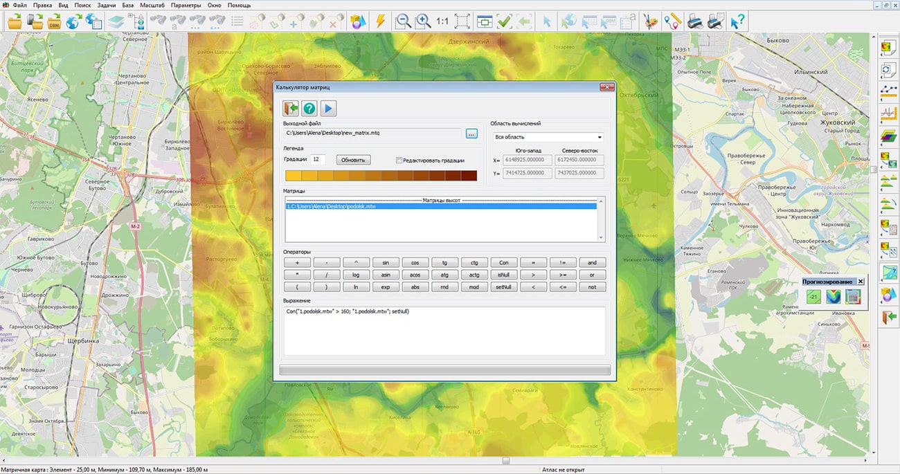
In KB "Panorama" the "Workstation of Geologist" version 13.6.3 has been developed. In the new version of the program the "Matrix calculator" has been updated, that provides execution of engineering calculations with using the methods of matrix algebra. Calculations can use simultaneously matrixes of qualities and matrixes of heights. Results of calculations will be presented in the form of a new matrix of qualities.
The matrix calculator supports not only computational operations (addition, subtraction, multiplication), but also logical operations for comparing elements of matrixes of heights of a relief and quality characteristics of the terrain. Many problems solved using matrix algebra are reduced to finding areas in which the values from the matrix must meet a given condition. The matrix calculator allows you to build expressions to form a request of engineering calculation with a combination of calculation and comparison methods. For example, on the basis of a matrix of heights and a matrix of quality containing values of level of water rising, it is possible to build a matrix of depths.
The matrix calculator allows you to perform geological, hydrological and mine surveying calculations to obtain estimated matrixes containing binary values - whether it meets or does not meet the expression conditions. The matrixes of the estimated coefficients are further used for contouring the areas corresponding to the given calculation conditions. For example, the expression: Con("1.podolsk.mtw" > 160; "1.podolsk.mtw"; setNull), allows you to solve the problem of finding areas in which the value of the matrix of heights podolsk.mtw is greater than 160.
In the new version of the program, due to the use of multithreaded processing on a multicore processor, the import of rasters and matrixes from the GeoTIFF, PNG, JPEG, SRTM, IMG formats into the internal formats of the "Panorama" geoinformation platform has been significantly accelerated. For users who have the right to view the state of the operation, in the "Monitoring" bookmark, there is added the ability to save the log (protocol) of the server operation into a text file for further analysis or sending to the technical support service.
The new version of the program is available for download in the Download section.


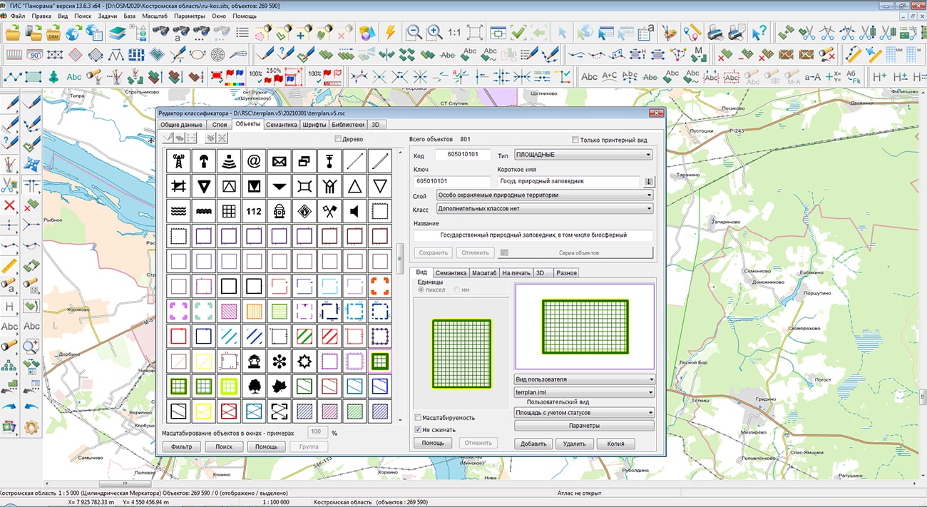
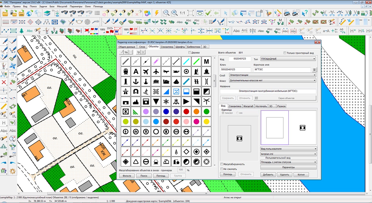
Specialists of KB "Panorama" have updated the digital classifier of schemes of territorial planning terrplan.v5.rscz. The classifier is intended for the preparation of the graphic part of territorial planning documents, in accordance with the Order of the Ministry of Economic Development of the Russian Federation dated 01/09/2018 № 10 "On approval of the Requirements for the description and display in the documents of territorial planning of objects of federal significance, objects of regional significance, objects of local significance and on recognizing as invalid the order of the Ministry of Economic Development of Russia dated December 7, 2016 №793 ".
In accordance with the section of the order "Principles for the formation of cartographic conventional symbols of objects" a large number of objects with a polygon localization as a symbol have the value "not displayed" or do not have an indication about the view of conventional symbol. This causes large-scale schemes to be displayed with empty areas that actually contain various objects. To improve the clarity of the schemes with the preservation of the number of objects contained in the scheme, the symbol of the polygon includes an image of a point symbol with the same code as that of the polygon.
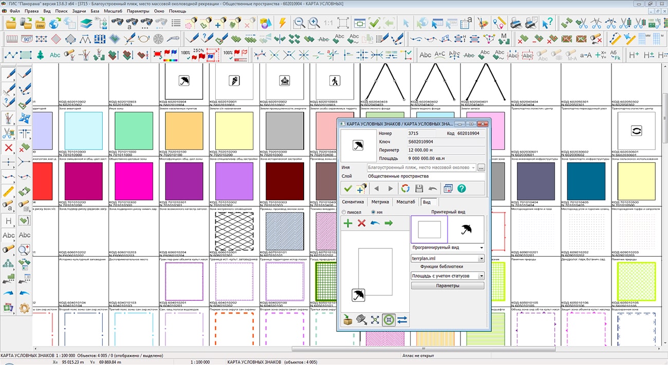
In the classifier terrplan.v5.rscz for ranges new property - "Polygon with a point" is added. The user can change the position of the point in the "Map Editor". At changing the characteristics of object "Object status" and "Object value", the view of the sign in the center of the polygon and the contour of the object change accordingly.
For objects with this property, when creating and editing an object, or when sorting, a subobject with one point in the center of the polygon is automatically created. If a conventional symbol of polygon contains polygon parameters and parameters of a point or vector symbol, the corresponding symbol will be displayed in the center of the polygon. The user can change the position of the point in the "Map Editor".
Classifier survey.v5.rscz has been updated.
The digital classifier is included into the and is used to structure and unify information about objects of federal significance, objects of regional significance and objects of local significance, necessary for the preparation of territorial planning documents of the Russian Federation, constituent entities of the Russian Federation and municipalities.
The updated classifier is available for download in the "Classifiers" section.


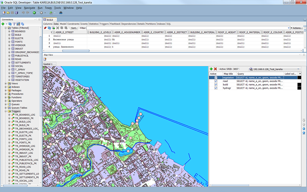
Specialists of KB "Panorama" have prepared a set of examples demonstrating technologies for working with spatial databases. The set includes archives of demo databases that can be deployed in PostgreSQL, Oracle and Microsoft SQL Server, and also a project of maps intended for use in . Access to spatial databases (DB) running under the control of "industrial" DBMS PostgreSQL, Oracle, Microsoft SQL Server is implemented at the level of the geoinformation core and is supported in the and applications of KB "Panorama", as well as in applications based on the geoinformation core "Panorama" with use of the MAPAPI interface or components from toolset of and .
Demonstration spatial databases contain a fragment of the map of the city of Petrozavodsk in the Republic of Karelia, divided into separate thematic layers (hydrography, road network, buildings, etc.), which are physically represented in separate database tables. Each such spatial layer corresponds to a *.dbm file included in the demo. The * .dbm file is required for opening a spatial layer from a database. In the software products of KB "Panorama", both a separate spatial layer and the whole map can be opened. For this, a map project (*.mpt) is used that combines several spatial layers.
The demo example for each of the above DBMSs includes a readme.ru.txt file containing instructions for deploying a demo spatial database. Demonstration examples of spatial databases are available for download in the Download section.


Geoportal has been supplemented with a map of England, formed according to OpenStreetMap data. Source data were obtained from website. To work with the map, you can use the program or other software products of KB "Panorama".
The map was led to the modernised classifier of large-scale plans of scale 1: 5 000 (map5000m.rsc). Publishing of updates in bank of spatial data is made by using the program of . Publishing contents of bank of spatial data on the geoportal and data access for downloading are implemented by means of .
Free maps on the basis of OpenStreetMap data are available for download on the page "Digital maps".


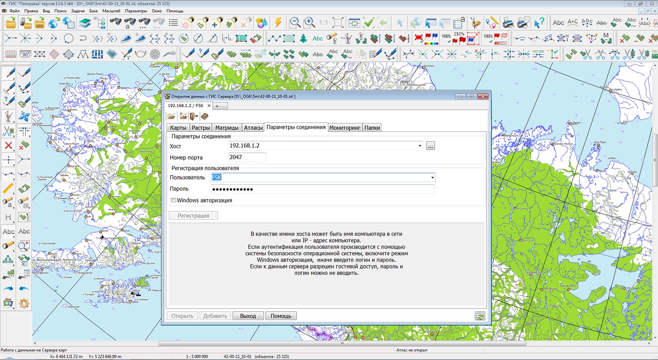
In KB "Panorama" the version 9.4 has been developed. In the new version a support of access to the format has been added. The packaged project may include a comprehensive representation of the territory in the form of vector maps of different levels of detail, terrain images in RSW format, matrixes of heights and matrixes of terrain quality characteristics. The virtual folder on the GIS Server can be supplemented/updated by MPTZ projects in the background mode, changing the area and detail of the background cartographic coverage and the composition of remote sensing data without additional data administration. To read MPTZ, the client must be version 13.6.3 or higher.
Support for the formats , SITZ, MAPZ, MPTZ has been added to the procedure for backup of vector maps. The SITZ, MAPZ, MPTZ extensions have been added into the filter of vector maps for monitoring virtual folders. The protocol for loading data sets into the Databank of the Digital Maps and ERS is written in UTF-8 encoding. Calculation of checksums of files when writing into the is performed using the CRC32 algorithm. The program has improved the caching of packed sitz\mapz maps opened from another server. The algorithm for backup of DBM files has been changed to exclude the background opening of the spatial database without an explicit client request. The dongle driver has been updated from version 6 to version 7 for correct operation of the network license.
The GIS Server is designed to provide remote access to vector maps, remote sensing data, matrixes, documents and spatial databases of users of the programs the , , and others. Users of desktop and web applications on different platforms can simultaneously view and edit data in accordance with access rights.
The new version of the program is available for download on the page.


Ph.: +7 (495) 739-0245, +7 (925) 221-1603
www.gisinfo.ru | panorama@gisinfo.ru
105005, Russia, Moscow, Baumanskaya Street 7, building 1, office 229 (m. Baumanskaya)
Copyright © Panorama Group 1991 - 2024


 Mobile version
 Full version