Copyright © Panorama Group 1991 - 2024

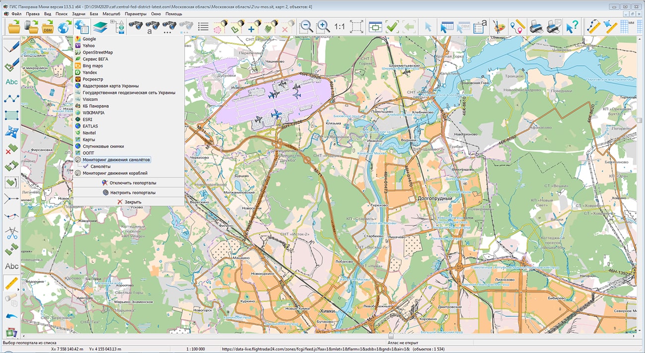
Specialists of KB "Panorama" prepared and placed on the geoportal the map of Moscow Region. The map was formed using OpenStreetMap data, source data was obtained from website. To work with the map, you can use the program or other software products of KB "Panorama".
The map was led to the modernised classifier of large-scale plans of scale 1: 5 000 (map5000m.rsc) and was saved into a packed project (MPTZ). The MPTZ format project includes a digital map of the region's territory (country, subject of the federation, administrative region), a map of the administrative-territorial division of the region and a digital classifier. Publishing of updates in bank of spatial data is made by using the program of . Publishing contents of bank of spatial data on the geoportal and data access for downloading are implemented by means of .
Free maps on the basis of OpenStreetMap data are available for download on the page "Digital maps".


In KB "Panorama" the "Workstation of cadastral engineer" version 13.6.2 has been developed. The new version contains tools that provide the formation of graphical applications to the forest declaration. The form of the forest declaration, the procedure for filling it out and submitting it, the requirements for the format of the forest declaration were approved by the order of the Ministry of Natural Resources and the Environment of the Russian Federation of July, 30th, 2020 N 539.
The forest declaration contains information about the location of the forest area; about the volume of forest use; about the types of forest use that are provided for by the lease agreement for the forest plot, or other document in accordance with which the use of forests is carried out, by the forest development project for the declared period. To prepare graphic applications for the forest declaration by means of the "Workstation of cadastral engineer", it is necessary to create a digital map using the updated forestry.v2 classifier, to draw the boundaries of forest areas and to fill in the necessary attributes. The contour of forest areas should describe the boundaries of forest infrastructure objects (including cutting areas), objects of timber processing infrastructure and objects not related to the creation of forest infrastructure.
For formation of reports the modes of "Geodesy editor" from panel "Formation of reports" are used. "To print the summary report on the selected objects" mode ensures creation of appendices 1 and 2 to the forest declaration, and the "Create an object scheme and filling the report" mode of appendices 3 and 4 to the forest declaration. To form reports, templates are used that are located into the Geodesy.dot folder.
The new version of the program is available for download in the Download section.


In KB "Panorama" the version 13.6.2 has been developed. In the new version, the display of conventional symbols the width of which changes when changing the text of signature inside the sign has been improved. In the "Editor of a vector sign" there is added the button "[T]" - Choice of a text chain for specifying the size of a sign. In order that the sign changes its width at changing the text of a chain, it is necessary in the list of chains to choose a text element by which the width of a sign will be controlled and to press the "[T]" button. [T] symbol will be displayed to the left of the selected chain. You need to choose the chain, the text of which is most likely to be longer than the rest. The chain coordinates should be closer to the edges of the frame, so that when the sign is stretched proportionally, empty areas are not formed at the edges of the signature. Stretchable signs are used in maps of the operational situation (control points), aeronautical maps (zone signatures), topographic maps (road number in a frame) and others.
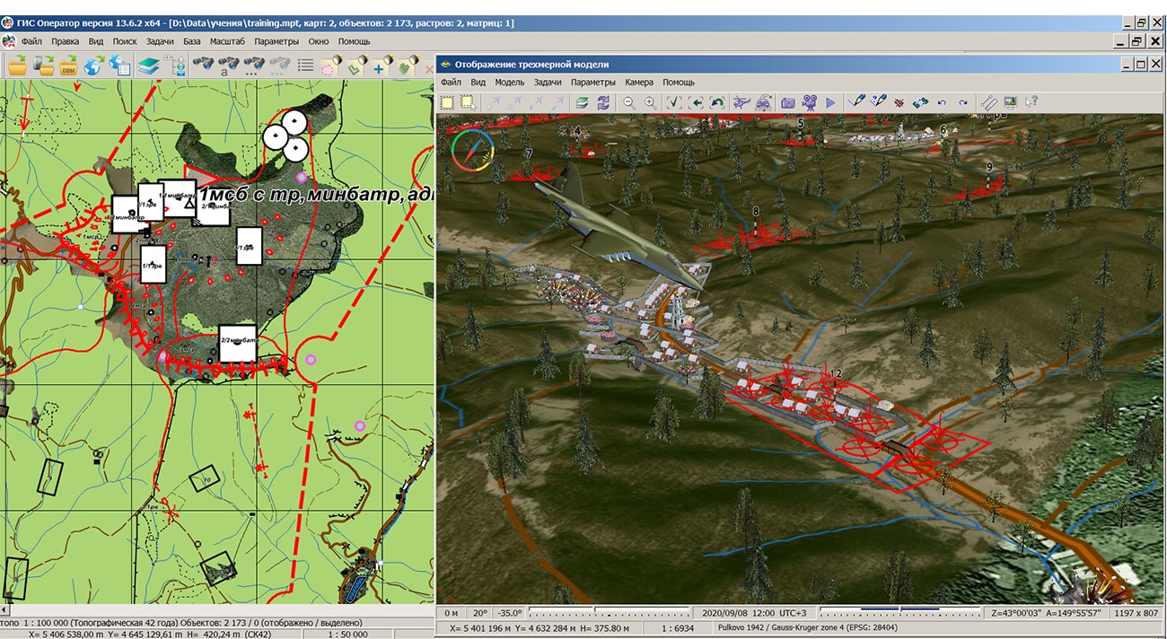
The classifier of objects of the operational situation operator.rsc has been updated. There is specified the type of conventional signs such as command posts, communication facilities, engineering equipment, units of permanent readiness and many others contained in the layers: "Actions of ground forces. Strikes, fires of missile-artillery means", "Engineering troops", "FSB bodies", "MIA of the RF","GIBDD of MIA of the RF", "Ministry of Transport of the RF", "Electronic Warfare troops", "Signal troops", "Road Bodies of the RF", "Space troops", "Mobilization deployment", "Moral and psychological support of troops", "EMERCOM and Civil defense", "Operational objects of general use", "Border agencies. Management", "Enemy - position, actions", "Strategic missile forces", "Formations and military units of technical troops", "Topogeodetic support of troops" and others.
Classifier of emergency situation emercom.v2.rsc has been updated. There is specified the type of conventional symbols of the type of control points, departments of EMERCOM, elements of the warning system and others contained in the layers: "Objects of transport infrastructure", "Objects of communication systems, monitoring, warning and informing population", "Territories, objects of economy and infrastructure", "Objects of civil defense and ensuring the protection of the population from emergencies", "Objects, territories, routes and forces for carrying out evacuation measures", "Governing bodies and forces of the civil defense and RSChS", "Units and subdivisions of the civil defense and RSChS".
In the new version, the transformation of vector maps from one coordinate system to another has been accelerated by 4-6 times. The task is called from the menu "Tools\Coordinate systems\Standard transformation" or when adding maps in different coordinate systems. Import of graphic files of GeoTIFF, PNG, JPEG and other formats into RSW format is accelerated by 3-6 times due to the use of multi-threaded processing on a multi-core processor. A test case from 384 GeoTIFF files in volume of 45 GB has been processed in 57 minutes instead of 190 minutes in the previous version. The optimization of the list of rasters in RSW format is 2-4 times faster due to the use of multi-threaded processing on a multi-core processor: compression, decompression and updating of general images of rasters (pyramids of tiles). A test case of 384 rasters with a total size of 125 GB is compressed using the JPEG algorithm up to 2.37 GB in 25 minutes instead of 48 minutes in the previous version of the program.Import of matrixes of heights and quality characteristics from HGT (SRTM), GeoTIFF and IMG files has been accelerated 3-5 times due to the use of multi-threaded processing on a multi-core processor. The test set from 379 GeoTIFF files in volume of 44 GB was processed in 44 minutes instead of 156 minutes in the previous version of the program.
The tasks "Raster passport" and "Matrix passport" have been improved. The bookmark "Metadata" has been added, on which the code EPSG, a filename of metadata and the size of image or matrix in kilobytes have been specified. For editable raster or matrix files, saving metadata into an XML file is available. The metadata of images and matrices can contain the characteristics of the dataset (accuracy, coordinates of dimensions, conditional name, classification, etc.), as well as information about the organization and employees who create the sets.
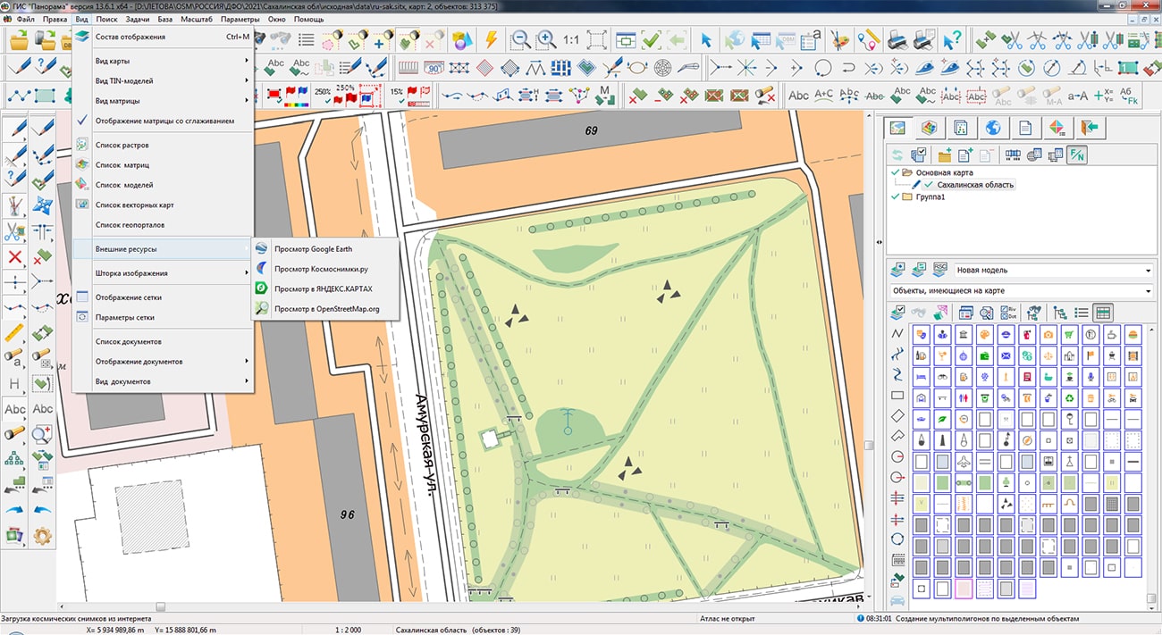
The task of connecting geoportals has been improved. Ability has been added for simultaneously connecting several layers according to the international standard OGC WMS or OGC WMTS through the "Open map from WMS server" dialog. In this case, each layer will be added as a separate connection in the general list.
The new version of the program is available for download in the section.


In KB "Panorama" the version 13.8.0 has been developed. In the new version the list of supported requests for working with spatial objects has been expanded. For overlay operations, a request has been implemented to check the relative position of map objects, taking into account common intersection points or common segments. The request was added: whether the layer with 3D data into the list of setup file is published. For compatibility with Linux systems, all layer identifiers and data paths have become case sensitive. The parameter has been added that allows you to display the encoded value for semantics of the "Classifier" (list) type for GetFeature requests. A new parameter has been added to the GetFeature requests, which allows to limit the number of objects in the response for complex XMLRPC requests for each layer separately. The request for building thematic maps has been improved.
The user interface is optimised. Additional parameters are hidden into the separate block. Possibility of connecting the tracks of motion of 3D objects has been added. Possibility of selecting the several schemes for a layer has been implemented.
In order to improve security, into the program for Linux and MS Windows operating systems a control over the integrity of the installation and service files when it starts has been added. The reliability of work with data on the is increased. The output of messages into the system event log has been improved.
Possibility has been implemented to work with semantics from a DB directly without their additional settings in the dbm file and a transfer to the cache created by the service. This will greatly speed up the cache creation process, and also will simplify process of synchronisation of spatial data.
GIS WebService SE supports all international standards (OGC WFS, WFS-T, WMS, WMTS, WCS), which are used to transfer and display spatial data. The program implements the ability to issue tiles for any user or local coordinate system. The application is implemented on Windows and Linux platforms and is compatible with Apache, IIS and nginx web servers.
The new version of the program and documentation are posted on the website in the section.


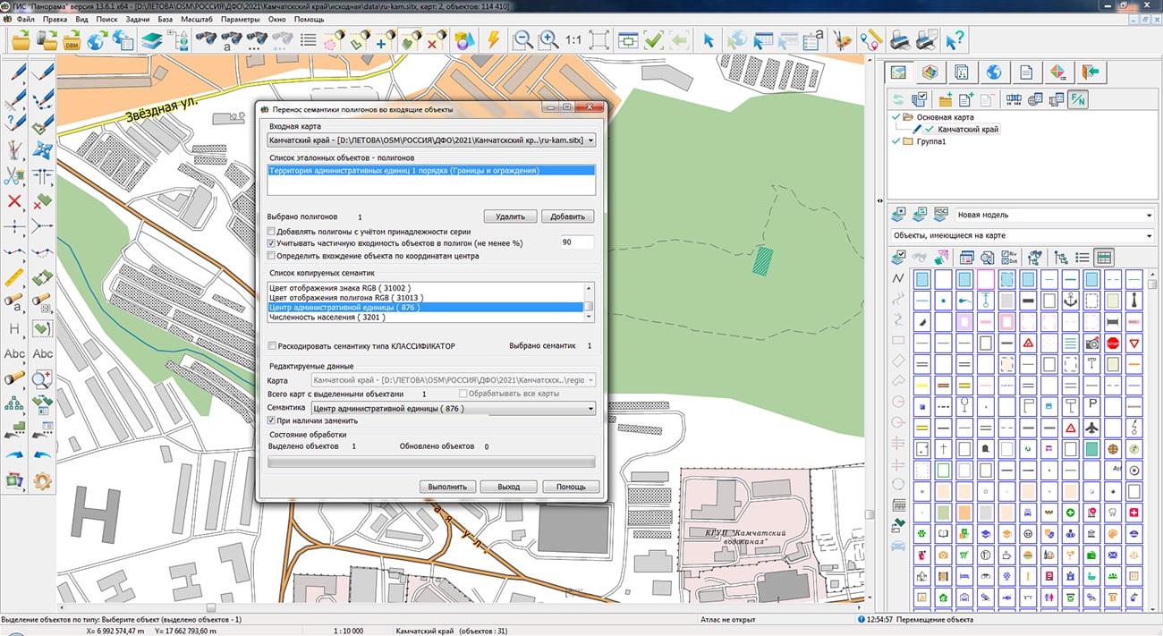
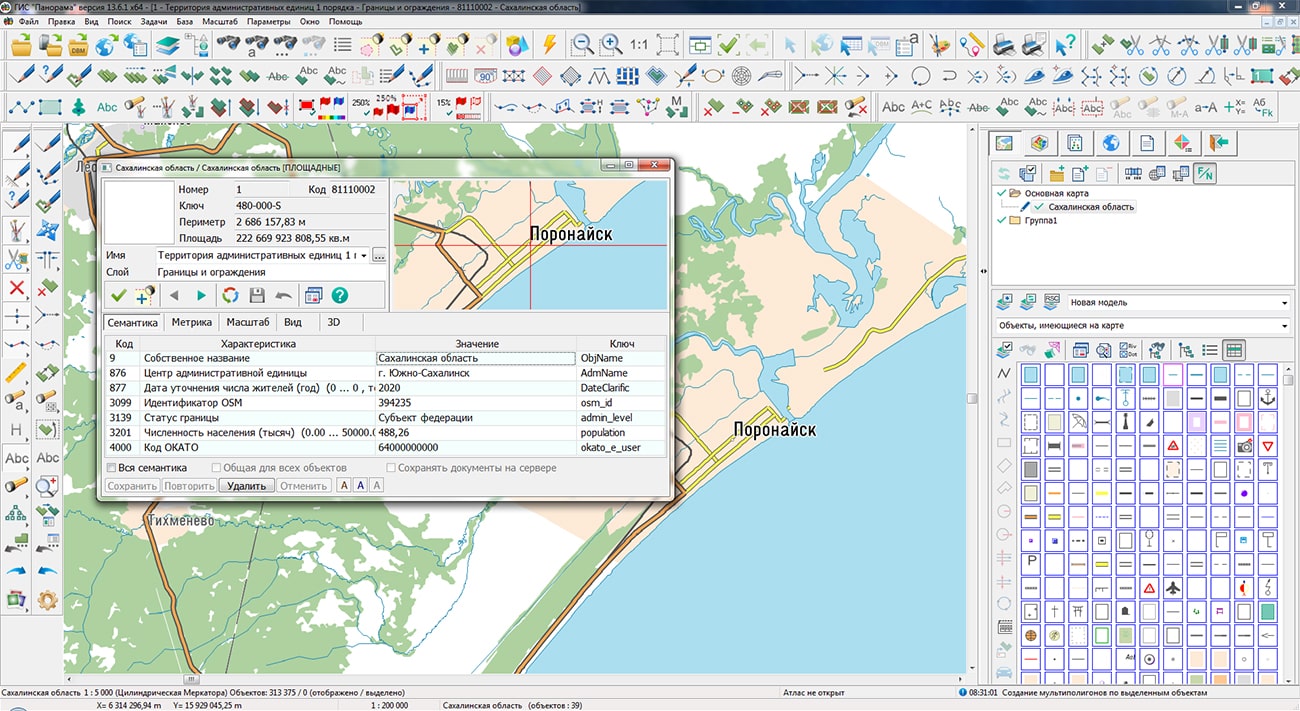
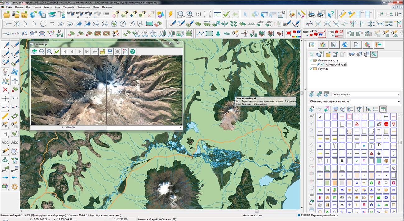
Specialists of KB "Panorama" prepared and placed on the geoportal the maps of the Kamchatka Krai and Sakhalin region. The maps were formed using OpenStreetMap data, source data was obtained from website. To work with the maps, you can use the program or other software products of KB "Panorama".
The maps were led to the modernised classifier of large-scale plans of scale 1: 5 000 (map5000m.rsc) and were saved into a packed project (MPTZ). The MPTZ format project includes a digital map of the region's territory (country, subject of the federation, administrative region), a map of the administrative-territorial division of the region and a digital classifier. Publishing of updates in bank of spatial data is made by using the program of . Publishing contents of bank of spatial data on the geoportal and data access for downloading are implemented by means of .
Free maps on the basis of OpenStreetMap data are available for download on the page "Digital maps".


Ph.: +7 (495) 739-0245, +7 (925) 221-1603
www.gisinfo.ru | panorama@gisinfo.ru
105005, Russia, Moscow, Baumanskaya Street 7, building 1, office 229 (m. Baumanskaya)
Copyright © Panorama Group 1991 - 2024


 Mobile version
 Full version