Copyright © Panorama Group 1991 - 2024

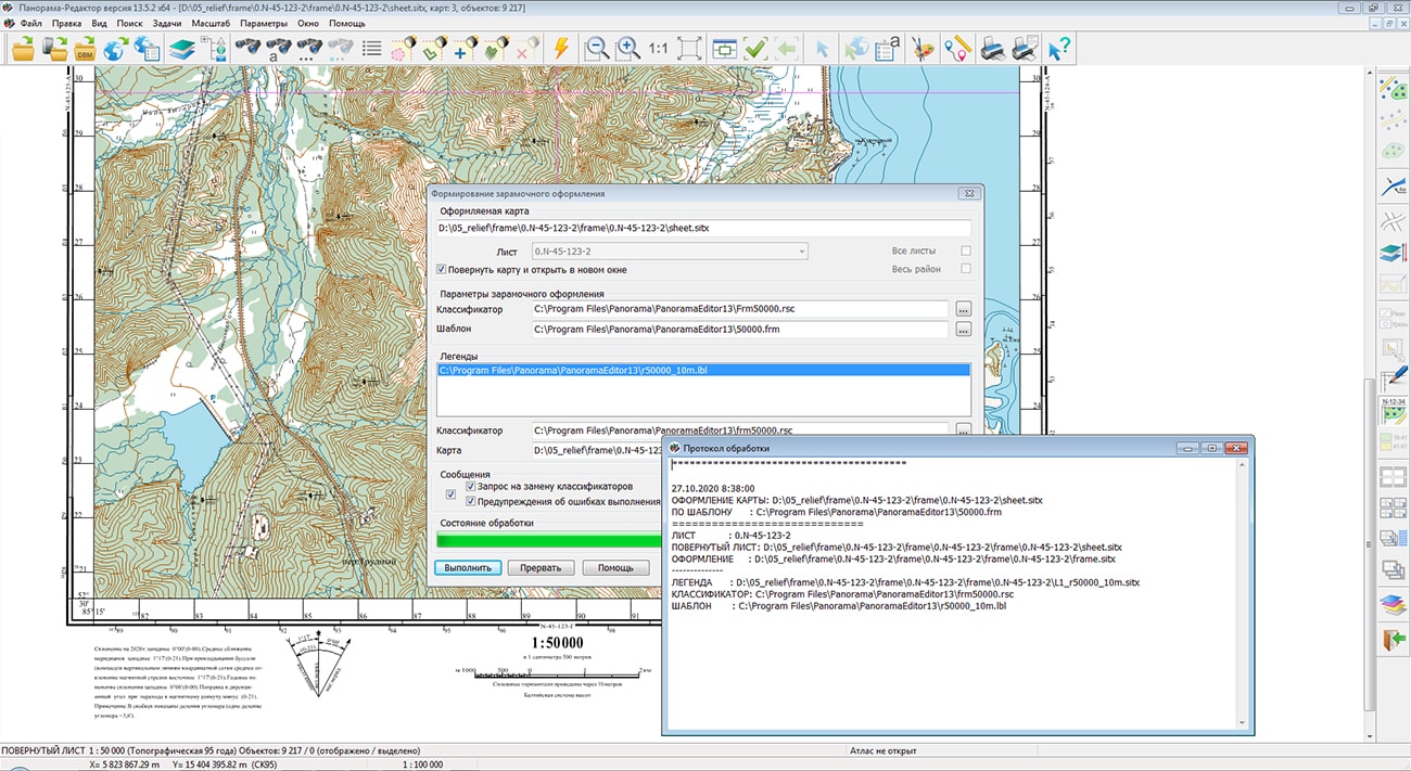
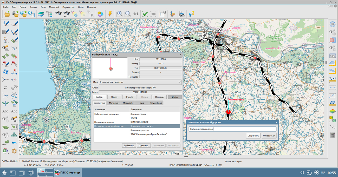
In KB "Panorama" the professional vectorizer version 13.5.2 has been developed. In the new version for the task "Formation of outborder decoration", the classifiers and templates of out-of-frame bordering have been improved. Topographic fonts have been added to the frm10000.rsc classifier. For scales 1: 200,000, 1: 500,000, 1: 1,000,000, the following objects have been corrected in the classifiers: frame lines, labels of geographic coordinates, labels of squares numbers. In templates of out-of-frame bordering (frm files) for scales from 1:10 000 to 1: 1 000 000, object codes for elements of bordering have been corrected, distances between the map frame and other elements of bordering have been clarified. In files 500000.frm, 1000000.frm the element "Security classification" has been added.
In the task, the modes of intersection search have been improved. The mode "Crossing and touch" has been added which carries out searches for pairs of objects which are crossed or touched. The "Crossing" mode has been changed - it searches for pairs of objects that, when intersected, form the inner and outer parts relative to a closed contour.
In the "Undo operation" dialog of the task, the possibilities of filtering transaction log records have been expanded. When the option Operations with selected number is enabled, the window for entering the object number becomes available. The transaction tree is refilled with those records in which the specified object participated.
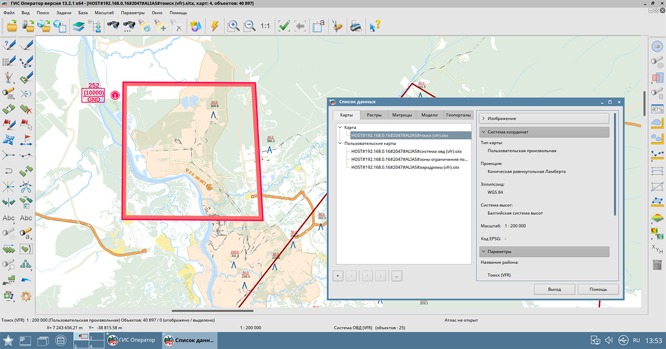
The task has been improved. On the "Map" bookmark the information line "Parameters" has been added in which the number of sheets and objects is indicated. On bookmarks "Rasters", "Matrixes" in parametres there is displayed the information on the permission of editing, copying and printing, a measurement unit of a matrix and other data.
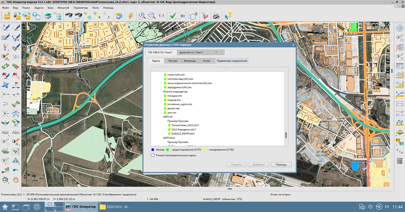
In the dialog the ability has been added to open a list of datasets selected with the mouse and the CTRL and SHIFT keys, or included into the selected nodes of any level. To work with large lists of open datasets, there is added a search for datasets in the tree by name when pressing CTRL+F.
The task of connecting geoportals for viewing information about objects at a given point of the image has been improved. If several layers from different geoportals are open, then the request is made to the current layer specified in the dialog. Information about objects is requested by the geodetic coordinates of a point, is transmitted and displayed in the form of an html page, the content of which depends on the selected geoportal. Support of geoportal via WFS protocol was improved. When forming a cartographic representation of layers, it is possible dynamically to create a classifier (RSC) according to the requested xsd-scheme, taking into account the composition of layers, objects and their attributes. In accordance with the list of layers selected by the operator, objects containing geometry and semantics (attributes) are put on the map. For the convenience of selecting layers, a search by name has been added in the dialog of connecting WFS geoportals.
In the tasks of importing files of waypoints, routes, tracks for OziExplorer and Magellan Explorist there is added a saving into the metric of the object of the fourth dimension - date and time. Data is read from the corresponding fields in the waypoint files and track log files. In the task a saving into the metric of object of the fourth dimension - date and time. When loading waypoints from the device to fill in the fourth dimension of the object stored on the map, the date and time of determining the coordinates are requested from the GPS\GLONASS receiver. When using the task in the "Almanac" mode (determining the coordinates of the location in real time), the system date and time of the computer are taken.
The task has been improved. The "Signature" mode has been added into the toolbar. The new mode allows you to create a signature on the raster image with the pen color of any font installed in the system.
Dialog "Appear license" has been improved, it is intended for customizing the type of license and parameters for connecting to the network license. In the lower left corner of dialog the button "?" has been added, which causes a window "License Information". This window contains information about the type of the current license, its number, and also the list of software products available for this license.
The new version of the program is available for download in the Download section.


The geoportal has been supplemented with a map of Slovak Republic, formed according to OpenStreetMap data. Source data obtained from website. To work with the map, you can use the program or other software products of KB "Panorama".
The map was led to the modernised classifier of large-scale plans of scale 1: 5 000 (map5000m.rsc). Publishing of updates in bank of spatial data is made by using the program of . Publishing contents of bank of spatial data on the geoportal and data access for downloading are implemented by means of .
Free maps on the basis of OpenStreetMap data are available for download on the page "Digital maps".


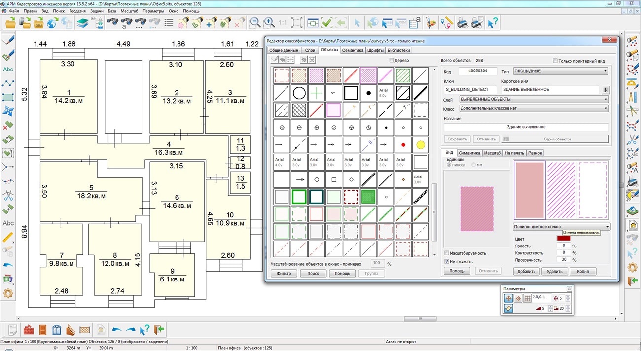
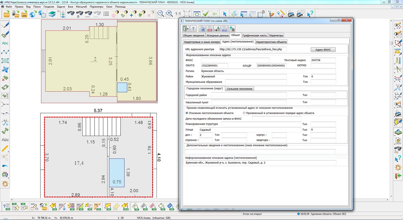
In KB "Panorama" the "Workstation of cadastral engineer" version 13.5.2 has been developed. The new version contains convenient tools for preparing a cadastral map within the boundaries of an object for performing complex cadastral works. It provides automated creation of an initial map based on data from the EGRN in the mode of stream loading of XML files of cadastral plans of territories and extracts about land plots and real estate.
Various input data are used for drawing and updating the location of the boundaries of land plots and real estate objects. The most popular methods of obtaining coordinates are the measurements by means of digital geodetic devices and a vectoring of borders according to the image of a large-scale orthophotomap. The program supports a loading of the images received by methods of shooting from unmanned aerial vehicles, including in the form of three-dimensional terrain models. Simultaneous synchronous display of a two-dimensional and three-dimensional map allows precisely to decode and describe metrically a contour of object of real estate or the borders of the ground area going along a fence. The use of three-dimensional models makes it possible to increase the efficiency of carrying out the complex cadastral works, the accuracy of measurements and reduce manhours for processing the obtained data.
The digital classifier of the cadastral map of complex cadastral works contains all the necessary conventional symbols for drawing land plots and real estate objects necessary for solving the problems specified in the new edition of 221-FZ "On cadastral activities", article 42.1. Objects of complex cadastral works. The software tools of "Workstation of cadastral engineer" are successfully used in the performance of various types of cadastral and land management works: land surveying; preparation of technical plans for real estate objects; creation of floor plans of buildings, constructions and premises; formation of documents for land management and forest management objects.
The new version of the program is available on the website in the Download section.


In KB "Panorama" the version 9.3.6 has been developed for OS Astra Linux SE (release "Smolensk") and CentOS. In the new version the possibility of transfering event log messages into the operating system has been implemented. Logging events in any service is one of the essential tools for a system administrator. With its help, he will be able to see the actions of users when working with maps and documents (connecting, creating, opening), as well as analyze configuration errors. The new version provides users with the ability to transfer the log into a service with support for the SysLog protocol. This allows you to use the full range of powerful software tools for storing and analyzing event logs.
Syslog is a full featured event logging system written by Eric Allman. It serves two important functions: it frees programmers from the tedious mechanical work of maintaining log files, and puts the management of the log files into the hands of administrators. Before the advent of the Syslog system, each program chose its own event logging scheme, and system administrators did not have the ability to control what information was stored and where exactly. Syslog is highly flexible. It allows to sort messages by sources and level of importance and to send them to various destinations: log files, user terminals, and even other computers. One of the most valuable features of this system is its ability to centralize the procedure of registration of events on the network.
GIS Server provides remote access to vector maps, remote sensing data, matrices, documents, spatial databases and pyramids of tiles in the formats GPKG, BIR, Mbtiles. GIS Server supports work with spatial databases under control of PostgreSQL and Oracle DBMS, which support the ability to access spatial data in accordance with the OGC 06-103r4 standard: "OpenGIS Implementation Standard for Geographic information - Simple feature access - Part 1: Common architecture".
New versions of programs are available for download in the section.


In KB "Panorama" the GIS Panorama Mini version 13.2.0 has been developed for OS Astra Linux SE (release "Smolensk") in Russian and English. The program is built on a multi-platform multi-threaded core for Linux, QNX, Android, MS Windows with support for Intel/AMD, Elbrus, ARM, PowerPC, SPARC, MIPS and others. To improve the reliability of the software, numerous automated functional tests have been developed, the code has been optimized using the analyzers of text and performance evaluation on a multi-core architecture. The program processes modern spatial data formats: data from geoportals, pyramids of tiles BIR, GPKG, multiscale packed maps MAPZ, MPTZ and others.
GIS Panorama Mini supports import of data from the most popular formats: vector maps SXF, TXF, DIR, SHP (Shapefile), DXF (AutoCAD), OGC GML (XML), KML (Google), DXF, S57 and others; the raster data (RSW, BMP, JPEG, PNG, GeoTIFF, TIFF); matrixes of heights and matrixes of qualities MTW, MTQ, GRD, SRTM, GeoTIFF; geological matrixes of layers, TIN-models and the data of laser scanning (a cloud of points in MTD format); navigation data GPX;aeronautical data ARINC-424.
The software allows to create new maps of MAP, SIT, SITX formats with automatic filling of parameters by EPSG code or from the list of parameters in XML format. A created or imported map can be modified by the user with the help of "Map Editor". The "Map Editor" task provides the following possibilities: creation of simple objects and objects with subobjects; creation of objects according to the type selected from the panel of breadboard models of created objects; creating, deleting and moving the points of the object contour; moving and rotating objects; drawing simple lines and polygons; input of texts of signatures and values of attributes in UNICODE. Search for objects on the map is carried out according to geometric and semantic characteristics.
GIS Panorama Mini allows you to combine vector, raster and matrix data in different projections. Thus, projection transformation will be executed on the fly. The multiuser access to the remote data with control of access by means of connection to the is supported.
Connections to popular geoportals are supported, which allow displaying user maps over images received from the sites OpenStreetMap (Map), Yandex (Sputnik), Yandex (Map), Rosreestr, Kosmosnimki, Monitoring of aircraft movement and others. The list of geoportals is constantly expanding and can be supplemented by system users. In addition, GIS Panorama Mini can be used to connect to arbitrary servers using the OGC WMS and OGC WFS protocols (for example, based on ).
The user can print open data to various output devices with customizable print parameters. Vector data can be exported into exchange formats SXF, TXF, DIR, SHP (Shapefile), OGC GML (XML) S57, ARINC-424 and others; raster data - into RSW, BMP, JPEG, PNG, TIFF formats.
The new version of the program is available for download in the section.


Ph.: +7 (495) 739-0245, +7 (925) 221-1603
www.gisinfo.ru | panorama@gisinfo.ru
105005, Russia, Moscow, Baumanskaya Street 7, building 1, office 229 (m. Baumanskaya)
Copyright © Panorama Group 1991 - 2024


 Mobile version
 Full version