Copyright © Panorama Group 1991 - 2024

The geoportal has been supplemented with a map of the Republic of Slovenia, formed according to OpenStreetMap data. Source data obtained from website. To work with the map, you can use the program or other software products of KB "Panorama".
The map was led to the modernised classifier of large-scale plans of scale 1: 5 000 (). Publishing of updates in bank of spatial data is made by using the program of . Publishing contents of bank of spatial data on the geoportal and data access for downloading are implemented by means of .
Free maps on the basis of OpenStreetMap data are available for download on the page .


In KB "Panorama" the version 13.5.1 has been released. For processing results of the measurements presented in a linear coordinate system, the new modes using the 4D-metric (X, Y, Н, M) of objects have been added. Tools of support of linear coordinate system are intended for execution of calculations along linear object - a route based on information about linear measurements. A linear measurement contains the value of distance measured along the route from its first point (the origin of the linear coordinate system) to the location you are looking for.
In the process of calculations there are performed the calculation by linear measurements of spatial coordinates (X, Y, H) and displaying the results of calculations on a map in the form of picket (a point sign) or a segment (a linear sign). Linear coordinate systems are widely used in the road and transport industry for describing the properties of an object and events along the route. For example, "Breakdown of a regular bus at 38 km of the M4 highway" or "A defect in the pipeline from 3458 to 3461 meters was found".
The measurement is stored in the M coordinate and contains the measured distance in meters from the first point to the desired one in the route. The M coordinate of the route must be formed before using the linear coordinate system. For its formation the "Route calibration" mode is intended. There are provided a simple calibration and calibration taking into account the division of the object by kilometer marks. For creating pickets on the map based on the results of linear measurements, the "Placing pickets along the route" mode is intended. The calculation of the coordinates of pickets is supported by measurements specified in the dialog or from a file of CSV format. The "Placing segments along a route" mode provides drawing on the map of linear objects - segments, limited by two pickets.
The new version of the program is available on the website in the .


In KB "Panorama" the version 7.5 for the 13 has been developed. In the new version the possibility of processing and storage of aviation messages from external sources has been added. This will allow users to create the necessary message bases for the benefit of the airlines. The complex implements the function of analysis and automatic processing of NOTAM messages, which allows you to form and analyze the base of restrictions in the airspace in a graphical form. The use of the NOTAM database allows the operator to create maps of time restrictions, activated zones and closed sections of routes for a certain region in a given period of time, which increases the efficiency of modeling the aeronautical situation. In the task "Flight procedures construction" the possibility has been added for forming the report of intermediate data of calculations of inverse schemes. The work of the AIXM import converter has been improved, the tools for processing several files in one session have been improved.
The complex of preparing documents of aeronautical information is intended for the creating and maintaining a database of aeronautical information, the formation of aeronautical maps, the designing of aircraft flight routes and the exchange of data with other information systems. Information exchange is carried out in the format of ARINC and AIXM 5.1. The main source of aeronautical information is the aeronautical data base created on the basis of the AICM (Aeronautical Information Conceptual Model), with additions for storing planned information and results of designing routes. The model is recommended by the "Eurocontrol" - international organization of planning and coordination of air traffic.
The new version of the program, examples of documents of aeronautical information, the operational documentation, video lessons and presentations are available for download on the .


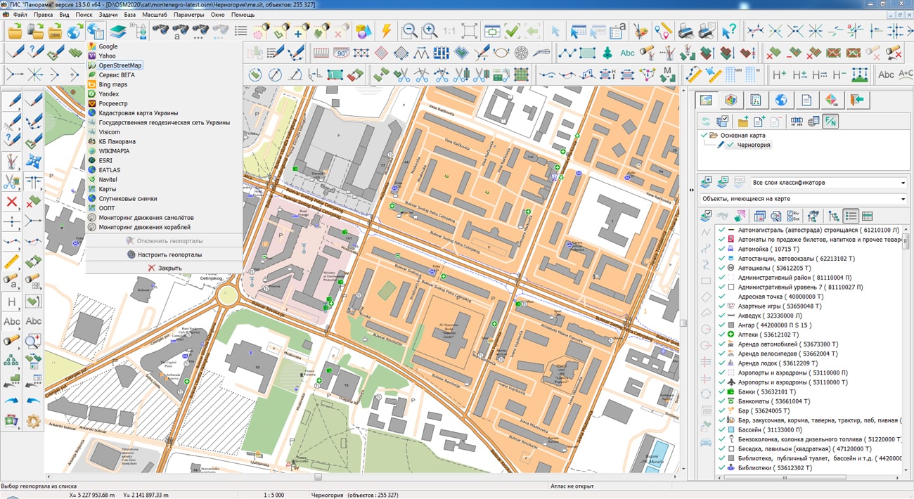
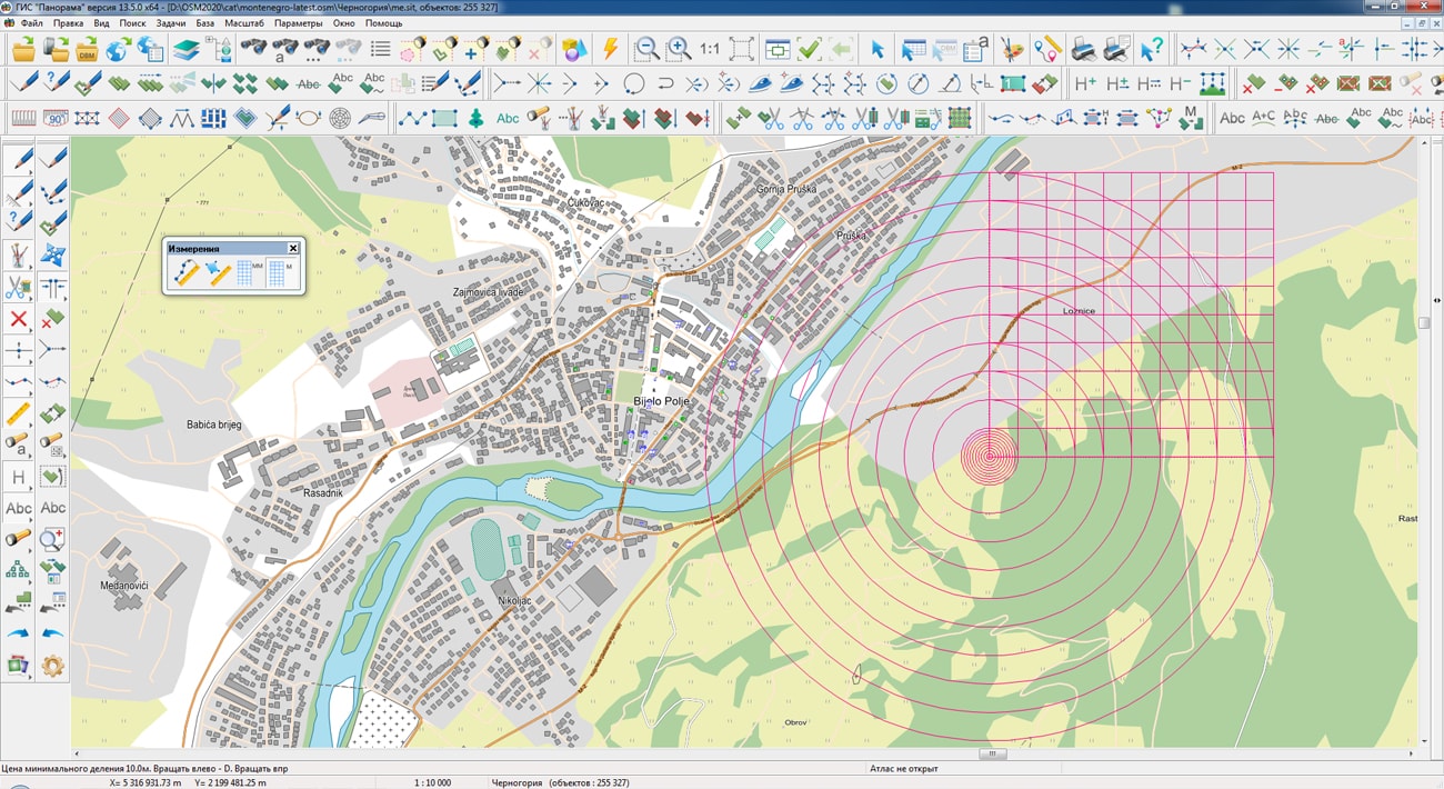
The geoportal has been supplemented with a map of Montenegro, formed according to OpenStreetMap data. Source data obtained from website. To work with the map, you can use the program or other software products of KB "Panorama".
The map was led to the modernised classifier of large-scale plans of scale 1: 5 000 (). Publishing of updates in bank of spatial data is made by using the program of Databank of digital maps and remote sensing data. Publishing contents of bank of spatial data on the geoportal and data access for downloading are implemented by means of .
Free maps on the basis of OpenStreetMap data are available for download on the page .


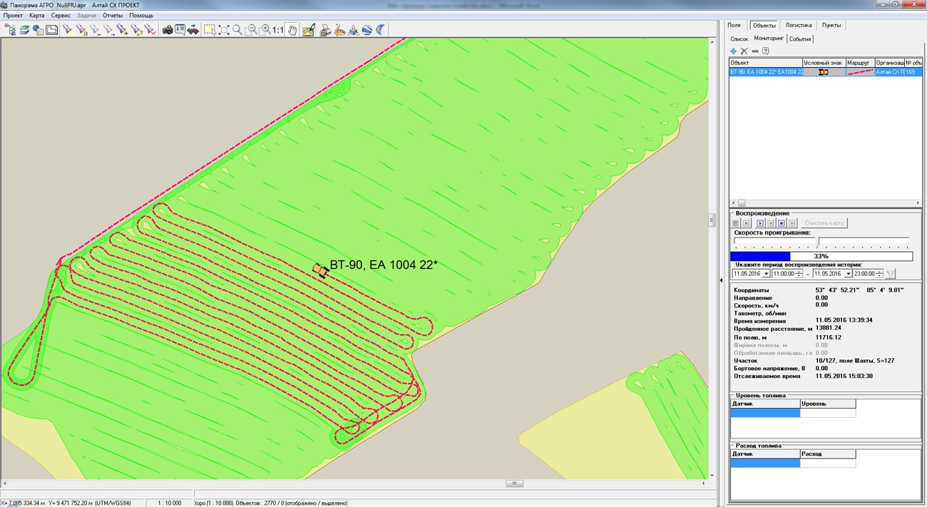
In KB "Panorama", software the Panorama AGRO Service version 3.2 has been developed. It is intended for retransmission of data of monitoring the vehicles from various telematic platforms into a single base of corporate geoinformation system of the agricultural enterprise. The new version has improved the reliability of data reception via the EGTS protocol (Era Glonass Telematics Standard, GOST R 54619-2011), which is supported by most of the new domestic systems of transport's monitoring. EGTS is included into the set of standards "Global Navigation Satellite System. Emergency Response System in Accidents" and is one of the basic standards of the complex.
Panorama AGRO Service allows you to receive and transmit data from systems the AutoGRAPH, ENDS, Stabliner, GLOSAV, Wialon, Gelix-2. The variety of supported telematics platforms allows receiving navigation information from hundreds of different types of trackers.
The data received with the help of the repeater is processed in the . On their basis, the calculation of the processed area, the traveled distance, the consumed fuel is made. According to telemetry data, the location of vehicles is displayed against the background of a map in real time and in history mode, as well as related events are calculated: parking in the wrong place, operation of sensors, position relative to the route, and others.
The new version of the program is available for download on the .


Ph.: +7 (495) 739-0245, +7 (925) 221-1603
www.gisinfo.ru | panorama@gisinfo.ru
105005, Russia, Moscow, Baumanskaya Street 7, building 1, office 229 (m. Baumanskaya)
Copyright © Panorama Group 1991 - 2024


 Mobile version
 Full version