Copyright © Panorama Group 1991 - 2024

The geoportal has been supplemented with a map of the Kingdom of Belgium, formed according to OpenStreetMap data. Source data obtained from website. To work with the map, you can use the program or other software products of KB "Panorama".
The map was led to the modernised classifier of large-scale plans of scale 1: 5 000 (map5000m.rsc). Publishing of updates in bank of spatial data is made by using the program of . Publishing contents of bank of spatial data on the geoportal and data access for downloading are implemented by means of .
Free maps on the basis of OpenStreetMap data are available for download on the page "Digital maps".


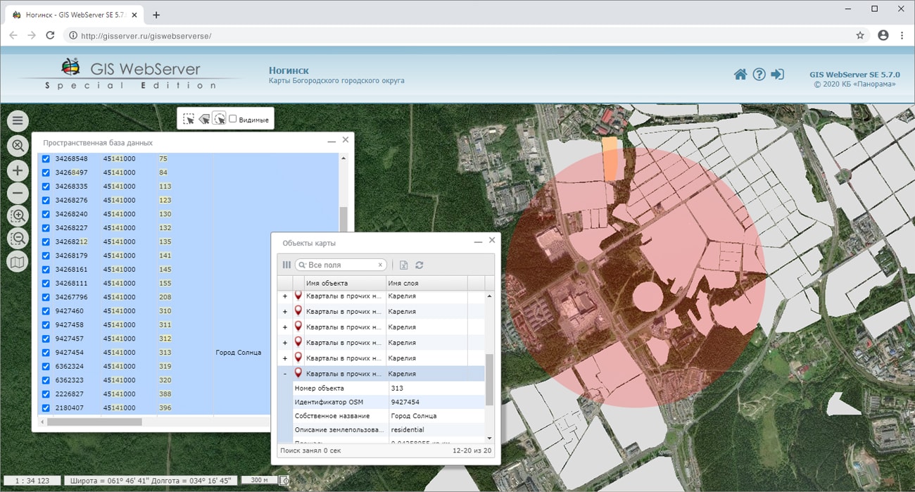
In KB "Panorama" the version 5.7.0 has been developed for the Astra Linux, Windows, CentOS operating systems. In the new version the "Spatial database" component has been added. The component displays in the table the information about map objects, the cartographic representation of which is created from the spatial database. It is possible to carry out search of map objects, choosing records in the table; to carry out automatic search of the table's records when searching for objects in a map; to filter the table with simultaneous search of objects in a map. Spatial data for working with the database are published on the service, obtaining information from the database is performed through requests to the service. The connection with the spatial database is carried out by the GIS WebService SE service. In the administration module, the user interface settings have been extended. You can display a welcome message to the client, customize the content of information about objects, the way to highlight objects in the map.
In the new version, the Web application development toolkit is enhanced, which extends the capabilities of GIS WebServer SE and can be integrated into other information systems. Access to data (images, vector maps, and terrain information) is provided by Web services using generally accepted OGC protocols and ISO standards. The GIS WebService SE service (OGC WMS/WMTS) provides spatial information in the form of graphic images. As a digital elevation model, various types of elevation data are used: matrixes (in SRTM, GeoTIFF, IMG, MTW formats), TIN-models, point cloud and others. The service provides the ability to publish three-dimensional terrain models unloaded in DB3D format. These models can be obtained from files of the COLLADA type, as well as from photorealistic three-dimensional models of unlimited size (TLS, OC3).
As a source of spatial data, the can be used. It provides the collection, storage, search and delivery of spatial data in exchange formats, displaying the state of the data bank in the form of maps-schemes, and the automated formation and updating of geo-covers.
GIS WebServer SE is used in the construction of closed corporate systems to ensure the protection of data having a security classification or a trade secret. GIS WebServer SE is certified for Level 2 of absence of undeclared capabilities. The new version of the program expands the application's capabilities in solving problems of analysis, management and long-term planning of the territories development. GIS WebServer SE is implemented using the toolkit of GIS WebToolKit SE, which can be used in development tools that use the JavaScript.
The new version of the program and the documentation are available on the website in the section.


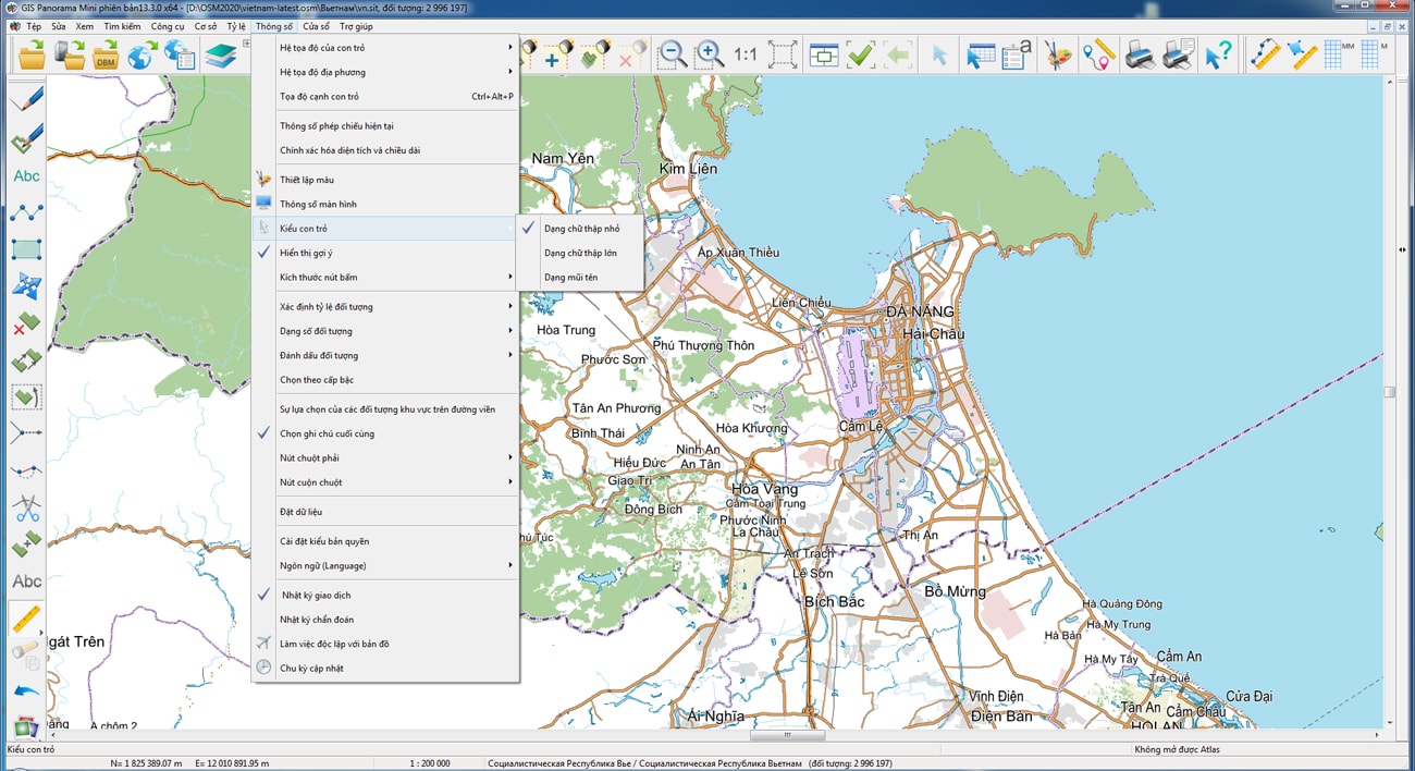
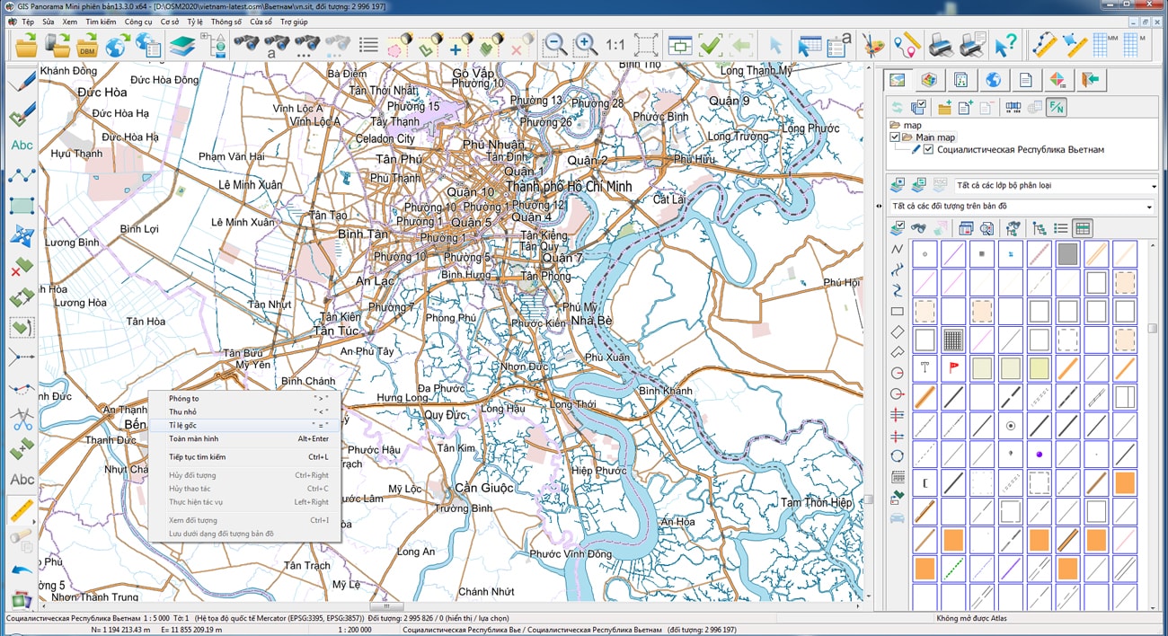
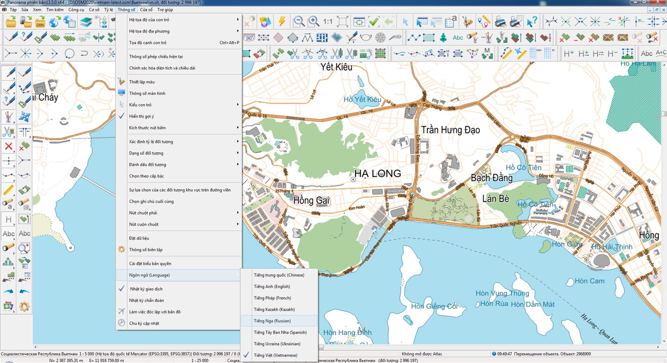
The geoportal has been supplemented with a map of the Socialist Republic of Vietnam, formed according to OpenStreetMap data. Source data obtained from website. To work with the map, you can use the GIS Panorama Mini program or other software products of KB "Panorama".
The map was led to the modernised classifier of large-scale plans of scale 1: 5 000 (map5000m.rsc). Publishing of updates in bank of spatial data is made by using the program of . Publishing contents of bank of spatial data on the geoportal and data access for downloading are implemented by means of .
Free maps on the basis of OpenStreetMap data are available for download on the page "Digital maps".


In KB "Panorama" the training materials have been prepared for developers of web-components in the environment. Development tools the GIS WebToolKit SE and SDK are used for creation of client-server web applications. In the documentation "GIS WebServiсe SE the system programmer's guide" in the chapter "Development and connection of libraries for executing extended REST requests" the order of creation and use of web-component is described.
Web-components can be of two types. The first type processes data on the client without accessing external services. For example, calculation of the area and length of object by its coordinates in the GeoJSON format, received on WFS-request from another component. Such component is implemented as JavaScript on the client. Another type of component requires interaction with a web service to process large amounts of spatial data located on the server and available for reading and updating by many users simultaneously.
For example, the server hosts matrix and vector geo-covers with relief over large areas. It is necessary to determine the height of a point by its coordinates on the ground. GIS WebService SE can use the functions of the MAPAPI interface, which provide automatic analysis of data available at a given point, selection of a source with the highest accuracy to determine the height at a point, performing geodetic calculations and interpolation of values by the surrounding objects. To take advantage of these tools, a new REST request is added into the web service on the basis of a set of SDK libraries written in C ++. SDK GIS WebServiсe SE automates analysis of request parametres, loads library and a method for its processing, provides access to the spatial layers published on service, and forms the service response (xml, json and others). On the web client side in JavaScript, input of request parametres and displaying the result are implemented.
The updated documentation uses examples to show how to add a new request to the GIS WebService SE and call it from the side. The examples are implemented using the GIS WebToolKit SE JavaScript client scripts library and run in a web browser.
In the first example, a button is added into the control panel to invoke the panel "Get Geo-Coverage value at a point". When you select a point on the map, the height value of the specified point is displayed in the table. Data exchange is performed via the GetCoveragePoint REST request added into the GIS WebService SE. The request is processed by a custom library written in C ++ and connected to the service.
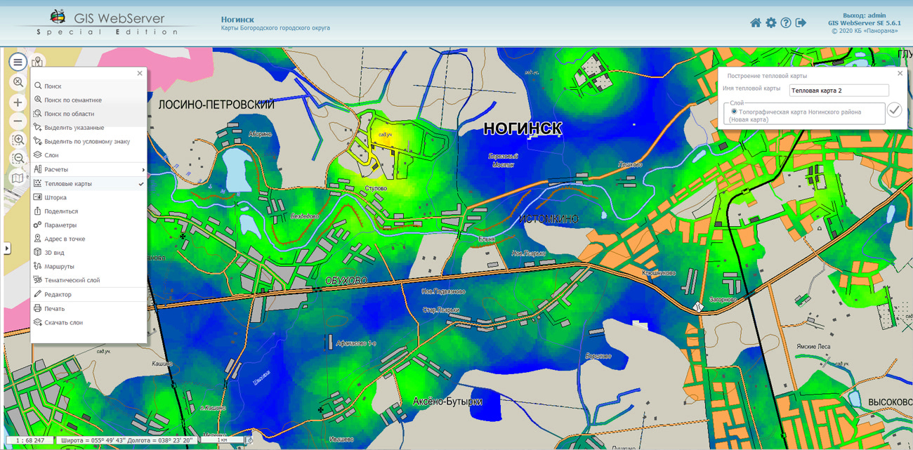
In the second example, a button is added to the control panel to invoke the panel "Building a heat map". On the panel the parameters of for building a heat map are set. Clicking on the "Build" button will display the heat map as a separate layer. Building a heat map is performed on the server using the BuildHeatMap REST request. The lifetime of the layer is determined by the request parameters or the service settings.
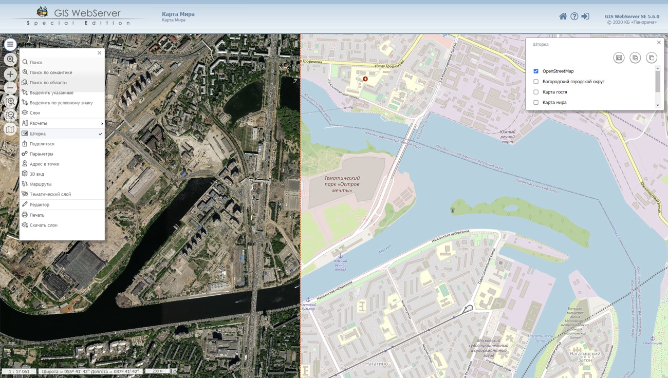
GIS WebService SE supports all international standards (OGC WFS, WFS-T, WMS, WMTS, WCS), which are used to transfer and display spatial data. The program implements the ability to issue tiles in a user or standard coordinate system. The application is implemented on Windows and Linux platforms and is compatible with Apache, IIS and nginx web servers.
Training materials are available on the website in the Documentation section.


The geoportal has been supplemented with a map of the Republic of Austria, formed according to OpenStreetMap data. Source data obtained from website. To work with the map, you can use the GIS Panorama Mini program or other software products of KB "Panorama".
The map was led to the modernised classifier of large-scale plans of scale 1: 5 000 (map5000m.rsc). Publishing of updates in bank of spatial data is made by using the program of Databank of digital maps and remote sensing data. Publishing contents of bank of spatial data on the geoportal and data access for downloading are implemented by means of GIS WebServer SE.
Free maps on the basis of OpenStreetMap data are available for download on the page "Digital maps".


Ph.: +7 (495) 739-0245, +7 (925) 221-1603
www.gisinfo.ru | panorama@gisinfo.ru
105005, Russia, Moscow, Baumanskaya Street 7, building 1, office 229 (m. Baumanskaya)
Copyright © Panorama Group 1991 - 2024


 Mobile version
 Full version