Copyright © Panorama Group 1991 - 2024

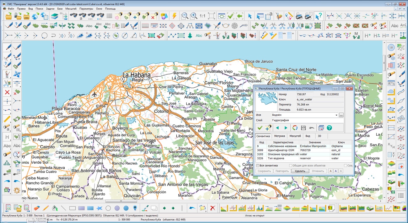
On the geoportal , the map of the Republic of Cuba, formed according to OpenStreetMap data, has been updated. Source data were obtained from website. For work with a map it is possible to use the program or other software products of KB "Panorama".
The map was led to the modernised classifier of large-scale plans of scale 1: 5 000 (map5000m.rsc). Publishing of updates in bank of spatial data is made by using the program of . Publishing contents of bank of spatial data on the geoportal and data access for downloading are implemented by means of .
Free maps on the basis of OpenStreetMap data are available for download on the page "Digital maps and images".


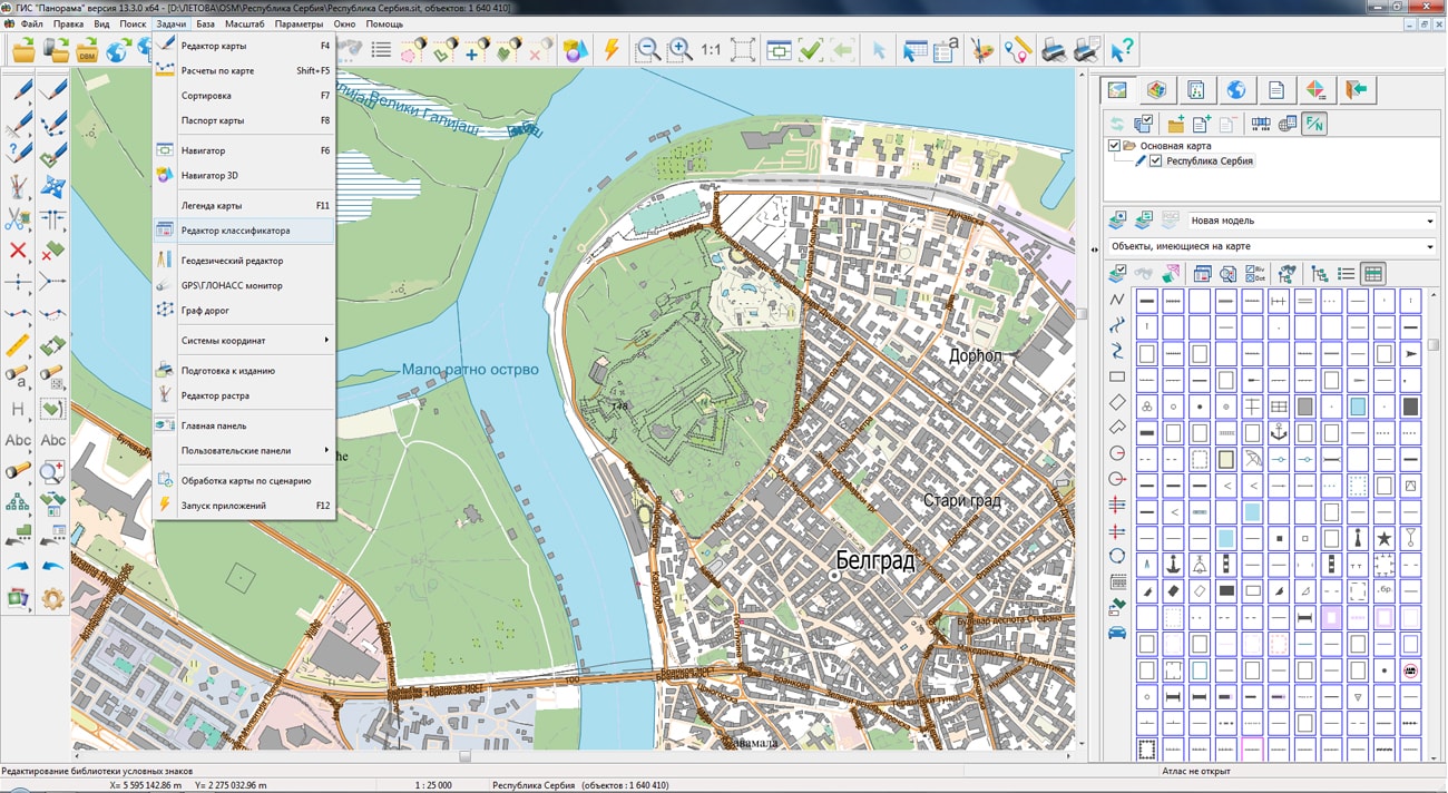
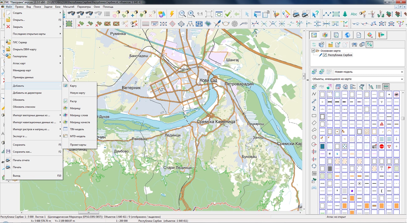
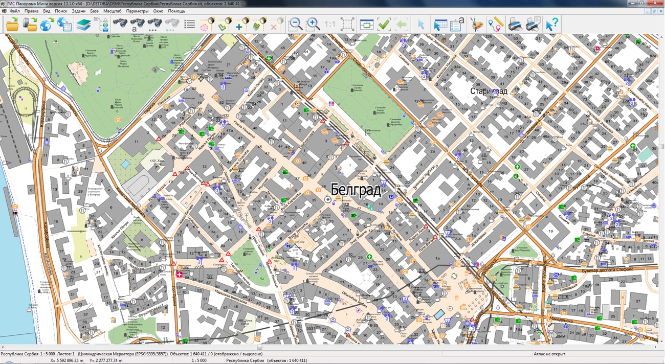
On the geoportal , the map of Republic of Serbia, formed according to OpenStreetMap data, has been updated. Source data were obtained from website. For work with a map it is possible to use the program or other software products of KB "Panorama".
The map was led to the modernised classifier of large-scale plans of scale 1: 5 000 (map5000m.rsc). Publishing of updates in bank of spatial data is made by using the program of . Publishing contents of bank of spatial data on the geoportal and data access for downloading are implemented by means of .
Free maps on the basis of OpenStreetMap data are available for download on the page "Digital maps and images".


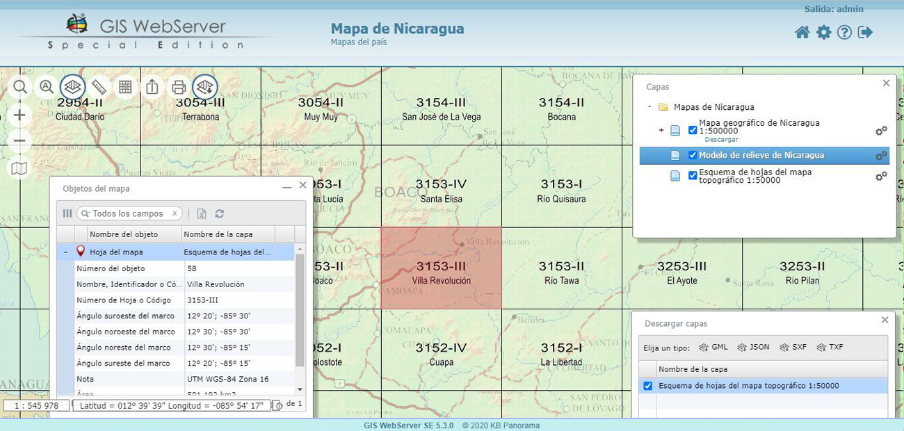
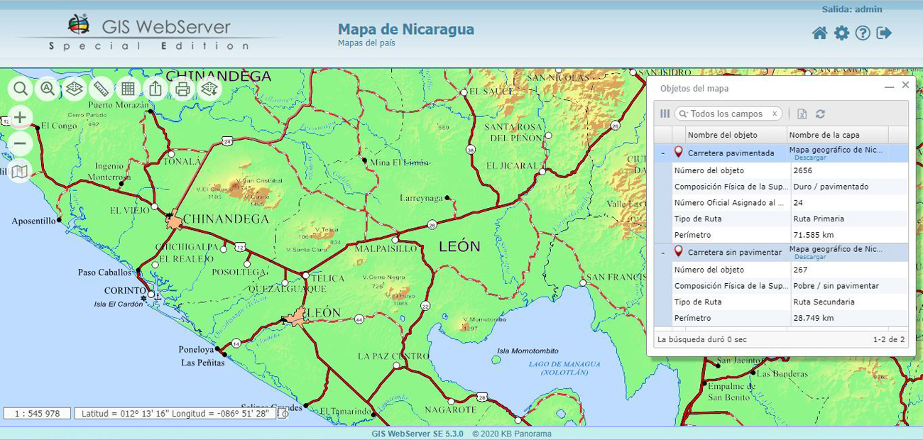
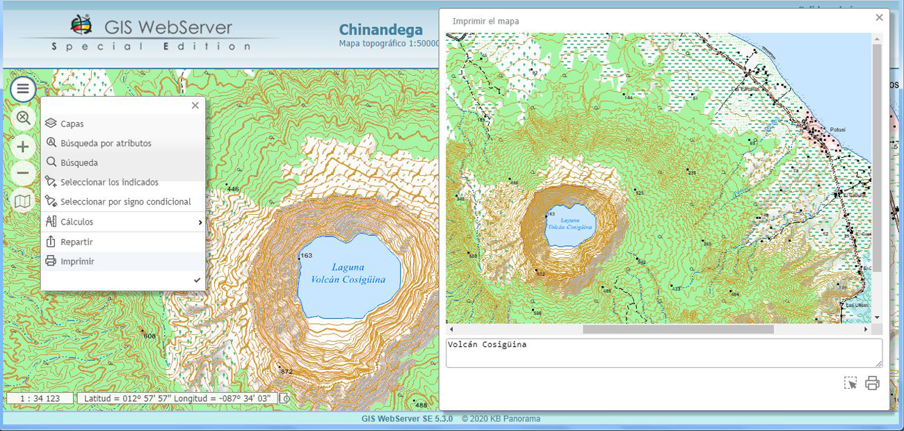
In KB "Panorama" the geoportal in Spanish onto territory of Nicaragua has been developed. The geoportal includes two projects, the first of which displays a general map of Nicaragua and a relief model. Users can view the map in different scales, select any object on the map and see its attributes, search for objects by geographical names, measure the lengths and areas. In this project, you can see a scheme of sheet division of the territory of Nicaragua by sheets of topographic maps of a scale of 1: 50 000, familiarize yourself with the parameters of each sheet, or download the entire scheme in GML, JSON, SXF or TXF format. Users can print any selected fragment of the map or generate a link to quickly return later to the part of the map interesting for them.
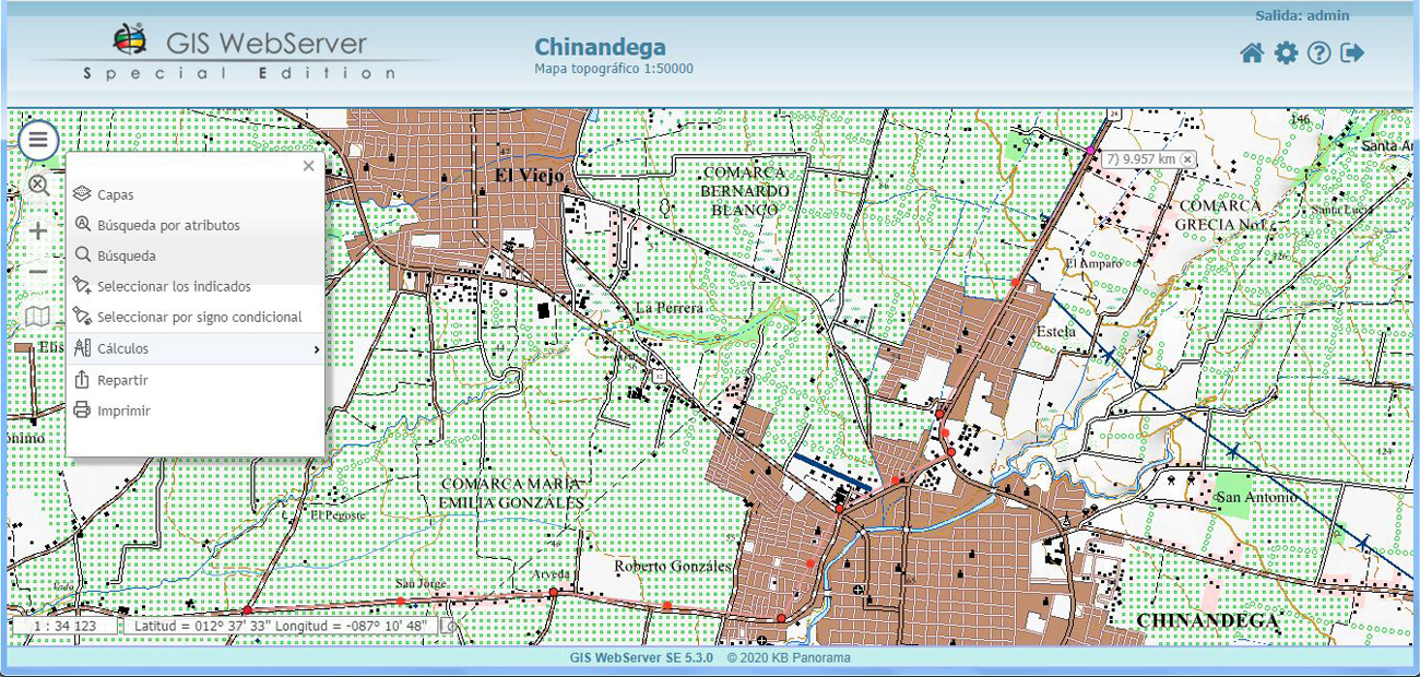
The second project "Chinandega" demonstrates the possibilities of the for the preparation of topographic maps, adapted to national standards. In this project the topographic map of scale of 1: 50 000 for the western part of the Chinandega department is available. Users can view the map using browsers or can work with it in desktop applications (GIS "Panorama", ), saving it locally. The map is also available for viewing via the web in any GIS that supports WMS, WFS and WCS technologies.
The geoportal is implemented on the basis of software products the , and , adapted for Spanish-speaking users. Preparation of maps and relief models was carried out by specialists of KB "Panorama" using the multilingual version of the GIS "Panorama".
The geoportal is available for familiarization at address the mapas.gisinfo.net.


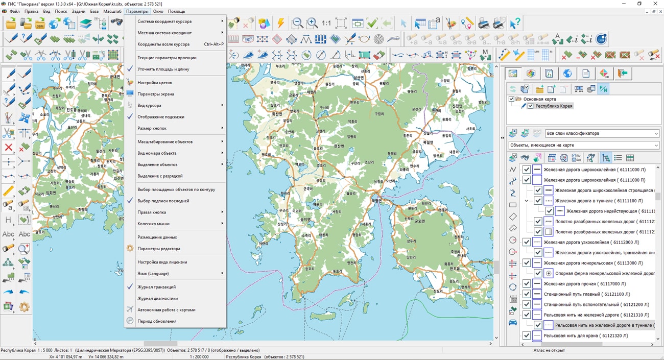
On the geoportal , the map of the Republic of Korea, formed according to OpenStreetMap data, has been updated. Source data were obtained from website. For work with a map it is possible to use the program or other software products of KB "Panorama".
The map was led to the modernised classifier of large-scale plans of scale 1: 5 000 (map5000m.rsc). Publishing of updates in bank of spatial data is made by using the program of . Publishing contents of bank of spatial data on the geoportal and data access for downloading are implemented by means of .
Free maps on the basis of OpenStreetMap data are available for download on the page "Digital maps and images".


In KB "Panorama" the version 5.6 has been developed for operating systems Astra Linux, Windows, CentOS. In the new version, "3D map" was supplemented with the "Dynamic scenario" mode. Scenario allows you to simulate the movement of active models of objects along planned routes with a preset speed. You can pause and resume movement, change the speed of the models. Demo example is posted on the site. On a three-dimensional map of Noginsk, various transport models move along the specified trajectories. Creation of scenarios of mobile objects is carried out in the . The spatial data for work of scenario is published on service the . The possibilities of measurements in the "3D map" are expanded, there is added a calculating the area of an arbitrary figure built by the points of a three-dimensional model. The perimeter, area and internal angle of the measurement object are calculated. The vertices of the figure are marked on the map and can be moved or removed by the user. When constructing a flat object, the slope to the earth's surface is additionally calculated. The plugin "Diagram" has been added which carries out building the circular diagrams by semantics of map objects at creation of thematic layers.
In the new version, the GIS WebToolKit SE Web application development toolkit is enhanced, which extends the capabilities of GIS WebServer SE and can be integrated into other information systems. Access to data (images, vector maps, and terrain information) is provided by Web services using generally accepted OGC protocols and ISO standards. The GIS WebService SE service (OGC WMS/WMTS) provides spatial information in the form of graphic images. As a digital elevation model, various types of elevation data are used: matrixes (in SRTM, GeoTIFF, IMG, MTW formats), TIN-models, point cloud and others. The service provides the ability to publish three-dimensional terrain models unloaded in DB3D format. These models can be obtained from files of the COLLADA type, as well as from photorealistic three-dimensional models of unlimited size (TLS, OC3).
As a source of spatial data, the can be used. It provides the collection, storage, search and delivery of spatial data in exchange formats, displaying the state of the data bank in the form of maps-schemes, and the automated formation and updating of geo-covers.
GIS WebServer SE is used in the construction of closed corporate systems to ensure the protection of data having a security classification or a trade secret. GIS WebServer SE is certified for Level 2 of absence of undeclared capabilities. The new version of the program expands the application's capabilities in solving problems of analysis, management and long-term planning of the territories development. GIS WebServer SE is implemented using the toolkit of GIS WebToolKit SE, which can be used in development tools that use the JavaScript.
The new version of the program is available on the website in the section.


Ph.: +7 (495) 739-0245, +7 (925) 221-1603
www.gisinfo.ru | panorama@gisinfo.ru
105005, Russia, Moscow, Baumanskaya Street 7, building 1, office 229 (m. Baumanskaya)
Copyright © Panorama Group 1991 - 2024


 Mobile version
 Full version