Copyright © Panorama Group 1991 - 2024

) and KB "Panorama" entered into the agreement on cooperation in sphere of creating the Russian information technologies and software products.
KB "Panorama" is a leading Russian company in the area of developing the geographic information technologies. More than 20 countries of the world use the geoinformation technologies of the company to solve the problems of the national economy and defense. Over 76 000 users in federal departments, regional and local government bodies, large companies use the KB Panorama software: , , , , and others. More than 110 educational institutions use geoinformation solutions of KB "Panorama" for the training of specialists.
JSC "IVK" manufactures and supplies a wide range of advanced computer equipment based on processors Elbrus, AWP 1892VM14YA, Baikal and others, Alt 8 SP operating system, provides services for the development and implementation of software products. The company's quality management system complies with ISO 9001 standards. JSC "IVK" has an extensive network of service centers in 81 constituent entities of the Russian Federation.


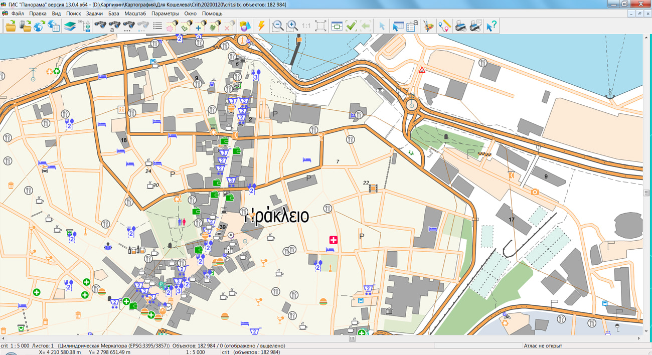
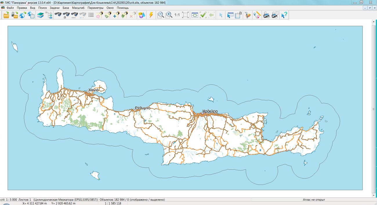
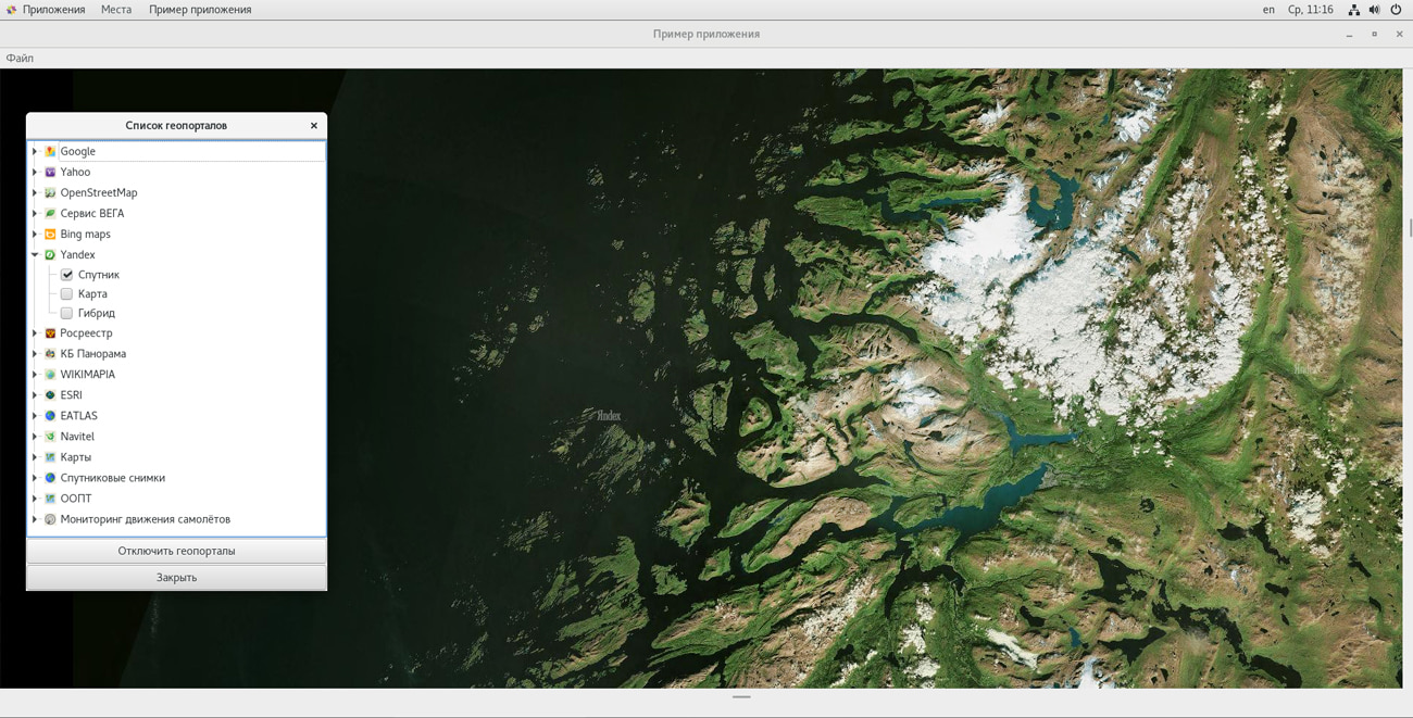
On the geoportal , the map of the island Crete, formed according to OpenStreetMap data, was updated.
The source data was obtained from the website. For work with the map it is possible to use the program of or other software products of KB "Panorama".
The map was led to the modernised classifier of large-scale plans of scale 1: 5 000 (map5000m.rsc). Publishing of updates in bank of spatial data is made by using the program of . Publishing contents of bank of spatial data on the geoportal and data access for downloading are implemented by means of .
Free maps on the basis of OpenStreetMap data are available for download on the page "Digital maps and images".


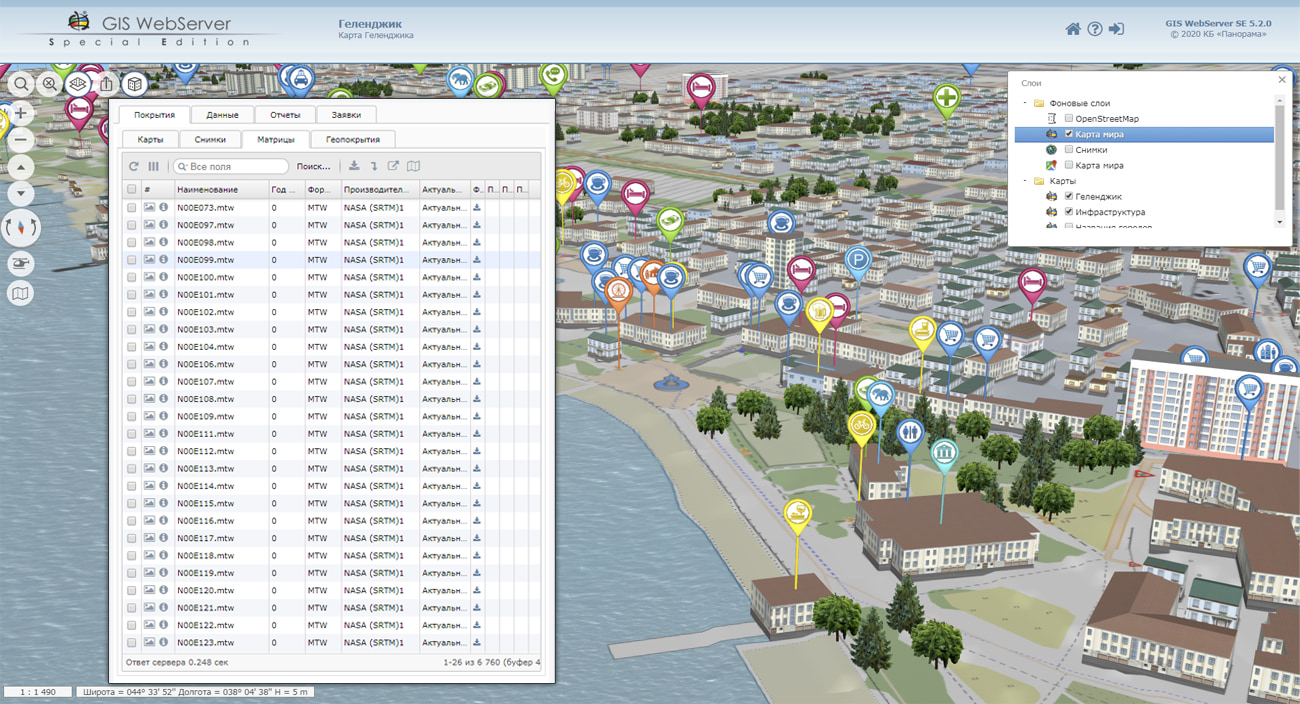
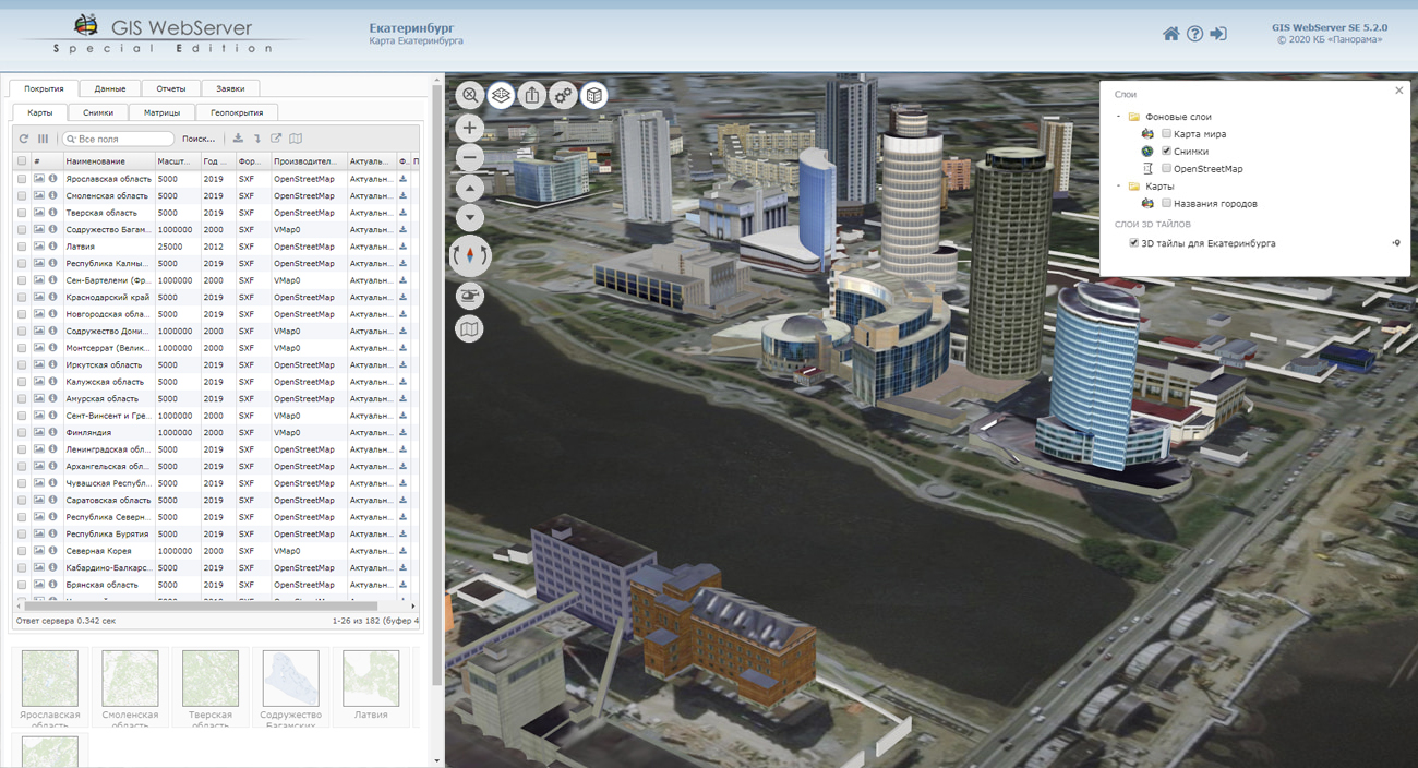
In KB "Panorama" the examples of using the tools of in web projects are developed. Examples demonstrate the possibility of using GIS technologies in finished and developing projects. Spatial data can easily be added onto any page of the site and interaction between the web application and the GIS is organized. The examples demonstrate the display of terrain maps, remote sensing data, aerial and satellite imagery materials, matrixes of heights and other spatial data on the site pages, in a separate browser window and in a frame.
Methods of organizing interaction between applications, methods of establishing link between objects are shown. The updated documentation describes an example of working with a database, which allows you to display tables, establish a logical link between database objects and map objects, search for objects by table records and vice versa, using the mechanism of linked records.
The GIS WebToolKit SE tools allows you to create web applications that display cartographic information about the area, get information about the characteristics of map objects, create new ones and edit existing objects. Provides access to the infrastructure of spatial data (vector, raster, matrix maps, remote sensing data), performing of special calculations. It can be used on Linux-based systems.
GIS WebToolKit SE supports spatial data exchange protocols by standards of Open Geospatial Consortium (OGC): Web Map Tile Service (OGC WMTS), Web Map Service (OGC WMS), Web Feature Service (OGC WFS), Web Coverage Service (OGC WCS) and additional requests for execution of special calculations. service is used as a source of geospatial data. It provides obtaining a graphical image of the map, the geometry of objects and various help information about the map objects, an obtaining the spatial information about the terrain, performing calculations and measurements on the map.


In KB "Panorama" the GIS Constructor for Qt Designer SE version 13 was developed for the CentOS 7 operating system. The new version improves the reliability of working the multithreaded GIS applications that process spatial data hosted on the . GIS application in the background mode monitors the status of virtual channels and, if necessary, reconnects. GIS Constructor implements support for a single geographic information space managed by servers of spatial data (GIS Server) and application servers (). Due to the ability to connect to the GIS Server, users of GIS applications can directly connect to geospatial data bases, view and edit tables in the form of maps in specified conventional symbols. Support for interaction with the GIS WebServiсe SE allows you to access spatial data according to international standards OGC WMS, WMTS.
CentOS (Community ENTerprise Operating System) is the popular distribution kit Linux based on commercial Red Hat Enterprise Linux and compatible with it. The distribution kit consists of the free software with the open code. The source codes for the operating system is provided under the GPL licence. The operating system is reliable and flexible in configuration, supported by a large community of developers, thanks to which it is constantly being developed and updated.
GIS Constructor is a set of geoinformation components for use in the visual programming environment of Qt Designer, which allows you to develop your own GIS applications. The visualization of the contents of digital maps is made in conventional symbols adopted for topographic, geographical and various special maps. Geoinformation system has ample opportunities for performing calculations, for providing display of spatial data on various graphic devices in standard and user systems of conventional symbols. The main functions can be executed in multithreaded mode. It supports automatic optimization of used memory for processing large amounts of data (tens of gigabytes) on limited resources (hundreds of megabytes).
The toolkit is adapted to work on a wide range of platforms and supports operating systems such as Astra Linux SE, MSVS, CRTOS "Neutrino", "Elbrus", "Zarya", Ubuntu, Alt Linux, QNX, CentOS and others. It can be used in computer complexes with processors of architectures ARMv7, Elbrus, PowerPC, Intel x86, Intel x64 and others.
The new version of the program is available for download in the section.


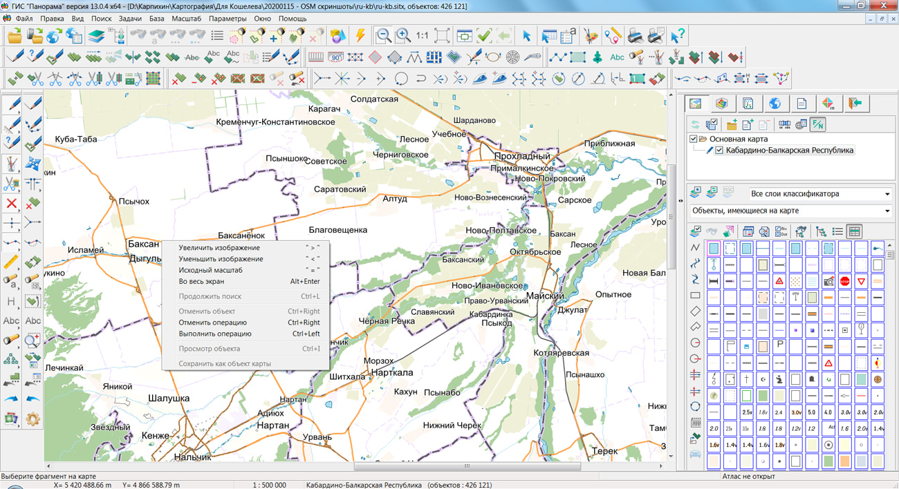
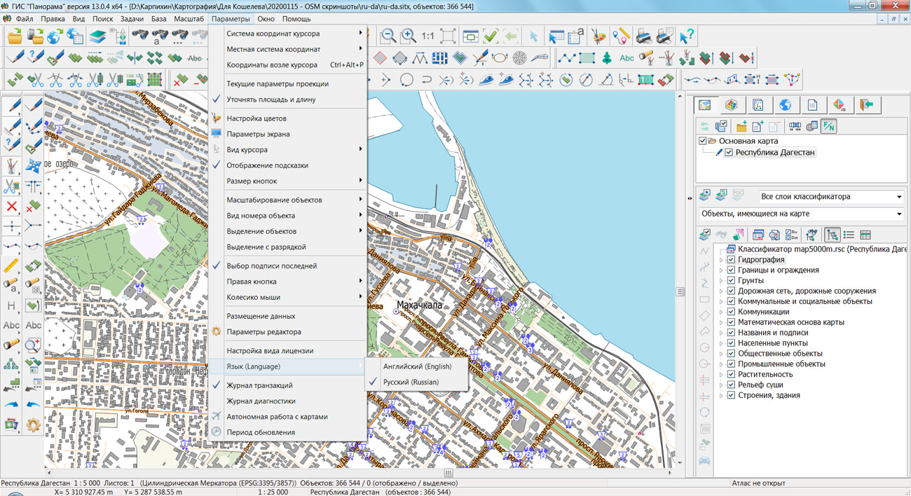
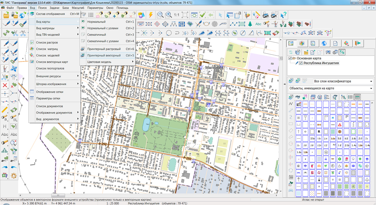
On the geoportal , the maps of regions of the North Caucasian Federal District, which were formed according to OpenStreetMap data, were updated. The composition of the maps includes the Republic of Dagestan, the Republic of Ingushetia, the Kabardino-Balkar Republic, the Karachay-Cherkess Republic, the Republic of North Ossetia-Alania, the Chechen Republic and the Stavropol Krai. The source data was obtained from the website. For work with the maps it is possible to use the program of or other software products of KB "Panorama".
The maps were led to the modernised classifier of large-scale plans of scale 1: 5 000 (map5000m.rsc). Publishing of updates in bank of spatial data is made by using the program of . Publishing contents of bank of spatial data on the geoportal and data access for downloading are implemented by means of .
Free maps on the basis of OpenStreetMap data are available for download on the page "Digital maps and images".


Ph.: +7 (495) 739-0245, +7 (925) 221-1603
www.gisinfo.ru | panorama@gisinfo.ru
105005, Russia, Moscow, Baumanskaya Street 7, building 1, office 229 (m. Baumanskaya)
Copyright © Panorama Group 1991 - 2024


 Mobile version
 Full version