Copyright © Panorama Group 1991 - 2024

In KB "Panorama" the GIS Constructor for Qt Designer SE version 13 was developed for the CentOS 7 operating system. The new version improves the reliability of working the multithreaded GIS applications that process spatial data hosted on the . GIS application in the background mode monitors the status of virtual channels and, if necessary, reconnects. GIS Constructor implements support for a single geographic information space managed by servers of spatial data (GIS Server) and application servers (). Due to the ability to connect to the GIS Server, users of GIS applications can directly connect to geospatial data bases, view and edit tables in the form of maps in specified conventional symbols. Support for interaction with the GIS WebServiсe SE allows you to access spatial data according to international standards OGC WMS, WMTS.
CentOS (Community ENTerprise Operating System) is the popular distribution kit Linux based on commercial Red Hat Enterprise Linux and compatible with it. The distribution kit consists of the free software with the open code. The source codes for the operating system is provided under the GPL licence. The operating system is reliable and flexible in configuration, supported by a large community of developers, thanks to which it is constantly being developed and updated.
GIS Constructor is a set of geoinformation components for use in the visual programming environment of Qt Designer, which allows you to develop your own GIS applications. The visualization of the contents of digital maps is made in conventional symbols adopted for topographic, geographical and various special maps. Geoinformation system has ample opportunities for performing calculations, for providing display of spatial data on various graphic devices in standard and user systems of conventional symbols. The main functions can be executed in multithreaded mode. It supports automatic optimization of used memory for processing large amounts of data (tens of gigabytes) on limited resources (hundreds of megabytes).
The toolkit is adapted to work on a wide range of platforms and supports operating systems such as Astra Linux SE, MSVS, CRTOS "Neutrino", "Elbrus", "Zarya", Ubuntu, Alt Linux, QNX, CentOS and others. It can be used in computer complexes with processors of architectures ARMv7, Elbrus, PowerPC, Intel x86, Intel x64 and others.
The new version of the program is available for download in the section.


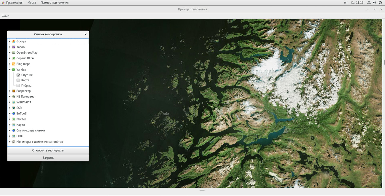

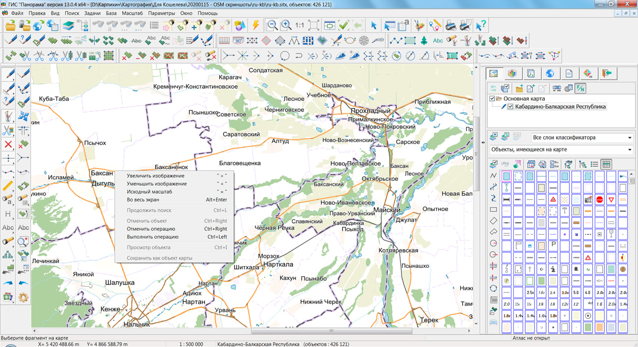
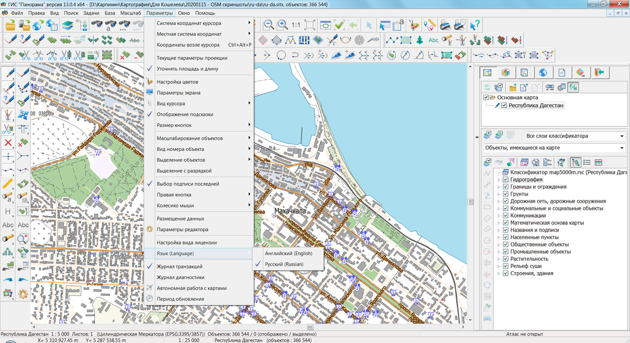
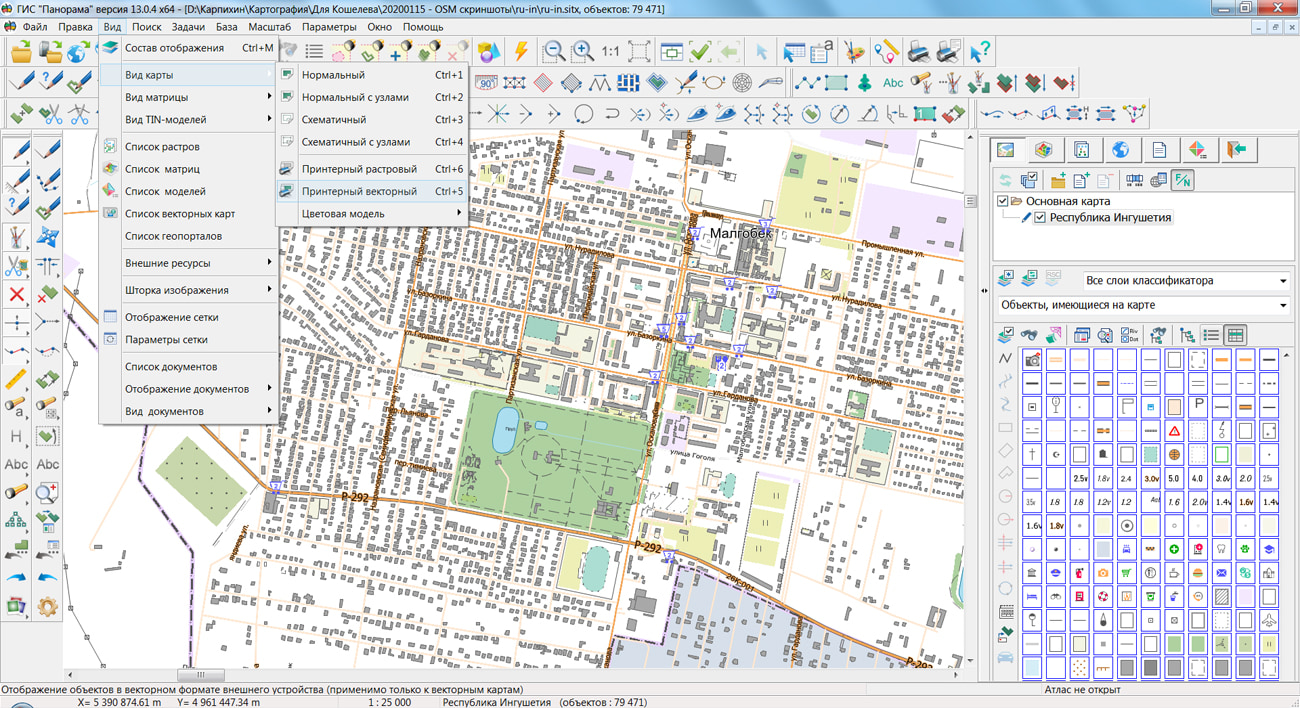
On the geoportal , the maps of regions of the North Caucasian Federal District, which were formed according to OpenStreetMap data, were updated. The composition of the maps includes the Republic of Dagestan, the Republic of Ingushetia, the Kabardino-Balkar Republic, the Karachay-Cherkess Republic, the Republic of North Ossetia-Alania, the Chechen Republic and the Stavropol Krai. The source data was obtained from the website. For work with the maps it is possible to use the program of or other software products of KB "Panorama".
The maps were led to the modernised classifier of large-scale plans of scale 1: 5 000 (map5000m.rsc). Publishing of updates in bank of spatial data is made by using the program of . Publishing contents of bank of spatial data on the geoportal and data access for downloading are implemented by means of .
Free maps on the basis of OpenStreetMap data are available for download on the page "Digital maps and images".


On February 13-14, 2020, the will be held in Moscow. Within the framework of this event, the specialists of KB Panorama will hold a master class the "Dynamic 3D-terrain models. Variants of creation and types of source data." Possibilities of software products the , , and others will be demonstrated to participants of event.
The three-dimensional terrain model in the geographic information system is a three-dimensional dynamically changing scene, consisting of terrain, ground, underground stationary and moving objects. For its construction, a wide variety of source data can be used: a vector map, a matrix of heights, a triangulation model of the relief and terrain, a point cloud, three-dimensional models of objects, aerial photographs, and three-dimensional tiles. In addition to such a variety of source data, the process of transmitting data and displaying a three-dimensional terrain model is complicated by the large amount of data and limitations of the transmission channels in the case of using WEB applications. This entails the need to create an optimal 3D terrain model.
The solution to the problem of large amounts of data and their transmission can become a tile representation of three-dimensional data - a format that contains a pyramid of the scales of a three-dimensional model in the form of small blocks for each level. At the master class, the specialists of KB "Panorama" will talk in more detail about the tile model, as well as demonstrate the technology for creating a three-dimensional terrain model based on all the variety of source data using the company's .
At the international conference, participants will be able to get acquainted with the latest Russian and foreign companies in the field of technology, equipment and software for collecting and processing geospatial data. Specialists of branch will discuss prospects of developing the market of the geodesy, mine survey and aerial photography, will visit master classes of the leading companies, will share experience with their colleagues.
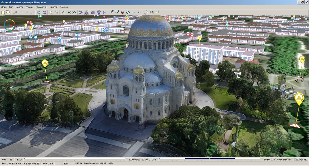


In KB "Panorama" the version 5.2 is developed for operating systems Astra Linux, CentOS and Windows. The new version of 3D map displays more detailed three-dimensional terrain models while maintaining high speed. The completely updated core of the 3D component allows you to increase the detail of the display up to 8 times. The screen refresh rate is up to 30 frames per second. Function of viewing the map in the "skeleton" mode is added to assess the complexity of scene models. It is possible to familiarise with new possibilities of a three-dimensional map on examples of model of and the simplified model of the city of .
The toolkit of developing the Web-applications the has been improved, which expands possibilities of GIS WebServer SE and can be integrated into other information systems. The 3D map component has expanded the list of labor-intensive tasks performed outside the main stream. There are added fundamental classes of the component (vectors, matrixes, geographic coordinates, spheroids), as well as algorithms and infrastructures (for example, message queue). At the level responsible for interacting with the video card, types have been developed that represent an abstraction for managing GPU resources and optimizing drawing calls. Scene level contains the ready structures, allowing on the basis of available data to carry out construction and display of the basic types of geoinformation models (globe, vector data, terrain relief, 3D tiles).
Access to data (images, vector maps and terrain information) is provided by web-services using common OGC protocols and ISO standards. Service of (OGC WMS/WMTS) provides spatial information in the form of graphic images. Various types of high-altitude data are used as a digital elevation model: matrixes (in the formats SRTM, GeoTIFF, IMG, MTW), TIN-models, point cloud and others. The service provides the ability to publish three-dimensional terrain models unloaded in DB3D format. These models can be obtained from files of the COLLADA type, as well as from photorealistic three-dimensional models of unlimited size (TLS, OC3).
As a source of spatial data, the can be. It provides the collection, storage, search and delivery of spatial data in exchange formats, a displaying the state of the data bank in the form of maps-schemes, the automated formation and updating of geo-covers.
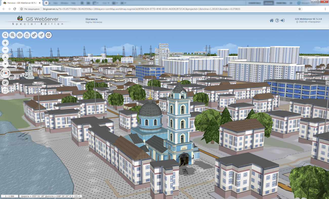
GIS WebServer SE is used in the construction of closed corporate systems to ensure the protection of data having a security classification or a trade secret. GIS WebServer SE is certified for Level 2 of absence of undeclared capabilities. The new version of the program expands the application's capabilities in solving problems of analysis, management and long-term planning of the territories development. GIS WebServer SE is implemented using the toolkit of GIS WebToolKit SE, which can be used in development tools that use the JavaScript.
The new version of the program is available on the website in the section.


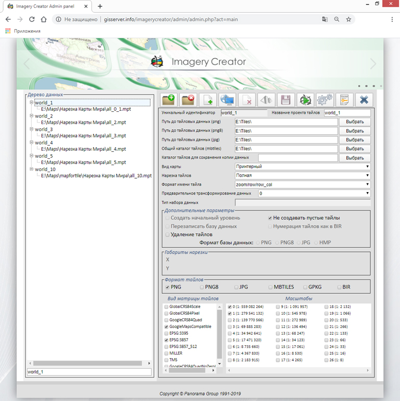
version 10 for the Windows, Astra Linux, and CentOS operating systems was developed at KB "Panorama". The new version of the program has expanded the ability to create pyramids of tiles for integration with existing information systems. Imagery Creator can be integrated into the , simplifying the process of creating tiles for a particular information system. Users can specify the format of the name of the tiles and their storage structure, for example, scale/row/row_column.png, scale/row/column.png, scale/column/row.png.
In the new version, the process of forming the tiles for Big Data data is several times faster by creating a tree-like data storage structure. There are added the parameters for adjusting the quality and speed of tile formation (enable/disable smoothing for lines, polygons, titles; printer/screen view; loading maps into RAM). Possibility is implemented for cutting tiles by rasters and matrixes "on the fly", without preliminary transformation of data. It will allow to save time on additional preparation of data. The program has improved the administrator interface, added the ability to specify the path to the configuration files.
The program allows you to create tiles in the formats JPEG, PNG, PNG8, Mbtiles, BIR and GeoPackage according to the international standard OGC WMTS 07-057r7 version 1.0.0, the standard TMS and OGC 12-128r15 GeoPackage version 1.2.1. The tile data generated by the Imagery Creator program is used by the , software to provide high-speed execution of requests for displaying spatial data to large territories with the simultaneous access of a large number of users.
The new version of the program is available for download on the page.


Ph.: +7 (495) 739-0245, +7 (925) 221-1603
www.gisinfo.ru | panorama@gisinfo.ru
105005, Russia, Moscow, Baumanskaya Street 7, building 1, office 229 (m. Baumanskaya)
Copyright © Panorama Group 1991 - 2024


 Mobile version
 Full version