Copyright © Panorama Group 1991 - 2024

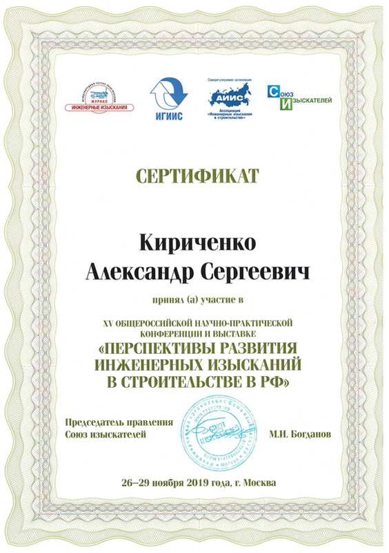
From November 25 till 29, 2019, the Fifteenth All-Russian Scientific and Practical Conference and Exhibition was held in Moscow. At the conference, KB "Panorama" was presented by Alexander Kirichenko, project manager, with a report on "Maintaining a fund of digital materials for engineering surveys". The report highlighted the current problem: the majority of organizations involved in engineering surveys do not systematize materials of engineering surveys and do not provide public access to them based on the results of their work. These valuable data can make a significant contribution to the formation of unified funds of materials of engineering survey, which could simplify the searching and obtaining materials for carrying out future survey work, simplifying them and reducing time and money costs.
At conference the possibilities of the for forming and conducting the fund of materials of engineering researches have been presented. The software product is intended for the accumulation, accounting and issuance of various types of spatial data - vector maps, remote sensing data, digital elevations matrixes, points of planning and altitude basis, as well as digital materials of engineering surveys. Each type of data has its own set of metadata, which describes materials as fully as possible and in the future will make it more convenient to search for data in the system. For engineering survey's materials, the main metadata is: type of engineering survey, address, cadastral number, start date and end date of the survey, contractor.
File storage of the Databank can be distributed and hosted on several storage devices, including in the cloud. At the same time, the software package does not limit the amount of data stored - the size of the storage depends on the technical capabilities of the customer. The main advantage of the Databank is its visual representation of spatial data: all materials of engineering survey in the form of spatial objects are displayed on the map-scheme. Thus, the software package is suitable for the formation and maintenance of a fund of digital materials for engineering surveys, and due to its flexible structure and decentralized organization of storage, the Data bank of digital maps and RSD can be used for conducting funds at different levels: federal, regional, municipal.
The conference "Prospects for the development of engineering surveys in construction in the Russian Federation" is the largest event in the industry, with more than 500 specialists annually taking part in it. As part of the event, a plenary session and the thematic sections devoted to different types of engineering surveys were held.


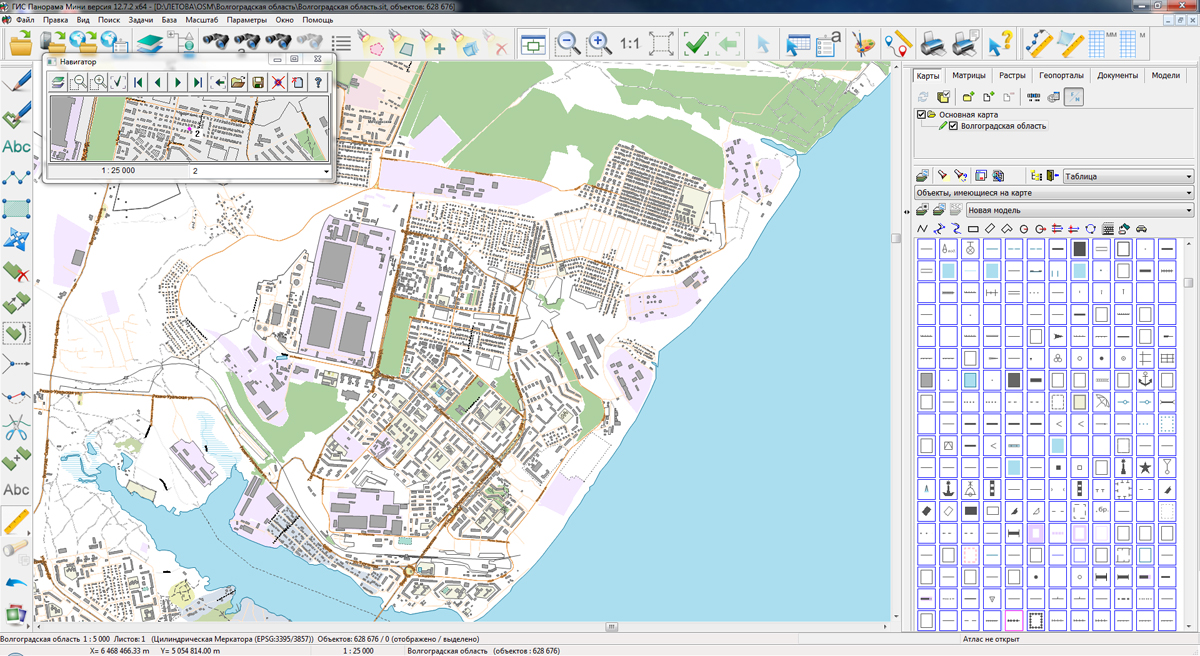
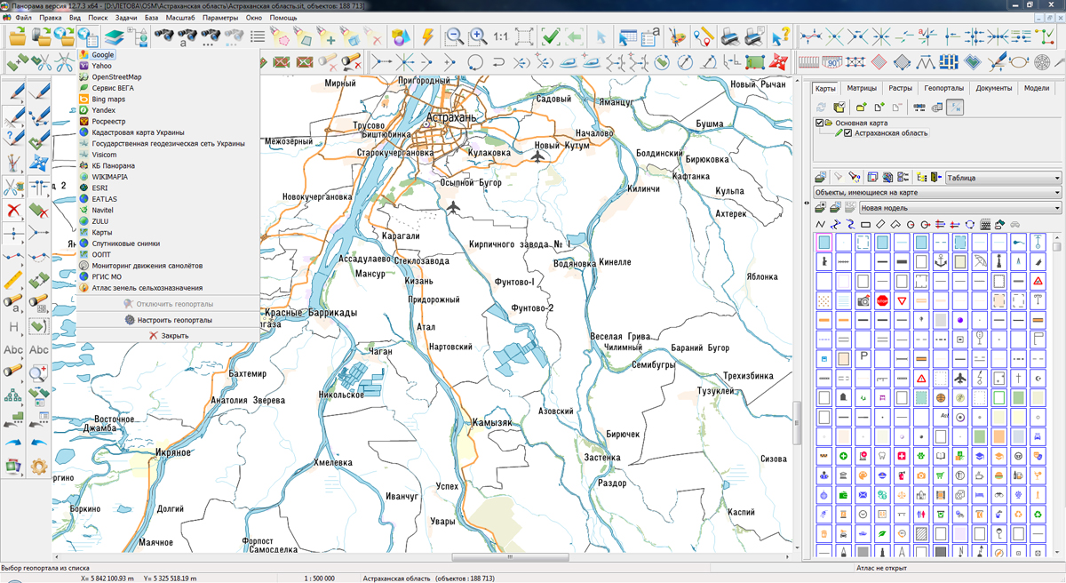
On the geoportal , the maps of regions of the Southern Federal District, which were formed according to OpenStreetMap data, were updated. The composition of the maps includes Astrakhan, Rostov, Volgograd oblasts, Republic of Kalmykia, Republic of Adygea, Krasnodar Krai and others. The source data was obtained from the website. For work with the maps it is possible to use the program of or other software products of KB "Panorama".
The maps were led to the modernised classifier of large-scale plans of scale 1: 5 000 (map5000m.rsc). Publishing of updates in bank of spatial data is made by using the program of . Publishing contents of bank of spatial data on the geoportal and data access for downloading are implemented by means of .
Free maps on the basis of OpenStreetMap data are available for download on the page "Digital maps and images".


In KB "Panorama" the version 5 is developed. In the new version of the program the possibility to use the map menu is added. The menu allows you to change the page layout and adapt the map interface for mobile devices. Menu items are associated with map tools; they provide users with the ability to switch operating modes and perform necessary operations on the map. The composition of the menu depends on the tools available on the map that are configured for the project. In the "Manual object marking" and "Mark for equivalent image" modes, the output of the selection results into the "Map objects" panel is added. When performing search queries to Yandex maps, an API key is applied in accordance with the Yandex Geocoder API Terms of Use. The data search in the "Rosreestr" component has been updated. In the "Unloading layers" component the permissions to download layers data files are added. The mechanism of single access to the application and administration module based on a common user session has been added.
The toolkit of developing the Web-applications the has been improved, which expands possibilities of GIS WebServer SE and can be integrated into other information systems. Access to data (images, vector maps and terrain information) is provided by web-services using common OGC protocols and ISO standards. Service of (OGC WMS/WMTS) provides spatial information in the form of graphic images. Various types of high-altitude data are used as a digital elevation model: matrixes (in the formats SRTM, GeoTIFF, IMG, MTW), TIN-models, point cloud and others. At request the most accurate data onto a specified terrain site with a given resolution is automatically sampled. To transfer data of the digital terrain model to the Web, the WCS protocol is used. The relief data is represented as tiles and cached on the client.
As a source of spatial data, the can be. It provides the collection, storage, search and delivery of spatial data in exchange formats, a displaying the state of the data bank in the form of maps-schemes, the automated formation and updating of geo-covers.
GIS WebServer SE is used in the construction of closed corporate systems to ensure the protection of data having a security classification or a trade secret. GIS WebServer SE is certified for Level 2 of absence of undeclared capabilities. The new version of the program expands the application's capabilities in solving problems of analysis, management and long-term planning of the territories development. GIS WebServer SE is implemented using the toolkit of GIS WebToolKit SE, which can be used in development tools that use the JavaScript.
The new version of the program is available on the website in the section.


In KB "Panorama" the document "Schemes and drawings of the technical plan. Description of technology" is prepared. This document contains a description of the technology for creating schemes and drawings of the technical plan using the software of the x64 and application the Complex of geodesy calculations (Geodesy editor).
Creation of schemes, drawings and plans is performed in digital form when preparing the technical plan. Most often they are used to receive graphic files in PDF or JPEG format for subsequent use when filling out report sections of a technical plan. The technology for creating schemes and drawings of the technical plan of the property describes both the procedure for preparing files for the graphic part of the technical plan, and the procedure for preparing a digital work map of the technical plan used in the automatic formation of a report and an electronic XML document.
The document provides a technological scheme and enlarged stages of preparation of schemes and plans. The procedure for creating a digital map for a scheme and a drawing or a plan is described. There are described the requirements for indicating the parameters of the coordinate system used for schemes and drawings or for plans of real estate. The modes for obtaining source data from various sources are indicated: digital cadastral map of the municipality; cadastral plans of territories and extracts from the USRT; scanned plan of a storey, building, construction; results of cadastral measurements.
The procedure is given for digitizing the boundaries of the property when preparing a digital work map of technical plan. The digital model of the property is described used at automation of the filling a text report and an electronic XML document. The user’s actions for various options for the formation of the technical plan are described in detail: a property with several external contours, the formation of parts, changing information about the property and its parts, and more. Variants of the metric description of several contours of one real estate object using sub-objects, multipolygons and sets of objects are given. The features of creating and selecting objects on a digital map with the simultaneous formation of two or more real estate objects are indicated.
For the first time, the procedure for preparing a digital model of a building (construction) and premises and/or parking spaces in it with using a set of digital maps, including a drawing of a real estate object and several plans of floors containing the boundaries of the premises (parking spaces), is described. The features of preparing a set of digital maps for a linear construction located in several cadastral districts are described.
You can familiarize yourself with the document "Schemes and drawings of the technical plan. Description of technology" on the website in the Download section.


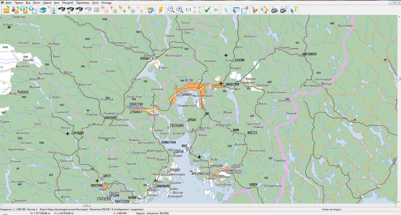
KB "Panorama" prepared a digital geographical map of scale 1: 1 000 000 in format SXF onto the territory of the Kingdom of Norway. obtained according to information from the website has served as source for map's preparation.
The map contains information about the quantity of inhabitants for cities and the names of settlements in Russian. As additional materials the World map of scale 1: 5 000 000 and data of were used. The map was led to the classifier of geographical maps of scale 1: 1 000 000 (1mogk13g.rsc). It can be used for the general estimation of the terrain and studying of an environment, an ensuring of educational process, as a basis for creation of geographical maps of smaller scale, thematic and special maps and solving other tasks.
The map is distributed free according to the free . Digital geographical map of scale 1: 1 000 000 in format SXF is available for downloading on page the "Digital maps and images".


Ph.: +7 (495) 739-0245, +7 (925) 221-1603
www.gisinfo.ru | panorama@gisinfo.ru
105005, Russia, Moscow, Baumanskaya Street 7, building 1, office 229 (m. Baumanskaya)
Copyright © Panorama Group 1991 - 2024


 Mobile version
 Full version