Copyright © Panorama Group 1991 - 2024

In KB "Panorama" the version 12.5.1 is developed. In the new version a support of the international format OGC 12-128r15 GeoPackage version 1.2.1 (*.gpkg) is added. This format is a SQLite 3 database that stores tiles of various formats, their coordinate system, matrixes of descriptions, and metadata. GeoPackage format is used in applications for providing access to spatial information: maps, images, matrixes of elevations. The format can be used in cloud storages and for simplifying the exchange of information, since all data is stored in one file.
In the new version a support of the packed pyramids of tiles in BIR format is added, that are stored in a database under the control of SQLite DBMS. This format is an array of SQLite databases in which tiles are stored. Tiles are stored in png, jpg, png8 or bmp formats. The bmp format represents tiles by the size 65х65 pixels containing data about elevations (digital matrixes of elevations). By dividing the entire Earth's surface into several databases, it is possible to carry out a faster search for tiles.
Pyramids of tiles, according to these formats, can be created in the program, including in the environment of the , using vector maps, remote sensing data and matrixes of elevations of relief and terrain objects.
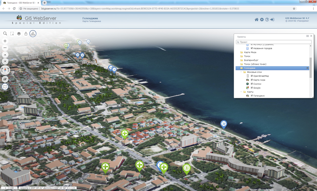
In the new version of the service, there are expanded the possibilities for working with the transaction log and various types of requests: obtaining 3D terrain models, obtaining vector tiles, obtaining metadata by the classifier. New formats are added for output of the spatial data - SXF/TXF.
GIS WebService SE supports all international standards (OGC WFS, WFS-T, WMS, WMTS, WCS), with the help of which the transmission and display of spatial data is carried out. The program has the ability to issue tiles by any user or local coordinate system. The application is implemented on Windows and Linux platforms, is compatible with Apache, IIS and nginx web servers.
The new version of the program and documentation are available on the website in the section.


In KB "Panorama" the "Workstation of Agronomist" version 12.7.3 is developed. In the new version the interface is optimised and technologies are improved for storing information about monitoring the fields. Information on agricultural land, posted in the database of agricultural enterprises, includes information on soil composition, weather conditions, crop rotation, the condition of crops and crop cultivation technologies. Modern technologies provide monitoring of crops using satellite-based materials of fields monitoring. To do this, it is necessary to process and analyze large volumes of images hosted on various servers in the data cloud of a particular operator of space data. This task is performed by the Geosys geoservice, the requests to which are formed by the "Workstation of agronomist".
By results of requests execution the matrixes of vegetation indices and zoning maps are formed. The data are loaded into branch base of agrarian GIS and are stored both in the special matrixes characterising value of an index in each cell of the established size, and in the form of time series of averaged values for each contour of the arable land. together with the implements structured storage of large amounts of data, sorted by category and time. "Workstation of Agronomist" provides the possibility of remote, multi-user, authorized access to current state data and fields monitoring.
Sorting data according to measurement time allows you to build a slice of information about crop growth on a specific date or on the removal of nutrients from the soil in different years, taking into account crop rotation. Using visualization tools, you can view matrixes of various indicators and graphs of their changes. Graphs are constructed on averaged values for the entire contour of the work area or for a given point. The storage and processing of matrixes and time series for agrochemical indicators, vegetation indices, crop yields, phytosanitary indicators, meteorological data and other monitoring indicators is supported.
Displaying the values of the matrixes at the point under the cursor allows you to visually analyze the changes of the indicator when moving the mouse cursor over the map of agricultural land. To build graphs of changes of the selected indicators, several matrixes are used that correspond to different points in time.
New analysis tools, integrated with the big data warehouse, make it possible to identify local areas of arable land that differ in the level of plant development and provide the ability to quickly make decisions aimed at increasing productivity and preventing plant death.
The new version of the program is available for download in the Download section.


By the invitation of the , specialists of KB "Panorama" took part in the seminar . The meeting discussed the regulatory and methodological foundations and topical issues of creating the federal state information system the "Unified Fund of geological information on subsoils" (FSIS "UFGI"). One of the important discussed issues was the formation of a single information space in terms of geological information and the organization of information exchange between the funds and systems of Rosnedra, subsoil users and consumers of geological information.
The presentation "Scientific and technical aspects of integration of funds of the spatial data" emphasizes that the formation and development of a single information space of the Russian Federation is the inter-branch and inter-regional problem. In the report the current state of automation of conducting funds and databanks in various departments is reflected.
The formation of a single information space is associated with the implementation of the spatial data infrastructure, geoservices and geoportals for request and reception of the spatial data from suppliers - holders of funds. The use of OGC web services, such as the WMS and WMTS web map service, the WCS web coverage service and the WFS web function service, allows various information systems to receive and use spatial data in a unified form for further analysis, visualization and planning.
The developed by KB Panorama, fully complies with modern requirements and is intended for loading, storing and issuing various types of spatial data and materials. The complex is already used for conducting the state fund of digital cartographical products in FSBI "Center for Geodesy of Cartography and SDI". The functionality of the complex is constantly expanding, in addition to digital maps, a conducting the database of engineering surveys and technical reports with a high level of automation of technological processes is maintained.

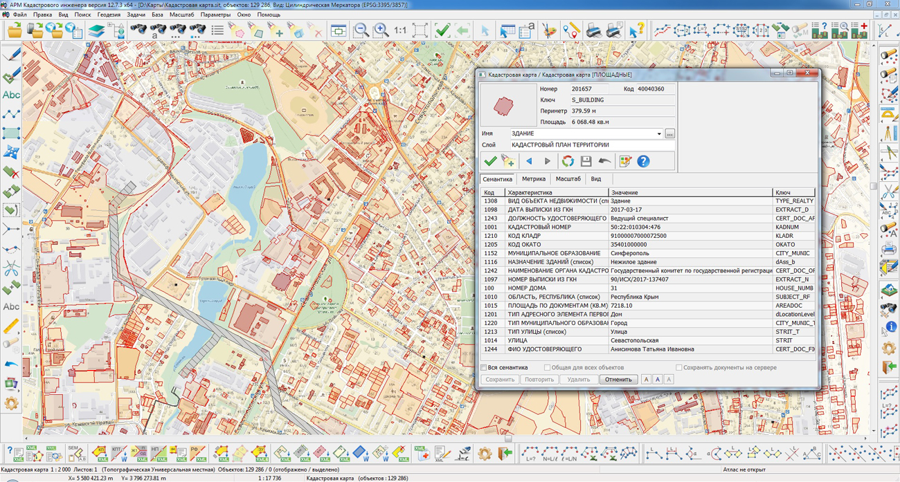
In KB "Panorama" the version 12.7.3 is developed. The new version implements support for creating an XML file for car spaces. XML-scheme of the technical plan of version 06 allows you to create an electronic document for the state cadastral registration and accounting for changes in car spaces. The program changes the preparation of an electronic technical plan document for a building, construction, object under construction and premises. Into the XML-file there are added the elements "Cadastral number of another real estate object (objects) within which the real estate object is located" and "Type (s) of permitted use" for a building, construction and premises. Ability is added to create an XML file for state cadastral registration of a building, an apartment building and a construction along with premises and (or) car spaces. For premises located in the construction, a list of types of residential premises of a specialized housing stock has been added.
In the form of data input for the preparation of the technical plan, changes have been implemented that implement the input of new attributes of objects taking into account the type of real estate object. For example, for the premises, you can specify only the cadastral number of the building or a construction in which the premises is located or the cadastral number of the apartment in which the room is located. There are updated the input tools for describing the plans of all floors or, in the absence of floors, plans of building. Software algorithms are implemented for reading the metrics of objects for writing into the report and into the XML file the information about the depth and height of the real estate object, as well as the intersection points of structural elements. Support is provided for multi-contours parts of a building, construction and premises. Digital classifier survey.v5.rsc is updated. New semantics and objects are added. A series of objects has been developed to display various conventional symbols of the ground, underground and overground contours of the object of real estate in combination with the line color: black for existing objects, red for the created ones.
In the dialogs "Technical plan", "Land Survey Plan", "Map (plan)", "Reading CPT and updating the map”, "Editing the object of cadastral works", the input and editing information for the address (location) of the real estate object is brought to a single view, in accordance with the requirements for the preparation of an electronic document of the technical plan according to XML-scheme version 06. The obtaining the address in a structured form from the federal information address system has been added.
The new version of the program is available for download in the Download section.


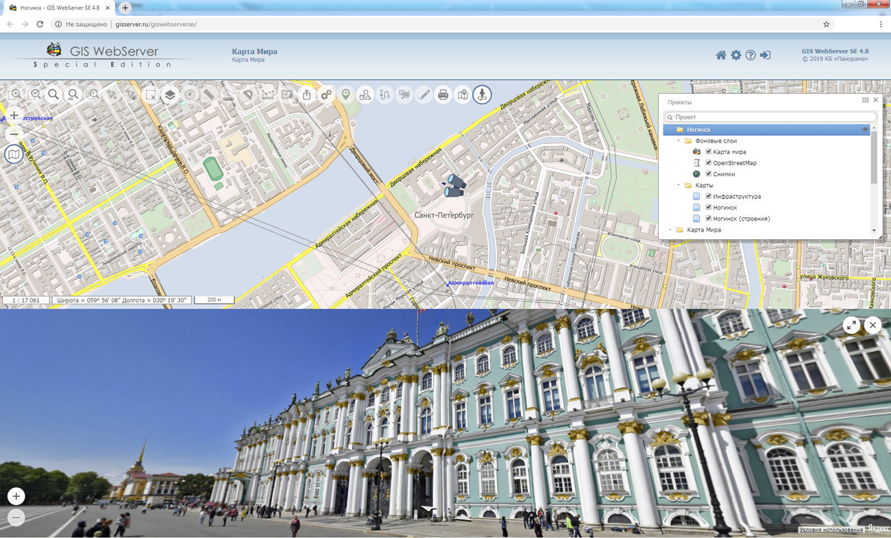
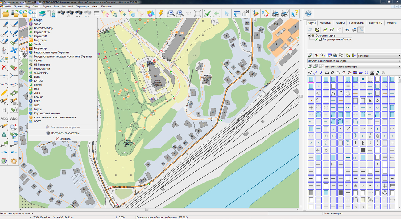
On the geoportal , the map of the Vladimir region, which was formed according to OpenStreetMap data, was updated. Source data were obtained from the website. For work with the map it is possible to use the program of or other software products of KB "Panorama".
The map was led to the modernised classifier of large-scale plans of scale 1: 5 000 (map5000m.rsc).
Publishing of updates in bank of spatial data is made by using the program of .
Publishing contents of bank of spatial data on the geoportal and data access for downloading are implemented by means of .
Free maps on the basis of OpenStreetMap data are available for download on the page "Digital maps and images".


Ph.: +7 (495) 739-0245, +7 (925) 221-1603
www.gisinfo.ru | panorama@gisinfo.ru
105005, Russia, Moscow, Baumanskaya Street 7, building 1, office 229 (m. Baumanskaya)
Copyright © Panorama Group 1991 - 2024


 Mobile version
 Full version