Copyright © Panorama Group 1991 - 2024

In KB "Panorama" the version 9.7 is developed. The new version of the program adds support for the formation of tiles according to the international standard OGC 12-128r15 GeoPackage version 1.2.1 (* .gpkg). This format is a SQLite 3 database that stores tiles, their coordinate system, matrixes of descriptions , and metadata. The GeoPackage format is used in mobile applications to provide access to spatial information (maps, pictures) in offline mode. It is suitable for quick sharing in cloud storage, transferring information using USB drives, since all data is stored in one file.
The new version of Imagery Creator allows you to create tiles according to the BIR standard. It is an array of SQLite databases where tiles in the formats png, jpg, png8 or bmp are stored. This format allows you to store not only spatial information in the form of tiles, but also digital information containing altitude data (Digital Elevation Matrixes). The advantage of BIR is a quick search of information due to the matrix division of the entire Earth's surface into several databases. In addition, this format allows access to spatial data Big data on the territory of the north and south poles. This is achieved by storing information in the projection EPSG:4326 of international matrix OGC GoogleCRS84Quad.
In addition to creating tiles from ready-made data, Imagery Creator allows you to recreate tiles from previously generated tiles, using built-in algorithms for scaling pixel graphics for raster data and interpolation methods for matrix data. For example, having 16 levels of scaling, the program can form tiles by building the reduced copies for all levels 0-15.
The program allows you to create tiles in the formats JPEG, PNG, PNG8, Mbtiles, BIR and GeoPackage according to the international standard OGC WMTS 07-057r7 version 1.0.0, the standard TMS and OGC 12-128r15 GeoPackage version 1.2.1. The tile data generated by the Imagery Creator program is used by the , software to provide high-speed execution of requests for displaying spatial data to large territories with the simultaneous access of a large number of users.
The new version of the program is available for download on the page.
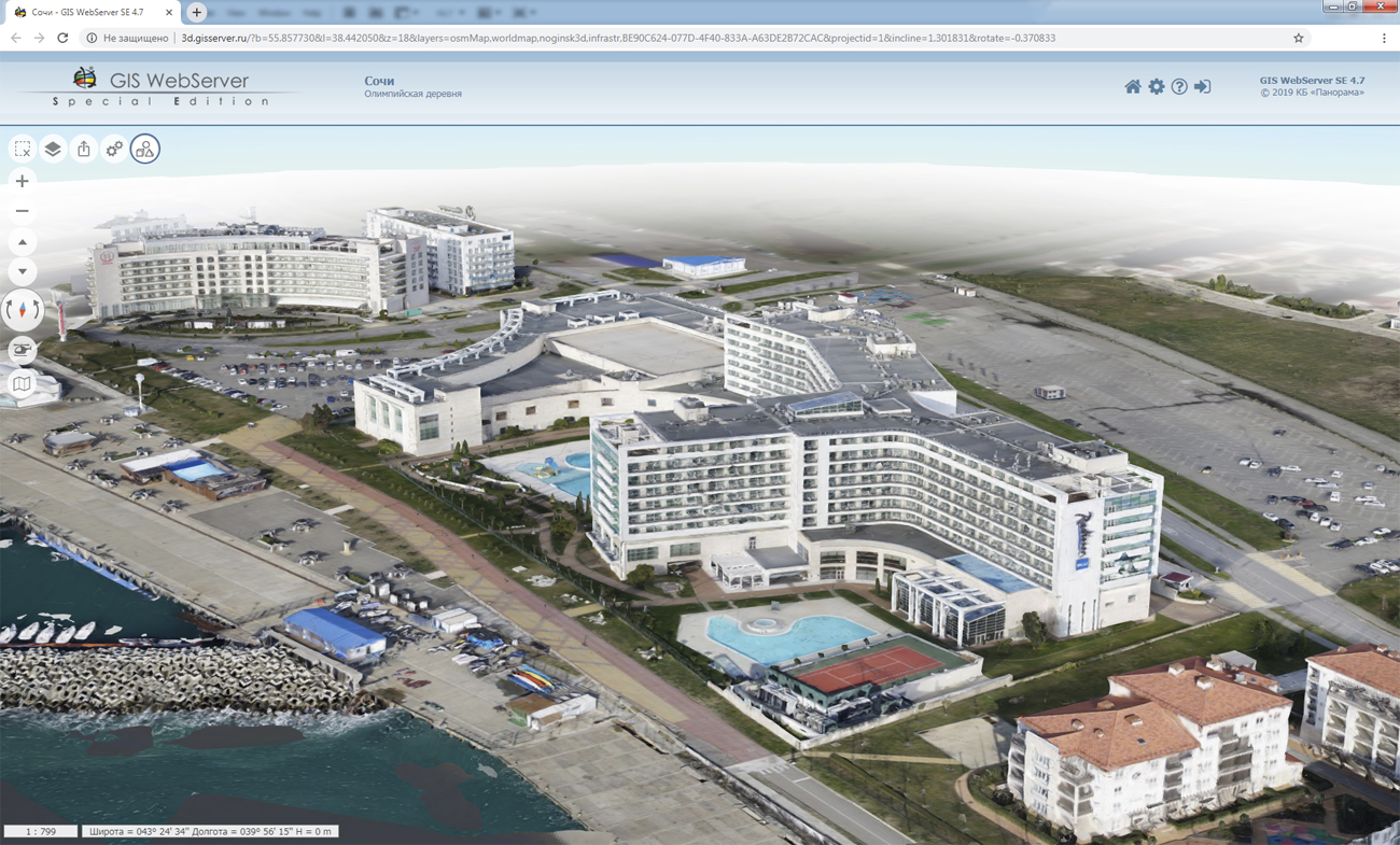


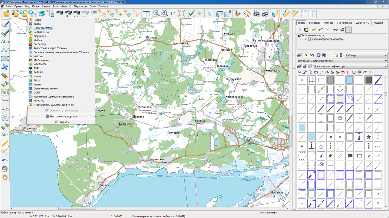
On the geoportal , the map of the Kaliningrad region, which was formed according to OpenStreetMap, was updated. Source data were obtained from the website. For work with the map it is possible to use the program of or other software products of KB "Panorama".
The map was led to the modernised classifier of large-scale plans of scale 1: 5 000 (map5000m.rsc).
Publishing of updates in bank of spatial data is made by using the program of .
Publishing contents of bank of spatial data on the geoportal and data access for downloading are implemented by means of .
Free maps on the basis of OpenStreetMap data are available for download on the page "Digital maps and images".


In KB "Panorama" the GIS Constructor for Qt Designer SE version 12.6.0 is developed for OS Astra Linux SE (release "Smolensk"). The new version adds a mechanism for converting projections of raster and matrix data on the fly. The user can combine an arbitrary set of spatial data without additional actions. The projection parameters will be automatically converted to the projection of the first open map. In this case, all the necessary changes will be made in RAM, which allows you to keep the original cartographic material unchanged. The obtained data set can be used for updating, calculating, and building a three-dimensional model.
The interface of standard dialogs: "Search and mark", "Creating map object", "Map contents", "Information about object" has been improved. In the "Data list" dialog, the functionality of geoportals connecting is expanded. In the new version of the GIS-applications core, the efficiency of data display is enhanced by improving the object selection mechanism. Support for multilanguage filenames of digital maps is improved. There is added the ability to select a large number of objects on the map by means of visual components of the GIS Constructor.
GIS Constructor is a set of geoinformation components for use in the visual programming environment of Qt Designer, which allows you to develop your own GIS applications. The visualization of the contents of digital maps is made in conventional symbols adopted for topographic, geographical and various special maps. Geoinformation system has ample opportunities for performing calculations, for providing display of spatial data on various graphic devices in standard and user systems of conventional symbols. The main functions can be executed in multithreaded mode. It supports automatic optimization of used memory for processing large amounts of data (tens of gigabytes) on limited resources (hundreds of megabytes).
The toolkit is adapted to work on a wide range of platforms and supports operating systems such as Astra Linux SE, MSVS, CRTOS "Neutrino", "Elbrus", "Zarya", Ubuntu, Alt Linux, QNX, CentOS and others. It can be used in computer complexes with processors of architectures ARMv7, Elbrus, PowerPC, Intel x86, Intel x64 and others.
The new versions of programs are available for download in the section.


In KB "Panorama" the version 12.7.2 is developed. The new version provides formation of an electronic document - a technical plan of a building (including an apartment house), a construction, an object under construction, premises in which the property information necessary for state cadastral registration is indicated. The XML file of the electronic document conforms to the XML-schema TP_v06.xsd and is made in accordance with the requirements for the preparation of the technical plan. To support the formation of an electronic document of a technical plan, a number of regimes of the "Geodesy editor" have been modified implementing the introduction of new attributes of real estate objects. The content of the address information (location) of the property has been updated. In accordance with the requirements for the preparation of an electronic document of a technical plan under the scheme TP-v06, the address of the property, as well as the location of the property, in the absence of an address assigned in the prescribed manner, must be presented in a structured form in accordance with the federal information address system (FIAS ). The program has built-in means of obtaining the address (location) in a structured form with a choice of values from FIAS.
Tools of entering descriptions of plans for all floors or, in the absence of floors, building plans have been updated. Sequential input of information on one or several plans is provided, indicating for each plan a file name with an image and a scale. When recording into an XML document, there is indicated the relative path to the directory with the image and the filename with the image, for example, "pictures\description 2.jpg", in accordance with the restriction on the line type "sName500JPG".
A new algorithm for obtaining information about the contours of the property, which is a combination of individual contours, has been implemented. A multi-polygon is used to describe a multi-contour property. Creating a multipolygon can be performed using the special mode "Creating a multipolygon", which is part of the "Geodesy editor". If the property has a multipolygon attribute, the program decides that the property (a part of the property) has more than one external contour. In this case in the XML-file the branch "Contours" is formed. Each external contour is described in the "Contour" element, the serial number of the external contour is recorded into the attribute "NumberRecord" (for a previously registered property) or "Definition" (for the formed property).
The new version of the program takes into account the suggestions and comments of users in the order of entering and editing data in the modes "Editing the object of cadastral works", "Land Survey Plan" and "Technical plan". In the mode “Loading of cadastral data from file XML” there is implemented a creation of multipolygons for parts of the plot with several external contours.
New modes were added that are applied at designing forestries, forest parks, an establishment of their borders, division of territories of forestries, forest parks into district forestries, definition of a quarter network. The forest quarter is a part of the forest delimited by glades or natural boundaries (for example, rivers). Each quarter has a permanent number. By current standards, the numbering of blocks in the forest massif goes from west to east, in rows, from north to south. The "Numbering of objects, in rows" mode provides for the formation of the accounting number of the object in accordance with its location on the map and is intended to fill the numbers of forest quarters in rows. To automate the process of merging the forest quarters into district forestries, the mode "Union of objects" is intended. The mode provides stream processing of map objects that have adjacent borders and the same attribute values. The program collects statistics on semantics, selects unique values, automatically creates samples of objects with the same values of semantics and performs their merge. The result of the execution is a multipolygon, including merged and isolated contours for each unique combination of semantic values, for example, the name of forestry and the number of the area.


In KB "Panorama" the version 12.7.2 for x64 platform was developed.
In the new version of the program on the basis of classifiers of digital topographic maps (DTM) of 1:50 000 and 1: 100 000 scales, modernized classifiers 50t05gm.rsc and 100t05gm.rsc were prepared, intended for the automated generalization and automation of the creating and updating DTM. The modernized DTM combines the basic properties of a topographic and navigation map. With the help of the task "Creating of passages in settlements" and prepared classifiers, streets and passages in settlements are automatically formed. Tools of automated control and correction of the quality of digital maps provide control of the topology according to the metrics of objects. By created streets and passages along with the road network objects when solving Navigation tasks a graph of roads is formed. A complete road and street network in settlements increases the degree of automation in the forming the maps of smaller scales (generalization). Significantly the composition of the layers is reduced by combining the data of the same type. The order of displaying objects in the classifier is set in accordance with the priority of the layers and the priority of objects in the layer, which makes it unnecessary to use additional layers. In the properties of some objects that are not used in practice when creating a DTM based on remote sensing data, the sign "Obsolete object" is set. Obsolete objects are not displayed in the objects list of the "Create object" dialog, unless the "Obsolete objects" field is enabled. This allows you to store in classifier the objects from the obsolete classifiers "05" and "09" for compatibility, but not display them when creating and updating the map to facilitate the selection of actual types of objects. For the automatic formation of labels using the task "Automatic labels alignment", the corresponding labels are customized according to the semantics of the objects.
The task "Geodesy Editor" is improved. The modes "Union of objects" and "Numbering of objects, in rows" have been developed. New modes are included into the panel "Processing of attributes of objects". The mode "Union of objects" is intended for automatic processing of selected objects, taking into account the value of one or several semantics that uniquely identify the object of accounting. The "Numbering of objects, in rows" mode is intended to form a unique object number using the algorithm of numbering from west to east, by rows from north to south.
The mode "Loading of cadastral data from file XML" is improved. The creation of multipolygons for parts of the section with several external contours is implemented. The mode "Land survey plan" is improved. When specifying the location of the border and/or area of a single land use, the rounding of the area value for information about the isolated land plot in its composition is performed up to two characters after the decimal point. Implementation is extremely important for land plots with a small area (less than one square meter). The mode "Technical building plan" is refined. The functions of editing location information have been changed to correctly record the names of the municipality and settlement for rural and urban settlements. Changes are made to the order of filling the area value in the XML file at the state cadastral registration of changes in the building - if the area has not changed (the value from the semantics coincides with that calculated on the map), then the Area element is not recorded.
In the "Select Object" dialog, new modes have been developed: "Select object on a map" and "Object autosave". The mode "Select object on a map" allows you to mark the selected object on the map. The mode "Object autosave" is intended for automatic saving the attributes and metrics of object with possibility of step-by-step restoration. For semantics of type the link to a file there is added the ability to select a folder. When referring to the semantics value, the dialog for selecting a file from this folder for viewing will be called. For files of zip type, a list of files compressed in the archive is displayed with automatic decompression and display of the selected file.
To simplify the preparation of reports in the "View Passport" dialog, there is added the ability of a map creation by a format of standard printed page with mapping of a frame of the print area in the form of graphic object. The frame of the print area is formed in accordance with the specified indents for the print area. To form a map by page format, select the menu item New\Plan and in the dialog enable property the "Frame by page size". When generating a report, the insets, documents, labels and other elements can be put to the created plan.
In the "Map Print" dialog box, the automatic setting of the parameters of the current printer has been added with the setting of the paper size and the printable area corresponding to the created plan.
There is added the ability to display insets under the vector maps, which simplifies the preparation of reports against the background of map fragments, images and other types of data that are connected as insets. The mode "Create object" of the task "Map Editor" has been improved. When creating an object using the "Arbitrary contour" mode for linear, polygonal and vector objects, the ability of dynamic entering the length of a segment is added.
The task of creating a matrix of heights by a vector map is improved. Into the application directory there is added a filter of objects s57navy.imh used by default for creating a matrix of heights by sea maps with the s57navy.rsc classifier. When creating a matrix using sea maps, isobaths are used (semantics the "ISOBATH VALUE", code 174), depths marks (H coordinate from metric), as well as objects of the "OBSTACLE" layer, for example, "UNDERWATER DRYING ROCK", "SUNKEN SHIP" (semantics the "DEPTH VALUE", a code 179). To include the specified objects in the processing in the matrix creation dialog, you need to set the matrix type "Summary elevations" and enable the mode "Use elevations from 3D-metric of objects".
In the menu Options\Coordinate System\Geodetic (World WGS 1984 spheroid) the item "Degrees, Minutes" has been added to display the coordinate view, as in a number of applications for smartphones.
The transformation of the coordinate system of raster and matrix data is accelerated by 10-15 times due to the use of multi-thread processing for multi-core processors and new algorithms for tile processing.
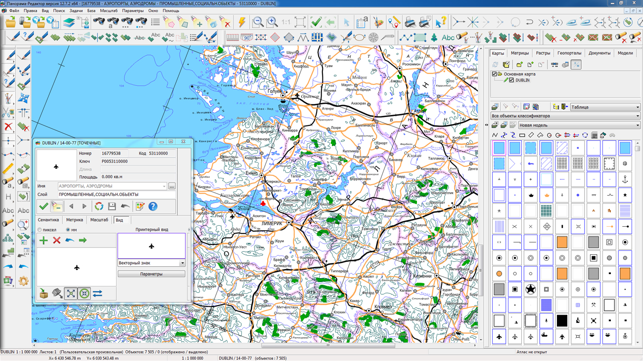
Dialogs for editing conventional symbols of objects are improved. There are added the buttons for copying from one object and inserting into another one of any conventional symbol through the clipboard. A new type of conventional symbol is added: shift line of type the "Color glass". For lines of the type "Set of elements", the ability is added to change the color of all line elements simultaneously and swap the elements. Into dialog of editing a vector symbol the additional marking with the center in a point of a binding is added, which allows you to speed up the process of creating and editing of images of vector symbols.


Ph.: +7 (495) 739-0245, +7 (925) 221-1603
www.gisinfo.ru | panorama@gisinfo.ru
105005, Russia, Moscow, Baumanskaya Street 7, building 1, office 229 (m. Baumanskaya)
Copyright © Panorama Group 1991 - 2024


 Mobile version
 Full version