Copyright © Panorama Group 1991 - 2024

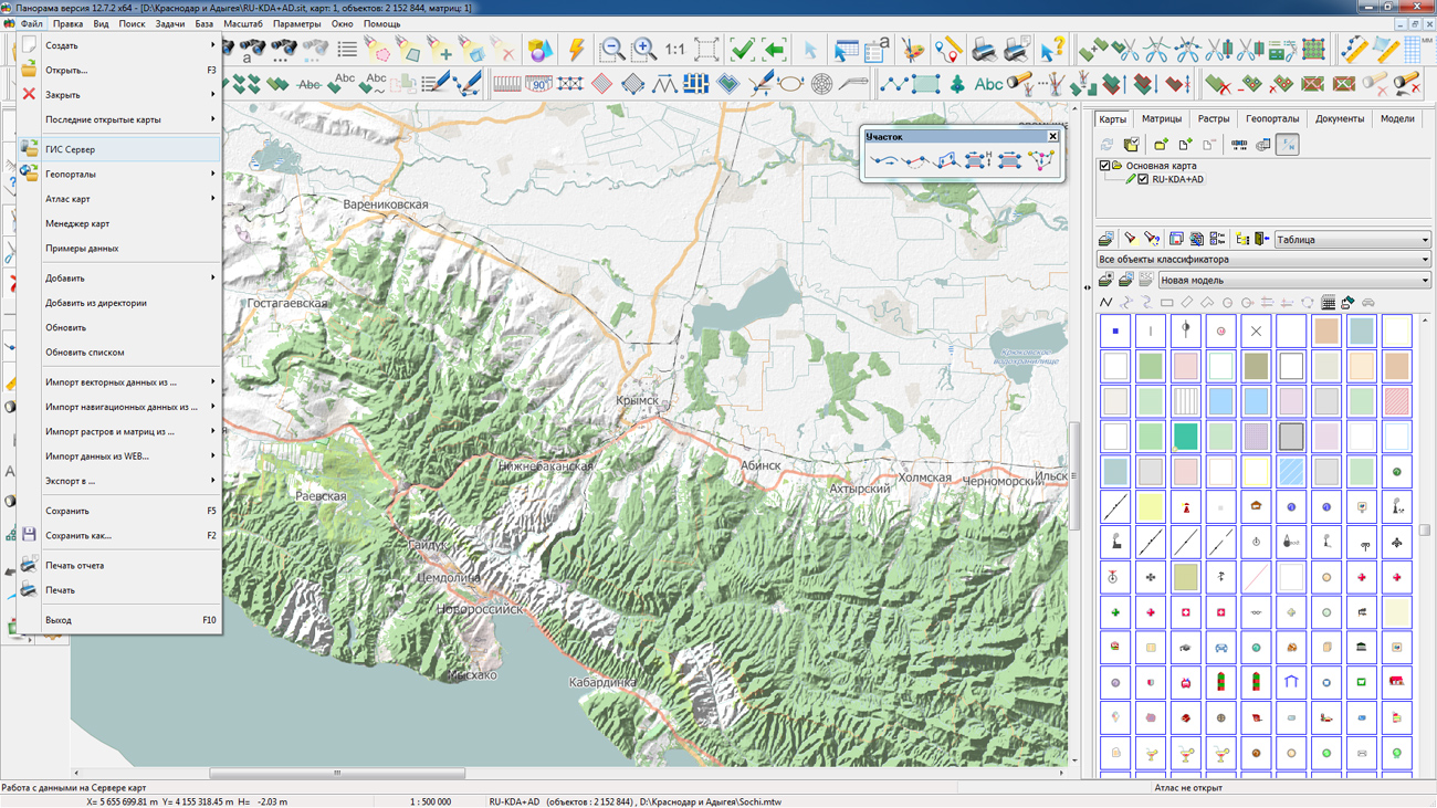
In KB "Panorama" the version 4.0.2 is developed. The new version adds support for loading pyramids of tiles of BIR format (MBTiles) and 3D models of DB3D format stored in SQLite database. The composition of the subdirectories included in the pyramid, the dimensions of models, the EPSG code and other attributes are automatically determined.
Pyramids of tiles can be placed and downloaded as separate folders or from a common directory. The composition of the pyramid subdirectories is automatically determined by the metadata stored in the SQLite database. Processing of pyramids of three types is supported: remote sensing data, matrixes of elevation, images obtained from digital maps. Pyramids of tiles recorded in virtual folders of the are automatically published for clients who have access rights to these folders.
Composition of processed metadata is expanded. For remote sensing data sets, the sun's elevation at the time of the survey (SunElevation) and the mean square error of the geospatial data binding (StandardDeviation) are additionally processed. Files with the extension ".json" or ".geojson" containing the coordinates of the survey sites have priority over the metadata recorded in other ways - in the ".meta.xml" file or in the data set. The operator can clarify some attributes of the metadata immediately before loading the data.
To increase the speed of receiving data from the repository, the ability to receive data sets through the exchange folder on the server has been added. The list of such folders is configured by the administrator of the complex. To ensure security, the actual location of the folders may be hidden from the user. If the size of downloaded data sets exceeds the established limit, then it is suggested to download them through the exchange folder.
The way of getting datasets stored in the form of folders (3D models, tiles, data in BIR format) has been changed. Uploading such data is made only through the exchange folder. They are not placed into the archive as usual data sets, but copied into the directory with the archive, keeping their own hierarchy of folders.
Ability is added of selecting the type of hierarchy in the archive when downloading data sets. It is possible to set the location of all files in archive at one level, or to leave hierarchy of folders by default.
Within the framework of a single geoinformation space, the Data Bank of digital maps and remote sensing data realises gathering, storage, search and delivery of the spatial data in exchange formats. The spatial data selected by means of the program can be placed for the multiuser access on the GIS Server and be published according to the international standards OGC WFS, WFS-T, WMS, WMTS, WCS on application server the . Users can access data from both a thin client (by means of ) and from desktop applications (, ). The databank of digital maps and remote sensing data provides construction of cloud warehouse of spatial data, provision of access to these data, the automated formation and updating of geo-covers. The current state of spatial data is displayed by means of maps-schemes that are maintained for each type of stored data: vector maps, remote sensing data, elevation matrixes and terrain models. It provides remote placing the sets of spatial data into file warehouse, keeping versions of stored sets, updating maps-schemes of data availability, the automated collection and formation of metadata, and the formation and updating of geo-covers. Automated collection and formation of metadata is performed according to the standards of ISO 19115: 2003, Geographic information - Metadata and ISO/TS 19139, Geographic information - Metadata - XML schema implementation. The reduced copies of data images are automatically formed, checksum of files and completeness of data sets are checked.
The new version of the program is available for download on the page.


Specialists of KB "Panorama" prepared a video lesson . It is intended for the English-speaking users independently studying possibilities of the . This lesson describes ways of correction of errors in the coordinate description of objects. You will learn how to replace, check, delete and convert groups of objects on the map.
The training material acquaints users with dialog "Correction of objects metrics", which is located in the "Run applications" section. It is necessary for processing digital maps imported from various sources. In addition, it can be used for preparing maps for the purpose of their subsequent conversion into other GIS. All tools of the "Correction of objects metrics" dialog are conditionally divided into groups, located in separate tabs. Video lesson shows the processing of pre-selected objects on the map: the names of settlements, coastlines, roads and others.
Previously other video lessons of this series were published: , , , , , , .
You can get acquainted with training materials in English in the section .


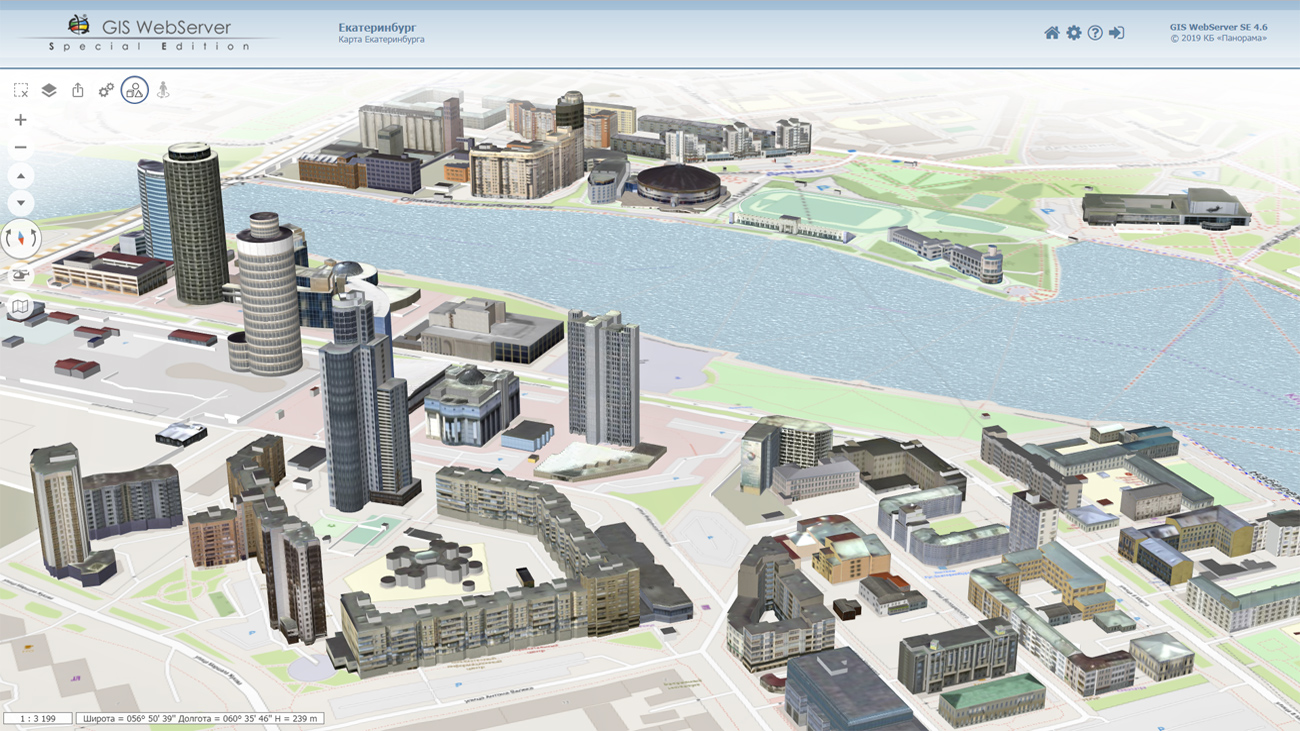
In KB "Panorama" a sample application in C# was prepared with use of GIS WebToolKit SE - the map component of Web-applications development toolkit. Display of a map and management of it are performed in 2D and 3D modes. Layers of spatial data of cartographical service the are used. Objects editing, various kinds of map objects search, construction of passages routes, creation of thematic maps by attributes of objects and other operations are carried out. To initialize the map, the configuration files of the parameters of version 4.6 are used.
The application works under control of IIS server in the Microsoft.NET Framework 4.5 environment. The GIS WebToolKit SE web-applications development toolkit can be built into various information systems with cartography use. For access to the data (images, vector maps and terrain information) the Web-services are used. Cartographical service GIS WebService SE provides spatial information in the form of graphic images of the area, vector description of spatial objects. As a digital elevation model, the various types of elevation data are used: matrixes (in SRTM, GeoTIFF, IMG, MTW formats), TIN-models, point cloud, and others. At requests the most accurate data onto a specified terrain site with a given resolution is automatically sampled. To transfer data of the digital terrain model, the WCS protocol is used. The relief data is represented as tiles and cached on the client.
GIS WebServer SE is used in the construction of various information systems, as well as of closed corporate systems with ensuring the protection of data having a security classification or a trade secret. The program is certified for Level 2 of absence of undeclared capabilities. GIS WebServer SE is implemented using the toolkit of GIS WebToolKit SE.
You can get acquainted with the example of the application's work by the .


In KB "Panorama" the version 8.6.1 is developed. In the new version there are added the controls the integrity of the installation after installation. The program includes a file checkcontents.xml, containing a list of installation files with an indication of the size and checksum using the "CRC32" algorithm. At the start of the GIS Server, an automatic check of the integrity of the installation is performed and the result of the check is recorded into the program operation log. To increase the stability of the GIS Server to DDOS-attacks, the analysis of input messages is performed by content and compliance with the protocol of exchange with clients. If connections send messages that do not conform to the protocol, they are immediately closed.
GIS Server provides remote access to vector maps, remote sensing data, matrixes, documents and spatial data bases. The program supports work with spatial databases managed by PostgreSQL and Oracle DBMS, which support the ability to access spatial data in accordance with the OGC 06-103r4 standard: "OpenGIS Implementation Standard for Geographic information - Simple feature access - Part 1: Common architecture".
The new version of the program is available for download on the page.


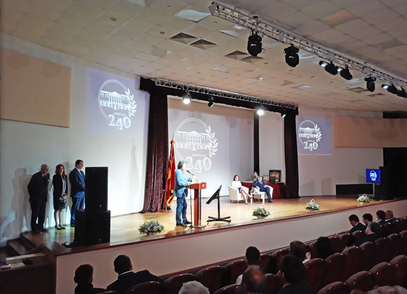
Specialists of KB "Panorama" took part in events dedicated to the . At the plenary session of the International Scientific and Technical Conference , the report "Modern geoinformation technologies" was presented.
The conference was attended by heads of the Federal Registration Service and the Military Topographic Department, representatives of Russian and foreign educational institutions, professional communities of survey engineers, designers and cadastral engineers, specialists in the field of photogrammetry, cartography and spatial data analysis, teaching staff and graduates of MIIGAiK.
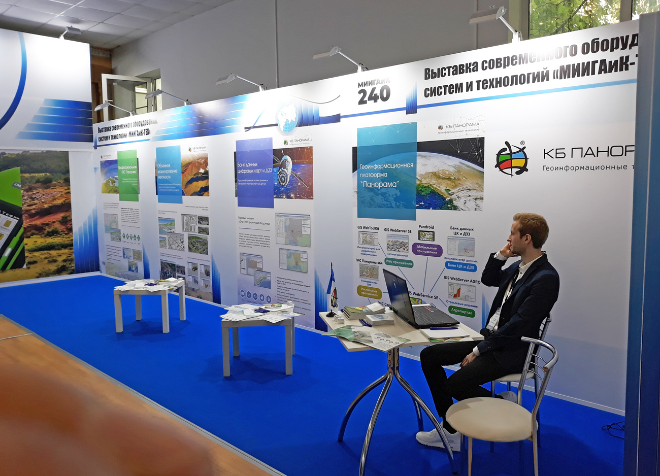
In parallel with the conference on the university site, on May 27 - 29, 2019, the exhibition of was working. At the stand of KB "Panorama" the software products that make up the domestic geoinformation platform were presented: , , , , . The conference participants, teachers and students familiarized themselves with the latest developments of the company for geodesy, cartography, cadastre, urban planning, ecology, geology, navigation, territorial planning and management.
At a round table "State Funds of Spatial Data: Practices and Prospects of Interaction" to the specialists of the operator of federal fund of the spatial data - FSBI "Federal Science and Technology Center for Geodesy, Cartography and Spatial Data Infrastructure" and to representatives of subjects of the Russian Federation, responsible for conducting regional funds of the spatial data demonstrated the capabilities of the software product the .
MIIGAiK is one of the most famous specialized higher educational institutions in Russia for the training of specialists in the field of geodesy, photogrammetry, cartography, aerospace surveys, geoinformation systems, optical instrumentation and other fields. As part of the 240th anniversary of the University, KB "Panorama" is updating existing and supplying new software products for inclusion in curricula for training young and ambitious specialists who will implement the national project to create the digital economy of the Russian Federation.


Ph.: +7 (495) 739-0245, +7 (925) 221-1603
www.gisinfo.ru | panorama@gisinfo.ru
105005, Russia, Moscow, Baumanskaya Street 7, building 1, office 229 (m. Baumanskaya)
Copyright © Panorama Group 1991 - 2024


 Mobile version
 Full version