Copyright © Panorama Group 1991 - 2024

In KB "Panorama" the GIS Constructor for Qt Designer SE version 12.4.0 is developed. The new version includes service files for automatic processing of national coordinate systems and cartographical classifiers of a number of countries. For execution of import the user can use the test example included in the installation. For this purpose it is necessary to choose setting files and the directory with the data in the Shapefile format. The test example will automatically search for spatial data in the selected directory and create a map in national conventional symbols in the format.
In the new version of the GIS-applications kernel, the data display is optimized due to an improved mechanism of selecting the objects. Selection of objects on the map by means of visual components is improved. There is improved a convenience of working with standard dialogs that are part of the GIS Constructor.
GIS Constructor is a set of geoinformation components for use in the visual programming environment of Qt Designer, which allows you to develop your own GIS applications. The visualization of the contents of digital maps is made in conventional symbols adopted for topographic, geographical and various special maps. Geoinformation system has ample opportunities for performing calculations, for providing display of spatial data on various graphic devices in standard and user systems of conventional symbols. The main functions can be executed in multithreaded mode. It supports automatic optimization of used memory for processing large amounts of data (tens of gigabytes) on limited resources (hundreds of megabytes).
The toolkit is adapted to work on a wide range of platforms and supports operating systems such as Astra Linux SE, MSVS, CRTOS Neutrino, Elbrus, Zarya, Ubuntu, Alt Linux, QNX, CentOS and others. It can be used in computer complexes with processors of architectures ARMv7, Elbrus, PowerPC, Intel x86, Intel x64 and others.
The new version of the program is available for download in the section.


Specialists of KB "Panorama" took part in the second All-Russian scientific conference with international participation . The conference was held from 26 to 28 September 2018 at the Agrophysical Research Institute in St. Petersburg.
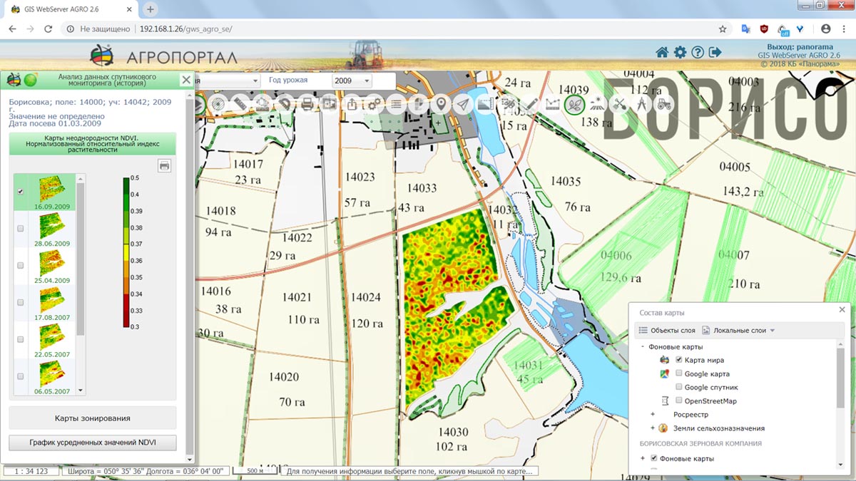
Employees of the company presented the report on the topic "Collecting and preparing the remote sensing data of the Earth from open sources for the purpose of information support for precision farming systems" with an overview of current data sources and methods for their correction for use in a single geographic information system of agricultural enterprises. The presented methods and technologies of satellite monitoring are applied in software products of KB "Panorama": , , "Workstation of agronomist". Using the integration of the external service Geosys there are realised the possibilities of obtaining the geolocated values of vegetation indexes and constructing maps of zoning and the differentiated application of fertilizers.
Agrophysical Research Institute - one of the oldest scientific institutions engaging in researches in the field of agriculture and particularly of the use of remote-sensing instruments of the Earth. Held since 2015, the All-Russian Scientific Conference is a platform for the presentation of theoretical developments and the exchange of experience for all participants in the agricultural field of activity.


In KB "Panorama" the version 12.1.4 is developed. In the new version, interaction with the is improved, for this a new request for deleting folders from the has been added. This allows you to optimize server disk space when removing geo-coverings from the Data Bank. To obtain information on the process of downloading information to the Data Bank, a new request has been added to receive the log of the program's operation.
The new version improved the creation of tiles for matrixes of heights. The service allows you to get a smoothed terrain model without gaps and emissions of heights on the borders of tiles. Together with the appearance of the object, the service transmits data about heights, metadata and vector information. Use of the service allows you to model the entire surface of Globe in the three-dimensional form.
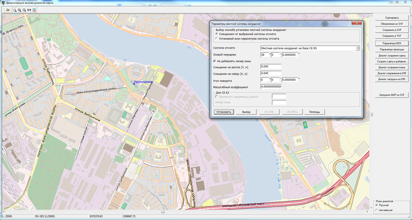
GIS WebService SE supports all international standards (OGC WFS, WFS-T, WMS, WMTS, WCS), with the help of which the transmission and display of spatial data is carried out. The program has the ability to issue tiles by any user or local coordinate system. The application is implemented on Windows and Linux platforms, compatible with Apache, IIS and nginx web servers.
The new version of the program is available on the website in the section.


In KB "Panorama" the tools of of version 12.6.0 are developed for creating GIS applications in the environment of C ++ Builder, Delphi Embarcadero. The toolkit is based on the new version of the GIS-core, which increases the reliability of functioning the developed applications when working with a large amount of data in a high-performance environment. The basic libraries of the GIS core for working with the spatial data base are assembled in the Visual Studio environment, which allowed to make full use of the mechanism for processing structured exceptions (SEH) for Windows. Structured exception handling (SEH) improves the reliability of the application. New libraries are checked for absence of memory leaks with use of toolkit the Microsoft Application Verifier.
With GIS ToolKit, you can create multi-threaded high-load applications for processing large amounts of spatial data. An example of such an application can be , a web service for publishing spatial data over protocols: OGC WMS, OGC WMTS, OGC WFS, OGC WFS-T, OGC WCS.
GIS ToolKit is a tool for developing geoinformation systems, which allows processing spatial databases. The toolkit consists of a set of visual components (supplied in the source code) and API functions of GIS-core for direct access to the geodatabase. The geodatabase can be located both in the workplace (direct access to data), and in the local network or the Internet (using the access components or data exchange over international protocols).
The new version of the program is available for download on the page.


In September, 2018, the celebrated the 100th anniversary. Annually about 20 000 students study at the university (together with the correspondence form of education). Since 2000, the is widely used in the educational process in the areas of "Land management and cadastres" and "Construction", as well as in the course of additional vocational education. The Department of Cadastre and Geoengineering has prepared methodological instructions for the implementation of laboratory, practical and coursework based on the use of GIS Panorama. This software is one of the basic in studying such disciplines as: geodesy, engineering geodesy, applied geodesy, photogrammetry and remote sensing of territories. GIS "Panorama" is used in the preparation of the final qualifying work by bachelor students who study in the direction of 21.03.02 - "Land Management and Cadastres" and masters studying in the direction of 21.04.02 - "Land Management and Cadastres".
The staff of KB "Panorama" congratulated the department on the anniversary and transferred new licenses of GIS "Panorama" for use in the educational process. KB "Panorama" has developed the special program of licensing its software products for educational institutions. Within the framework of this initiative, the software products and technologies of KB "Panorama" for use in the educational process are provided under an agreement on preferential terms. To date, more than 110 educational institutions apply products of KB "Panorama" for training of specialists.


Ph.: +7 (495) 739-0245, +7 (925) 221-1603
www.gisinfo.ru | panorama@gisinfo.ru
105005, Russia, Moscow, Baumanskaya Street 7, building 1, office 229 (m. Baumanskaya)
Copyright © Panorama Group 1991 - 2024


 Mobile version
 Full version