Copyright © Panorama Group 1991 - 2024

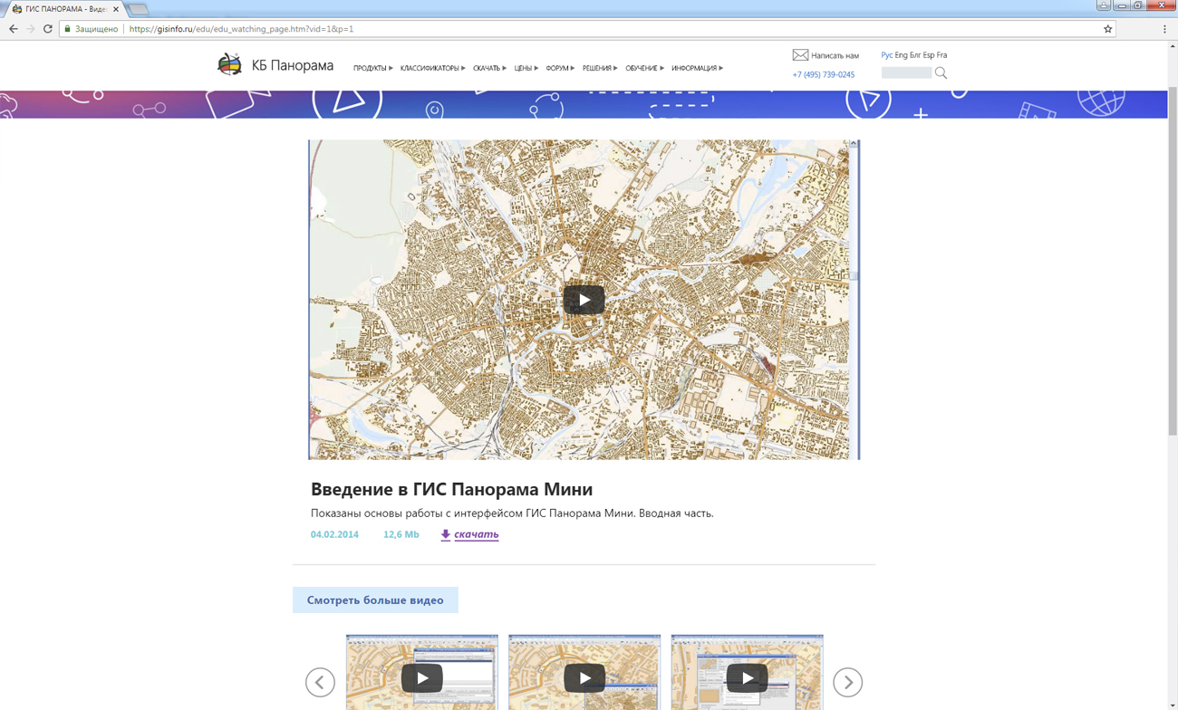
Specialists of the KB "Panorama have refined the section "Video lessons" on the site gisinfo.ru.The section received a new design and an improved navigation menu. The page has the ability to search for video lessons hosted on the server. Users can start to look the found lessons immediately in the section, without having to go to the video hosting site. Each video lesson is started on its own unique page, where a brief annotation is provided on it and a download link is available.
The section presents introductory lessons for those who are just starting to work with programs the , professional and desktop , , . Educational films for the formation of cadastral documents in XML format are available for familiarization. The video lessons shows the sequence of using the "Workstation of cadastral engineer" when loading the initial data, preparing a map and generating output documents in electronic form. Users can study materials on work in the . These lessons show a full cycle of processing of all types of aeronautical information, the order of its analysis and publication by means of the complex. The material is aimed at operators of aeronautical databases, schema designers, system programmers and specialists in the installation and configuration of databases. The volume of teaching materials is very large and constantly expands, you can see the full list of lessons in the section "Video lessons".
The official website of the company is always available for downloading current versions of the programs (GIS "Panorama", , and others), documentation.
On the "Digital maps and images" page and on the geoportal, there are free maps in the SXF format onto territory of the regions of the Russian Federation and foreign countries on the basis of data from open sources. To work with these maps, you can use the GIS Panorama Mini program. To organize the storage of spatial data in exchange formats, the Complex of conducting a databank of digital maps and remote sensing data can be applied.
For any questions related to the use of GIS-technologies of KB "Panorama", you can always contact the specialists of the company through the or by e-mail.


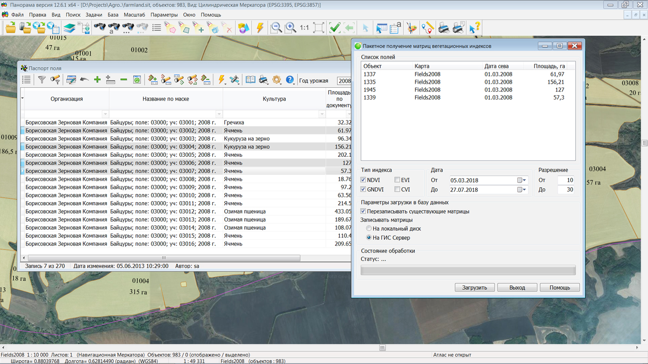
In KB "Panorama" the "Workstation of agronomist" version 12.6.1 is developed. The new version of the "Complex of agronomical tasks" implements the possibility of loading satellite monitoring's data for a list of fields. The mode provides tools for obtaining matrixes of different types of vegetation indices onto several fields contours. Such approach allows in convenient form to cover with satellite data all the fields of the organization for further analysis of the biomass state.
Selection of the received data is possible by means of setting filters according to the type of vegetation index, the date of shooting and the resolution of the original images. The most common types of indices are available for download: Normalized Difference Vegetation Index (NDVI), Chlorophyll Vegetation Index (CVI), Enhanced Vegetation Index (EVI) and Green Normalized Difference Vegetation Index (GNDVI). The source of remote sensing data is the external service of company.
Based on the data received from the service, the vegetation indexes distribution matrixes are automatically constructed and placed on the for the possibility of remote, multi-user, authorized access. References to matrixes are recorded in the database .


version 12.1.3 is developed in KB "Panorama". In the new version of the service, in order to increase performance and displaying 3D terrain models in multithreaded mode, there is added a support of SQLite databases of 3D objects of version 3.6.1 and below. For the formation and processing the matrixes of elevations and quality necessary for building 3D models, the reliability and speed of information exchange with the is increased. In order to reduce the time for data preparation, queries were added for transformation of matrix geo-covers to a specific projection. To increase the speed of searching for objects by vector data, search filters by key are added.
GIS WebServiсe SE supports all international standards (OGC WFS, WFS-T, WMS, WMTS, WCS) through which the transmission and display of spatial data is carried out. The program provides the ability to issue tiles for any user or local coordinate system. The application is implemented on Windows and Linux platforms, compatible with Apache, IIS and nginx web servers.
The new version of the program and the documentation are placed on the site in section.


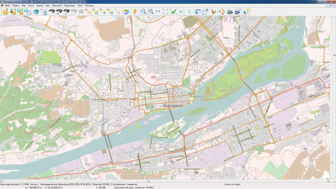
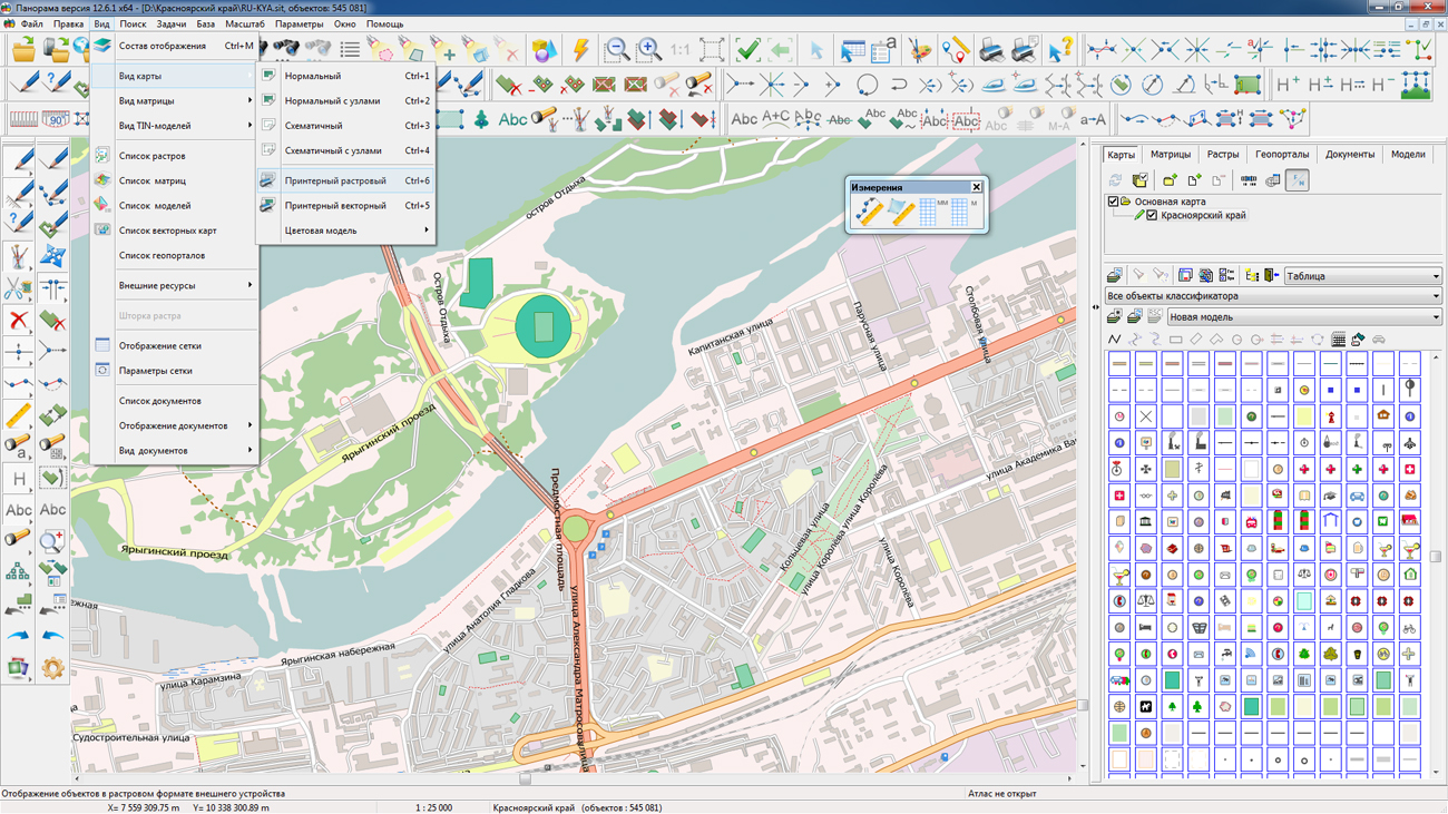
On the geoportal , the map of Krasnoyarsk Krai, formed according to OpenStreetMap data, were updated. Source data obtained from the GIS-Lab website are complemented by objects from maps of scale 1: 1 000 000. There are added the objects of hydrography, vegetation, road network. For work with the received maps it is possible to use the program of or other software products of KB "Panorama".
Publishing of updates in bank of spatial data is made by using the program of . Publishing contents of bank of spatial data on the geoportal and data access for downloading are implemented by means of .
Free maps on the basis of OpenStreetMap data are available for download on the page "Digital maps and images".


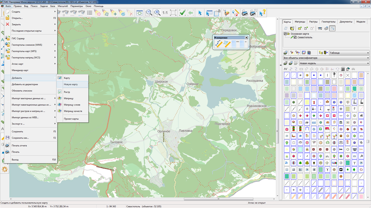
On the geoportal , the maps of Republic of Crimea and the city of Sevastopol, formed according to OpenStreetMap data, were updated. Source data obtained from the GIS-Lab website are complemented by objects from maps of scale 1: 1 000 000. There are added the objects of hydrography, vegetation, road network. For work with the received maps it is possible to use the program of or other software products of KB "Panorama".
Publishing of updates in bank of spatial data is made by using the program of . Publishing contents of bank of spatial data on the geoportal and data access for downloading are implemented by means of .
Free maps on the basis of OpenStreetMap data are available for download on the page "Digital maps and images".


Ph.: +7 (495) 739-0245, +7 (925) 221-1603
www.gisinfo.ru | panorama@gisinfo.ru
105005, Russia, Moscow, Baumanskaya Street 7, building 1, office 229 (m. Baumanskaya)
Copyright © Panorama Group 1991 - 2024


 Mobile version
 Full version