Copyright © Panorama Group 1991 - 2024

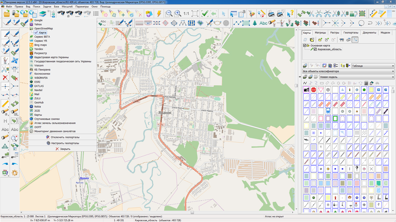
On the geoportal , map of the Kirov region, formed according to OpenStreetMap data, was updated. Source data obtained from the GIS-Lab website are complemented by objects from maps of scale 1: 1 000 000. There are added the objects of hydrography, vegetation, road network. For work with the received maps it is possible to use the program of or other software products of KB "Panorama".
Publishing of updates in bank of spatial data is made by using the program of . Publishing contents of bank of spatial data on the geoportal and data access for downloading are implemented by means of .
Free maps on the basis of OpenStreetMap data are available for download on the page "Digital maps and images".


version 11.10.1 is developed in KB "Panorama". The new version of the service adds support for SQLite databases in Mbtiles and TBIR format. These formats are convenient for storing tile data, since they consist of one file (Mbtiles) or several (TBIR). On average, tiles in Mbtiles and TBIR format take up to 30% less hard disk space compared to individual files. The speed of access to the tile from the SQLite database is comparable with the speed of access to the tiles folder. Use of Mbtiles format will simplify and speed up the process of transferring tiles between servers and hard disks.
In the new version of service a support of international standard OGC WFS-T is improved. The service allows you to process objects whose coordinates go beyond the dimensions of the standard tiles pyramids (-180 and 180 degrees). This allows users to correctly edit or create objects, for example on the Chukchi Peninsula, using .
GIS WebService SE supports all international standards (OGC WFS, WFS-T, WMS, WMTS, WCS), through which the transmission and display of spatial data is carried out. The program provides the ability to issue tiles for any user or local coordinate system. The application is implemented on Windows and Linux platforms, is compatible with Apache, IIS and nginx web-servers.
The new version of the program is available for download on the website in the section.


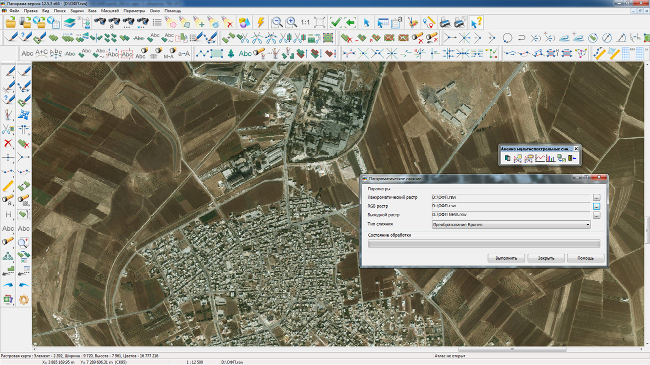
In KB "Panorama" the version 12.5.3 for the x64 platform is developed. In the new version of the program into the task "Analysis of multispectral images" the mode of panchromatic merging of rasters is added. It allows you to increase the resolution of a color raster with use of the higher-resolution panchromatic image. Multispectral data often contains a panchromatic channel of higher-resolution, by merging with it, you can improve the visual characteristics of a color raster. The merge is performed in one of three ways: by the averaging over channels, by transformation through the IHS color space, and using the method of Transformation of Brovey.
Into the task of Map Editor a new mode "Building the azimuth circle" is added. The azimuth circle is a set of closed circles of a preset radius and the straight lines divergent in all directions in accordance with specified indicators of angles. Values of radiuses and angles of the azimuth circle are drawn onto the map in the form of explanatory labels. The parameters of lines and labels can be set by the user when building the azimuth circle.
The task of Restructuring map sheets by template is improved. There is accelerated the execution of cutting the source map into sheets of the output map with the transformation of projection. Speed of transformation and cutting of maps is increased at 10-12 times due to multi-threaded processing on multi-core processors. There is added support for cutting multi-polygons from the source map (previously it was required to convert multipolygons to individual polygons before cutting).
In procedure for export of the data to the SHP format the possibility is added for a choice of arranging the output data (each layer in a separate folder or all data sets in one folder). There is added the possibility to save and restore parameters of data export, including the composition of layers, objects and their attributes in DBF, in the file of parameters.
Mode "Reading the cadastral plan of territory and updating the map" is updated. Possibility is added for recording the information about created and the updated cadastral objects into the protocol. The protocol with the file name "map name.txt" is created in the folder of the map's INI file location. The structure of the log file corresponds to the file with delimiters (CSV). The protocol file can be downloaded for analysis in Microsotf Excel or analog.
Support of SQLite database for pyramids of tiles in Mbtiles format is added. You can open the data from the main menu File - Open. Mbtiles format is convenient for storing tile data, since it consists of one file. Satellite images in TIFF format can contain tens of gigabytes of information, therefore they are slowly displayed. To speed up the display and preserve the quality of the data, they are converted to the Mbtiles format. You can convert data into Mbtiles format using the program.
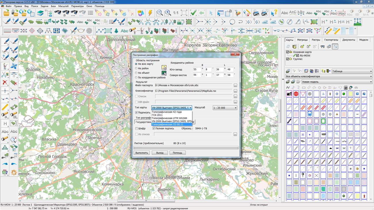
There is added the new type of maps "Topographic PZ-90.11" (Pulkovo2017), based on application of the PZ-90.11 ellipsoid and the Gauss-Krueger projection. Into the tasks the "View Passport" and "Creation of rule" there is added a support for the new type of maps. In the "Select Object" dialog box, in the "Metric" tab there is added the displaying and editing the geocentric coordinates of the object computed for the map ellipsoid or WGS-84 ellipsoid.
In the task of "Map Computer" in the "Coordinate calculation" dialog, the connecting the geoid model EGM2008 was added for accounting at the conversion of geodetic and normal heights. Into the installation of GIS Panorama, a geoid model with a 2.5 minute increment is included - egm2008_2.5min.mtw. A more accurate model (1 minute) is posted on the site.
The new version of the program is available for download in the section.


KB "Panorama" created the toolkit of the developer of geoinformation systems the GIS ToolKit Active version 12. The new version allows you to create 32x and 64-bit applications in any development environment that supports ActiveX technology, for example, Visual Studio, 1C, Microsoft Office, Microsoft Access. GIS ToolKit Active comes with component source code and usage examples. The product provides the use of all kinds of spatial data (geodatabases) prepared in the , including those imported from the exchange formats of other geographic information systems (MIF/MID, DXF, SHAPE, KML, GDF).
GIS ToolKit Active contains a set of visual and non-visual components that allow you to use spatial and attributive data to display and perform special calculations. Using these components, geoinformation systems of various levels (federal, regional, municipal, corporate) are created. The toolkit supports the local, state and international coordinate systems (parameters of more than 4 000 different coordinate systems are included into the delivery). An extensive geospatial data bank is available to use the toolkit.
The geo-database can be located either in the workplace (direct access to data) or in the local network or the Internet (using the components of access to the or data exchange over the international protocols WMS, WFS, WCS, WMTS). The toolkit provides access to spatial data published by geoportals from different manufacturers, including predefined settings for popular geoportals: Yandex, Google, Rosreestr, Panorama, Kosmosnimki, Navitel, Mail, Air traffic monitoring and others. The list of available geoportals is constantly expanding. Data from geoportals can be combined with spatial data on the client. There is a set of methods for managing the visualization parameters of WMS-rasters (transparency, brightness, contrast).
The components set allows creating monitoring systems for mobile objects that store coordinate descriptions in popular databases (Oracle, MS SQL Server, Postgre SQL). The using the special components of navigation and managing the geodatabase allows to simplify work with vast territories.
For the programmer, the tools for constructing routes with the using the graph of roads based on various criteria are available. A complete list of the toolkit components and the order of their use is reflected in the documentation that is included in the installation package.
The new version of the program is available for download on the page.


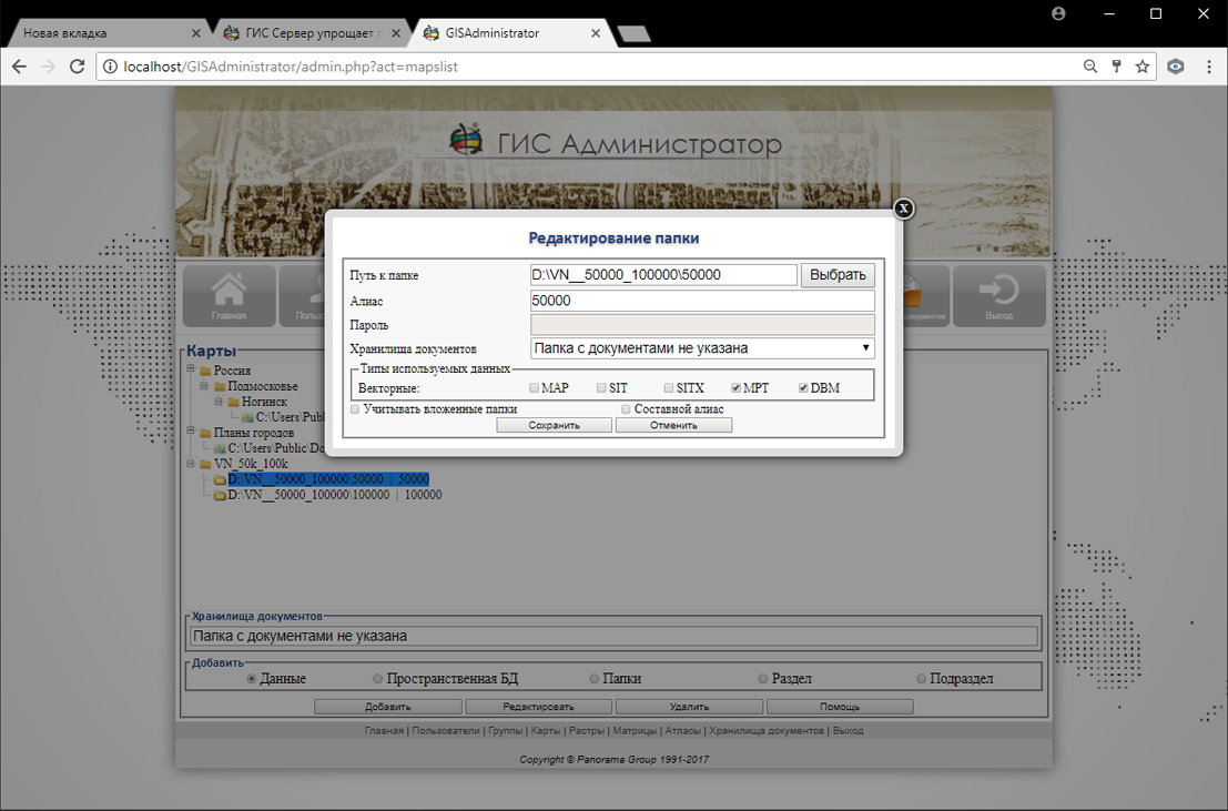
In KB "Panorama" the version 7.4.3 is developed. The new version provides complete management of spatial databases of arbitrary structure. There is implemented a direct editing of databases records with fields of different types, containing the coordinates of objects. Fields of spatial description of objects are supported for DBMS of Oracle, and PostgreSQL is SDO_GEOMETRY, St_Geometry ArcSDE, St_Geometry PostGIS. Database connection parameters, coordinate system code, library of conventional symbols and table fields assignment are customized by the GIS Server Administrator. For compensation of absence of some information layers and some attributes in a database (titles, kilometer grids, filling signs, undirected point signs - bridges, buildings and so on) in the are implemented an automatic procedures on arrangement of titles, formation of grids, a turn of signs and others. It provides editing of data in multi-user mode with high intensity, including support for applications that transmit data in automatic mode. On the client's monitor, the map will have the same appearance and be edited by the same tools, regardless of how the data is stored on the server-in data sets or in a database. The assembly of information by layers stored in various tables (one cover can be collected from more than a hundred tables) is performed automatically at the time of access to the data. Different layers can be located in different bases and in data sets as part of general image of the territory.
GIS Server automates the creation of backup sets of data in the , control of integrity of data sets and their recovery. Automatic creating one or two backup copies of downloadable into the Databank of data sets with distributed storage of backups for different data groups is performed. In procedure of control of the databank metadata a check of backup copies availability in accordance with the group settings is added. In the absence of the first or second backup copies the automatic formation of a copy of the main data set and auxiliary files (classifiers, metadata, images, etc.) is carried out. Automatic recovery of data sets is ensured if there are two identical backup copies in the Data Bank of Digital Maps and Remote Sensing Data.
The possibility is added for transferring the arbitrary (user) metadata for data sets loaded into the Data Bank of Digital Maps and Remote Sensing Data directly in the list of xml format sets. In the list of downloadable sets, you can specify metadata for both the entire data list and for each set individually.
The network-centric architecture of storing and processing data is realized due to the distribution of data storage functions and the provision of access to them onto a group of servers united into the network, with automatic duplication and replication of transmitted information, with the ability to function in the event of failure of individual servers by readdressing requests and issuing a copy of data stored on an inaccessible server. Replication of information is carried out in the minimum necessary volume: the description of only updated (coordinates or attributes) or created objects is transferred. GIS Server is intended to provide remote access to the spatial data for users of programs the GIS "Panorama", , and others. GIS Server is certified in the information security system.
The new version of the program is available for download on the page.


Ph.: +7 (495) 739-0245, +7 (925) 221-1603
www.gisinfo.ru | panorama@gisinfo.ru
105005, Russia, Moscow, Baumanskaya Street 7, building 1, office 229 (m. Baumanskaya)
Copyright © Panorama Group 1991 - 2024


 Mobile version
 Full version