Copyright © Panorama Group 1991 - 2024

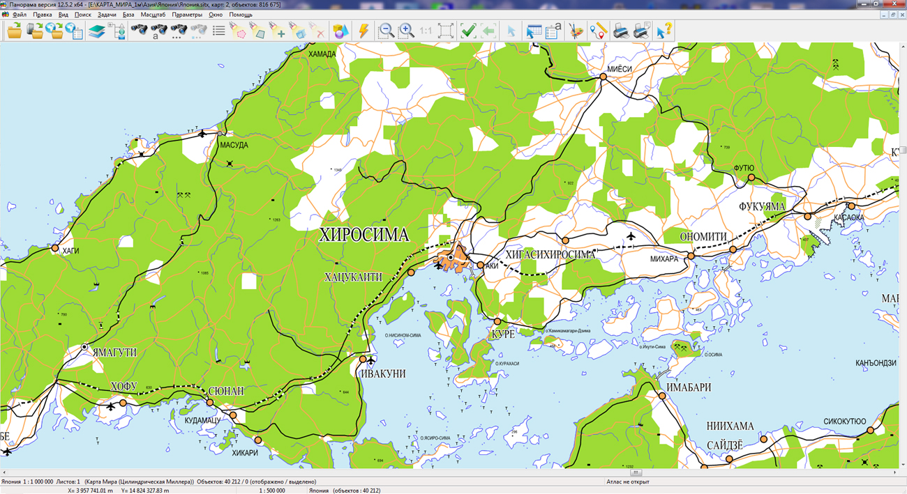
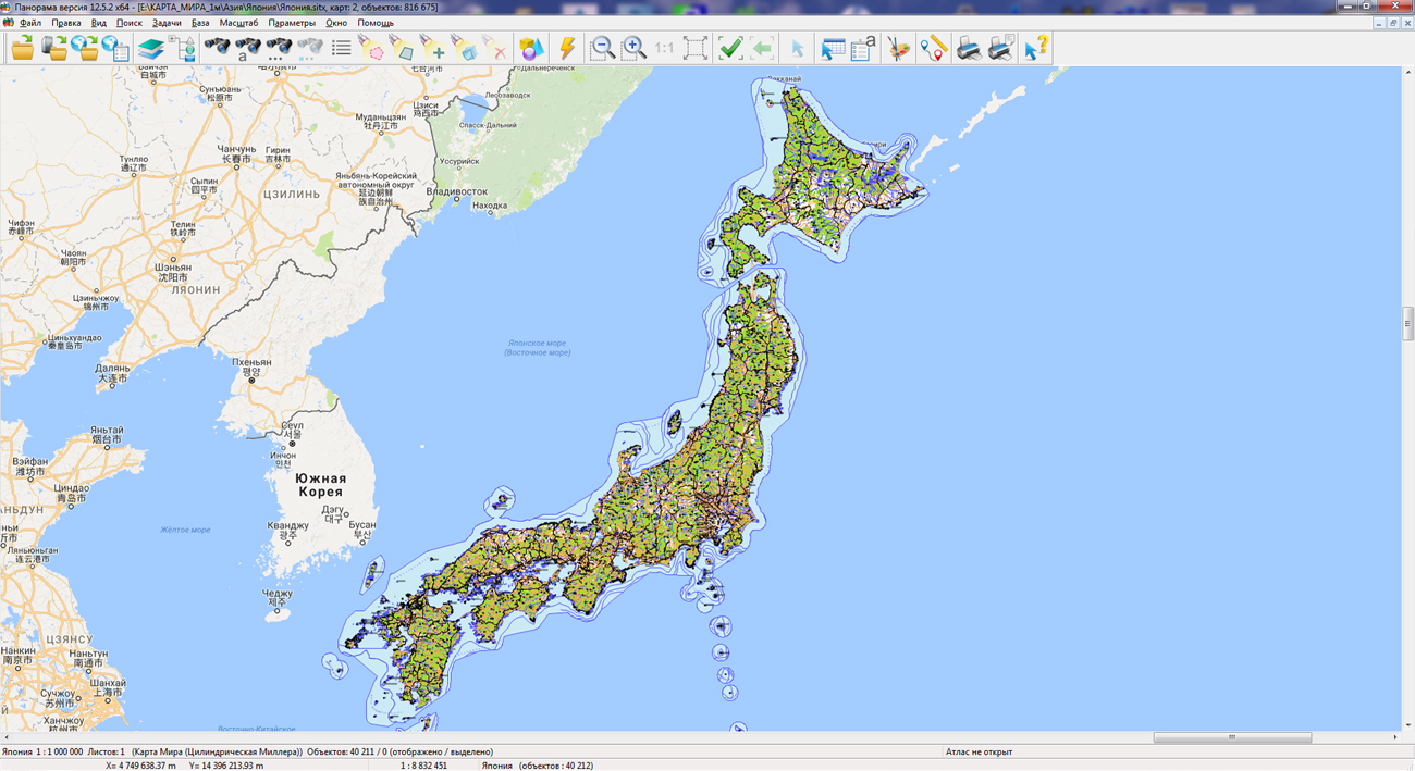
KB "Panorama" prepared a digital geographical map of scale 1: 1 000 000 in format SXF onto territory of Japan. data obtained according to information from the website has served as source for map's preparation. The map contains information about the quantity of inhabitants for cities and the names of settlements in Russian. As additional materials the World Map of scale 1: 5 000 000 and data of OpenStreetMap were used. The map is led to the classifier of geographical maps of scale from 1: 1 000 000 (1mogk13g.rsc).
It can be used for the general estimation of district and studying of an environment, an ensuring of educational process, as a basis for creation of geographical maps of smaller scale, thematic and special maps and solving other tasks. The map is distributed free according to the free .
Digital geographical map of scale 1: 1 000 000 in format SXF is available for downloading on page "Digital maps and images".


In KB "Panorama" the version 9.3.1 is developed. The new version of the program allows you to use cloud technologies to configure projects and generate tiles on the server. A single user interface provides the ability to administrate the process of preparation and cutting of tiles from any workplace via the Internet and the browser remotely. Thus, the program is easily scaled and allows to form for few minutes the files of tiles Big Data consisting, of billions of tiles.
The program administrator can run different projects from one workstation on different servers. The user interface helps the administrator to monitor the progress of the process of cutting tiles, to switch between existing projects, to set the parameters for cutting (scale, view, format, projection, etc.).
The program allows you to create tiles in the formats JPEG, PNG, PNG8 and Mbtiles according to the international standard OGC WMTS 07-057r7 version 1.0.0 and the TMS standard. The tile data generated by the ImageryCreator program are used by software the , to provide high-speed query execution for displaying spatial data over large areas while simultaneously accessing a large number of users. A new version of the program is available on the Download page.


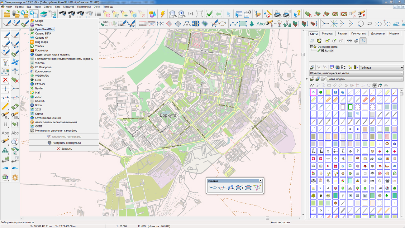
On the geoportal , map of the Komi Republic, formed according to OpenStreetMap data, was updated. Source data obtained from the GIS-Lab website are complemented by objects from maps of scale 1: 1 000 000. There are added the objects of hydrography, vegetation, road network. For work with the received maps it is possible to use the program of or other software products of KB "Panorama".
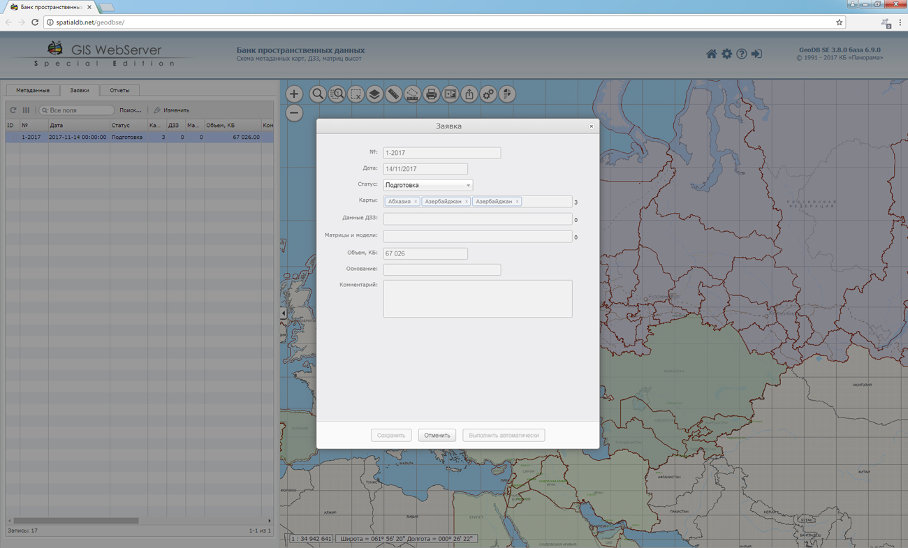
Publishing of updates in bank of spatial data is made by using the program of . Publishing contents of bank of spatial data on the geoportal and data access for downloading are implemented by means of .
Free maps on the basis of OpenStreetMap data are available for download on the page "Digital maps and images".


In KB "Panorama" the version 3.8 is developed. The bank's storehouse can include hundreds of gigabytes of spatial information and contain vector maps, remote sensing data, elevation matrixes, terrain models and other types of data.
The new version automates the creation of backup sets of data, control of the integrity of data sets and their recovery. Automatic creating one or two backup copies of downloadable data sets with the distributed storage for different data groups is carried out. In the metadata control procedure, a check of backup copies availability in accordance with the group settings is added. It supports automatic updating of metadata maps-schemes, import and export of metadata, automatic updating of geo-covers.
The accounting of executed requests for obtaining the spatial data is conducted. Service of conducting requests provides the ability to form requests on data acquisition from storehouse to users who have not the right to direct downloading. At requests formation, there are available the tools of search for data sets by a data format, projection, by year of the terrain's state, date of updating, scale, territorial binding.
Within the framework of a single geoinformation space, the Data Bank of digital maps and remote sensing data realises gathering, storage, search and delivery of the spatial data in exchange formats. The spatial data selected by means of the program can be placed for the multiuser access on the and be published according to the international standards OGC WFS, WFS-T, WMS, WMTS, WCS on application server the . Users can access data from both a thin client (by means of ) and from desktop applications (, ).
The databank of digital maps and remote sensing data provides construction of cloud storehouse of spatial data, provision of access to these data, the automated formation and updating of geo-covers. The current state of spatial data is displayed by means of maps-schemes that are maintained for each type of stored data: vector maps, remote sensing data, elevation matrices and terrain models. It provides remote placing the sets of spatial data into file storehouse, keeping versions of stored sets, updating maps-schemes of data availability, the automated collection and formation of metadata, and the formation and updating of geo-covers. Automated collection and formation of metadata is performed according to the standards of ISO 19115: 2003, Geographic information - Metadata and ISO/TS 19139, Geographic information - Metadata - XML schema implementation. The reduced copies of data images are automatically formed, checksum of files and completeness of data sets are checked.
The new version of the program is available for download on the page.


KB "Panorama" took part in the work of the section "Crop production" of the , which was held in Belgorod from October 25 to 27. The organizer of the conference was Ltd. "CenterProgrammSystem".
Specialists of KB "Panorama" introduced the presentation . The issues of providing automation of business processes in the crop sector were considered. The content of the report aroused great interest of the conference participants. Within the section work there were held the meetings with representatives of the companies the Rostselmash, AFG National, AIST and other manufacturers of agricultural machinery, software and crop production. As a result of the negotiations, a number of agreements have been reached aimed at developing own agrarian line of geoinformation systems, including , "Workstation of Agronomist", .
The complex of the presented programs is the tool providing the decision of the basic problems causing success in the conditions of the modern market: presence of the timely objective information, ability to accept correct administrative decisions and an opportunity to realize these decisions in practice.
The combination of these products, as well as their interaction with the cartographic and the professional GIS "Panorama" allow to create the distributed scalable computing systems that provide a single geographic information space for the agro-enterprise. The "Agro-management" conferences are held annually in Belgorod, starting from 2012. The main goal of the event is to demonstrate examples of import substitution of foreign technologies by Russian developments, advanced experience of agricultural enterprises using innovations to improve the efficiency of agricultural production. More than 200 managers, masters and experts of agribusiness, leading domestic and foreign specialists in the field of development and integration took part in the event.
Ph.: +7 (495) 739-0245, +7 (925) 221-1603
www.gisinfo.ru | panorama@gisinfo.ru
105005, Russia, Moscow, Baumanskaya Street 7, building 1, office 229 (m. Baumanskaya)
Copyright © Panorama Group 1991 - 2024


 Mobile version
 Full version