Copyright © Panorama Group 1991 - 2024

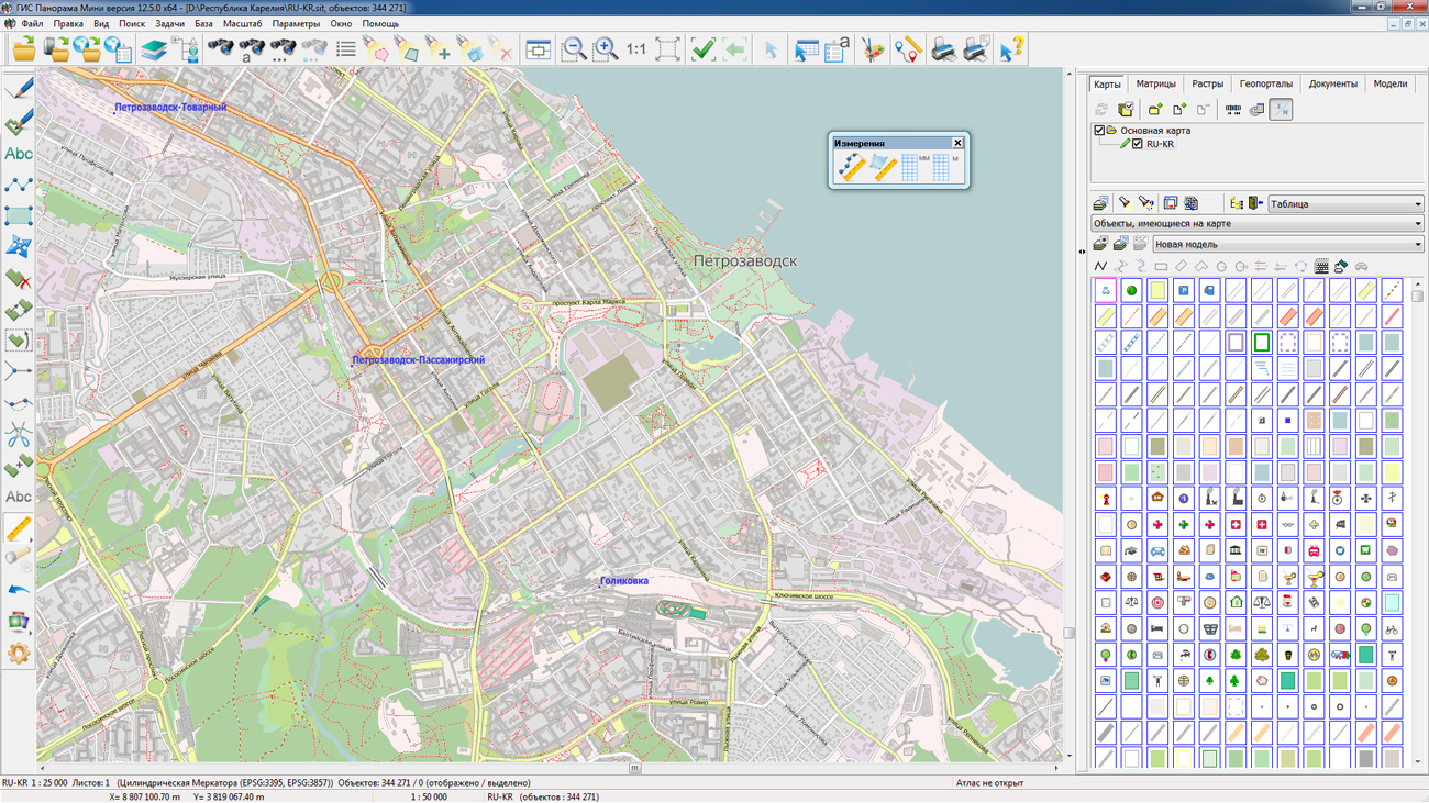
On the geoportal , maps of the Republic of Kareliya and the Pskov region, formed according to OpenStreetMap data, were updated. Source data obtained from the GIS-Lab website are complemented by objects from maps of scale 1: 1 000 000. There are added the objects of hydrography, vegetation, road network. For work with the received maps it is possible to use the program of or other software products of KB "Panorama".
Publishing of updates in bank of spatial data is made by using the program of . Publishing contents of bank of spatial data on the geoportal and data access for downloading are implemented by means of .
Free maps on the basis of OpenStreetMap data are available for download on the page "Digital maps and images".


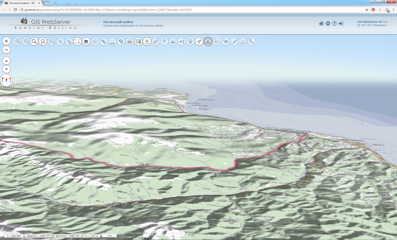
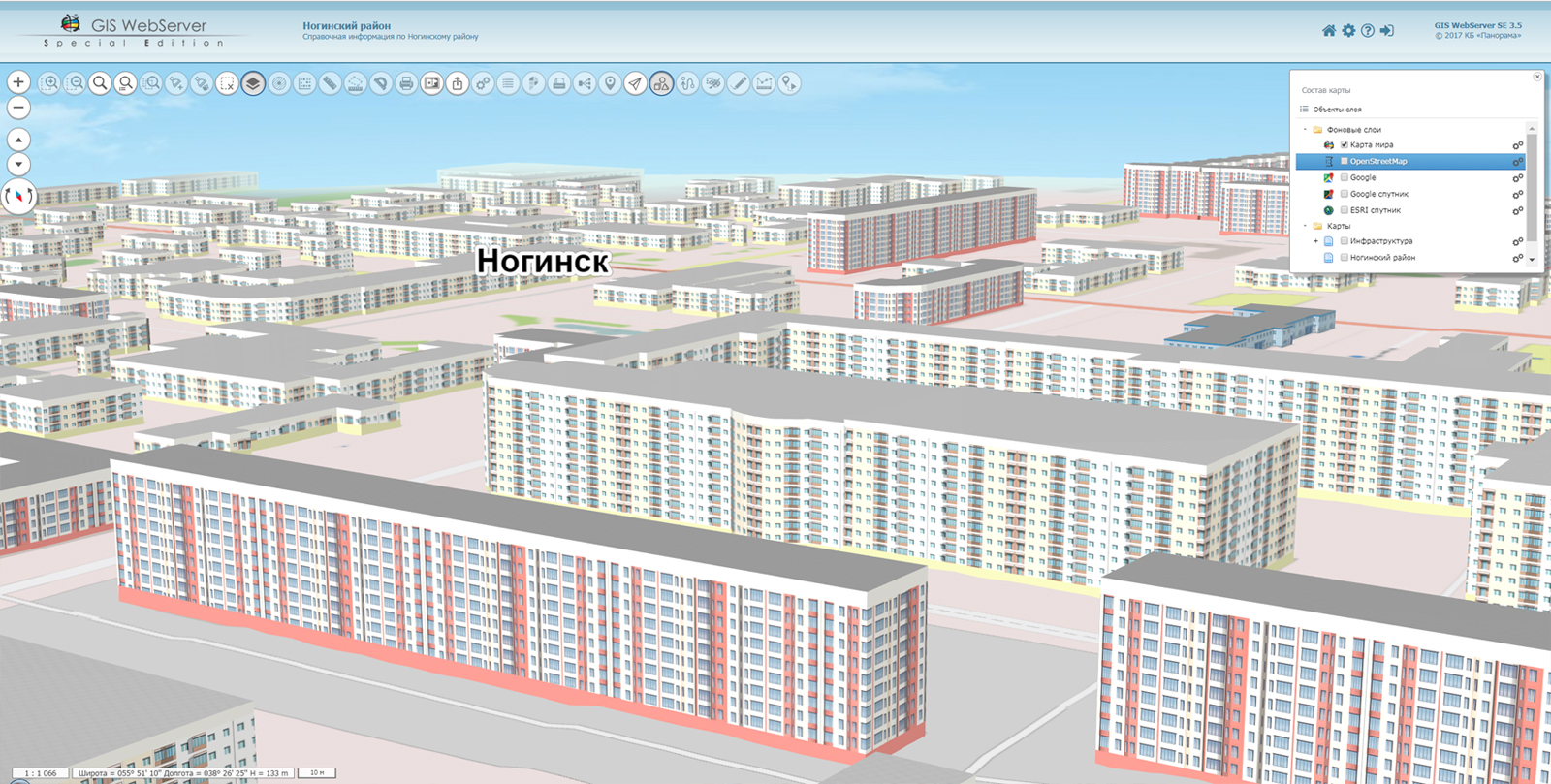
On the updated website of KB "Panorama" the demo thematic geoportals (municipal, agrarian, transport and others)are presented. For each of the examples a short description and a gallery of screenshots are published.
Information geoportal may be as an example of construction of a municipal GIS for administrations of oblasts, districts, cities, settlements and other territorial units. The urban area is formed on the basis of digital plans of cities, snapshots, relief data and can be represented in the form of a traditional map or a volumetric terrain model. The geoportal provides the means for solving a direct and inverse geodetic task; calculation of distances, areas, angles; constructing an optimal route of travel between two points and others. The user interface allows you to print a map with your own comments. The geoportal is easily integrated into existing information systems.
provides an opportunity for agricultural producers to access the agricultural GIS of the enterprise from anywhere in the world. The geoportal is intended for management of agriculture, provides creation of a digital map of contours of fields of an economy, conducting a base of soil fertility and an electronic corded book of history of fields. On the basis of indicators of agrochemical composition of soils and information on crop rotations the technological maps are formed and planning of the mechanised works is carried out. The agroportal is integrated with the monitoring system for agricultural machinery and vehicles and includes services for automating various calculations, including: the need for mineral fertilizers, mileage of vehicles, the processed area arable land and others. The results of the calculations can be presented in the form of thematic cartograms displayed together with background information, cadastral data and agricultural land contours for visualization of the analyzed indicator (crop distribution, planned and actual yield, sowing or harvesting works, etc.).
On the portal possibilities are presented for the organisation of storing, accounting and issuing cartographic materials in vector, raster and matrix form. The portal contains vector maps in SXF format, formed on the basis of data from open sources (OpenStreetMap, VMap0). The spatial data includes maps: of subjects of the Russian Federation, countries and cities of near and far abroad. In total there are more than 160 maps. All published maps are distributed free of charge under a free license.
has been developed by the company's specialists within the bounds of the preparation for VIII International Salon "Integrated Security 2015". The Web application provides systematized information about the forces of the Unified State System for the Prevention and Elimination of Emergencies and on the objects of the economy and infrastructure on the territory of the Russian Federation.
All information geoportals presented on the gisserver.ru website, are implemented on the basis of .


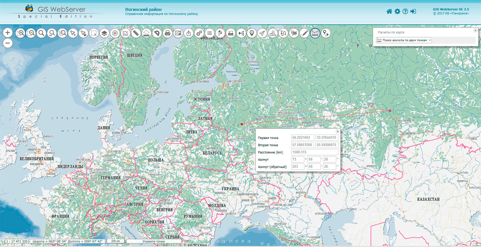
In KB "Panorama" the versions 3.5 is developed. The new version of the program implements the possibility of online solving a direct and inverse geodetic task on a plane. By means of this mode users can carry out an interactive choice of terrain points and entering the required values of azimuth and distance between points. The results of calculations are displayed on the map and in the form.
Modes of selection of map objects are expanded - there are added a selection of objects randomly specified on a map and a selection of objects by a conventional symbol of the selected object. Into the module "Editor of a map" the group operations are added at deleting map objects. Users can delete all selected objects, or select the ones required in the group.
Ability is added to share a link to a 3D map. The status of the 3D map display is saved between sessions. You can see an example of the work of a three-dimensional map on the .
The web applications development tool the GIS WebToolKit SE has been refined, which extends the capabilities of GIS WebServer SE and can be integrated into other information systems. Access to data (images, vector maps and terrain information) is provided by Web services using common OGC protocols and ISO standards. Service GIS WebService SE (OGC WMS/WMTS) provides spatial information in the form of graphic images. As digital model of a relief the various kinds of high-altitude data are used: matrixes (in formats SRTM, GeoTIFF, IMG, MTW), TIN-models, a cloud of points and others. At request there is carried out the automatic sample of the most accurate data onto the specified terrain site with a given resolution. To transfer data of the digital terrain model to the Web, the WCS protocol is used. The relief data are represented as tiles and are cached on the client.
As a source of spatial data, the can be. It provides the collection, storage, search and delivery of spatial data in exchange formats, a displaying the state of the data bank in the form of maps-schemes, the automated formation and updating of geo-covers.
GIS WebServer SE is used in the construction of closed corporate systems to ensure the protection of data having a security classification or a trade secret. GIS WebServer SE is certified for Level 2 of absence of undeclared capabilities. The new version of the program expands the application's capabilities in solving problems of analysis, management and long-term planning of the territories development. GIS WebServer SE is implemented using the toolkit of GIS WebToolKit SE, which can be used in development tools that use the JavaScript.
The new version of the program is available on the web-site in the section.


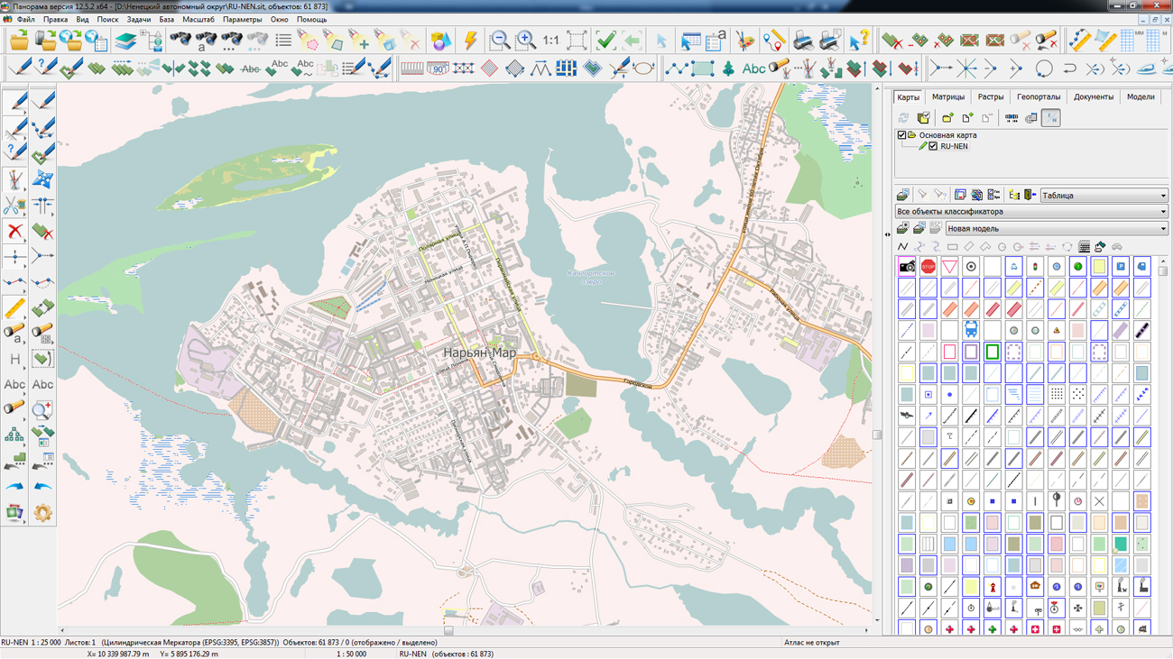
On the geoportal , maps of Novgorod region and the Nenets Autonomous Okrug, formed according to OpenStreetMap data, were updated. Source data obtained from the GIS-Lab website are complemented by objects from maps of scale 1: 1 000 000. There are added the objects of hydrography, vegetation, road network. For work with the received maps it is possible to use the program of or other software products of KB "Panorama".
Publishing of updates in bank of spatial data is made by using the program of . Publishing contents of bank of spatial data on the geoportal and data access for downloading are implemented by means of .
Free maps on the basis of OpenStreetMap data are available for download on the page "Digital maps and images".


In KB "Panorama" the of for the x64 platform is developed. In the new version, the task of connecting geoportals has been refined. Support of a new geoportal is added for realisation of monitoring the movement of aircraft. Geoportal "Monitoring the Air Traffic" uses the public web service Flightradar24, which allows real-time monitoring of the situation of aircrafts, being in air. To view the current position of the aircraft in the program it is necessary to connect a geoportal "Monitoring the Air Traffic", to set the period of updating the image of the program window for 5 seconds, and to turn on the property "Update of WMS layers". In the process of monitoring, detailed information about the selected flight is available: airport of departure and arrival, travel time, model, speed, direction of movement, altitude and other parameters. Aircraft on the map are displayed with various conventional symbols from the classifier service.rsc depending on their model, dimensions, seating capacity. In total into the classifier service.rsc 16 new conventional symbols for a designation of aircraft were added. Among them, such lines of aircraft as SuperJet, TU, IL, Airbus, Boeing, Bombardier, Dassault aviation and others. The user can change the image of conventional symbols and expand the list of available aircraft models in the "Classifier Editor". GIS "Panorama" allows you to work with dynamic data coming from geoportals (various types of transport, road, rural and forest economy, hydrometeorology and ecological monitoring of the environment, subsoil use and others).
The parameters of the local coordinate system of the Republic of Crimea for zone 1 and zone 2 are added into the file "LCS of RF Subjects.XML", which provides the storage of the list of parameters of local coordinate systems. The choice of coordinate system parameters from the file is carried out in the task of "Map Passport" and in dialogs the "Setting projection parameters of a raster" and "Setting projection parameters of a matrix". Local coordinate systems are set for making geodetic and topographical works in engineering surveying, construction and operation of buildings and constructions, land surveying, conducting cadastres and realisation of other special works.
The task "Check of vector map quality" is improved. The vector map is checked in accordance with the selected control scheme containing a list of types and parameters of check. The report with results of control is sent to the HTML-file. The file format of the scheme of control parameters is changed from binary CXM onto textual XML. In a folder \Control.Dot\ the XML-files of schemes of control parameters with *.CXML extension have been updated.
A new mode "Reading the cadastral plan of territory and updating the map" is developed, which provides stream reading of several XML-files using two XML schemes of the cadastral plan of territory (CPT): V09_KPT and extract_cadastral_plan_territory_v01. The files corresponding to the scheme extract_cadastral_plan_territory_v01 are received within the framework of interdepartmental electronic interaction and are used in state and municipal authorities. The mode supports the processing of new types of cadastral objects: "water body", "land plot by land survey project", "zone, territory, natural object". During the processing of information read from the XML-CPT file, a search is performed on the map of the corresponding cadastral object and a decision is made to update the information on the map. To update the cadastral map, in addition to the cadastral number, the registry (accounting) number of the cadastral object is used as identification information. The digital classifier survey.v5.rsc was updated. In the updated classifier, new cadastral objects and semantics have been added to the layer "Cadastral plan of the territory", that are necessary to automate the process of updating the cadastral information.
The task of "Opening data from the GIS Server" is refined. There is implemented the opening and addition into the current document of the list of the documents belonging to the selected node of the data tree. Actions are performed using the pop-up menu on the right button when the node of the map tree, rasters or matrices is activated.
In the mode "Mark for equivalent image" the possibility is added for a choice of graphic objects (not having code from the classifier) with selection of all objects having conterminous graphic parameters (conventional symbol) .
The mode "Create objects from the XML file of real estate cadastre" is improved in the part of mapping objects with no coordinates - conditional objects. For conditional objects, the conditional coordinates are calculated according to the coordinates of the center of the cadastral quarter in which they are located. The algorithm of reading XML-files containing cadastral data in several coordinate systems is improved.
The new version of the program is available for download in the section.


Ph.: +7 (495) 739-0245, +7 (925) 221-1603
www.gisinfo.ru | panorama@gisinfo.ru
105005, Russia, Moscow, Baumanskaya Street 7, building 1, office 229 (m. Baumanskaya)
Copyright © Panorama Group 1991 - 2024


 Mobile version
 Full version