Copyright © Panorama Group 1991 - 2024

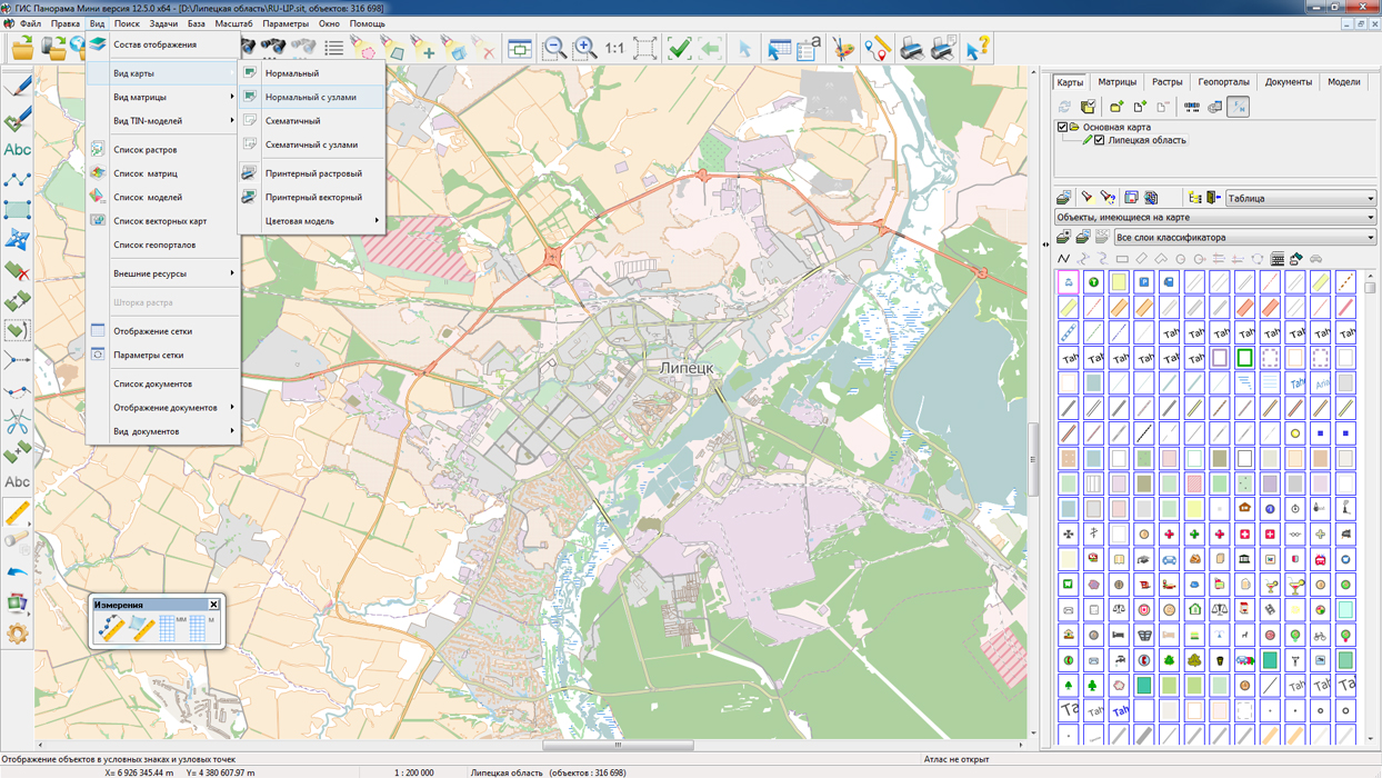
On the geoportal , maps of the Lipetsk and Oryol regions, formed according to OpenStreetMap data, were updated. Source data obtained from the GIS-Lab website are complemented by objects from maps of scale 1: 1 000 000. There are added the objects of hydrography, vegetation, road network. For work with the received maps it is possible to use the program of or other software products of KB "Panorama".
Publishing of updates in bank of spatial data is made by using the program of . Publishing contents of bank of spatial data on the geoportal and data access for downloading are implemented by means of .
Free maps on the basis of OpenStreetMap data are available for download on the page "Digital maps and images".


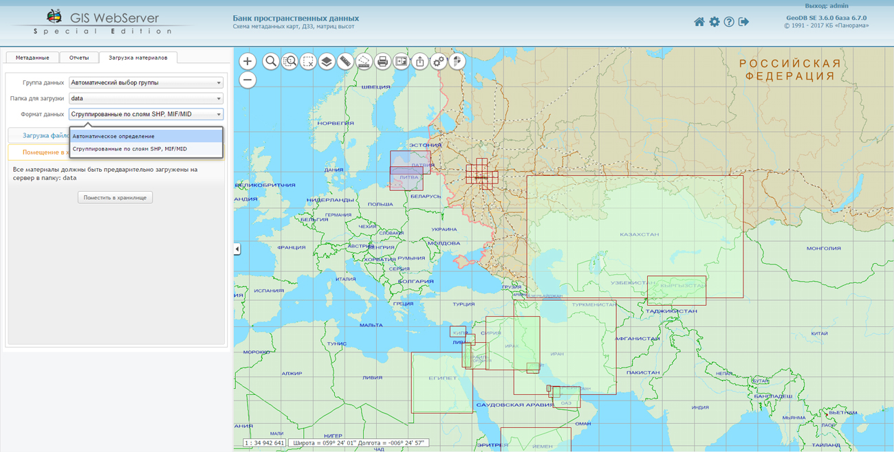
In KB "Panorama" the of version 3.6 is developed. In the new version the automated processing of the input information is supported at a placement into storehouse. Formats of loaded data are automatically determined.
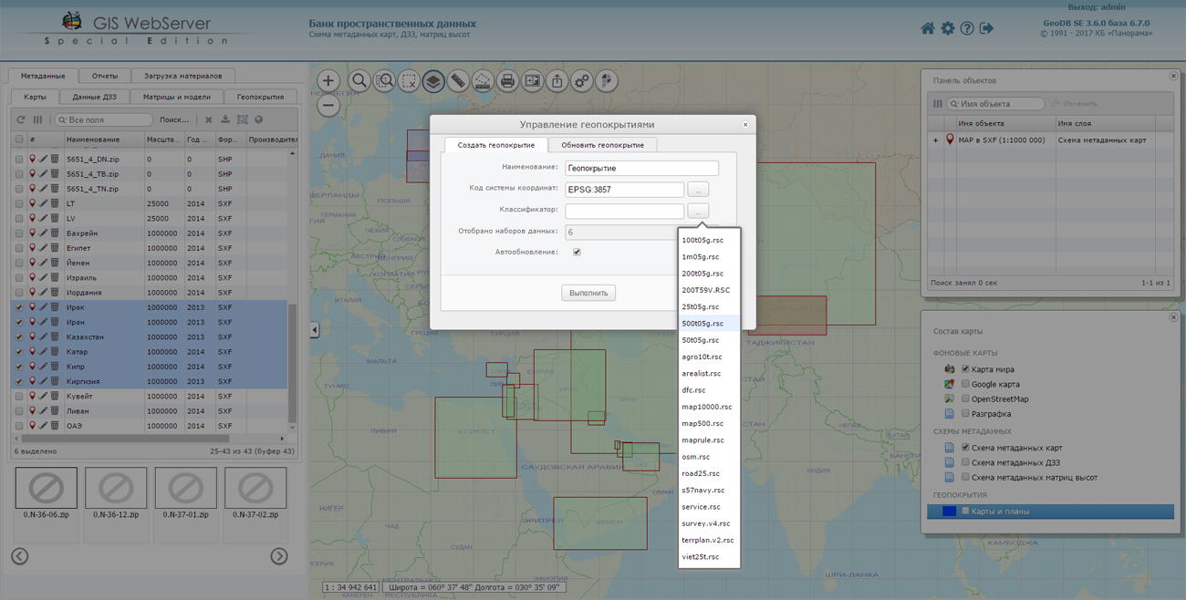
The possibility is added for automated creation of geo-covers by data received from various sources. Various national coordinate systems and projections are supported. You can combine the formats SXF, SHP, MIF/MID and others among themselves. The created geo-covers are automatically available for use in other applications.
The new version supports the loading of spatial data of format SHP and MIF/MID, grouped by folders or packed in archives. It considerably simplifies loading and raises speed of placing data into storehouse.
Possibility of cyclic displaying and moving the map is added. Smooth animation at scaling is implemented. In the mode of distances measurement the calculation of length of the segment by an orthodrome is added.
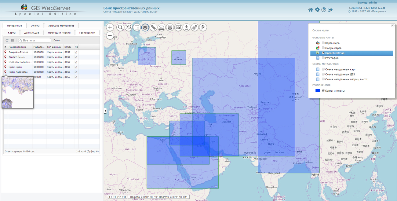
Within the framework of a single geoinformation space the Data Bank of digital maps and remote sensing data implements a collection, storing, search and output of spatial data in exchange formats. The spatial data selected with the help of the program can be placed for multiuser access on the and published according to the international standards OGC WFS, WFS-T, WMS, WMTS, WCS on the application server. Users can access data from both a thin client (using the ) and from desktop applications (, ).
The databank of digital maps and remote sensing data provides the construction of a cloud repository of spatial data, the provision of access to these data, the automated formation and updating of geo-covers. The current state of the spatial data is displayed by means of maps-schemes that are maintained for each type of stored data: vector maps, remote sensing data, matrixes of heights and terrain models. It provides remote placement of sets of spatial data into file storage, a keeping the versions of stored sets, an updating of maps-schemes of data availability, the automated collection and formation of metadata, and the formation and updating of geo-covers. Automated collection and formation of metadata is performed according to the standards of ISO 19115: 2003, Geographic information - Metadata and ISO/TS 19139, Geographic information - Metadata - XML schema implementation. The reduced copies of data images are automatically formed, the checksum of files and completeness of data sets are checked.
The new version of the program is available for download on the page.


In KB "Panorama" the of version 6.6 is developed for platform x64. In the new version of the program the procedure of quality control is accelerated and the list of formats for generating report documents is expanded. The output of reports into text documents containing markup in HTML is implemented. The templates of reports of the results of quality control and correction of maps in HTML format are developed. The received reports can be opened with the help of various office programs, text editors and Web-browsers.
The complex of automated quality control and correction of digital maps is intended to obtain a single digital map by the original digital maps in the SXF format created by different classifiers. The complex of the automated quality assurance and correction of digital maps consists of a set of programs: code conversion and quality assurance DTM with editing, control of the coordination of adjacent sheets DTM, association of adjacent sheets DTM, the conformity analysis object structure of maps and classifiers.
The new version of the program is available for download in the section.


In KB "Panorama" the is developed for power structures of version 12.5.2 for the platform x64. In the new version, the task of connecting geoportals has been refined. Support of a new geoportal is added for realisation of monitoring the movement of aircraft. Geoportal "Monitoring the Air Traffic" uses the public web service Flightradar24, which allows real-time monitoring of the situation of aircrafts, being in air.
Tracking with the help of service the position of the aircraft is possible only if it is equipped with a transponder of ADS-B type and that is switched on. An aircraft equipped with an ADS-B transponder, during the entire flight, approximately every second generates and sends into an air a broadcast, open radio message, which contains the actual data at the time of departure-its exact coordinates, current speed, altitude and other information. The service uses ADS-B receivers installed around the world that receive information from aircraft and send it to the Flightradar24 server. To view the current position of the aircraft in the GIS "Operator" it is necessary to connect a geoportal "Monitoring the Air Traffic", to set the period of updating the image of the program window for 5 seconds, and to turn on the property "Update of WMS layers". In the process of monitoring, detailed information about the selected flight is available: airport of departure and arrival, travel time, model, speed, direction, altitude and other parameters. Aircraft on the map are displayed with various conventional symbols from the classifier service.rsc depending on their model, dimensions, seating capacity. In total into the classifier service.rsc 16 new conventional symbols for a designation of aircraft were added. Among them, such lines of aircraft as SuperJet, TU, IL, Airbus, Boeing, Bombardier, Dassault aviation and others. The user can change the image of conventional symbols and expand the list of available aircraft models in the "Classifier Editor".
The task "Loading data from the COLLADA format (* .dae)" has been refined to edit the 3D view of the object in the classifier editor. A new format has been developed for storing data in the SQLite database in the form of tiles that are convenient for displaying in web applications. Processing of nested nodes with links is added.
New possibilities are added for processing rasters that open directly without conversion to RSW (when open, the mode "Do not copy the source image to the RSW file" is selected). There is added joint opening and display of Landsat, Kompsat and GeoEye images supplied as a set of single-channel TIF rasters. Single-channel TIF rasters are interpreted as different channels of the same image.
The restriction on the maximum size of survey images of 4 GB is removed, which allows processing images of any size. The GDAL library has been updated to version 2.2.0, in which new formats of processed rasters have been added.
The dialog of the "Data List of map" and "Map Legend" task has been improved. Multichannel Landsat, Kompsat and GeoEye images, supplied as a set of single-channel TIF rasters, are displayed in the list of rasters as a node containing a complete list of used TIF files.
At requesting lengths of objects or segments having a length of more than 5 degrees in longitude, the orthodrome is automatically constructed, which ensures the calculation with the accuracy of class 1 triangulation. Accurate length calculations are performed if the "Precise square and length" property is set in the Options menu.
The new version of the program is available for download in the section.


In KB "Panorama" the version 11.8.0 for CentOS OS is developed. In the new version, the administrator can assign a lifetime to each user or virtual folder separately. As a result, "in the fast access" there is the most necessary and relevant data, and by optimizing the data set stored in the RAM, the speed of the service is increasing.
The functional of obtaining the calculated information is expanded. For creation of buffer zones there is implemented a request of their construction by the closed linear objects, and also by an arbitrary object, passed through the input file. The new request of obtaining the distance, azimuth and directional angle is added. Requests of transactions are improved, allowing to analyze the list of available for object of editing of semantic characteristics and to update only transferred for semantics change.
GIS WebService SE implements support for a single geoinformation space, providing the transmission and display of spatial data located on a spatial data server (), according to international standards OGC WFS, WFS-T, WMS, WMTS, WCS. For preliminary selection of data to be placed on the GIS Server, and also for automated formation and updating of geo-covers, the is used. Requests implemented in the new version of the service allow you to select the conventional symbols used in the formation of geo-covers, and dynamically configure the composition of layers located on the GIS Server.
A new version of the program is available on the site in the section.


Ph.: +7 (495) 739-0245, +7 (925) 221-1603
www.gisinfo.ru | panorama@gisinfo.ru
105005, Russia, Moscow, Baumanskaya Street 7, building 1, office 229 (m. Baumanskaya)
Copyright © Panorama Group 1991 - 2024


 Mobile version
 Full version