Copyright © Panorama Group 1991 - 2024

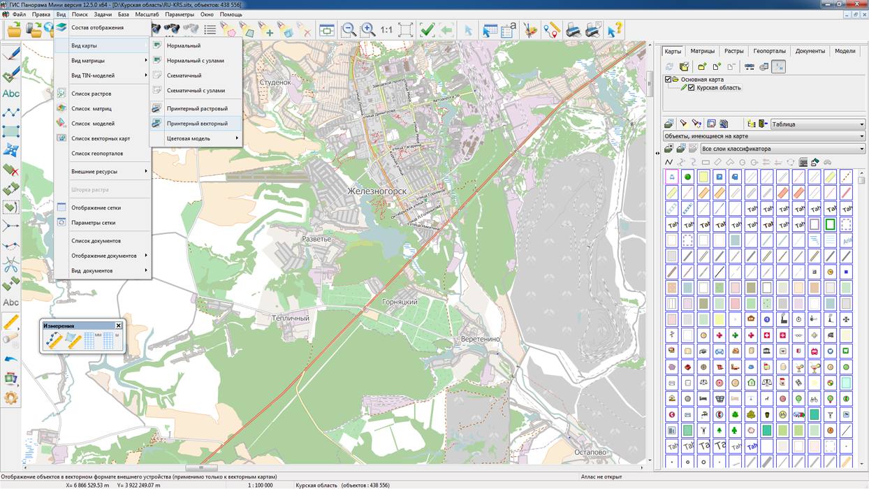
In KB "Panorama" the is developed for power structures of version 12.5.2 for the platform x64. In the new version, the task of connecting geoportals has been refined. Support of a new geoportal is added for realisation of monitoring the movement of aircraft. Geoportal "Monitoring the Air Traffic" uses the public web service Flightradar24, which allows real-time monitoring of the situation of aircrafts, being in air.
Tracking with the help of service the position of the aircraft is possible only if it is equipped with a transponder of ADS-B type and that is switched on. An aircraft equipped with an ADS-B transponder, during the entire flight, approximately every second generates and sends into an air a broadcast, open radio message, which contains the actual data at the time of departure-its exact coordinates, current speed, altitude and other information. The service uses ADS-B receivers installed around the world that receive information from aircraft and send it to the Flightradar24 server. To view the current position of the aircraft in the GIS "Operator" it is necessary to connect a geoportal "Monitoring the Air Traffic", to set the period of updating the image of the program window for 5 seconds, and to turn on the property "Update of WMS layers". In the process of monitoring, detailed information about the selected flight is available: airport of departure and arrival, travel time, model, speed, direction, altitude and other parameters. Aircraft on the map are displayed with various conventional symbols from the classifier service.rsc depending on their model, dimensions, seating capacity. In total into the classifier service.rsc 16 new conventional symbols for a designation of aircraft were added. Among them, such lines of aircraft as SuperJet, TU, IL, Airbus, Boeing, Bombardier, Dassault aviation and others. The user can change the image of conventional symbols and expand the list of available aircraft models in the "Classifier Editor".
The task "Loading data from the COLLADA format (* .dae)" has been refined to edit the 3D view of the object in the classifier editor. A new format has been developed for storing data in the SQLite database in the form of tiles that are convenient for displaying in web applications. Processing of nested nodes with links is added.
New possibilities are added for processing rasters that open directly without conversion to RSW (when open, the mode "Do not copy the source image to the RSW file" is selected). There is added joint opening and display of Landsat, Kompsat and GeoEye images supplied as a set of single-channel TIF rasters. Single-channel TIF rasters are interpreted as different channels of the same image.
The restriction on the maximum size of survey images of 4 GB is removed, which allows processing images of any size. The GDAL library has been updated to version 2.2.0, in which new formats of processed rasters have been added.
The dialog of the "Data List of map" and "Map Legend" task has been improved. Multichannel Landsat, Kompsat and GeoEye images, supplied as a set of single-channel TIF rasters, are displayed in the list of rasters as a node containing a complete list of used TIF files.
At requesting lengths of objects or segments having a length of more than 5 degrees in longitude, the orthodrome is automatically constructed, which ensures the calculation with the accuracy of class 1 triangulation. Accurate length calculations are performed if the "Precise square and length" property is set in the Options menu.
The new version of the program is available for download in the section.


In KB "Panorama" the version 11.8.0 for CentOS OS is developed. In the new version, the administrator can assign a lifetime to each user or virtual folder separately. As a result, "in the fast access" there is the most necessary and relevant data, and by optimizing the data set stored in the RAM, the speed of the service is increasing.
The functional of obtaining the calculated information is expanded. For creation of buffer zones there is implemented a request of their construction by the closed linear objects, and also by an arbitrary object, passed through the input file. The new request of obtaining the distance, azimuth and directional angle is added. Requests of transactions are improved, allowing to analyze the list of available for object of editing of semantic characteristics and to update only transferred for semantics change.
GIS WebService SE implements support for a single geoinformation space, providing the transmission and display of spatial data located on a spatial data server (), according to international standards OGC WFS, WFS-T, WMS, WMTS, WCS. For preliminary selection of data to be placed on the GIS Server, and also for automated formation and updating of geo-covers, the is used. Requests implemented in the new version of the service allow you to select the conventional symbols used in the formation of geo-covers, and dynamically configure the composition of layers located on the GIS Server.
A new version of the program is available on the site in the section.


On the geoportal , maps of the Kostroma and Kursk regions, formed according to OpenStreetMap data, were updated. Source data obtained from the GIS-Lab website are complemented by objects from maps of scale 1: 1 000 000. There are added the objects of hydrography, vegetation, road network. For work with the received maps it is possible to use the program of or other software products of KB "Panorama".
Publishing of updates in bank of spatial data is made by using the program of . Publishing contents of bank of spatial data on the geoportal and data access for downloading are implemented by means of .
Free maps on the basis of OpenStreetMap data are available for download on the page "Digital maps and images".


In KB "Panorama" the of for a platform x64 is developed. The new version adds a set of tasks "Forecasting the consequences of emergency situations" for the automated forecast of potential consequences in the event of emergencies on radiation-hazardous objects, chemically hazardous objects and hydraulic structures. The complex makes it possible to calculate the parameters of the damaging factors and to construct a zone of possible damage as a result of an emergency. The zone of defeat is placed on the map of situation in the emergency area with conventional symbols, which correspond to the requirements of the normative documents of the Ministry of Emergency Measures (GOST R 22.0.10-96). The calculation takes into account the weather conditions that are entered by the operator at the time of calculation. When simulating the occurrence of emergencies on a hydraulic engineering structure during a spill of liquid, a form of the terrain is taken into account, which is determined by the height matrix. At the radiation-hazardous object, terrain matrixes and vegetation data are used to make more specific affected area. After execution of calculations in the GIS, you can estimate the number of buildings (personnel, population) that have fallen into the affected area.
New possibilities are added for processing rasters that open directly without conversion to RSW (when open, the mode "Do not copy the source image to the RSW file" is selected). There is added joint discovery and display of Landsat, Kompsat and GeoEye images supplied as a set of single-channel TIF rasters. Single-channel TIF rasters are interpreted as different channels of the same image. The restriction on the maximum size of survey images of 4 GB is removed, which allows processing images of any size. The GDAL library has been updated to version 2.2.0, in which new formats of processed rasters are added.
The task of connecting geoportals has been improved. Possibility is added for scaling the image from the previous level if the data at the subsequent levels are not present. In order to improve the security of information exchange with geoportals, the ability to connect data via https is added. Support for these protocols will improve the protection against attacks based on listening to a network connection.
The task "Loading data from the COLLADA format (* .dae)" has been completed to edit the 3D view of the object in the classifier editor. A new format has been developed for storing data in the SQLite database in the form of tiles that are convenient for displaying in web applications. Processing of nested nodes with links is added.
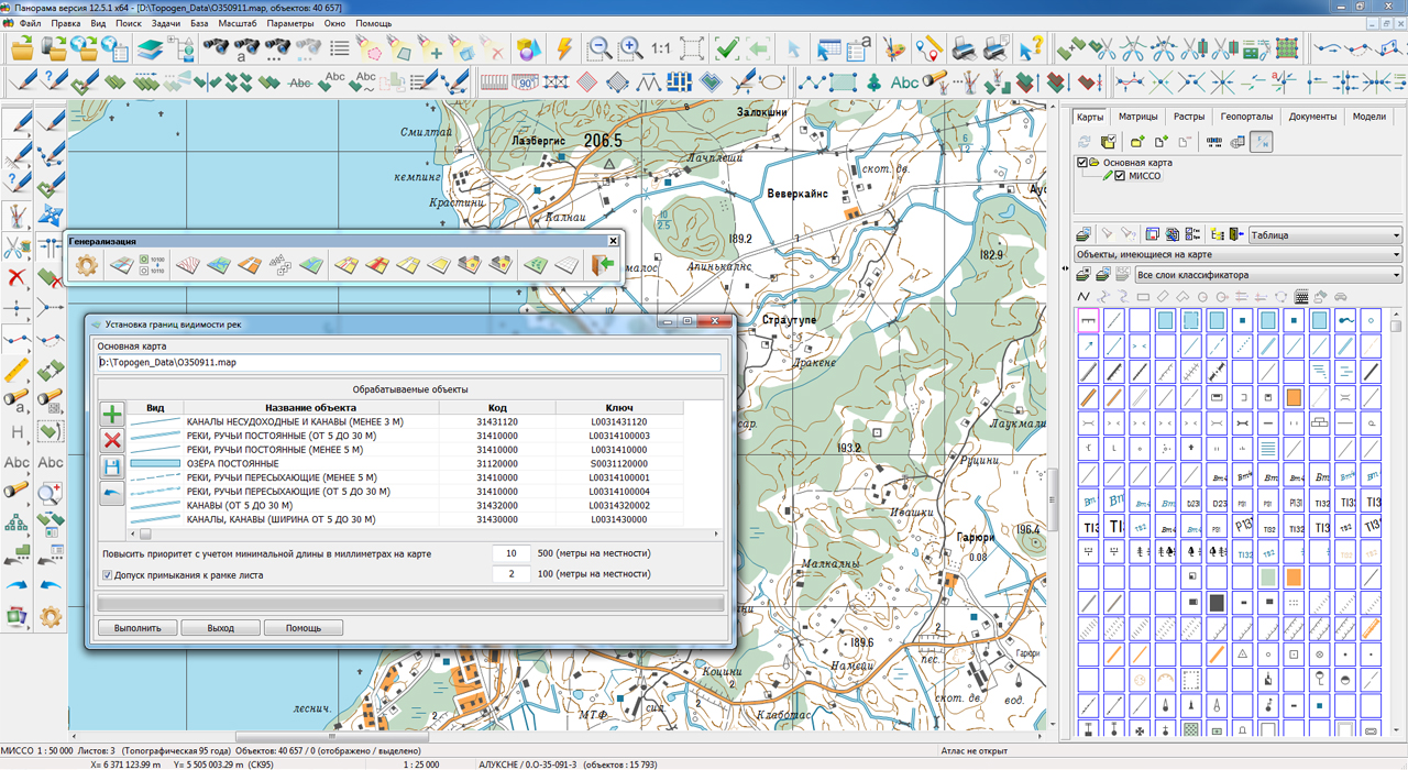
In the task "Automated generalization of topographic maps" the new mode "Setting the boundaries of rivers visibility" is added. The mode "Setting the boundaries of rivers visibility" is intended for simplification of a hydrographic network in the map scales 50 000 and 100 000. The goal of simplifying the hydrographic network is to assign specific ranges of visibility to specific objects of the hydrographic network, corresponding to their importance. Degree of the rivers importance is defined by the length and character of its location relative to other rivers.
In the complex of geodetic tasks, a new algorithm for generating reports on the metric and semantics of objects has been developed, which implements the functions of the report generator. The universal report generator works as a software wizard that performs the following procedures: customizing the schema and report parameters; automatic creation of scheme of the object; schema display and its interactive editing; filling the report on the beforehand prepared template.
At requesting lengths of objects or segments having a length of more than 5 degrees in longitude, the orthodrome is automatically constructed, which ensures the calculation with the accuracy of class 1 triangulation. Accurate length calculations are performed if the "Precise square and length" property is set in the "Options" menu.
The dialog "Data List of map" and the task "Map legend" have been improved. Multichannel images the Landsat, Kompsat and GeoEye, supplied as a set of single-channel TIF rasters, are displayed in the list of rasters as a node containing a complete list of used TIF files.
The new version of the program is accessible to downloading in the section.


In KB "Panorama" the GIS Constructor of version 12.1.0 is developed for operating system Astra Linux Special Edition (Release "Smolensk"). The new version combines the possibilities of developing the GIS-applications for Qt tools of version 4 and version 5. Using only one software product, the GIS Constructor user can create a GIS application for the required version of the Qt framework, with a minimum of effort.
The developer can easily switch the used version of the Qt framework using a command-line utility with a simple interface. With its help, you can get information about the used version in one action and change it to the desired one. After that, the GIS Constructor is fully ready to work with the selected libraries of Qt toolkit. For the convenience of the system administrator, the installer of GIS Constructor automatically performs the initial configuration of the application in the automatic mode. To determine the used version of the Qt framework, the current environment of the operating system is analyzed.
Universality of MAPAPI interface and GIS Constructor components provides portability of the developed source codes. The developer, depending on the task to be solved, can easily reassemble the GIS application for the required version of the Qt toolkit and create an image of the product for the end user.
The new version has expanded the possibilities of interacting with processing, which require significant resources of computational time. Using the modified callback interface, the developer can receive information about the progress of the processing and interact with the process in an interactive manner.
The display of operational signs, as well as programmable conventional signs of general purpose has been improved. The interface for creating temporary user maps has been expanded. Now the developer can directly specify the location of the created files by specifying a special environment variable.
GIS Constructor implements support for a single geoinformation space managed by spatial data servers (GIS Server) and application servers ().
Due to the ability to connect to the GIS Server, users of GIS applications can directly connect to geospatial data bases, view and edit tables in the form of maps in the specified conventional symbols. Support of interaction with GIS WebServiсe SE allows to get access to the spatial data by the international standards OGC WMS, WMTS.
GIS Constructor is a set of components for developing GIS applications for use in the visual programming environment of Qt Designer. Visualization of the contents of digital maps is made in conventional symbols adopted for topographic, geographic, cadastral and other types of maps. Geoinformation system has wide possibilities for creation (addition) of the user conventional symbols, supports the various coordinate systems and projections.
The new version of the program is available for download in the section.


Ph.: +7 (495) 739-0245, +7 (925) 221-1603
www.gisinfo.ru | panorama@gisinfo.ru
105005, Russia, Moscow, Baumanskaya Street 7, building 1, office 229 (m. Baumanskaya)
Copyright © Panorama Group 1991 - 2024


 Mobile version
 Full version