Copyright © Panorama Group 1991 - 2024

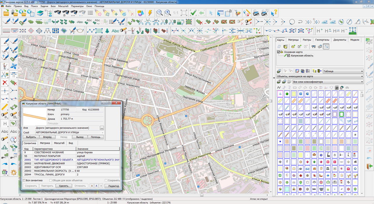
On the geoportal , maps of the Kaluga and Ivanovo regions, formed according to OpenStreetMap data, were updated. Source data obtained from the website are complemented by objects from maps of scale 1: 1 000 000. There are added the objects of hydrography, vegetation, road network. For work with the received maps it is possible to use the program of or other software products of KB "Panorama".
Publishing of updates in bank of spatial data is made by using the program of . Publishing contents of bank of spatial data on the geoportal and data access for downloading are implemented by means of .
Free maps on the basis of OpenStreetMap data are available for download on the page "Digital maps and images".


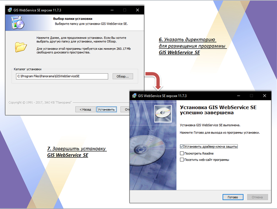
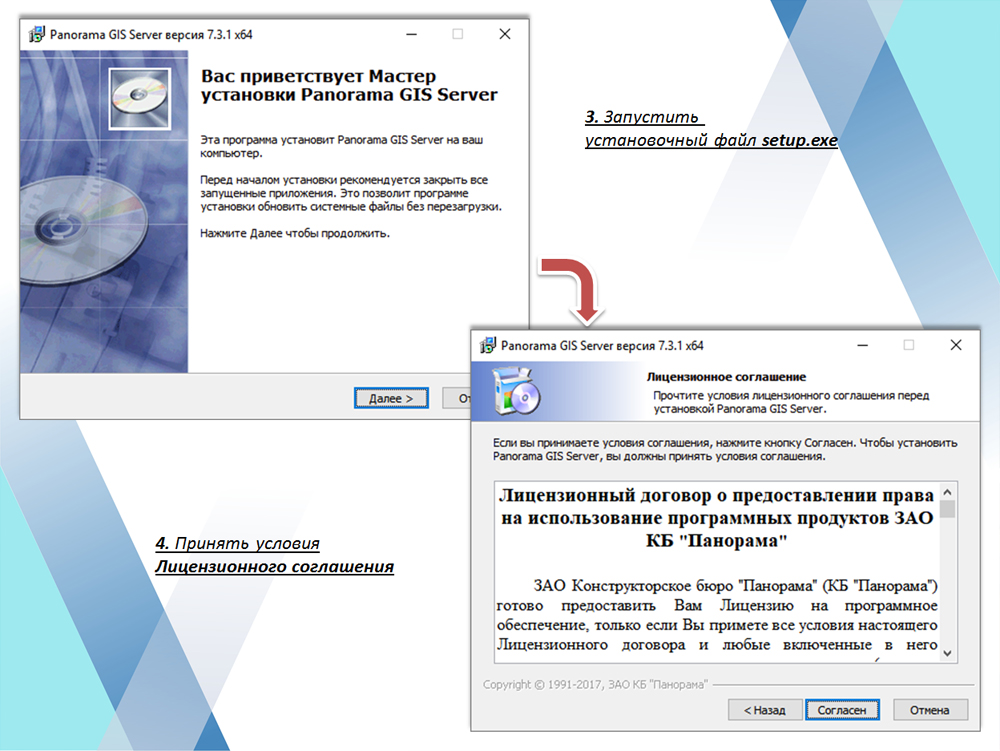
Specialists of KB "Panorama" have developed the instruction on installation and configuration of . The instructions show the main installation positions for the application in Windows with the IIS servers set.
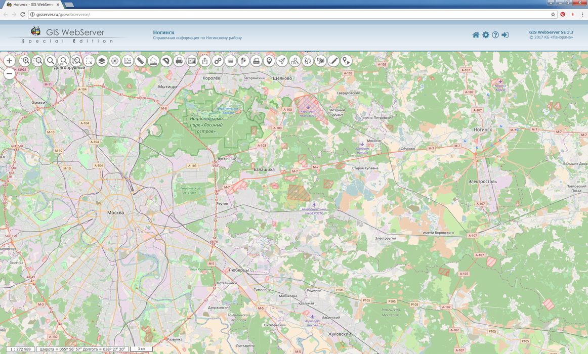
In GIS WebService SE, reliability is improved when working with data on the . In the event of termination of the right of access to the layers by the administrator of the GIS Server, the publication of this data on the service is completed. The presentation shows the stages of installing GIS WebService SE, connecting to the GIS Server, creating user groups and publishing new layers.
GIS WebServiсe SE supports all international standards (OGC WFS, WFS-T, WMS, WMTS, WCS) with which help the transmission and display of spatial data is carried out. The program provides the ability to issue tiles for any user or local coordinate system.
You can read the on installing and configuring GIS WebService SE in the section.


In KB "Panorama" the program of PARB.00049-01 version 7.3.2 is developed. In the new version there are improved the tools of remote placement in the of digital vector maps of formats SHP (Shape), MIF\MID and others. The procedure for remote loading of the Data Bank of Digital Maps (DMs) and Remote Sensing of the Earth (RSE) PARB.00033-02 is implemented as a 64-bit application, which allows to increase the speed of work, increase the amount of data processed and reduce the processing time due to multithreaded execution on multiprocessor servers. There is added an automatic processing of data, packed in a ZIP archive, while loading the Data Bank. For example, sets of SHP or MIF/MID files that correspond to a given territory (map sheet), it is more convenient to store and to issue as ZIP-archive. The analysis of the archive, definition of dimensions of data sets, coordinate systems, number of objects and other metadata is performed automatically with any nesting of folders in the archive.
Loading of data sets into the Databank of DMs and RSE is carried out by the command of the desktop client of GIS Server or the web-client of Databank of DMs and RSE. GIS Server allows you to create in an automated mode the geo-covers of vector maps, rasters and matrices stored in the Data Bank of DMs and RSE. During the formation of geo-covers, data are imported from exchange formats, are transformed into a given coordinate system and are placed into a virtual folder of the GIS Server. The file-sets of the SHP format, stored in the form of ZIP archives, selected by the operator in the Data Bank are automatically unpacked and converted into the internal format of the together with the SXF files for the formation of geo-covers.
GIS Server supports multi-level connection of servers among themselves for distributed storage and processing of spatial data with automatic replication, backup and data protection. Such architecture in tens times reduces load of a network of data transmission, speeds up access to data and improves reliability of work. Reducing the load on the data network is achieved through the access of individual groups of users through an intermediate GIS Server, which caches the requests and performs automatic data replication.
GIS Server provides work with spatial databases managed by PostgreSQL and Oracle databases with access to data in accordance with OGC 06-103r4 standard: "OpenGIS® Implementation Standard for Geographic information - Part 1: Common architecture".
The new version of the program is available for download on the page.

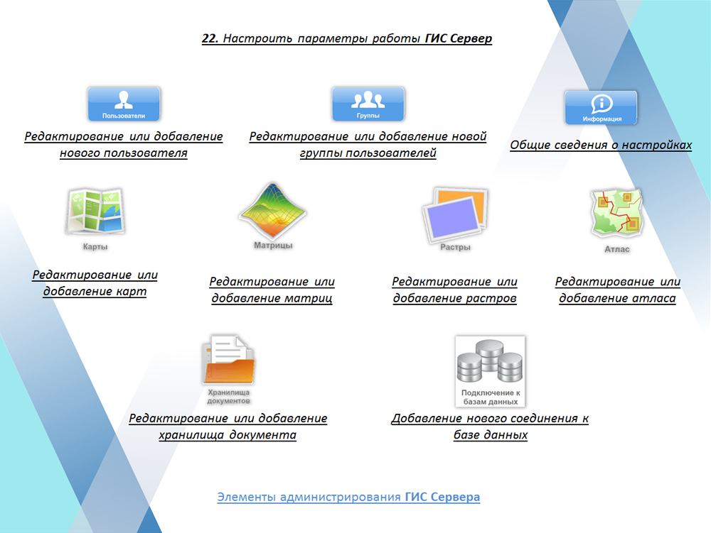
In KB "Panorama" the on installation and configuration of the program the are developed. One of the most important elements of the cloud storage of spatial data is a network formed from interconnected GIS Servers managing various kinds of spatial data - spatial data bases, digital vector maps and remote sensing data.
GIS Server provides work with spatial databases managed by PostgreSQL and Oracle databases with access to data in accordance with OGC 06-103r4 standard: "OpenGIS® Implementation Standard for Geographic information - Part 1: Common architecture".
Clients access the spatial data located on the server at high speed due to an efficient caching mechanism. A flexible load distribution onto the disk subsystem is provided by the ability to assign a separate directory with a cache for each connection of GIS Server SE with the geospatial database.
The data placement on the server provides data protection from illegal copying and modification, provides reliable operation for collective data editing. GIS Server supports the control of changes in spatial data on the server and their synchronous updating on the client. Access to new versions of orthophotomaps, matrixes of elevations and vector maps is provided automatically without manual operations from the server administrator or clients.
The mechanism for accessing data via virtual folders excludes administration for separate sets of data from digital maps and remote sensing data, which can be dynamically created during the execution of different requests. Documents files can automatically be saved into the document folder, to which the reference will be added in the semantics of objects of the vector map.
Despite the complexity of the tasks to be solved and a large number of opportunities for control access to spatial data, the installation and configuration of the GIS Server is intuitively clear, fast and does not require the high-level skill of the system administrator.
You can find the training materials on installation and customizing the program in the section.


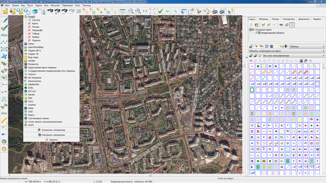
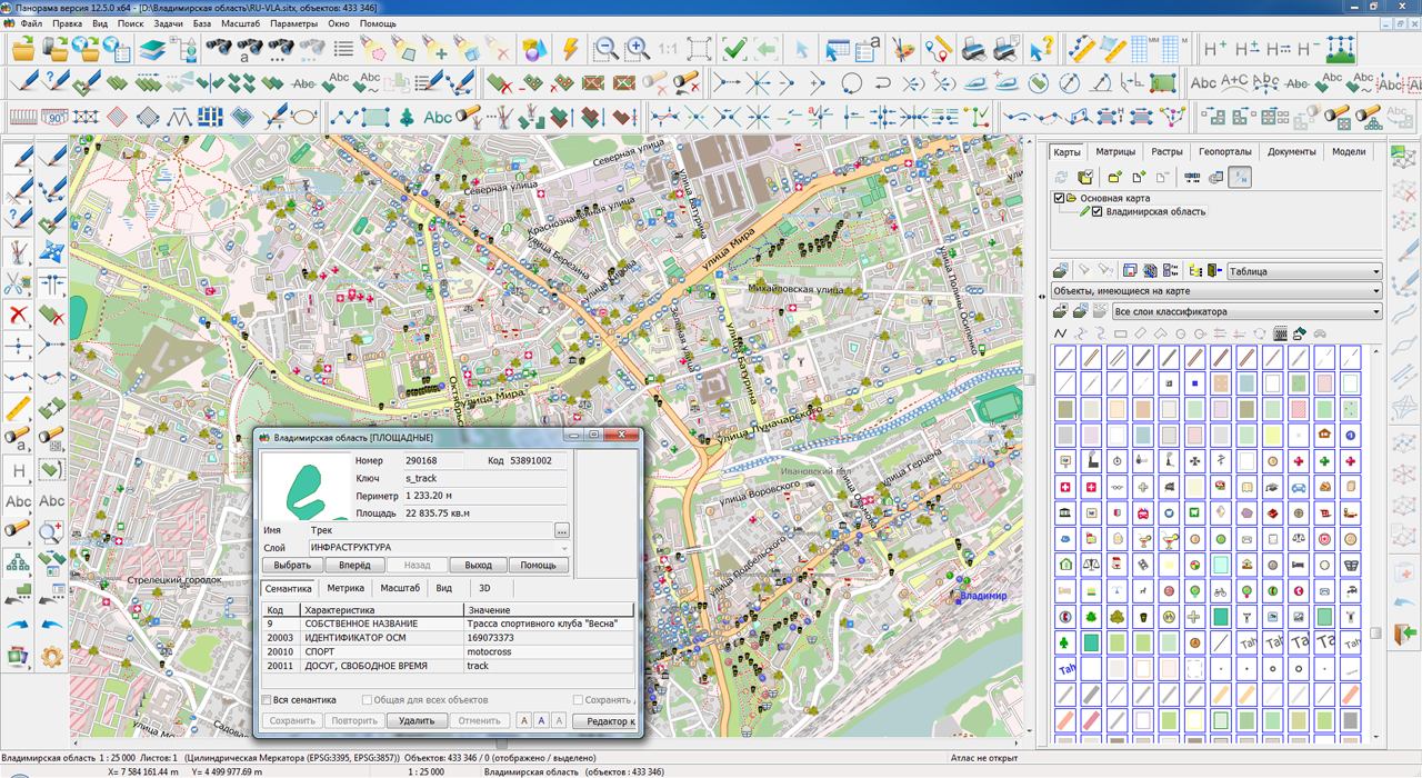
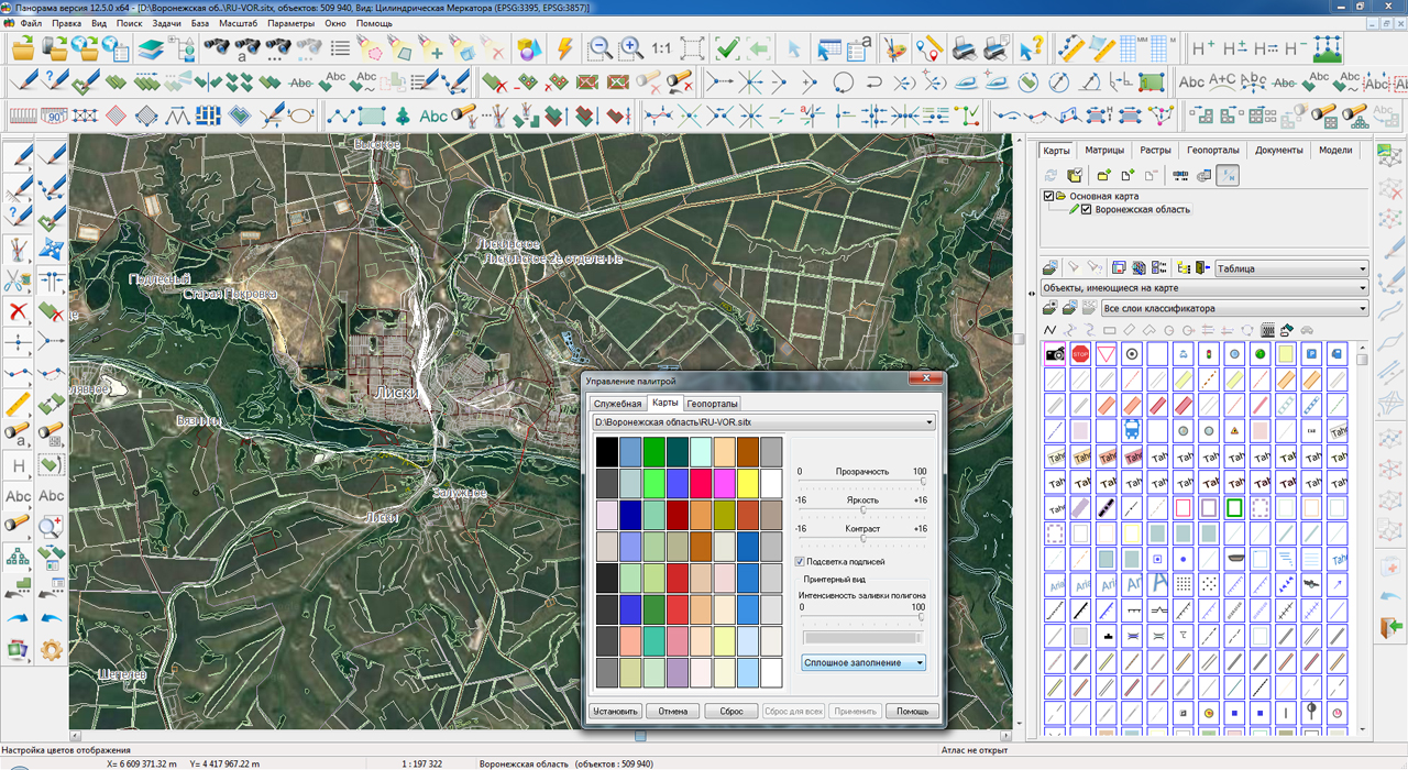
On the geoportal , maps of the Voronezh and Vladimir regions, formed according to OpenStreetMap data, were updated. Source data obtained from the website are complemented by objects from maps of scale 1: 1 000 000. There are added the objects of hydrography, vegetation, road network. For work with the received map it is possible to use the program of or other software products of KB "Panorama".
Publishing of updates in bank of spatial data is made by using the program of . Publishing contents of bank of spatial data on the geoportal and data access for downloading are implemented by means of .
Free maps on the basis of OpenStreetMap data are available for download on the page "Digital maps and images".


Ph.: +7 (495) 739-0245, +7 (925) 221-1603
www.gisinfo.ru | panorama@gisinfo.ru
105005, Russia, Moscow, Baumanskaya Street 7, building 1, office 229 (m. Baumanskaya)
Copyright © Panorama Group 1991 - 2024


 Mobile version
 Full version