Copyright © Panorama Group 1991 - 2024

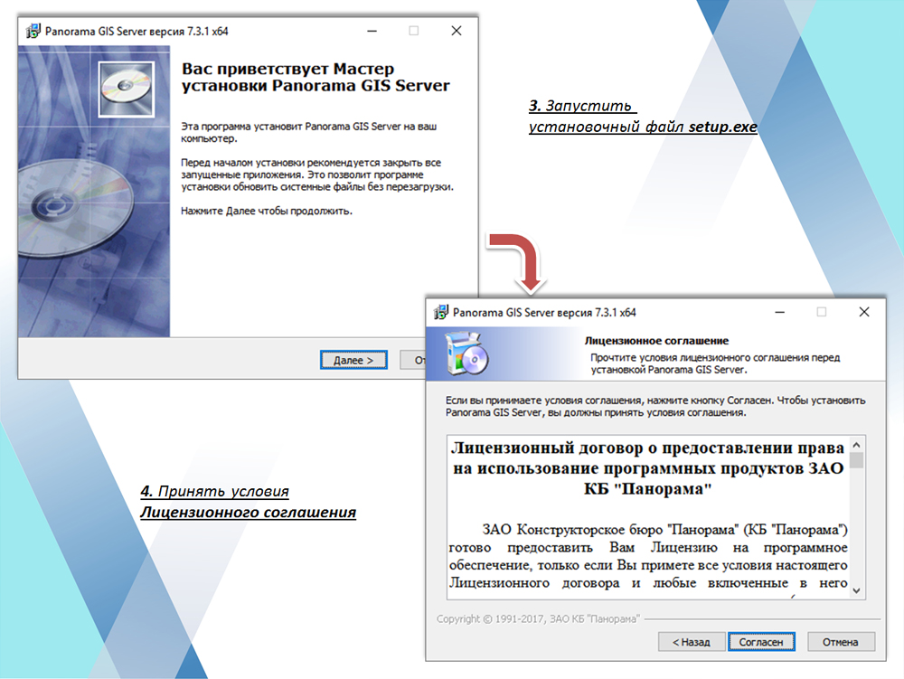
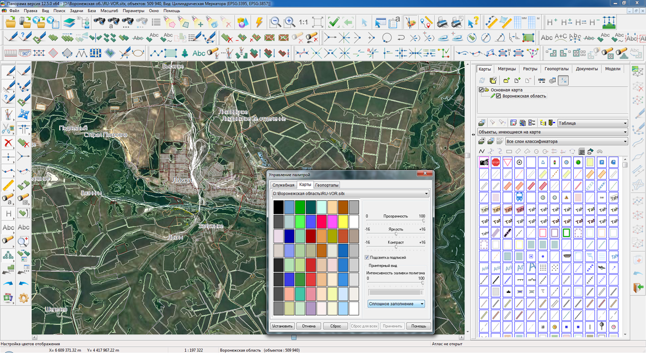
In KB "Panorama" the on installation and configuration of the program the are developed. One of the most important elements of the cloud storage of spatial data is a network formed from interconnected GIS Servers managing various kinds of spatial data - spatial data bases, digital vector maps and remote sensing data.
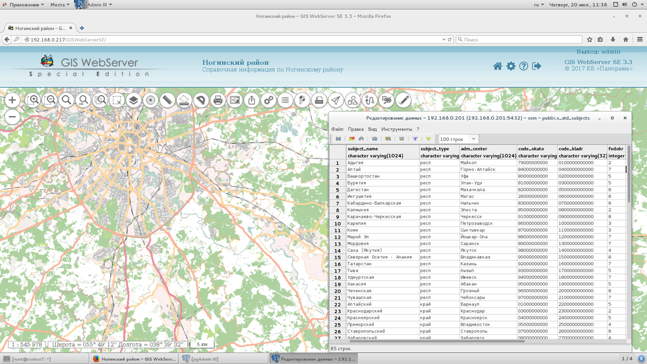
GIS Server provides work with spatial databases managed by PostgreSQL and Oracle databases with access to data in accordance with OGC 06-103r4 standard: "OpenGIS® Implementation Standard for Geographic information - Part 1: Common architecture".
Clients access the spatial data located on the server at high speed due to an efficient caching mechanism. A flexible load distribution onto the disk subsystem is provided by the ability to assign a separate directory with a cache for each connection of GIS Server SE with the geospatial database.
The data placement on the server provides data protection from illegal copying and modification, provides reliable operation for collective data editing. GIS Server supports the control of changes in spatial data on the server and their synchronous updating on the client. Access to new versions of orthophotomaps, matrixes of elevations and vector maps is provided automatically without manual operations from the server administrator or clients.
The mechanism for accessing data via virtual folders excludes administration for separate sets of data from digital maps and remote sensing data, which can be dynamically created during the execution of different requests. Documents files can automatically be saved into the document folder, to which the reference will be added in the semantics of objects of the vector map.
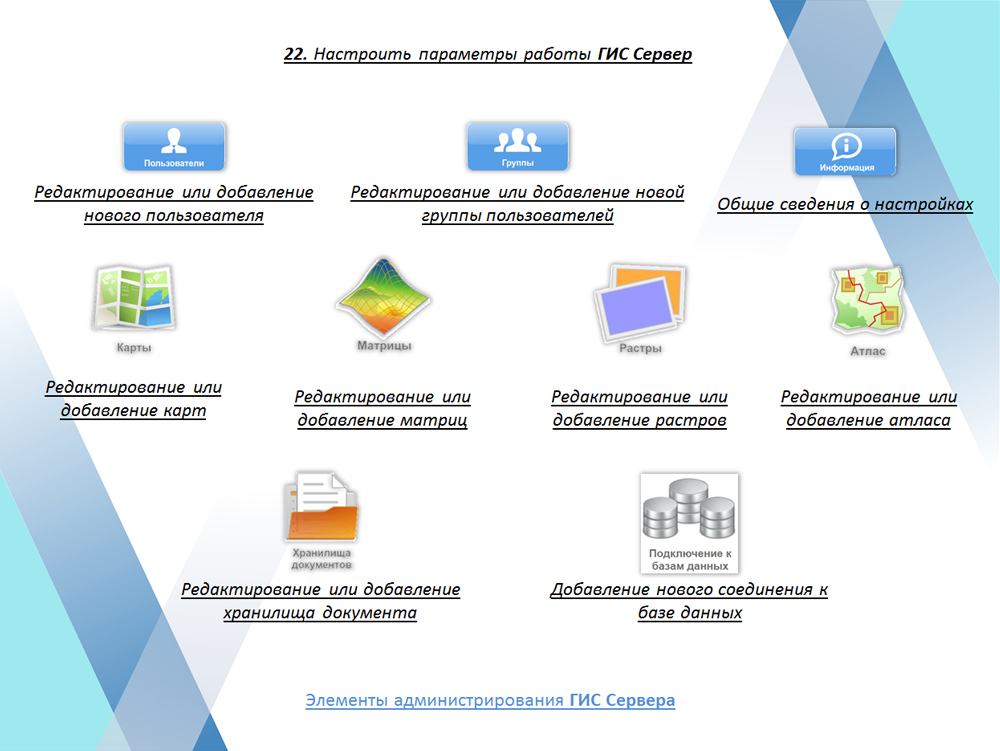
Despite the complexity of the tasks to be solved and a large number of opportunities for control access to spatial data, the installation and configuration of the GIS Server is intuitively clear, fast and does not require the high-level skill of the system administrator.
You can find the training materials on installation and customizing the program in the section.


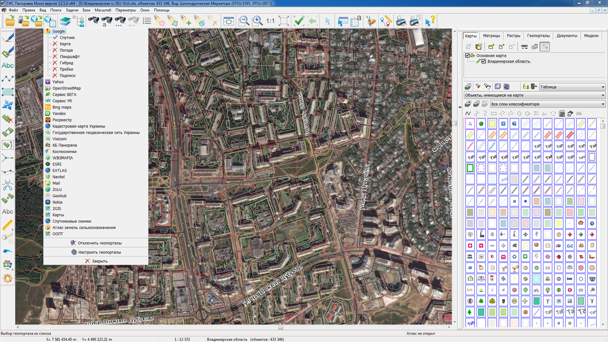
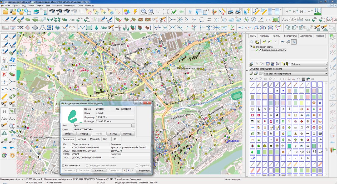
On the geoportal , maps of the Voronezh and Vladimir regions, formed according to OpenStreetMap data, were updated. Source data obtained from the website are complemented by objects from maps of scale 1: 1 000 000. There are added the objects of hydrography, vegetation, road network. For work with the received map it is possible to use the program of or other software products of KB "Panorama".
Publishing of updates in bank of spatial data is made by using the program of . Publishing contents of bank of spatial data on the geoportal and data access for downloading are implemented by means of .
Free maps on the basis of OpenStreetMap data are available for download on the page "Digital maps and images".


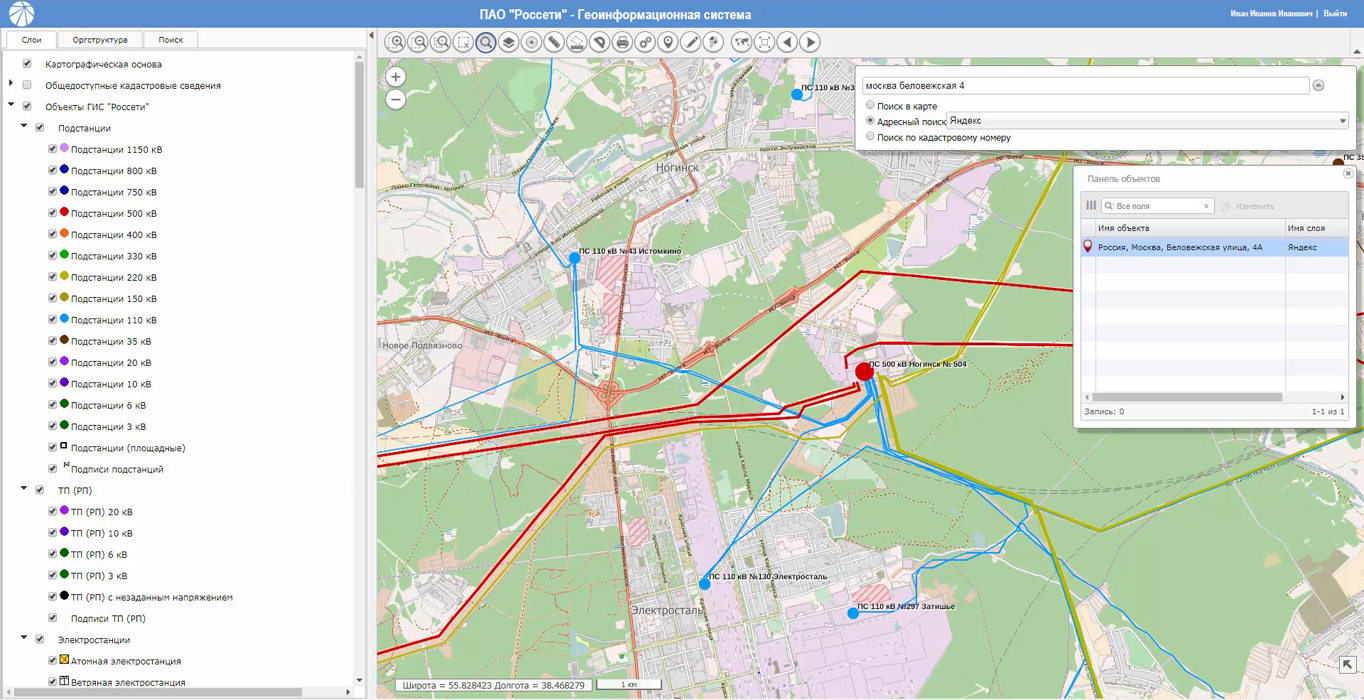
The first stage of the geoinformation system (GIS Rosseti) was developed and put into trial operation in the company. GIS "Rosseti" is a joint product of the companies of Closed Joint-Stock Company and Joint-Stock Company of KB "Panorama". The purpose of creating the GIS "Rosseti" is to increase the reliability and efficiency of managing the power grid complex distributed across the territory of 77 constituent entities of the Russian Federation.
The software that is part of the GIS "Rosseti" meets the modern requirements for processing and providing the spatial information and is fully implemented on the basis of domestic technologies of KB "Panorama". The development took into account the requirements of the technical policy of "Rosseti" in the field of import substitution, the use of a unified data model, a unified system of classification and coding. During development, Russian software was used: , , , GIS WebToolKit SE.
The main task of GIS "Rosseti" is to provide information support when performing work to reduce the probability of accidents, technological violations and other contingencies, and to mitigate their negative consequences. For processing the information about the objects of the power grid complex, GIS includes an online editor of spatial information about accounting objects, a toolkit for interacting with various address databases and obtaining publicly available cadastre information of Rosreestr.
For the prompt response of the staffs of the power grid complex to threats and the emergence of emergencies, accidents of natural, technogenic and other nature, the GIS "Rosseti" performs the collection, processing, transmission and storage of operational information on the availability and location of the emergency reserve, mobile teams and special equipment, mobile modular substations , the reserve sources of electric power supply, complete mobile switchgears.
To visualize the spatial objects of accounting, the symbols, rules and recommendations for the digital description of fuel and energy complex objects have been developed in accordance with the requirements of GOST R 56303-2014.
Information interaction between GIS and existing information systems of the "Rosseti" group is based on international standards for the exchange of geospatial data and services. Data processing is also supported in the accepted unified forms coming from the information systems of the subsidiaries of "Rosseti" and their branches. Work with information stored in GIS "Rosseti" is carried out taking into account the differentiation of access rights, the audit of user actions is performed.
Public Joint Stock Company (PJSC ROSSETI) – is one of the largest power companies in the world. The company manages 2,3 million kilometers of power lines and 496 thousand substations with the total transformer capacity of more than 773 thousand MVA. In 2016 the supply of electric power to consumers was up to 742,7 billion kW?h. The number of employees of the "Rosseti" Group of companies is 216 thousand people.
The complex assets of PJSC «Rosseti» are represented by 37 affiliated and dependent companies including 14 interregional and a regional distribution grid company. The controlling shareholder is the State represented by the Federal Agency of the State Property Administering of the Russian Federation, that owns 87.9 % of the share capital.
Closed Joint Stock Company "Russian corporation of communication facilities" is a leading domestic producer of telecommunications equipment, control systems, technologies and information security equipment of critical infrastructure in Russia.
Closed joint-stock company Konstructorskoe bureau "Panorama" - the leading Russian company in the field of development of geoinformation systems, automated control systems for various purposes and national mapping systems.


On the geoportal , the map of the Kurgan region, formed according to OpenStreetMap data, was updated. Source data obtained from the website are complemented by objects from maps of scale 1: 1 000 000. There are added the objects of hydrography, vegetation, road network. For work with the received map it is possible to use the program of or other software products of KB "Panorama".
Publishing of updates in bank of spatial data is made by using the program of . Publishing contents of bank of spatial data on the geoportal and data access for downloading are implemented by means of .
Free maps on the basis of OpenStreetMap data are available for download on the page "Digital maps and images".


In KB "Panorama" the version 7.3 is developed for server OS CentOS. The new version increases the speed of access to large arrays of information in spatial databases. This is achieved by the flexible configuration of data caching and the possibility of cache distribution over disk arrays.
Clients ( application servers and desktop applications) access the spatial data hosted on the server at high speed through an efficient caching mechanism. The cache of spatial database is formed in the form of cartographic representation already in the established conventional symbols. A flexible load distribution onto the disk subsystem is provided by the ability to assign a separate directory with a cache for each connection of GIS Server SE with the geospatial database.
The new version of GIS Server allows not to reread from the database the previously received information and stored in the cache, even if this information has not been accessed for a while by any server client, or even if the GIS Server has been restarted.
GIS Server SE can carry out actualization in the cache only of that data which has changed since the previous access to the spatial database, using the transaction log. The log is implemented using a separate table in the database. The period of poll by GIS Server of the table of changes log is installed by the manager in program settings.
To effectively access a spatial database in which transaction logging is not performed, the GIS Server SE can use the "time of data relevance". The cartographic representation generated by the original data set (geospatial database table or SQL query) may not be recreated until the established time interval has expired. At the expiry of this period, the cartographical representation will be automatically re-configured if the GIS Server SE has active connections to this data set. If no one is connected to the dataset, the cartographic view will be re-formed at the first access of the user to this set. The relevance time for the data set of the spatial database is determined by the administrator of the Server GIS based on what spatial information is contained in this set, how much and how often it is updated for the server's clients.
GIS Server SE within a single geoinformation space provides multi-user access to spatial data for application servers (GIS WebService SE) and desktop clients (, ). The program gives users the opportunity to make changes to geospatial data bases through the graphical interface of GIS "Panorama", by tools of editing digital terrain maps. In this case, the GIS Server monitors the changes in these databases, performed by any external applications. There is supported a multilevel connection of servers among themselves for the distributed storage and processing of spatial data with automatic replication, backup and data protection.
The new version of the program is available for download on the page.


Ph.: +7 (495) 739-0245, +7 (925) 221-1603
www.gisinfo.ru | panorama@gisinfo.ru
105005, Russia, Moscow, Baumanskaya Street 7, building 1, office 229 (m. Baumanskaya)
Copyright © Panorama Group 1991 - 2024


 Mobile version
 Full version