Copyright © Panorama Group 1991 - 2024

In KB "Panorama" the SE of version 11.13.9 is developed for the Astra Linux Special Edition operating system (Release "Smolensk"). The new version supports the import and export of aeronautical data in ARINC 424 format. This format is an international standard for the exchange of data that can be used for creation of aeronautical databases and the formation of aeronautical maps. Drawing the information on a map is carried out without deleting or modifying existing map objects.
Possibilities of the mode of building a profile of heights by terrain relief are extended. The user in interactive mode can move along the borders of the object or the broken line he constructed, obtaining dynamic information about the altitude and angular characteristics at the current point. The built profile can be exported to text or graphic format.
The task of creating a user map has been improved. Convenience of the user's work with the main dialogs of the application is improved.
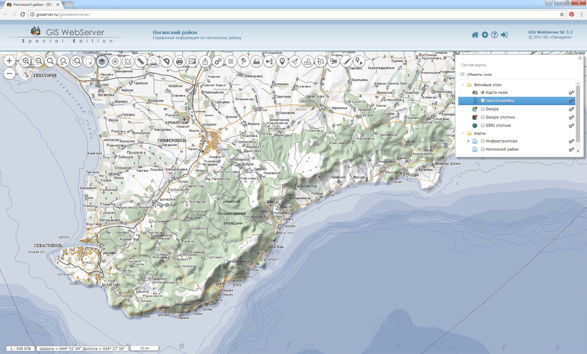
GIS Operator SE supports a single geoinformation space managed by spatial data servers () and application servers ().
Due to the ability to connect to the GIS Server, users can directly connect to geospatial data bases, view and edit tables in the form of maps in the specified conventional symbols. Support of interaction with GIS WebServiсe SE allows to get access to the spatial data according to the international standards OGC WFS, WFS-T, WMS, WMTS, WCS.
GIS "Operator" for power structures (GIS Operator SE) provides creating the maps of operative conditions, displaying of 3D models of terrain, execution of calculations of lengths, areas, azimuths, volumes on a map, construction of profiles, zones of visibility, zones of flooding, routes along the road network.
The new version of the program is available for download in the section.


In KB "Panorama", toolkit the of version 12.5.0 was developed for creating GIS applications in environment of Delphi, C ++ Builder Embarcadero.
The new version adds the ability to display and embed OLE-documents in a common cartographic image. MS Word document, MS Excel spreadsheet, MS PowerPoint slide, MS Graph may be as OLE-documents. When you change the data in the embedded OLE-document the updating is carried out and in the cartographical image on the monitor or at the printing. At a choice of the embedded document by double mouse click the editing of the document is carried out by that program in which it has been created (depending on document type). To quickly study the possibilities of embedding OLE-documents into the cartographic project, an example application (included into the installation package) is developed. All settings for displaying the OLE-document on the background of the cartographic image are saved in a special file, which is located together with the map. For OLE-document introduction into a map it is possible to use the GIS Panorama for which the user interface is already developed for work with such documents.
In the new version there is improved the work of standard components of the map area selection - TfrmDlgSelRt, TMapSelectRect. Components are used in such tasks of processing the spatial data as a choice of area for printing, a choice of area for display, a choice of area for search, a choice of area for copying and converting objects.
Possibilities of management by the maps atlas are expanded. The components of working with map atlas (TAtlasListDlg, TOpenAtlasDlg) allow to implement a multiscale model of displaying spatial objects onto the same territory.
GIS ToolKit is a toolkit of the developer of geoinformation systems, allowing to process spatial databases. The toolkit consists of a set of visual components (supplied in the source code) and API functions for direct access to the geodatabase. The geo-database can be located both in the workplace (direct access to data) and in the local network or the Internet (there are used the components of access to the GIS Server or data exchange over the international protocols WMS, WFS, WCS, WMTS).
New versions of the programs are available for download on the page.


version 8.2 is developed in KB "Panorama". The new version increases the reliability when working with data on the , which is connected with a geospatial data base. The service allows you to monitor any changes made in the database, to analyze them and to rebuild the changed tiles for their later display in by the OGC WMTS protocol.
When configuring projects in the web administrator of the service, the user can choose the language of work convenient for him. By default, support for two languages is enabled - Russian and English. To add a new language, you can connect new localization files.
The service provides updating the pyramids of tiles in formats PNG, PNG8 and JPEG. It allows you to keep tiles up-to-date according to the data located on virtual GIS Server folders. The pyramids of tiles are published using the OGC WMTS protocol by service the .
The new version of the program is available on the site in the section.


In KB "Panorama" the of version 3.5 is developed for CentOS. The new version adds the ability to load spatial data into the repository directly from the local directory. This allows you to increase the speed of data placement by not having to use the HTTP protocol for transfer.The user is able to simultaneously download a large amount of data in a short period of time.
Security is increased when working with the database by using a separate account with limited rights. The rights to access data and functionality of the complex are assigned to users in accordance with the rights of the groups to which they belong.
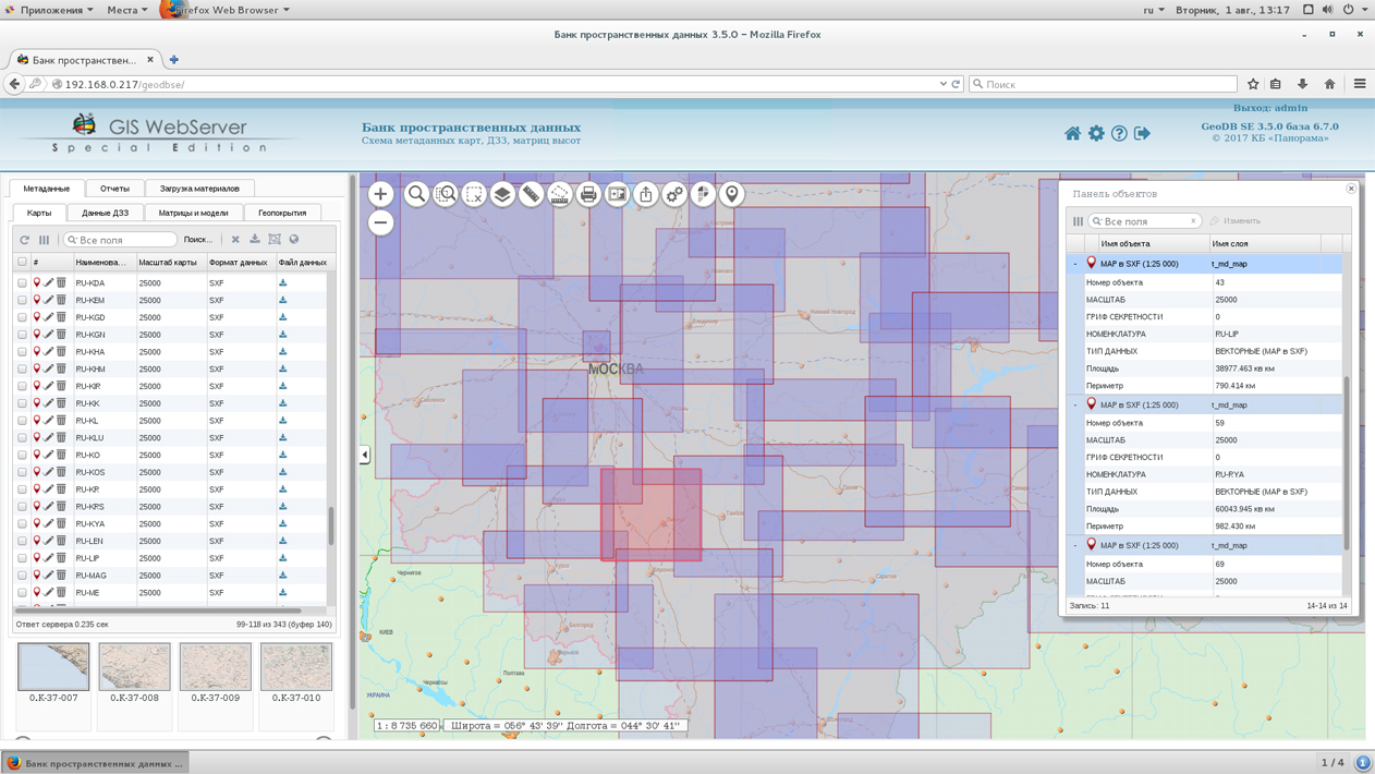
There is expanded the list of metadata fields for maps and remote sensing data, which are automatically filled when materials are placed into the data warehouse. The mode of search and selection of materials is optimized, the ability to manage the list of displayed fields is added to the search tools. The system of the help on work with a complex is realized.
Within the framework of a single geoinformation space, the Data Bank of digital maps and remote sensing data collects, stores, searches for and provides spatial data in exchange formats. The spatial data selected with the help of the Data Bank can be placed for multiuser access on the GIS Server and published according to the international standards OGC WFS, WFS-T, WMS, WMTS, WCS on the application server. Users can access data from both a thin client (using the ) and from desktop applications (GIS Panorama, ).
The database of digital maps and remote sensing data provides the construction of a cloud repository of spatial data, the provision of access to these data, the automated formation and updating of geo-covers. The current state of the spatial data is displayed by means of maps-schemes that are maintained for each type of stored data: vector maps, remote sensing data, matrixes of heights and terrain models. It provides remote placement of sets of spatial data into file storage, a keeping the versions of stored sets, an updating of maps-schemes of data availability, the automated collection and formation of metadata, and the formation and updating of geo-covers. Automated collection and formation of metadata is performed according to the standards of ISO 19115: 2003, Geographic information - Metadata and ISO/TS 19139, Geographic information - Metadata - XML schema implementation. The reduced copies of data images are automatically formed, the checksum of files and completeness of data sets are checked.
The new version of the program is available for download in the section.


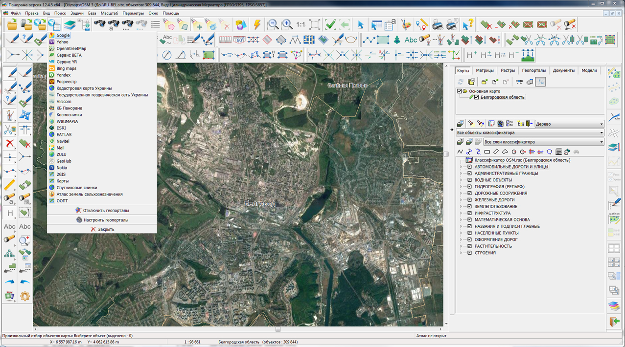
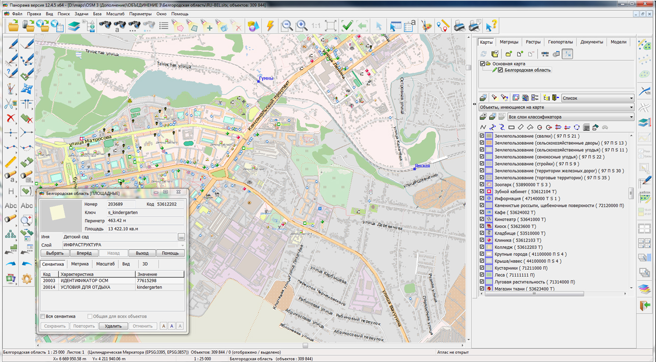
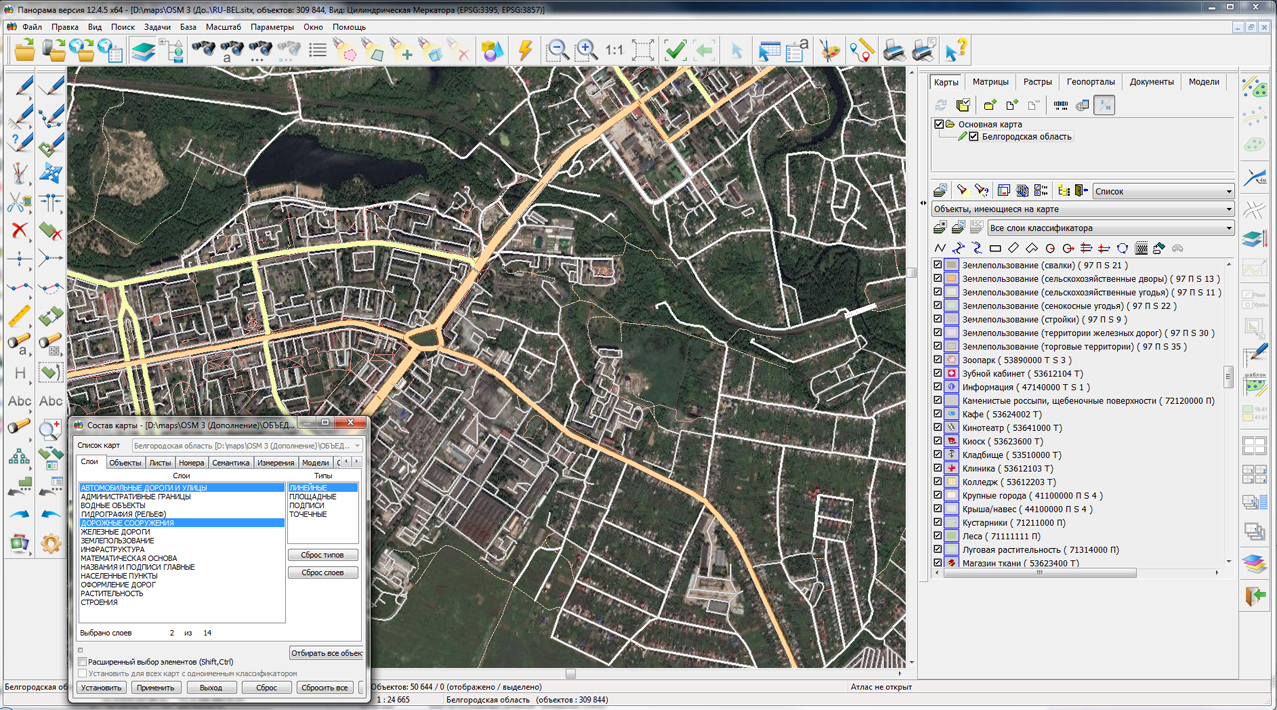
On the geoportal , the maps of the Belgorod and Bryansk regions, formed according to OpenStreetMap data, were updated. Source data obtained from the website are complemented by objects from maps of scale 1: 1 000 000. There are added the objects of hydrography, vegetation, road network. For work with the received map it is possible to use the program of or other software products of KB "Panorama".
Publishing of updates in bank of spatial data is made by using the program of . Publishing contents of bank of spatial data on the geoportal and data access for downloading are implemented by means of .
Free maps on the basis of OpenStreetMap data are available for download on the page "Digital maps and images".

Ph.: +7 (495) 739-0245, +7 (925) 221-1603
www.gisinfo.ru | panorama@gisinfo.ru
105005, Russia, Moscow, Baumanskaya Street 7, building 1, office 229 (m. Baumanskaya)
Copyright © Panorama Group 1991 - 2024


 Mobile version
 Full version