Copyright © Panorama Group 1991 - 2024

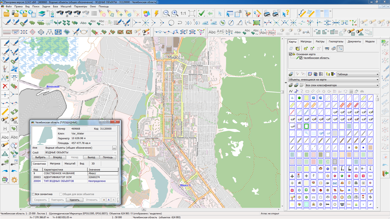
On the geoportal , the map of the Chelyabinsk region, formed according to OpenStreetMap data, has been updated. Source data obtained from the website are complemented by objects from maps of scale 1: 1 000 000. There are added the objects of hydrography, vegetation, road network. For work with the received map it is possible to use the program of or other software products of KB "Panorama".
Publishing of updates in bank of spatial data is made by using the program of .
Publishing contents of bank of spatial data on the geoportal and data access for downloading are implemented by means of .
Free maps on the basis of OpenStreetMap data are available for download on the page "Digital maps and images".


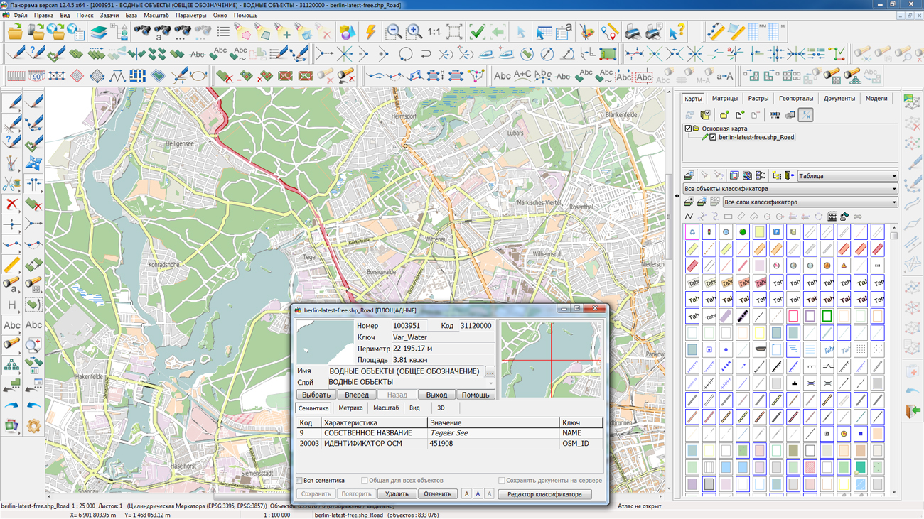
The list of public data in SXF format on the geoportal is supplemented with a map to the territory of Berlin at a scale 1: 25 000. The map is formed from the initial data of OpenStreetMap obtained from the site . For work with the map it is possible to use the program of or other software products of KB "Panorama".
Publishing of updates in bank of spatial data is made by using the program of . Publishing contents of bank of spatial data on the geoportal and data access for downloading are implemented by means of .
Free maps on the basis of OpenStreetMap data are available for download on the page "Digital maps and images".


version 9 is developed in KB "Panorama". To build corporate, regional, departmental geoinformation systems, it is necessary to use large amounts of information (Big Data). These systems should work in a single geoinformation space, monitor changes in territories and display them promptly. To this end, a new version of the ImageryCreator program was developed to publish large amounts of information in the form of Big Data tiles. It allows you to use all resources of a multi-core server. By distributing the load across the threads, ImageryCreator allows you to cut the tiles several times faster. Thus, the time for creating huge data sets in tens of terabytes is shortened from a few days to several hours.
The program can work at once with several data projects. The parameters of each user's work are saved separately. The program allows to create several pyramids of tiles which can have different formats, scales and types of matrixes. ImageryCreator and have a single structure of the settings file. This allows to simplify the process of data administration, to make a technological chain (ImageryCreator - - ) for publication of the spatial data more simple and understandable.
The program allows you to create tiles in JPEG and PNG formats according to the international standard OGC WMTS 07-057r7 version 1.0.0. The tile data generated by the ImageryCreator program are used by software the GIS WebServer SE, GIS WebService SE to provide high-speed query execution for displaying spatial data over large areas while simultaneously accessing a large number of users.
A new version of the program is available on the page.


KB "Panorama" will take part in the , which will be held from 26 to 28 September 2017 in Berlin. At the company's stand D1.003 in Hall 1.1 our specialists will present software solutions: , , , and others. Issues of creation, processing and analysis of spatial data, introduction of modern geospatial technologies and services will be considered.
INTERGEO is the largest event in the world for geodesy, geoinformatics and land management. It is held annually at various venues in Germany and has about 1300 participants from 37 countries. In the course of the work, topical issues of politics, management, science and industry are considered in such areas as: the use of remote sensing data as the basis for decision making in business, the use of open data, smart city - digital city, design and construction in 3D, optimization and increase of efficiency of UAV use, innovations with use of spatial data.


version 3.2.1 is developed in KB "Panorama". In the new version of the program, loading of data for classifiers of layers is optimized - data acquisition is performed when there is a need for them. There are added a control of moving the map image for small scales of displaying, control of borders of scaling in the mode of scaling a map by a frame. When creating or opening local layers, users can prevent them from being edited.
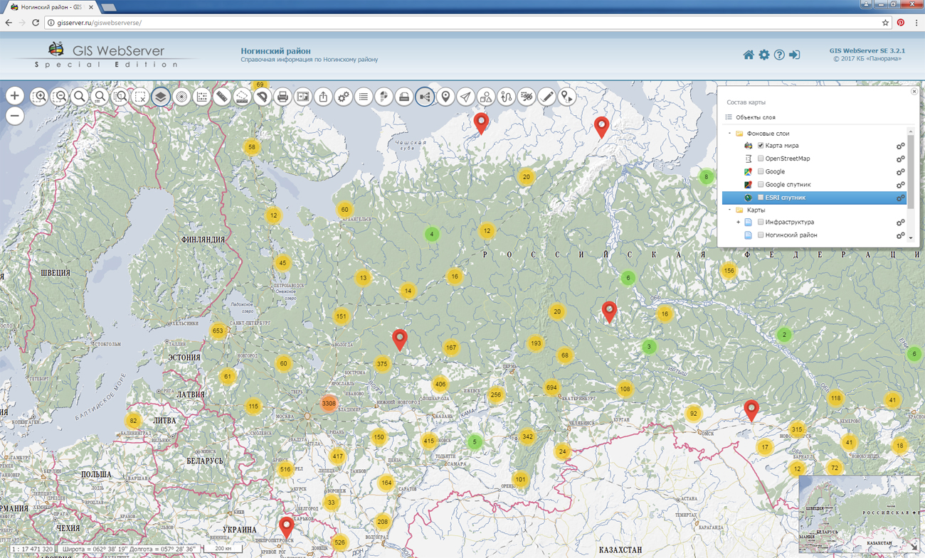
Map layers of GIS WebServer SE published from the GIS Server reflect the current state of the spatial data base in the mode of time near to the real. , starting with version 7.1.3, monitors the changes of the connected geospatial databases and automatically updates their images in the specified conventional symbols. In GIS WebServer SE displayed objects of both two-dimensional, and spatial model are dynamically synchronized with current changes on a map.
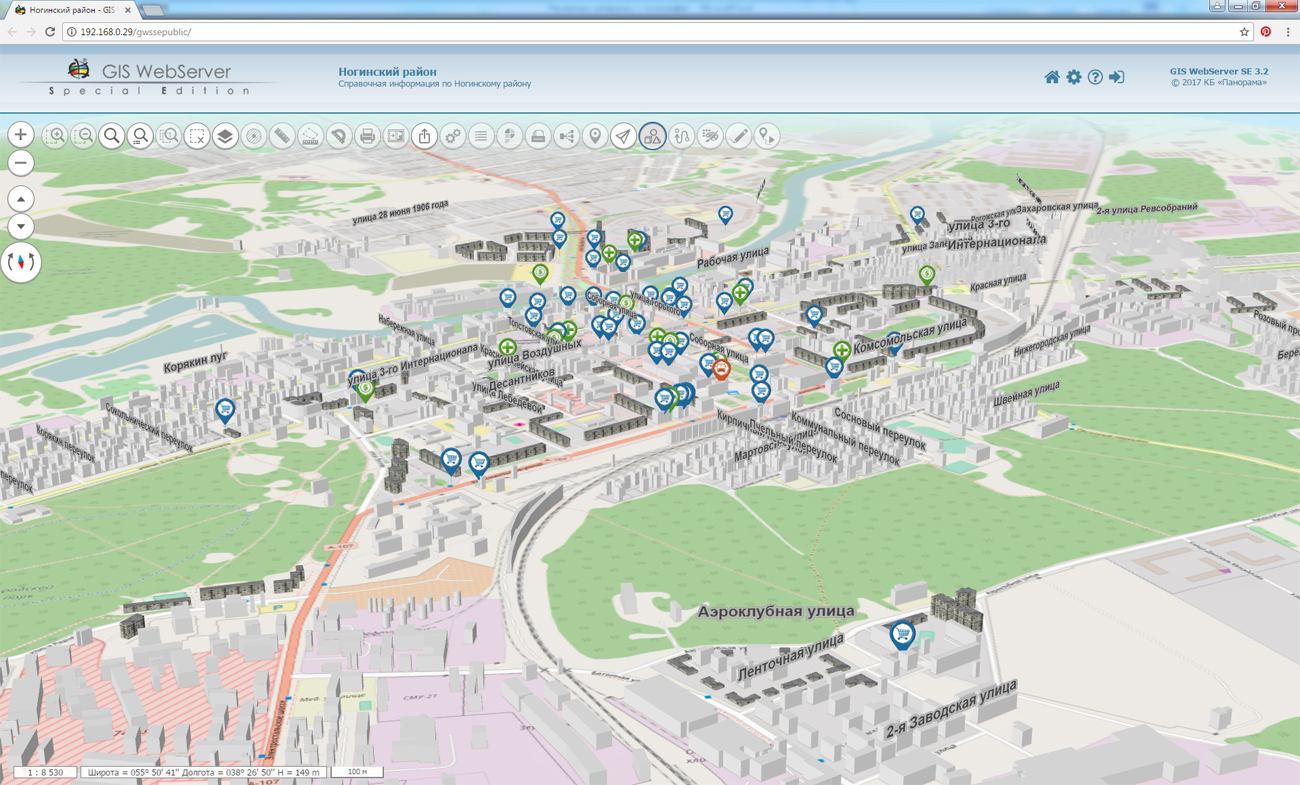
Component of three-dimensional model of a map has been updated. 3D model provides the ability to work and view information layers of various types (vector, matrix and raster maps) for spatial analysis and decision making during designing. 3D surface is created taking into account the terrain. Detailed models can contain three-dimensional objects that correspond to objects of a two-dimensional map. 3D Map allows you to select objects and to get information about them. In the new version of the component of 3D model of a map the ability to work with the touch screen is added, the scaling and displaying the model is improved, the initial display scale is automatically set. The administration module provides support for the output of Cyrillic names when configuring domain users and groups.
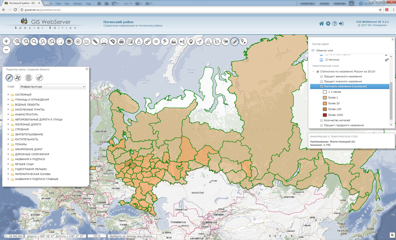
GIS WebToolKit SE Web applications development tools has been improved, which extends the capabilities of GIS WebServer SE and can be integrated into other information systems. Access to data (images, vector maps and terrain information) is provided by Web services using common OGC protocols and ISO standards. Service GIS WebService SE (OGC WMS/WMTS) provides spatial information in the form of graphic images. As digital model of a relief the various kinds of high-altitude data are used: matrixes (in formats SRTM, GeoTIFF, IMG, MTW), TIN-models, a cloud of points and others. At request there is carried out the automatic sample of the most accurate data onto the specified terrain site with a given resolution. To transfer data of the digital terrain model to the Web, the WCS protocol is used. The relief data are represented as tiles and are cached on the client.
As a source of spatial data, the can be. It provides the collection, storage, search and delivery of spatial data in exchange formats, a displaying the state of the data bank in the form of maps-schemes, the automated formation and updating of geo-covers.
GIS WebServer SE is used in the construction of closed corporate systems to ensure the protection of data having a security classification or a trade secret. GIS WebServer SE is certified for Level 2 of absence of undeclared capabilities. The new version of the program expands the application's capabilities in solving problems of analysis, management and long-term planning of the territories development. GIS WebServer SE is implemented using the toolkit of GIS WebToolKit SE, which can be used in development tools that use the JavaScript.
The new version of the program, documentation and presentation are available on the web-site in the section.
Ph.: +7 (495) 739-0245, +7 (925) 221-1603
www.gisinfo.ru | panorama@gisinfo.ru
105005, Russia, Moscow, Baumanskaya Street 7, building 1, office 229 (m. Baumanskaya)
Copyright © Panorama Group 1991 - 2024


 Mobile version
 Full version