Copyright © Panorama Group 1991 - 2024

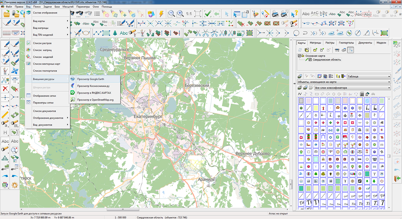
On the geoportal , the map of the Sverdlovsk region, formed according to OpenStreetMap data, has been updated. Source data obtained from the website are complemented by objects from maps of scale 1: 1 000 000.
There are added the objects of hydrography, vegetation, road network. For work with the received map it is possible to use the program of or other software products of KB "Panorama".
Publishing of updates in bank of spatial data is made by using the program of .
Publishing contents of bank of spatial data on the geoportal and data access for downloading are implemented by means of . Free maps on the basis of OpenStreetMap data are available for download on the page "Digital maps and images".


Geoportal updated the map of the Altai Territory and the Republic of Khakassia formed according to OpenStreetMap data. Source data obtained from the website are complemented by objects from maps of scale 1: 1 000 000. There are added the objects of hydrography, vegetation, road network. For work with the received map it is possible to use the program of or other software products of KB "Panorama".
Publishing of updates in bank of spatial data is made by using the program of Databank of digital maps and remote sensing data. Publishing contents of bank of spatial data on the geoportal and data access for downloading are implemented by means of GIS WebServer SE.
Free maps on the basis of OpenStreetMap data are available for download on the page "Digital maps and images".


In KB "Panorama" the x64 is developed with the interface in English. In the new version of the program, tools for creating and updating maps, means for working with databases, drawing up maps with complex symbols, computational tasks and other modules have been improved. At the expense of connection to the program there is added the possibility of viewing and editing the databases operated by DBMS PostgreSQL or Oracle, by tools of editing digital terrain maps. If you change the coordinates of the objects, the fields of the Geometry type in the database table will change, and when the semantics change, the fields with attributive data of objects will change. GIS Server supports direct connection to geospatial data bases for viewing tables in the form of vector maps in specified conventional symbols. There is expanded a support of the local SQLite database for displaying terrain matrix data in hmp format and performing all kinds of computational tasks related to heights (construction of profiles, visibility zones, estimation of elevation, calculation of ground volumes, 3D modeling and other tasks).
ZIP is added to the list of formats to be opened. If you select zip, it is automatically unpacked into the folder \Temp\Panorama.Cache\. Data opens in order of priority: the project of maps, vector maps, rasters, matrixes. This allows you to archive projects of the geodata, to copy and quickly to view. Data in archive opens on reading. After closing of the unpacked data they automatically are deleted. There is added a support for zip archives, encrypted by a user password, at performing the operations of opening the data sets (vector maps, images, matrices) and updating the open data. If the zip archive is encrypted, the user will be prompted to enter a password to access the data.
In the program the task "Export of vector data to GML/JSON format" is improved. Possibility is added for saving the vector data into GeoJson format with taking into account the styles of displaying. In this case, into the file not only the geometry of objects is saved, but also their metadata and external view. The output file can be published in web by means of services the Leaflet, OpenLayers, 2gis, OpenStreetMap and others supporting GeoJson with styles.
Due to multi-threaded processing on a multi-core processor, the execution time of operations on lists of objects is reduced by 6-8 times, displaying of rasters (imagery) of RSW format is accelerated in 3-5 times, a displaying the matrixes of heights of MTW format and matrixes of qualities of MTQ format is accelerated in 3-4 times. The evaluation is performed on an Intel i7 processor (4 real and 4 virtual cores).
Transformation of list of raster files of RSW format is refined. Due to multi-threaded processing on a multi-core processor, the task execution time is reduced by 6-8 times (for 8 threads).
Transforming the list of matrixes of heights of MTW format and matrixes of qualities of MTQ format is improved. Time of the task execution is reduced in 5-6 times (for 8 threads).
The classifier 50t05g.engl.rsc of topographic maps of scale 1: 50 000 has been developed and added to the installation of the program. Classifier is a systematized list of code marks for elements and objects of the terrain, as well as characteristics characterizing the properties of these objects, in English.
The program for loading and displaying the cloud of points (LAS) has been improved. Open binary format LAS is intended for storaging the records of points obtained by means of LIDAR locators (light detection and ranging) - the laser locators used for sounding of the sea and terrestrial surface. Loading of a cloud of points from files of LAS format of large volume is accelerated. At loading a cloud of points from the LAS format, the colors of the original points used for 2D and 3D-displaying are saved. One of such types of data is the dense digital model of a surface created by software of the company. The model, calculated on the basis of many kinds of input data by the method SGM (Semi-Global Matching), simplifies the creation of three-dimensional urban high-resolution models and can be downloaded into the GIS "Panorama" for mapping, vectorization, building a profile and execution of other computational tasks.
The new version of the program is available for download in the section.


Geoportal updated the map of Irkutsk region formed according to OpenStreetMap data. Source data obtained from the website are complemented by objects from maps of scale 1: 1 000 000.
There are added the objects of hydrography, vegetation, road network. For work with the received map it is possible to use the program of or other software products of KB "Panorama".
Publishing of updates in bank of spatial data is made by using the program of . Publishing contents of bank of spatial data on the geoportal and data access for downloading are implemented by means of .
Free maps on the basis of OpenStreetMap data are available for download on the page "Digital maps and images".


In KB "Panorama" the version 12.4.5 is developed. In the new version, the support of the local SQLite database is expanded for displaying the matrix data about terrain and for performing all kinds of calculation tasks related to heights (construction of profiles, visibility zones, estimation of excess, calculation of ground volume, 3D modeling and other tasks).
The program for loading and displaying the cloud of points (LAS) has been improved. Open binary format LAS is intended for storaging the records of points obtained by means of LIDAR locators (light detection and ranging) - the laser locators used for sounding of the sea and terrestrial surface. Loading of a cloud of points from files of LAS format of large volume is accelerated. At loading a cloud of points from the LAS format, the colors of the original points used for 2D and 3D-display are saved. One of such types of data is the dense digital model of a surface created by software of the company. The model, calculated on the basis of many kinds of input data by the method SGM (Semi-Global Matching), simplifies the creation of three-dimensional urban high-resolution models and can be downloaded into the GIS "Panorama" for mapping, vectorization, building a profile and execution of other computational tasks.
There is added a support for zip archives, encrypted by a user password, at performing the operations of opening the data sets (vector maps, images, matrices) and updating the open data. If the zip archive is encrypted, the user will be prompted to enter a password to access the data.
The task for Export of vector data to formats DBF, XLS, TXT, CSV, HTM is refined. For saving the map's object characteristics the LENGTH and the AREA the choice of a unit of measure is expanded. In addition to meters and kilometers for calculating the length, millimeters on the map can be used, to calculate the area of the object - hectares. Established in dialog the units of measure of length and the area are remembered and restored at the subsequent starts of the task.
New property "Save time and date of object update" is added in the dialog of creating a new map. If the map is created with the specified property, then into each object, when creating and editing, service semantics are automatically recorded with the date and time of the performed operation and with the name of the operator that performed the operation.
Support of the pseudo-conical equal-projection of Bonn (EPSG:9827) is added. The new projection can be selected for maps of the Geographical type.
The new version of the program and the documentation are available for download in the section.


Ph.: +7 (495) 739-0245, +7 (925) 221-1603
www.gisinfo.ru | panorama@gisinfo.ru
105005, Russia, Moscow, Baumanskaya Street 7, building 1, office 229 (m. Baumanskaya)
Copyright © Panorama Group 1991 - 2024


 Mobile version
 Full version