Copyright © Panorama Group 1991 - 2024

In KB "Panorama" there is developed the SE of version 11.13.8 for the Astra Linux SE operating system, the release of Smolensk. In the new version, the possibilities of combining digital data are expanded.
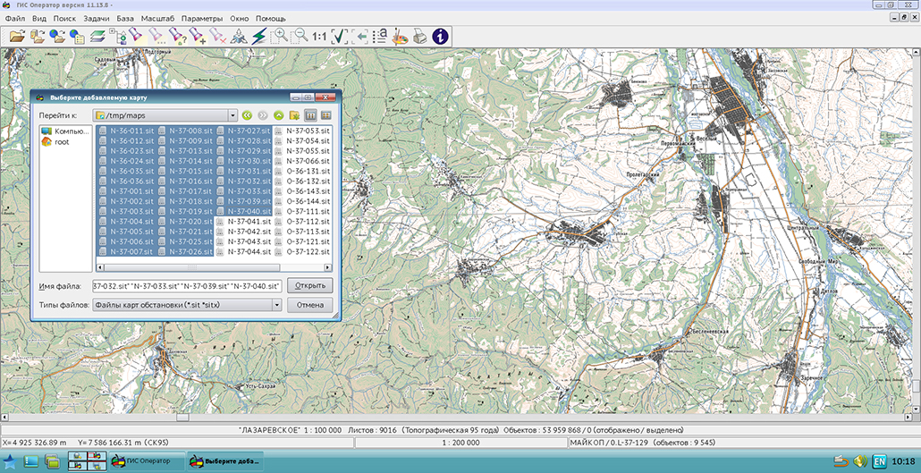
Now to the list of the open data the user can add interesting sets of maps, matrixes or rasters by a simple choice of the list. Among added maps both the user maps (formats SIT, SITX), and multisheets maps (MAP format) can be. The displaying the external view of the object has been improved, taking into account the library of programmable conventional signs in the tasks the "Classifier Editor" and "Information about Object". When importing data from a set of SXF files, the diagnostic output is extended. Import of maps from Shape format is optimised. The task "Show data list of map" has been completed. The new version of the program is adapted for work in OS Astra Linux SE, release Smolensk, version 1.5.
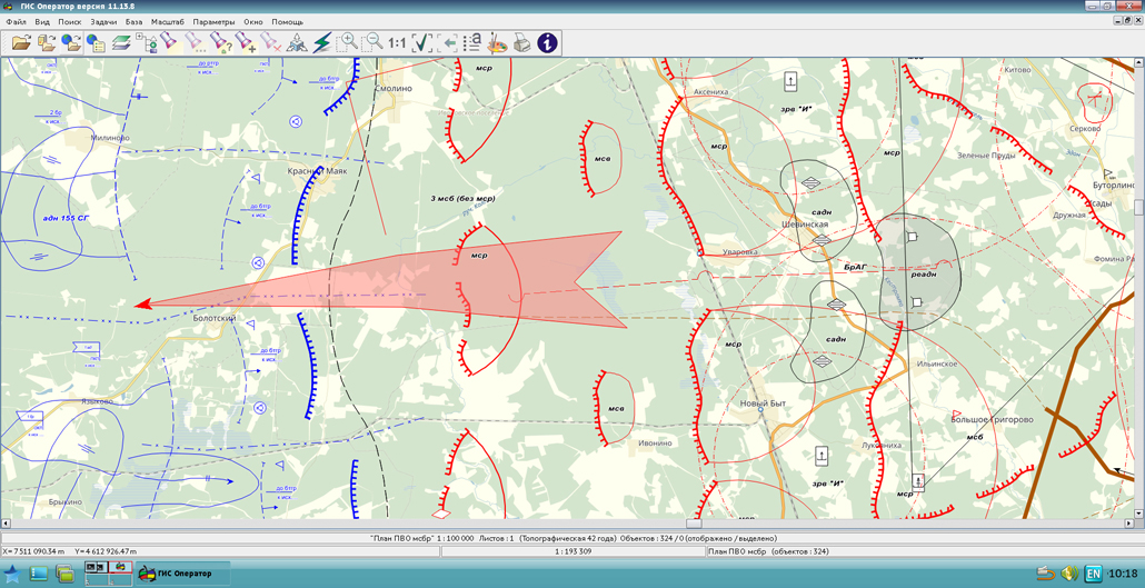
GIS «Operator» for power structures (GIS Operator SE) is the geoinformation system intended for creating and editing digital maps and solving typical application tasks. GIS Operator SE is adopted to supply the Armed Forces of the Russian Federation by the Order of the Minister of Defence and is certified in the system of certification of information security for the information security requirements.
The new version of the program is available for download in the Download section.


updated the maps of the Ulyanovsk region and the Chuvash Republic formed according to OpenStreetMap data. Source data obtained from the website are complemented by objects from maps of scale 1: 1 000 000. There are added the objects of hydrography, vegetation, road network. For work with the received maps it is possible to use the program of or other software products of KB "Panorama".
Publishing of updates in bank of spatial data is made by using the program of and remote sensing data. Publishing contents of bank of spatial data on the geoportal and data access for downloading are implemented by means of .
Free maps on the basis of OpenStreetMap data are available for download on the page "Digital maps and images".


In KB "Panorama" the version 11.7.0 is developed. The new version of the service increases the reliability when working with data on the . In the event of termination of the access right to the layers by the administrator of the Server GIS, the publication of this data on the service is completed.
By means of the built-in self-diagnostics the service allows to identify and eliminate failures that occur at processing the incorrect data or lack of server resources. These possibilities increase the reliability and fault tolerance of the application, and also speed up the search for errors and decision-making by the service administrator to change the server hardware resources.
Issuance of textures is added to display 3D object models. There is extended the output of semantic characteristics for issuing queries in GEOJson.
supports all international standards (OGC WFS, WFS-T, WMS, WMTS, WCS), through which the transmission and display of spatial data is carried out. The program provides the ability to issue tiles for any user or local coordinate system. The application is implemented on Windows and Linux platforms, is compatible with Apache, IIS and nginx web-servers.
The new version of the program and the documentation are posted on the site in the Download section.


Specialists of KB "Panorama" will take part in intersectoral . The event will be held from 22 to 26 May 2017 at the . At this event, KB "Panorama" will present its new software solutions for the creation, processing and analysis of spatial data necessary for the introduction of modern geospatial technologies and services. The presentation "Geoinformation platform" Panorama "- the basis for building information systems for various purposes" presents information on the main components of modern GIS: , , , and for processing and analysis of spatial data.
The report "Automating the processes of accumulation, storage and provision of spatial data in the form of services" focuses on the systemic approach to managing the storage of spatial data, monitoring and presenting actual data sets in the form of geoservices. During the master class "Implementation of service-oriented information systems for state, municipal and corporate governance," the practical aspects of the implementation of GIS components into integrated and branch systems of various directions will be considered: "Territory Management", "Cadastre and Land Management", "Construction and Architecture", "Agriculture", "Urban Management", "Smart City", "Emergency Situations and Security", "Nature Conservation and Ecology".
The initiator and organizer of GeoData will be MIIGAiK with the support of the Ministry of Education and Science of the Russian Federation and JSC Roscartography. According to the idea of the organizers, the event should become an annual event. It is expected that representatives of more than 200 organizations from 20 regions of the country and CIS countries will visit GeoData's stands, platforms, conferences and seminars. Plenary sessions and thematic sections will be held with the participation of representatives of the leading companies of the industry as speakers.
Spatial data are in demand in all branches of government and defense of the country. Participation in the annual GeoData Week of Science, Technology and Innovation "Geospatial technologies and spatial data for the economy and security of Russia" will allow representatives of state organizations, regional authorities and businesses to get acquainted with the most effective practices in the field of geodesy, cartography and geoinformatics.


In KB "Panorama" the Complex of preparing documents of the aeronautical information version 7.0.1 was tested. The new version optimizes the algorithms for the output of aeronautical information on the map. This allowed to reduce the creation time of digital maps by 10-15%. The functions of inputting data into the base of the complex have been improved. The program uses Postgres 9.4 or 9.5 (x64) DBMS, which makes it possible to speed up the process of batch entry of data from the exchange formats by 20-25%. Improved internal functions of interaction with the database, which in turn allowed to increase the productivity of input operations.
The work of the complex was improved at the stage of entering the infrastructure of the aerodrome. The performance of the application was tested using the example of the Kurgan airfield. Input of data from pre-prepared sources, including all infrastructure elements, took 2 hours instead of 8 hours in version 6.11.1.
There is carried out a import of aeronautical situation of the Russian Federation onto a map from format ARINC. Time of drawing all objects in the new version was reduced by 25%, time of import to the database - by 10%.
The functions of constructing the schemes of departure, arrival and landing, an algorithm for plotting the routes of zone navigation (RNAV) have been improved. The algorithm for creating and mapping OAS surfaces has been improved. Dialogs and forms of tasks of the complex are adapted to the styles of the operating system.
The tests were carried out on the computer with a Windows 7 x64 operating system, an Intel Core i3 processor and 4 GB of RAM. To evaluate the results of tests of the software complex in versions 6.11.1 and 7.0.1, statistical information was collected on the execution time, the RAM used and the CPU utilization.
Complex of preparing documents of the aeronautical information is intended for the creation and maintenance of a database of aeronautical information, the formation of aeronautical charts, the designing of flight routes for aircraft and the exchange of data with other information systems. Information exchange is carried out in ARINC and AIXM 5.1 format. The main source of aeronautical information is the aeronautical data base created on the basis of the Aeronautical Information Conceptual Model (AICM), with additions for storing the planned information and the results of the route designing. The model is recommended by the international organization for planning and coordination of air traffic "Eurocontrol".
The new version of the program, examples of documents of aeronautical information, the operational documentation, video lessons and presentations are available for download on the page.


Ph.: +7 (495) 739-0245, +7 (925) 221-1603
www.gisinfo.ru | panorama@gisinfo.ru
105005, Russia, Moscow, Baumanskaya Street 7, building 1, office 229 (m. Baumanskaya)
Copyright © Panorama Group 1991 - 2024


 Mobile version
 Full version