Copyright © Panorama Group 1991 - 2024

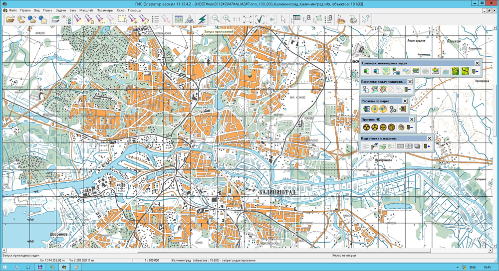
Geoportal updated the maps of Kursk and Oryol oblasts formed according to OpenStreetMap data. Source data obtained from the website are complemented by objects from maps of scale 1: 1 000 000. There are added the objects of hydrography, vegetation, road network. For work with the received map it is possible to use the program of or other software products of KB "Panorama".
Publishing of updates in bank of spatial data is made by using the program of . Publishing contents of bank of spatial data on the geoportal and data access for downloading are implemented by means of .
Free maps on the basis of OpenStreetMap data are available for download on the page "Digital maps and images".

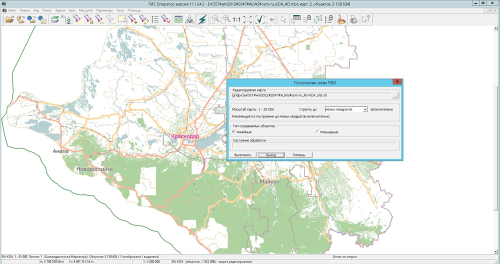
In KB "Panorama" the program version 11.13.4 is developed. In the new version in application the "Database" the mode is added, allowing to create reports in OpenOffice format. Unloading into the report is made with using the tools of spreadsheet OpenOffice Calc which is a part of the OpenOffice.org suite. The mode "Update of semantics" is extended. Possibility of updating of semantics of object by the key value is added (for semantics type - Code from the classifier (list)), saving/restoration of user settings is implemented.
Display of polygon symbol "CrossPolygon" is improved. There is added an inclined hatching in solid lines in a printer view and on the print with any angle of inclination up to 1 degree. The task "Image color adjustment" is improved. On the bookmark "Map" there are added the control modes by a map view in a printer mode and at the print: - Backlight titles - all titles of the map are displayed with a white outline; - Transparent fill - filling of all polygon objects are displayed transparently, transparency degree defines intensity of filling the polygons (from 0 up to 100). It is recommended to use these modes for improving the readability of titles and for maximum preservation of the raster image when displaying the map over the terrain images.
Into the list of commands pop-up by the right-hand menu button the item "Save as a map object" is added. The menu item allows you to save the selected on a map the contour obtained as a result of calculated task (construction of orthodrome, visibility zone, zone around the object, and the like). Actions on this menu element provide a selecting a sample of created object, layer and type, and also a map onto which the object will be put. In the menu File\Update and File\Update by list there is implemented the possibility of making changes into open vector map from data sets that are stored as zip-archive. The archive can contain files of type SXF or graphic files. Unpacking of archives is carried out automatically at map updating.
Into the Map Legend dialog the "Model" bookmark is added intended for displaying and editing parameters of irregular models of a surface - TIN-models (model of terrain) and MTD-models (a cloud of points).
Into the file with the description of parameters of local coordinate systems "LCS of the Russian Federation Subjects" there are added the parameters onto each zone of local coordinate system.
The list of units of measure is expanded at displaying distances and heights. There is added a choice of heights in feet and distances in nautical miles. Into dialog of building a profile of heights there are added the units of length measure - kilometers, nautical miles and the height measurement units - ft.
Into dialog "Calculator" there are added the units of measure - inches, ft, yards. In the task of Opening the data from the there is implemented the possibility of updating on the basis of data sets which are included into the current open document. A set of data for update can contain maps, rasters, matrixes. Vector maps before loading are converted into SXF format.
The new version of the program and documentation are available on the page.


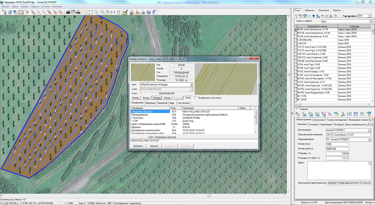
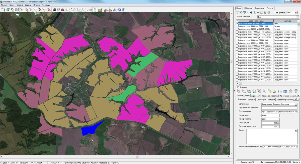
In KB "Panorama"the version 4.9 is developed. The new version provides detailed mapping the executed field works. Onto a map in the form of polygon objects there are plotted the exact contours of worked areas and related information: turnaround time, agricultural operations, performer, data on fertilizer, ameliorations, plant protection products and other information. Initial information for monitoring the progress of field work and drawing up the relevant detailed cartograms of their implementation are the navigation data coming from the satellite positioning system equipment installed on agricultural machinery and motor vehicles.
Navigation information from the operators of satellite positioning systems (Wialon, AutoGraph, GLOSAV and others) comes automatically for further processing in GIS. The received data include the data about spatial position of monitoring's object, time of measurements registration, indications of various sensors (fuel consumption, loading, work of the unit and others). Using the collected information, indicators of carried out works automatically are calculated: the worked area, the traveled distance, fuel consumption, volume of the brought fertilizers. The built-in system of technological planning and the plan-fact analysis allows to correlate actually performed works with the planned agro-technical actions.
Agrarian GIS "Panorama" is is based on the software products: "Panorama AGRO", , , "Workstation of Agronomist", Panorama AGRO Service and GIS WebServer AGRO SE. Various combinations of these products in conjunction with the cartographical server () and professional allow to create a single geoinformation space of agricultural holding.
The use of remote sensing data, the results of satellite navigation measurements, readings of different sensors and building on their basis of corporate agrarian geographic information system has proved highly effective in the management of agro-technical activities and ensuring reliable control technologies of cultivation of agricultural crops.
New versions of software are available for download in the section.


In KB "Panorama" the version 11 is developed. In the new version for the purpose of increase in productivity of service there are refined the architecture and a principle of functioning of PHP module of the application. New configuration files are added, allowing to reduce time for request processing. New features allow you to increase the upload speed of tile data in a 3-fold up to 4 milliseconds and to reduce the processing time for WMS, WFS, WCS and other RESTAPI and XMLRPC requests up to 30-40 ms.
For carrying out the check of throughput and speed of data return there was used the computer with operating system Centos 6.7 (4-core Intel Core i5 processor, 16 GB of RAM), ngnix, php-fpm. During all tests the computer's workload was 100 %. Testing was made on the standard map which is a part of installation, the map of the city of Noginsk consisting of 5000 objects. Tests have been carried out: "The return of finished tiles", "Performing the WMS requests" and "Giving back of tiles with the drawing, compressed and stored on the server disk."
The interface of the service's administrator is improved. Possibility of choosing a geoportal from the list of data is added. There is added a request for the Data Bank - downloading files from the GIS Server. The request of synchronization of setup files of the service is implemented. The request of obtaining the semantic characteristics of a map in GeoJSON format is improved.
GIS WebService SE supports all international standards (OGC WFS, WFS-T, WMS, WMTS, WCS), by means of which the transmission and display of spatial data are carried out. The application has the possibility of issuing tiles for any user or local coordinate system. The application is implemented on Windows and Linux platforms, is compatible with web-server the Apache, IIS, nginx.
The new version of the program and the documentation are available on the web-site in section.


Geoportal updated the maps of Kaluga and Kostroma regions formed according to OpenStreetMap data. Source data obtained from the website are complemented by objects from maps of scale 1: 1 000 000. There are added the objects of hydrography, vegetation, road network. For work with the received map it is possible to use the program of GIS Panorama Mini or other software products of KB "Panorama".
Publishing of updates in bank of spatial data is made by using the program of Complex of conducting a databank of digital maps and remote sensing data. Publishing contents of bank of spatial data on the geoportal and data access for downloading are implemented by means of .
Free maps on the basis of OpenStreetMap data are available for download on the page "Digital maps and images".
Ph.: +7 (495) 739-0245, +7 (925) 221-1603
www.gisinfo.ru | panorama@gisinfo.ru
105005, Russia, Moscow, Baumanskaya Street 7, building 1, office 229 (m. Baumanskaya)
Copyright © Panorama Group 1991 - 2024


 Mobile version
 Full version